Introduction for 13 November 00.00 UTC
|
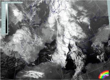
13 November 1997/00.00 UTC - Meteosat IR image
|
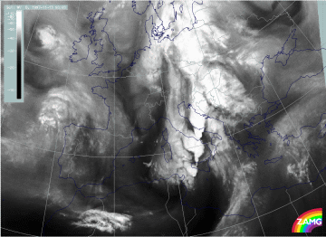
13 November 1997/00.00 UTC - Meteosat IR image
|
The IR and WV images from 13 November 00.00 UTC (left and right image) show somewhat changed features:
- The former Wave area and spiral structure has moved to north Germany and will no longer be discussed here;
- The Cold Front cloud band extends from Tunisia across Italy, Slovenia and Croatia northward to Hungary and Poland; there are a lot of substructures mentioned below;
- The intensification area released through jetstreak crossing is still recognisable between Tunisia, Sicily and Sardinia. It develops more and more a spiral structure; there is intensive Cb and MCS development at the leading side of the frontal cloud band from Sardinia northward to Croatia which will be discussed in a separate chapter together with the synoptic environment (compare Development of Thunderstorms and MCSs During the Whole Period);
- A fibrous cloud band with cyclonic curvature extending from Tunisia and Syria northward to south Italy has further developed since 18.00 UTC when it was first recognized; there is a very dry area between the two cloud bands there;
- With the eastward approach of the Cold Front cloud band the cloudiness over the Balkan Peninsula becomes less pronounced.

