Relative streams: Cloudiness over the Balkan peninsula
|
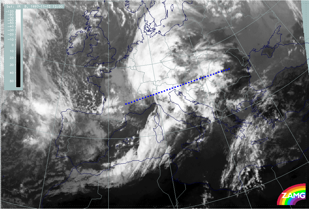
12 November 1997/12.00 UTC - Meteosat IR image; position of vertical cross section indicated
|
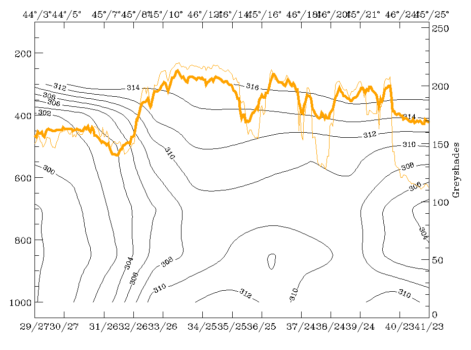
12 November 1997/18.00 UTC - Vertical cross section; black: isentropes (ThetaE), orange thin: IR pixel values, orange thick: WV pixel
values
|
|
|
|
|
|
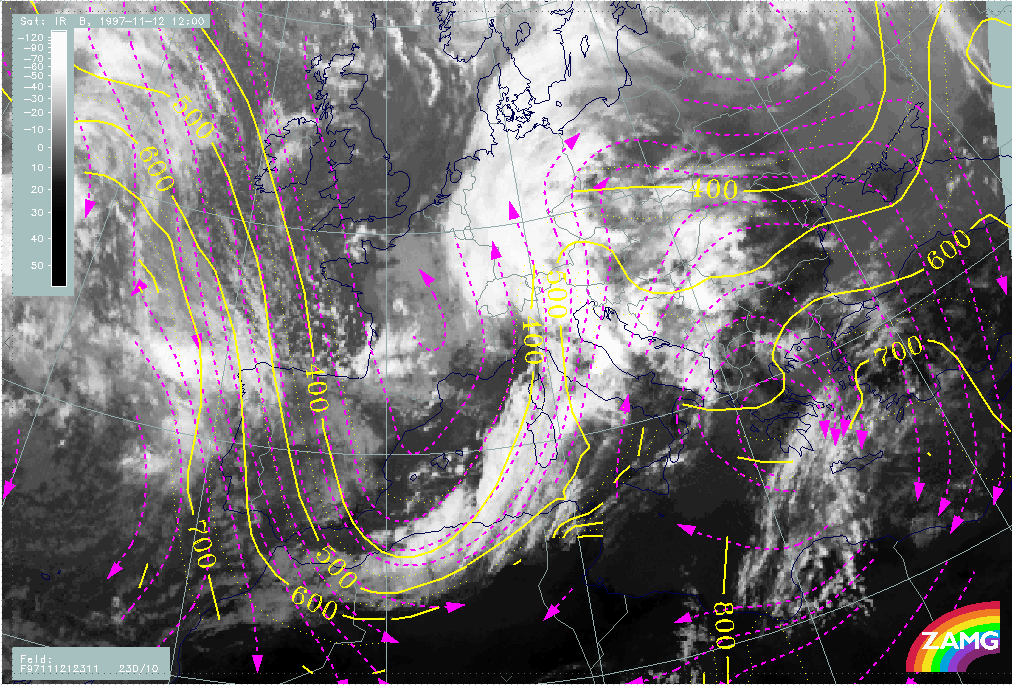
12 November 1997/12.00 UTC - Meteosat IR image; black: shear vorticity 300 hPa, magenta: relative streams 311K - system velocity
230° 10 m/s, yellow: isotachs
|
|
In the bottom left image the different relative streams involved in the synoptic situation can be clearly separated on the ThetaE surface of 311K which is on top of the frontal zone:
- The Warm Conveyor Belt from south-east which is rising while turning to the north-east over the Balkan Peninsula; it is responsible for the development of the cloudiness there;
- The humid relative stream from the rear side of the front but on the anticyclonic side of the jet axis which can be found in the leading part of the frontal cloud band;
- The dry intrusion which is to a certain degree superimposed on the rearward part of the frontal cloud band at this time. The process of jet streak crossing seems to be the reason that at higher levels dry air overruns the southern parts of the frontal cloud band under sinking motion, especially in the area of Algeria and Tunisia. This will have serious consequences and will be followed in the later points of time.