Basic Satellite Meteorology Course 2014
The Basic Satellite Meteorology Course was held from 6 May to 10 June 2014 and focused on satellite systems, sensors and instruments, on the information content of spectral channels and last but not least on the high variety of meteorological products. This course was aiming at students and professionals in meteorology who want to keep up to date on the present status and recent developments in the field of satellite meteorology.
The online course was co-organised by EUMeTrain, EUMETSAT and EUMETCAL.
Lecture 1a: Satellites and Orbits – from Past to Current Satellites
The invention of weather satellites has opened a new area in weather forecasting. Satellite observations enable to continuously monitor the weather regimes on the whole globe. Therefore they provide a powerful tool in weather forecasting. The first lecture of the satellite course leads from the invention of weather satellites to the current operational satellites.
Go to Webcast..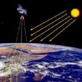
Lecture 1b: Instruments onboard Polar and Geostationary Satellites
The course will present an overview on the most commonly used instruments on board geostationary and polar orbiting satellites. The focus will be on the similarities and differences of instrument characteristics between these two types of satellites. Different types of instruments, covering the meteorological relevant spectrum, will be shown. Active and passive instruments are explained as well as the presently used scanning principles.
Go to Webcast..
Lecture 2: Principles of Radiation and Remote Sensing
The course gives an introduction to radiation and remote sensing principles: Questions like “what is remote sensing?”, “what is the electromagnetic spectrum?” and “which physical radiation laws describe all this?” are addressed. We then go into the specific application of all this to the earth-atmosphere system. The focus here is on radiation in the infrared and solar spectral range, as this is used in imaging instruments. Processes like absorption, emission, scattering and reflection will be described. In the end, a short outlook to (infrared) hyperspectral data will be provided.
Go to Webcast..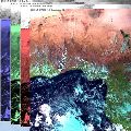
Lecture 3: Solar Channels
Meteosat solar channels are fantastic, and after 11 years of operation still largely untamed. Additional four solar channels are recruited for the next generation, from 2018, for an eight-a-side match against the infrared team. Have you ever seen midnight sunglints, fire traffic lights or fog dips? Google will not help you. This presentation might cast solar light on those concepts.
Go to Webcast..
Lecture 4: IR Channels
This presentation will deal with the origins of infrared (IR) radiance, with description of different IR spectral regions and selection of spectral bands for meteorological satellites.
In next part practical aspects of utilization of IR satellite data will be presented, from processing fundamentals through image mapping, visualization, practical usage up to recognition and interpretation of various meteorological features. Presentation will explain also how can measured IR radiation provide physical information from different atmospheric layers and how this information can be associated with model outputs. Finally some notes on anisotropy of Earth-Atmosphere system in IR window will be demonstrated on real comparison of simultaneous measurements of the same scene but from different satellite positions in space. When effects of anisotropy should be considered by user will be discussed.
Go to Webcast..
Lecture 5: WV Channels
The use of WV imagery to analyze and diagnose the 3-D structure and evolution of the atmosphere and meteorological processes. Real time WV data can provide a high resolution understanding of the atmosphere in time and space that is independent of NWP.
Go to Webcast..
Lecture 6: CO2 and O3 Absorption Channels
CO2 and Ozone channels are difficult to interpret directly because they are not "clean" channels that behave in a simple way. To understand them better, the basic concepts of atmospheric radiative transfer are introduced. In this way, it will be easier to understand how to interpret the meaning of these channels, and by extension, of all the other channels.
Go to Webcast..
Lecture 7: Radar/Lidar, multi-spectral and hyperspectral Soundings
High resolution infrared sounders, such as AIRS and IASI, and microwave sounders, such as AMSU, are a key element of the global satellite observing system and provide a wealth of data important for various operational applications including data assimilation and nowcasting applications. This presentation will revisit the physical basis of infrared and microwave sounding and provide an overview on the state-of-the-art of microwave and infrared soundings.
Go to Webcast..
Lecture 8: Image Enhancements and Parallax Shift
The lecture aims at basic principles of image enhancement, namely its applications in satellite meteorology. The main focus will be at color enhancement of IR brightness temperature (BT) imagery, namely when displaying tops of convective storms (deep convective clouds). The lecture will discuss the blue-red palette recommended by EUMETSAT's CWG, its range, shift and stretch, depending on tropopause height or geographic region. Next, the blended "sandwich" product of visible and color-enhanced IR-BT images will be presented. In the last part, the lecture will briefly address the role of parallax in satellite meteorology, the parallax shift of apparent position of higher clouds when observing these at skew angle.
Go to Webcast..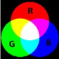
Lecture 9: Introduction to RGBs
What is the benefit to work with RGBs not only with single channel images? How to create an RGB image from raw data? How to create a good RGB image? How to enhance features and which features to enhance? Why to use standard RGBs? How to extract, distill, and package the data into products that are easy for forecasters to interpret and use?
Go to Webcast..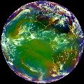
Lecture 10a: Airmass RGB
The Airmass RBG is for sure one of the more complex RGB composites as it uses brightness temperature differences and not single channels on each colour beam. But - as this presentation will show - it is nevertheless a very powerful tool for discriminating between different air masses and highlighting dynamic properties of the atmosphere.
Go to Webcast..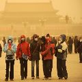
Lecture 10b: Dust RGB
Dust and smoke detection with SEVIRI RGB products: the lecture focuses on dust and smoke clouds and their identification in RGB products. The first part looks at the solar channels and the natural colours RGB product; the second part presents the triple window IR channels and the resulting dust RGB product. Some challenges of detecting dust clouds (like low level dust at night over water) will be discussed.
Go to Webcast..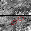
Lecture 11a: Satellite Products
The course gives a short introduction to some established methods to derive meteorological products from satellite data, including the benefits and downsides of products. Product examples will mainly focus on the MSG products, derived centrally at EUMETSAT and within the NWC SAF project.
Go to Webcast..
Lecture 11b: The SAF Products – an Overview
SAFs are dedicated centres of excellence for processing satellite data, achieved by utilising specialist expertise from the Member States. SAFs generate and disseminate operational EUMETSAT products and services and are an integral part of the distributed EUMETSAT Application Ground Segment.
Each SAF is led by the National Meteorological Service (NMS) of a EUMETSAT Member State, in association with a consortium of EUMETSAT Member States and Cooperating States, government bodies and research institutes. The lead NMS is responsible for the management of each complete SAF project. The research, data and services provided by the SAFs complement the standard meteorological products delivered by EUMETSAT’s central facilities in Darmstadt, Germany.
Go to Webcast..
Lecture 12a: Nowcasting of Severe Weather from Satellite Images for Southern Europe
Nowcasting of severe convective storms is still one of the most challenging tasks for operational forecasters. Satellite data are very useful in convection nowcasting because they enable a detailed monitoring of the various stages of convection; from the pre-convective environment to specific features on the tops of the mature convective clouds. Also, future MTG system will provide even better tools for convection nowcasting: satellite data with better temporal (every 2.5 min) and spatial resolution.
Various satellite products as well as their advantages and disadvantages for analysis and monitoring of the convective development over the Southern and Central Europe will be shown in the first part of the lecture presented by Petra Mikuš Jurković (DHMZ, Croatia). Also, the most interesting convective episodes detected during the 2.5 minute rapid-scan experiments with the MSG satellites will be analysed in detail.
In the second part of the lecture, severe weather cases of 29 July 2012 and 30 July 2013 will be analysed by Izolda Marcinonienė (Lithuanian LHMS), mainly using MSG- 2 satellite images and ECMWF data. The first event includes a more expanded North-Eastern European area – from Poland (where the unstable situation started) towards the Baltic States (where the severe weather phenomena developed) to Finland (where they ended). The second event hit only Lithuania, but local very heavy rain reached even the disastrous phenomenon criteria and will be shortly presented as well.
Go to Webcast..
Lecture 12b: Nowcasting of Severe Weather from Satellite Images for Northern Europe
See abstract above.
Go to Webcast..