Webcast


Nowcasting of Severe Weather from Satellite Images for Southern Europe
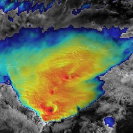
Nowcasting of severe convective storms is still one of the most challenging tasks for operational forecasters. Satellite data are very useful in convection nowcasting because they enable a detailed monitoring of the various stages of convection; from the pre-convective environment to specific features on the tops of the mature convective clouds. Also, future MTG system will provide even better tools for convection nowcasting: satellite data with better temporal (every 2.5 min) and spatial resolution.
Various satellite products as well as their advantages and disadvantages for analysis and monitoring of the convective development over the Southern and Central Europe will be shown in the lecture presented by Petra Mikuš Jurković (DHMZ, Croatia). Also, the most interesting convective episodes detected during the 2.5 minute rapid-scan experiments with the MSG satellites will be analysed in detail.
Filed under Keywords:
Convection, instability, convective initiation, cold ring, rapid scan