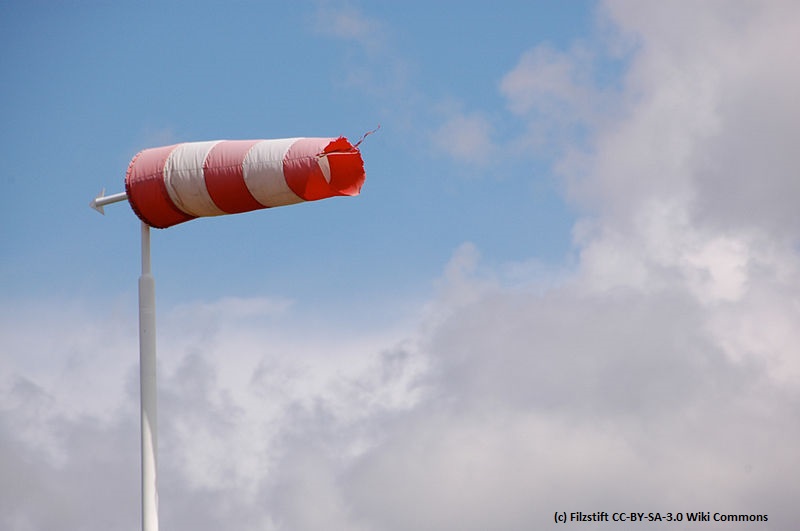
Wind Event Week 2022
In the week from 28 February to 4 March 2022, EUMeTrain organized a Wind Event Week. Several online presentations took place during these 5 days. The presentations covered many topics related to wind such as aviation, satellite derived winds, renewable energy, radar, sodar and SAF products.
The Wind Event Week aimed to cover the diversity of impacts that wind has on many fields in meteorology.
Session 1 - 28 February 2022
The standard surface wind speed and direction measurements are based on different measurement principles: cup anemometers and vanes, hot wires, pitot tubes and sonic anemometers. Pros and cons of the different measuring methods regarding accuracy and applicability will be discussed as well as some practical aspects concerning setup, maintenance and post-processing. Beyond surface wind measurements, the talk will also touch on ground-based systems to measure vertical wind profiles.
First efforts to observe the wind profile within the lowest kilometres above ground go back to the 1920s. The development of radio transmission led, among other things, to an upswing in the area of radiosondes and captive balloons. The invention of ground-based remote sensing made it possible to monitor continuously the wind profile without costly deployment of personnel. The advantages and disadvantages of measurement principles are discussed based on selected examples from measurement campaigns.
Session 2 - 28 February 2022
Only summer convection will be discussed. In the first part, basics of the Doppler-products' interpretation will be outlined (radial wind components, folding, convergences, divergences, rotations (meso-cyclones) and gusts estimation). Especially, the interpretation of PPI-products (plan position indicator) will be discussed, also in respect to fronts and temperature advection. The second part deals with instructive examples and a short overview of automatically derived nowcasting products at DWD.
Convective downdrafts are one of the major thunderstorm hazards which lead to frequent damage. But the prediction of these events is a challenge for the forecasters. Can radar data help in the warning of severe convective wind? Some prediction methods to estimate the potential downdraft wind speed from radar data are discussed.
Session 3 - 1 March 2022
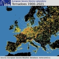
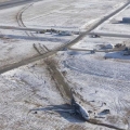
Violent (F4 - F5) tornadoes are extremely rare in Europe, which makes it almost impossible for local forecasters or surveyors to build experience with such events. This makes appropriate training for dealing with such events very important. After providing a brief overview of the climatology of tornadoes across Europe, we concentrate on violent tornadoes from three perspectives. The first perspective is typical damage associated with tornadoes of such strength, as documented from a field survey of the Moravian tornado. The second perspective is a contrast of precautions needed to take in such an event compared to the standard set of precautions mentioned in the standard severe wind warnings. The third perspective is an overview of contemporary procedures on forecasting and nowcasting such events compared to the environment and evolution of the 24th June case.
Windstorm and tornado intensity classification is usually done by assessing the inflicted damage, since reliable in-situ measurements are typically lacking. This presentation gives a practical introduction into windstorm and tornado damage assessment using the Fujita-(F)-Scale and the Damage Indicator (DI)-Degree of Damage (DoD) method. Examples from recent site surveys, carried out by ZAMG, are presented and current developments towards an International Fujita (IF)-Scale are briefly discussed.
In Lithuania, very strong winds (≥28m/s) are usually caused by Atlantic cyclones. Fifty-five cases in 173 sites have been registered during the period 1961–2021. Even a few cases with very powerful winds (>40 m/s) were observed. According to statistics, most events occur during the cold season and bring significant damage. Thus, a short summary will be presented. Additionally, the typical cyclone track and synoptic situation will be shown in this presentation.
Session 4 - 1 March 2022
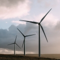
A reliable wind measurement is the basis for the successful accomplishment of wind power projects and the profitable operation of wind farms. Therefore, the current presentation gives an overview about the steps that are necessary to develop a wind power project from the green field, starting with a well-defined measurement campaign. Besides constraints originating from the conditions on site, pros and cons of different measurement techniques as well as the corresponding technical standards have to be kept in mind.
Reaching the measurement target therefore means, that sufficient data in a good quality is available to be used for further evaluations andassessments of the regarded site, which are then used to determine whether a project can be realised in terms of profit as we ll as from the technical point of view.
Even after a successful realisation of a project, wind measurements still play an important role, especially when it comes to the verification of the plant performance.
With the increase in wind energy production being fed into the power grid accurate high frequency predictions of the estimate d power for the next hours and days ahead are needed to schedule feed-in rates and secure power grid stability. To achieve this a combination of different kinds of information and data sets are needed. Here, statistical and machine learning methods proved to be a suitable tool. However, a thorough selection of input data is needed as well as considering extreme events (upper and lower tails) in model training and avoiding smoothed forecasts.
A brief introduction into post-processing for wind energy applications using statistics and machine learning, including useful tools/methods/data, will be given.
Session 5 - 2 March 2022
The NWCSAF/HRW-High Resolution Winds product provides a detailed calculation of Atmospheric Motion Vectors and Trajectories locally and in real time by its users. In this moment, it is able to do this in all regions of the Earth with 5 MSG/Himawari/GOES-R geostationary satellites and 12 NOAA/SNPP/Metop/EOS polar satellites (inside NWC/GEO v2021 and NWC/PPS v2021 software packages).
It is useful in Nowcasting applications, for watch and warning of dangerous wind situations, and monitoring of the general atmospheric flow, small scale circulation and wind singularities. It can also be assimilated in NWP Models and Climate applications, with special interest in its global applicability. In this session, examples will be provided considering all these possibilities.
Recording Javier Garcia Pereda
Extrapolated Imagery (EXIM) is one of EUMETSAT's NWCSAF/GEO products. EXIM kinematically extrapolates satellite imagery and selected NWCSAF products by up to a lead time of 1 hour.
The software developer gives an overview over EXIM's functionalities, the algorithm, challenges faced, and recent developments introduced in the latest version, which is currently under review for being released.
With the latest version of EXIM, new NWCSAF products were added to the list of sub-products and a new extrapolation feature, the so-called CTTH filter, was introduced. The CTTH filter allows extrapolating pixels using atmospheric motion vectors (AMVs) stemming from the same userdefined layer. This talk presents the value gained by extrapolating the new sub-products with EXIM and the impact CTTH-filter has on the extrapolation of the various sub-products.
Derivation of wind products from polar orbiting satellites has been developed in the 2000’s to populate the high latitude regions where no observation could be obtained from geostationary satellites. Taking advantage of a wider variety of instruments available at Low Earth Orbit, several types of wind information are now produced operationally, and not limited to Polar Regions anymore.
This presentation will give an overview of the actual wind products extracted from polar satellites over the world, and then focus on the EUMETSAT activities which includes the operational production from imagers, the recent development of 3D winds from Hyperspectral instruments, and the preparation of the future Doppler Wind Lidar mission.
Session 6 - 2 March 2022
Despite ever-advancing technology and automation, weather continues to have a major impact on aviation. Weather forecasts in aviation have two important functions. They support safety on the one hand and economic efficiency on the other. As part of this presentation, I would like to take a closer look at the complex subject area that the wind exerts on the approach and departure.
Flying in complex terrain is challenging as orographic induced turbulence can lead to unexpected loss of aircraft controls. In order to keep aircraft operations as long as possible actable and safe a skilled turbulence forecast is of vital importance. Since turbulence forecasts are highly dependent on model resolution and parameterization schemes, they do not always hit the scores. With the knowledge of general fluid dynamics and observations regions and onset of hazardous conditions can be specified. Let us explore what we can look at to improve our turbulence forecasting skill.

Session 7 - 3 March 2022
AC SAF provides various satellite observations on atmospheric composition, that are relevant for assessing air quality and climate. In this talk an overview of the AC SAF products is given by introducing practical examples of recent major air quality episodes. The focus will be on long range transport events that are highly affected by prevailing wind conditions.
Never before so many ocean wind sensing satellites were available for application in meteorology, oceanography and climate. These satellite ocean winds are continually improved in quality and service. An overview will be provided of the current products and services, with particular focus on their earth coverage, timeliness, quality and on coastal and extreme winds. Furthermore, relevant aspects for application in nowcasting, ocean forcing, climate and NWP data assimilation will be highlighted.
Satellite-derived winds are an important part of the global observing system. Atmospheric motion vectors, derived from tracking clouds in satellite imagery, and ocean surface winds from scatterometers have been routinely assimilated in global and regional NWP models for many years. More recently, wind profiles have become available from the Aeolus Doppler Wind Lidar. The talk will focus on how we use these datasets, their impact in global NWP models and some thoughts for the future.

Session 8 - 3 March 2022
Vertical and horizontal winds in a moist airmass may generate characteristic cloud patterns. Vice versa specific cloud patterns expose the wind fields behind the scene. The talk illustrates this interplay with imagery from data of operational sun-synchronous and geo-synchronous imaging satellites. It shows cases like gravity waves, undular bores, haboobs, ship tracks or stack plumes.
The new Geostationary Operational Environmental Satellite (GOES)-R Series Advanced Baseline Imager and similar instruments represent a substantial improvement in the spatial, spectral, temporal, and radiometric resolution of operational space-based imagery for atmospheric sciences. The enhanced resolutions enable the objective derivation of fine-scale brightness motion, or so-called "optical flow" (OF), over a variety of meteorological phenomena with techniques that address the weaknesses of current generation cloud and feature tracking algorithms. The techniques even allow for precise dense OF derivation, or motion retrieval at every image pixel, which has a variety of applications that will be invaluable to satellite remote sensing-based forecasting and research in the future. These applications include Atmospheric Motion Vector fields, temporal brightness interpolation, feature extrapolation, image stereoscopy, and semi-Lagrangian brightness temperature field derivation. As motion is an observable that provides unique context on features observed with an image, OF fields further offer significant new predictors to a variety of objective machine learning and decision-making tools now in development. This presentation will go into detail on how some of these new dense OF techniques are derived and highlight efforts to produce and validate new products. Demonstrations of novel RGBs and their uses for operational forecasting will be overviewed, such as blends of derived speed for inferring shear and cloud-top cooling for inferring vertical growth with clouds in visible satellite imagery. Efforts to validate wind products will also be shown which highlight the strengths and weaknesses of dense OF derivation for satellite remote sensing purposes. Examples of future applications and research will also be covered, including a look into the future of OF derivation with an example 6-sec GOES-17 dataset.

Session 9 - 4 March 2022
Although balloons were by far the first manned aircrafts in the sky their economic and military importance stayed marginal.
The main reason for that is the difficulty of steering a balloon. Balloons go with the wind flow and the only way to steer a balloon is to find different wind directions at different heights. Therefore, wind and wind forecasts are of utmost importance for sport- and commercial ballooning.
Exchange and transport processes in the ABL are driven by turbulence on a wide range of scales. Their adequate parameterization in numerical models is essential. In heterogenous and complex terrain, the common simplification of turbulence to statistical models does not necessarily hold. Coherent structures such as convective cells, gusts, slope and valley flows, but also turbulence in cities or behind wind turbines are features which are not well represented in models. A reason for the lack of understanding is the challenge to adequately sample their spatio-temporal structure. Small unmanned aerial systems (UAS, a.k.a. drones) are increasingly used to measure meteorological quantities, including the three-dimensional wind vector in the ABL. In this talk, methods and results will be shown how UAS, either fixed-wing or rotary-wing, can be used to obtain in-situ measurements and thus help to understand complex flows.