Event Week on Convection 2019

At the end of May 2019 from 20th to 24th, EUMeTrain organised an Event Week on convection. Shortly before the main convective season started, this event focused on topics like thunderstorms, tornadoes, storm damage and the use of satellite products in one week. The target audience comprised meteorologists from all fields but especially forecasters, students and model developers.
Session 1: 20 May 2019
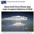
Above anvil cirrus plumes (AACPs) have been established in the scientific literature since 1980s. Recent improvements in the temporal and spatial resolution of the satellite data brought back attention to their potential use as an indicator of severity of convective storms. In 2018, we have identified 26 days, where damaging hail reaching at least 5 cm, causing significant economic or societal impact was reported to the European Severe Weather Database. For the selected hailstorm days, where rapid-scan imagery with 5-minute temporal resolution was available, we identified 29 very large (>= 5 cm) hail producing storms. 25 of these hailstorms did show an AACP, but only 12 of these plume producing storms could be clearly identified using the visible imagery. The range of lead time of the AACP appearance to the first hail report was very large and in about half of the cases, the plume occurred only during or after the time of the first large hail report. Due to the limited number of cases, the main purpose of the presentation is, rather than drawing conclusions, to open a discussion on the operational usability of AACPs in warnings for convective storms.
The goal of the SINFONY project of Deutscher Wetterdienst is to complement, refine and improve the methods of nowcasting (NWC) and numerical weather prediction (NWP) so that a continuous representation of atmospheric conditions and weather phenomena from the current time to the short-term forecast, i.e. in the period 0 to 12 hours, is possible. The pilot project focuses on summertime convective heavy-precipitation events, with the aim of providing more concise and accurate information for our warning service.
Session 2: 21 May 2019
Since 2014 the Austrian thunderstorm nowcasting tool (A-TNT) monitors and nowcasts thunderstorm developments operationally based on 3D radar and lightning data. The algorithm employs an object-oriented approach observing and storing specific parameter attributes of the individual developments of convective cells. Radar data provide information about the internal precipitation structure and the probability of hail and lightning data about the electrical activity. A daily classification of the weather patterns based on a domestic development following Bissolli and Dittmann (2001) is available since 2004.
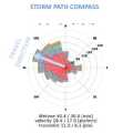
Based on a three years data sample the influence of synoptic flow regimes over Austria on typical thunderstorm parameters such as lifetime, cell size and core height, maximum and mean lightning stroke rate has been investigated as well as local thunderstorm frequencies and preferred storm paths.
According to their degree of organization, thunderstorms can conceptually be divided into single cells, multicells and supercells. Organized storms, in particular supercells, are responsible for the large majority of severe convective weather like large hail and damaging wind gusts. They are favored by high latent instability and/or strong vertical wind shear and exhibit characteristic behavior in radar and satellite data. For nowcasting purposes and timely weather warnings, it is therefore crucial to recognize organized and severe thunderstorms in remote sensing data. This presentation focuses on key properties of this distinction and illustrates some characteristic examples.
Session 3: 21 May 2019
Since the release of the WMO recommendations for impact based forecasts and warnings, reliable data about weather related effects on society and public life became increasingly important for operational forecasting. Particularly densely populated urban areas are vulnerable to the forces of convective weather hazards. In this regard, operational automatic station networks or remote sensing data cannot provide complete information about the ground truth like hail size, downburst related wind damage, flash floods or damage from lightning strikes. In order to fill this gap, targeted human assessment and observations are still needed. With the help of weather and impact reports a real-time feedback loop between forecasters and voluntary observers can be established, to improve impact based warnings and thus to increase weather related disaster resilience and mitigation. In our presentation, we introduce the Austrian weather- and impact observation system "wettermelden.at" with its applications and furthermore a concept for the swift exchange of these reports on national and European levels.
Windstorm and tornado intensity classification is usually done by assessing the inflicted damage, since reliable in-situ measurements are typically lacking. This presentation gives a practical introduction into windstorm and tornado damage assessment using the Fujita-(F)-Scale and the Damage Indicator (DI)-Degree of Damage (DoD) method. Recent site surveys, carried out by ZAMG in Austria, are presented and current developments towards an International Fujita-(IF)-Scale are briefly discussed.
Session 4: 22 May 2019
iSHAI (imaging Satellite Humidity and Instability) is the clear air product of the NWCSAF/GEO software that allows the monitoring in clear pixels of several key ingredients in convection; in addition, it allows to identify the regions where the numerical models used as input do not agree with the observation of the satellite. In version 2018, iSHAI has been adapted to Himawari satellites and it is being adapted for GOES-R class satellites.
PGE00 is an AEMET complementary tool that performs first the vertical, temporal and spatial interpolation (4D interpolation) of the profiles from NWP to the projection and time of the satellite images; allowing to generate for all the pixels the same fields that iSHAI. Second, PGE00 can be used to generate synthetic satellite images using RTTOV-12.1 in clear and cloudy conditions with a high degree of realism using the ECMWF model at hybrid levels. In addition to the comparison with real satellite images, synthetic images can be used to generate new developments and for preparation of MTG era through the generation synthetic MTG-FCI and MTG-IRS images.
The NWCSAF products and services for the future MTG-IRS will be also briefly presented.
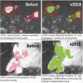
This talk focuses the cloud top height and microphysics that can be retrieved from the NWCSAF/GEO software. The algorithms will be outlined, the improvements implemented in the last version (v2018 just released this year) will be highlighted and some validation results will be shown. After having given some perspective for MTG-day1 release, a convective situation over France will be illustrated.
Session 5: 22 May 2019
Météo-France develops and contiuously upgrades CI (Convection Initiation) and RDT (Rapidly Developing Thunderstorm) products. Both have been developed in the framework of NWCSAF.
CI is a pixel-based product that provides the probability for a pixel to develop in thunderstorm. The last delivery, v2018, has reached the "pre-operational" status in Eumetsat sense thanks to new developments (e.g. use of microphysics), tuning and validation effort. RDT is an object-based product that aims to detect, track, characterize and forecast the convective cells. Version v2018, includes new features like lightning jumps detection and is highly flexible and configurable. Status is "operational". RDT is very useful for aviation end users.
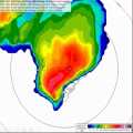
The Convective Rainfall Rate (CRR) and the Convective Rainfall Rate from Cloud Physical Properties (CRR-Ph) products are satellite derived rainfall products based on the MSG/SEVIRI channels and cloud top microphysical properties respectively. Both rainfall products have been developed within the NWC SAF context to provide with instantaneous rain rates and hourly accumulations associated to convective episodes. Last version of the NWCSAF software package includes a new version of the CRR-Ph for nigh time. CRR and CRR-Ph behaviour will be texted in different convective events.
Session 6: 23 May 2019
Detailed analyses of various types of storms using remote sensing (satellite, radar, lightning), in-situ and NWP data will be presented. Five cases for thunderstorms occurring in the Carpathian Basin were studied. We tracked the storms, to analyse the storms' temporal and spatial evolution and to see the possible relationships between lightning characteristics and severe convection development.
One frequent feature of supercell storms was that stronger lightning activity occurred in periods of mesocyclone intensification. This was probably also related to higher speed of updraft (or higher vertical acceleration) in these cases. Also in multicellular storms could be shown that the storm dynamics has major influence on the lightning activity (the number of lightning increased when signatures of strong convergence appeared in the Doppler radar velocity, though the radar reflectivity was not very high in that period).
Moist and conditionally unstable environments generally support development of severe storm with high electrification. However, some cases show that the storm’s dynamics and microphysics (e.g. distribution and type of the ice particle growth) can lead to large variability. For example, we found a case with tornadic thunderstorm, which exhibited much less lightning activity compared to other severe storms, despite of favourable environmental conditions concerning moisture or instability
Session 7: 23 May 2019
Soil moisture is supposed to be a key parameter in triggering convection as it influences the lower boundary conditions of the atmosphere and the partitioning of energy between sensible and latent heat fluxes. Using the convection-permitting numerical weather prediction model AROME, we try to quantify this impact by investigating sensitivity studies, hence estimating the potential of satellite-based soil moisture measurements to improve the forecast of convective events.
Recording Stefan Schneider and Georg Pistotnik
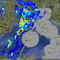
In early summer 2018 Central Europe was affected by several severe thunderstorms, many producing large hail. One of the most severe storms struck the town of Črnomelj, Slovenia. Interestingly, this storm did not look more severe in the remote sensing data than other storms on the same day. The presentation will investigate its development and impact. In addition, the preconvective environment of this and other severe storms of the last summer will be investigated with the help of satellite sounding data.
Session 8: 24 May 2019
The EUMETSAT Satellite Application Facility in Support to Operational Hydrology and Water Management (HSAF) generates and archives high quality products for operational hydrological applications. HSAF focuses on geophysical products of precipitation, soil moisture and snow parameters and the exploitation of these datasets to mitigate hazards and natural disasters such as flash floods, forest fires and landslides, and to monitor drought conditions, improving water resources management.
HSAF promotes the systematic and periodic products review with the continuous refinement of algorithms, validating results during calibration campaign, implementing operational driven procedures and services monitoring accordingly user requirement.
The current status of the Precipitation Cluster and the challenges for the future, looking at MTG and EPS-SG in particular, are presented.
The Mediterranean region is often impacted by heavy precipitation events, that are responsible for damages and sometimes casualties, especially over the coastal areas. Because of its peculiar geographical characteristics, conventional ground-based instruments, such as raingauge and radar networks, cannot be fully exploited for the monitoring, characterization and forecasting of severe events, in particular during their offshore development. For these reasons in the last decades satellite observations, both over geostationary and Leo platforms, have been recognized as a powerful tool to overcome the limitations of ground-based observations