Common Remarks
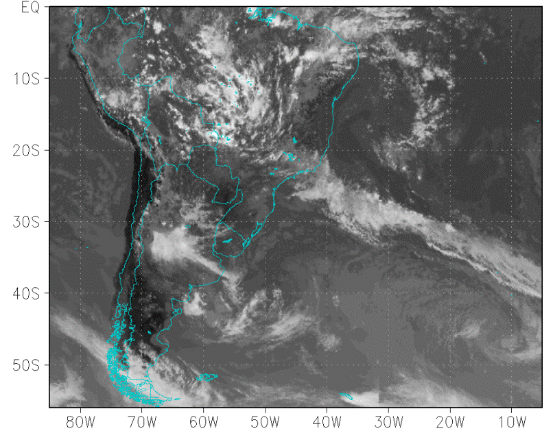
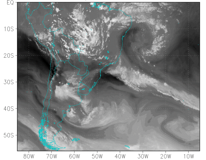
During austral summer (Dec-Feb) the upper tropospheric circulation over South America is characterized by the presence of a quasi-stationary high over Bolivia (know as Bolivian high) and a deep trough to its east over northeast Brazil and adjoining Atlantic Ocean (see Figure below). With certain frequency this trough closes forming upper tropospheric cyclonic vortices (UTCV - Kousky and Gan, 1981). The figure below shows an example of a UTCV over the northeast Brazil coast.
|
17 February 2014 /18.00 UTC - Thermal Infrared (11 µm) channel for GOES-Meteosat composite image (degrees Celsius)
|
17 February 2014 /18.00 UTC - Water Vapour (6.7 µm) channel for GOES-Meteosat composite image (degrees Celsius).
|
|
|
|

|
I. Appearance in Satellite Data
Learn about how to recognise and detect Upper Tropospheric Cyclonic Vortices in The Tropical South Atlantic in satellite images.
II. Meteorological Physical Background
Find out more about the meteorlogical and physical background of Upper Tropospheric Cyclonic Vortices in The Tropical South Atlantic
III. Key Parameters
Learn which key parameters to use for montoring Upper Tropospheric Cyclonic Vortices in The Tropical South Atlantic
IV. Typical Appearance In Vertical Cross Sections
Find out the typical appearance of Arctic Upper Tropospheric Cyclonic Vortices in The Tropical South Atlantic in vertical cross section
V. Weather Events
Explore the weather events associated with Upper Tropospheric Cyclonic Vortices in The Tropical South Atlantic
VI. References
Let these comprehensive documents in the references assist you in finding more about Upper Tropospheric Cyclonic Vortices in The Tropical South Atlantic