Weather Events
| Parameter | Description |
|---|---|
| Precipitation |
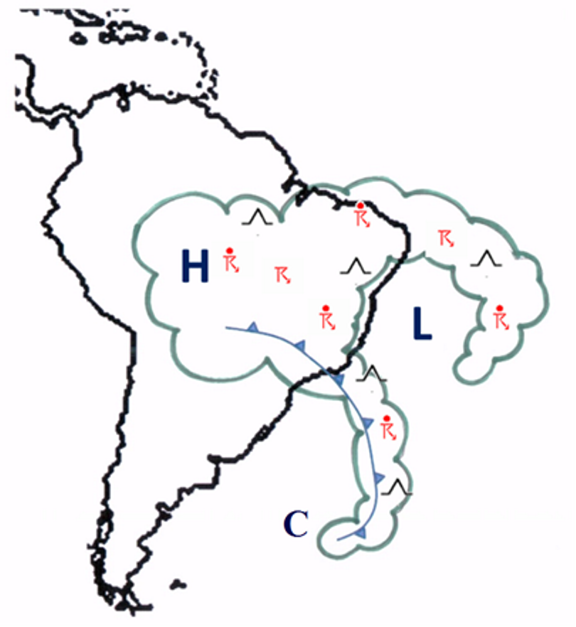
Precipitation (sometimes intense) can occur at the edge of the system, associated with divergence at high levels (300 hPa) and updrafts.
In many cases we can observe an anticyclonic circulation (Bolivian High) over the continent, which contributes to diffluence and divergence at upper levels, between this high and the UTCV. Convective clouds and intense preciptation may then develop in assocation with the upper-level divergence in this region. At the center of the vortex, cold, dry air in the upper levels (200-500 hpa) and the positive omega (downwards motion) suppresses most precipitation. However, isolated showers may still be observed near the center of the system, due to an additional, local circulation when the system is over the continent. |
| Temperature | The center of the system has clear skies. Cloudy skies, with rainfall and/or convective clouds can be seen at the edge. |
| Wind (including gusts) | Strong winds may be observed close to the edge of the system, at upper levels (300-200 hPa). This occurs mainly in the northern and northeastern areas. This could cause turbulence at upper levels, due to the strong gradient in the streamlines. |
|
Schematic of weather events associated with UTCV: H and L represent the mean position of high and low pressure systems at high levels. Convective clouds (sometimes associated with high volumes of rain) are observed over the continent, while clear skies, associated with dry and sinking air, are observed at the center of the system.
|
|
|
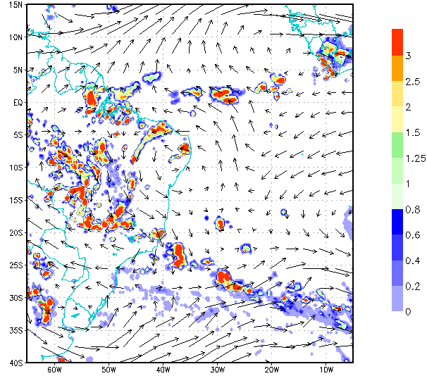
17 February 2014/00:00 UTC. Wind at 250 hPa (GFS analysis) and 3-hourly accumulated precipitation using the TRMM Multi-satellite Precipitation Analysis (TMPA) product.
|
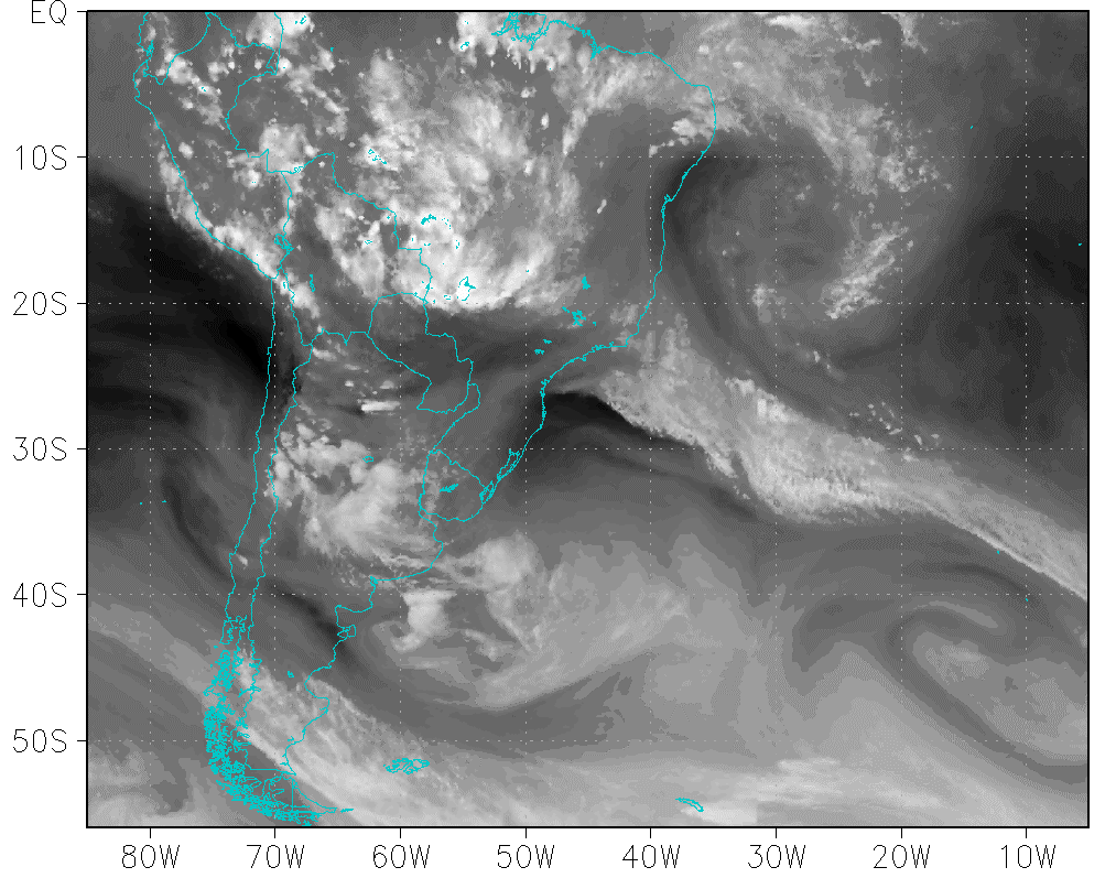
17 February 2014/00:00 UTC. GOES13-Meteosat 9 WV 6.7 composite image.
|
|
|
|
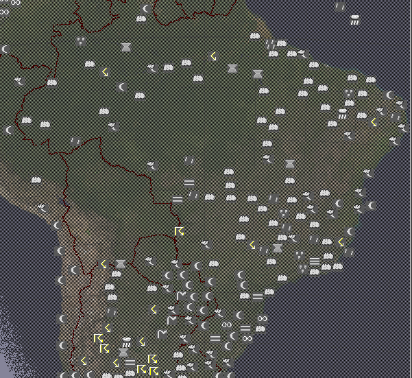
17 February 2014/00:00 UTC. Significant Weather (source: Ogimet)
|
|