Webcast


Use of satellite precipitation products in an early warning system
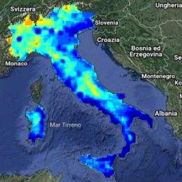
Many severe meteorological events occurred in Europe during the last decade and caused casualties and damages to the historical heritage and natural environment. The European Civil Protection agencies, supported by meteorological and hydrological institutes, aim to assess risk scenarios, to monitor and supervise events and risk levels, providing early warning to National and local authorities. Near real time accurate estimations of hydrological variables such as precipitation and soil moisture are invaluable for the hydrological risk evaluation, enable them to issue early warnings and plan for disaster relief at the local level. Besides measurements of key hydrological variables by ground-based instruments, often affected by a limited spatial coverage, advanced satellite-based precipitation and soil moisture products developed within different international programs as H SAF, are available and accessible to users in near-real time. Severe meteorological events are selected in order to understand how the main satellite precipitation product characteristics, i.e. accuracy, spatial pattern and resolution, update frequency and latency, impact the efficiency of a hydro-meteorological early warning system at a local level in an operational framework.