Event Week on MTG-I Satellite 2016
From 7 to 11 November 2016 EUMeTrain was running an event week on MTG-Imager satellite. During this week the FCI and Lightning Imager (LI) instruments on-board the MTG-I were presented. The new channels on the FCI will give the possibility to improve several existing products which are shown together with the potential of the new LI data. Each session comprised 1 or 2 presentations. The duration of a session will be around 1 hour.
Session 1: Preparations for MTG and GOES-R
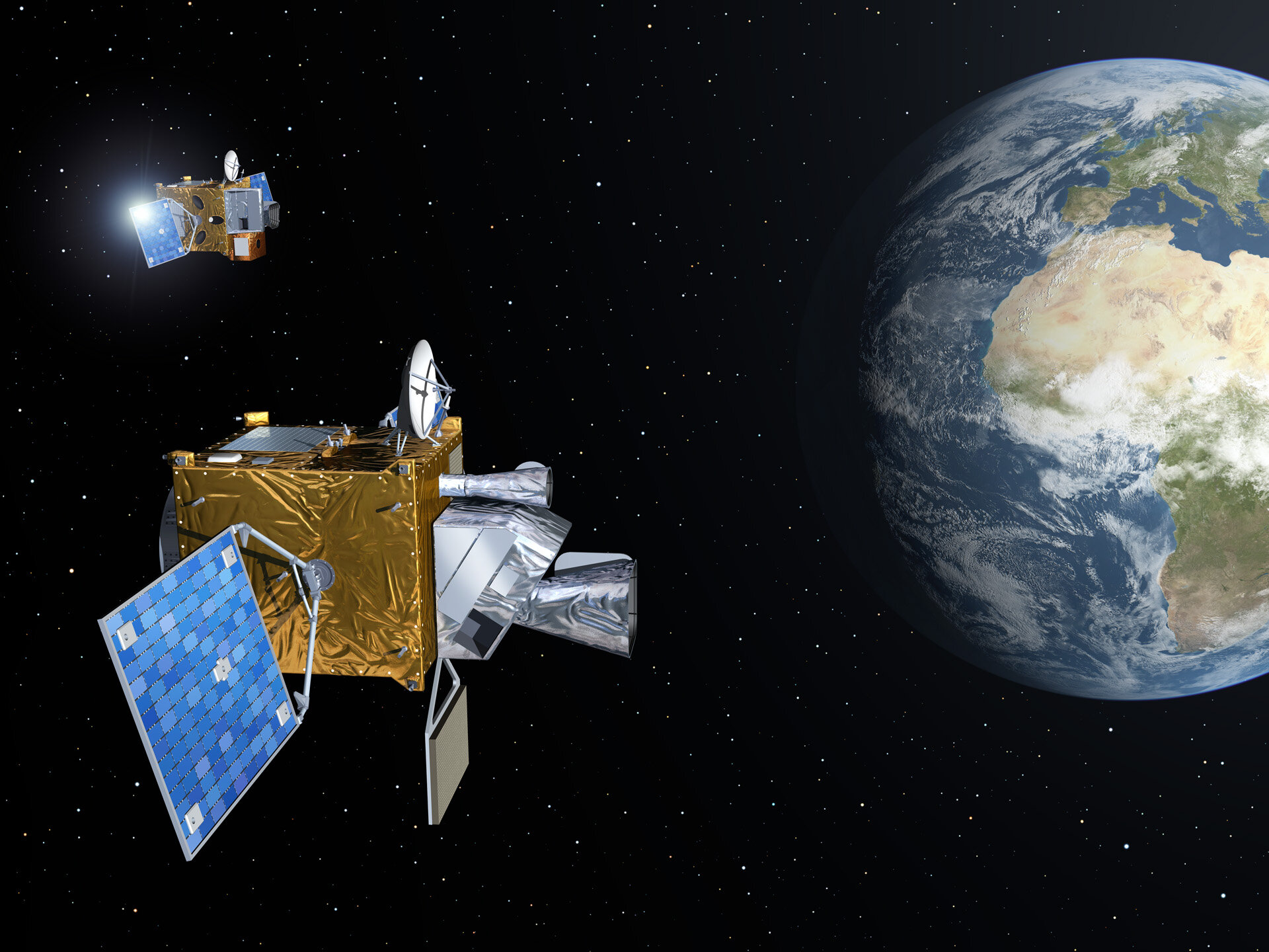
Jochen Grandell starts his presentation by introducing the Meteosat program from the beginning. Then he explains what the MTG mission is and what kind of instruments will be onboard the MTG satellites. He introduces the Flexible Combined Imager (FCI) and the Lightning Imager (LI). The differences between SEVIRI onboard MSG and FCI are discussed in more detail. The measurement technique of the LI is shown together with the role of this very new instrument.
The next generation of geostationary satellite, GOES-R, is scheduled for launch in November, 2016. NOAA has been preparing for the data from its Advanced Baseline Imager and Geostationary Lightning Mapper for over 10 years, but recently JMA launched Himawari-8, a geostationary satellite with a similar imaging instrument. This presentation will show how Himawari-8 data has been used to prepare for similar data to begin flowing in early 2017. Meteosat Third Generation (MTG) will also carry a similar imager, so lessons learned from Himawari and GOES-R will be helpful for MTG data users.
Recording Daniel Lindsey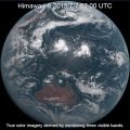
Session 2: Himawari Images and Products
The new-generation geostationary meteorological satellite of the Japan Meteorological Agency (JMA), Himawari-8, started operation in July 2015. Himawari-8 features a new imager, Advanced Himawari Imager (AHI), with 16 bands. The imager's spatial resolution and observation frequency is improved comparing with its predecessor satellites, MTSAT-series. This presentation will be an overview of Himawari-8/9. It will focus on the imaging capabilities and the data distributions.
This presentation summarises the adaptation of WMO / EUMETSAT endorsed RGB products to Himawari-8 data over the Australasian-Pacific region by WMO RAV and RAII stakeholders from the perspective of the Australian VLab Centre of Excellence. The content includes the tuning of the RGB products to the Himawari-8 data, the training conducted to permit effective use of the RGB products. Evidence is provided of the effective stakeholder use and development of the RGB products, including the development of new RGB products.
Recording Bodo Zeschke
Session 3: RGB Products from MTG and GOES-R Lightning Mapper
The amount of data from the world’s weather satellites is overwhelming. While each type of data is valuable, it’s almost impossible to use
them all operationally. It’s like trying to drink from a fire hose; there’s simply too much data to absorb, and much of it ends up not being used.
“Red, Blue, Green” or RGB processing is a simple but powerful technique that consolidates different channels of satellite imagery into single
products that are easy for forecasters to use. RGB processing used to be a visualization technique used mainly in research. But due to its
popularity, it is increasingly available to operational forecasters. A pre-requisite for this, however, is the standardization of RGB products,
i.e. the selection of the most useful RGB products for operational forecasting, generated at each Meteorological Service with the same identical
standard method/recipe.
The combination of individual images into RGB colour composites is modernizing the interpretation of satellite imagery. While black and white
imagery still has its uses, it often cannot match the effectiveness of RGB products. In fact, RGB images are often more useful than traditional
colour image enhancements.
The Flexible Combined Imager (FCI) of MTG will open new possibilities of RGB products, with higher temporal and spatial resolution and better
accuracy (less noise). Of particular interest will be the new NIR2.25 band that will improve cloud phase detection and detection of hot/large
fires. Two new RGBs related to this channel will be presented. Furthermore, some standard RGBs will need to be tuned to account for the slight
changes in central wavelength and band width. Some Himawari examples for this tuning will be given. Finally, the issue of local versions of RGB
products will be addressed using the examples of “tropical” Night Microphysics and Airmass RGBs.
The NOAA Geostationary Operational Environmental Satellite (GOES-R) series provides the continuity for the existing GOES system currently operating over the Western Hemisphere. The Geostationary Lightning Mapper (GLM) represents an advancement over current GOES by providing an entirely new capability for total lightning detection (cloud and cloud-to-ground flashes). The GLM will map total lightning continuously day and night with near-uniform spatial resolution of 8 km with a product latency of less than 20 sec over the Americas and adjacent oceanic regions. The total lightning is very useful for identifying hazardous and severe thunderstorms, monitoring storm intensification and tracking evolution. Used in tandem with radar, visible and infrared satellite imagery, and surface observations, total lightning data has great potential to increase lead time for severe storm warnings, improve aviation safety and efficiency, and increase public safety.
Recording Steven Goodman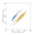
Session 4: Future NWCSAF Cloud Products with MTG-I
Meteosat Third Generation (MTG) will see the launch of six new satellites from 2021. MTG-I will embark a VIS/IR imager and a lightning imager. The talk details the improvement of NWCSAF/GEO cloud products using new MTG-I capabilities. The new channels will help for the detection of thin cirrus and will improve the cloud phase identification. Cloud products will take advantage of the enhanced spatial resolution, particularly, for the separation between cumuliform and stratiform clouds. Finally, the use of lightning imager should be useful for convection identification.
Recording Gaëlle Kerdraon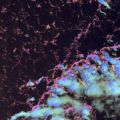
Session 5: Prospects of new MTG 2.3 µm channel
Major advancements of the MTG with respect to MSG are the superior resolution and the added 2.3 um channel, which in combination allow
retrieving cloud particle effective radius and discerning cloud phase at the very high resolution of 500 m. These cloud properties determine
whether a cloud would be precipitating, and if so whether it would be rain or snow. This information is particularly advantageous for observing
small boundary layer clouds, which often produce rain showers in very clean air masses, such as at the Atlantic coast, but stop raining when
polluted inland. This is also the case for post frontal clouds that may produce snow showers. It will be possible to detect it with the MTG.
The ability of retrieving high resolution cloud drop effective radius in convective clouds makes it possible to retrieve cloud drop concentrations,
which are dominated by aerosol particle concentrations. The retrieved cloud drop concentrations can be reversed to infer the concentrations of
particulate air pollution that occur under cloud decks that are rooted in the boundary layer. A proxy to the retrievals is an RGB color combination
that can show the same qualitatively.
Furthermore, the inferred cloud drop concentrations has a predictive value for the nature of foretasted convective storms in that air mass, because
the aerosols can invigorate the storms and make them more prone to producing lightning and hail.

Session 6: Meteosat Third Generation Lightning Imager
EUMETSAT is currently developing with ESA the geostationary Meteosat Third Generation (MTG) satellite system to continue and enhance the service currently provided by Meteosat Second Generation (MSG), from 2020 onwards. One of the new missions of MTG is the Lightning Imager (LI) mission, which is intended to provide a real time lightning detection and location capability in support to nowcasting of high impact weather. The LI measures the total lightning, i.e. the combined cloud-to-ground and intracloud/cloud-to-cloud lightning. One of the major tasks in the MTG program is to provide the Level 2 product processor. The initial L2 products are based on the detection of the optical pulses on top of clouds following a false event filtering and clustering of the detected triggered lightning events in time and space. These are composed to the initial L2 products, i.e. groups and flashes representing geophysical flashes and strokes. A further L2 product category is the Accumulated Products, which integrate the Flash products into a fixed 2 km grid (same as for the MTG Flexible Combined Imager IR channels) with a 30 sec accumulation period. These 30-sec periods can be further stacked by users. The products are disseminated as short duration chunks in order to meet the timeliness requirements.
Recording Heikki Pohjola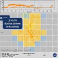
Session 7: Satellite-based Total Lightning Observations
Short-term Prediction Research and Transition (SPoRT) Center, part of the United States’ NASA program, has been a leader in transitioning total lightning observations to operational forecasters. This effort began in 2003 with a single, NASA-owned ground-based lightning mapping array. The effort has since expanded to include multiple networks supporting a variety of end users for severe weather, safety, and aviation. This effort serves as the foundation for preparing the United States forecaster community for the Geostationary Lightning Mapper (GLM) set to launch aboard GOES-R. This presentation will discuss the GLM and its observations, what total lightning is, and how these data can be used operationally based on ongoing activities to prepare the United States for GLM. The GLM instrument is very similar to the Meteosat Third Generation’s Lightning Imager and presents an opportunity for collaboration between U.S. and EUMETSAT forecasters.
Recording Geoffrey Stano
Session 8: Expected Benefits from MTG-I
The presentation addresses some of the general impacts of the higher temporal and spatial resolution, available with the most recent or upcoming geostationary weather satellites. Main contribution of the higher scan frequency (of the order of 2.5 minutes or shorter) is in much better temporal coverage of evolution of rapidly developing weather systems, namely those associated with deep convection. The impact of shorter scan frequency will be demonstrated using data from the MSG 2.5-minute experiment. Spatial resolution affects not only the fidelity of imagery, but also (and more importantly) some of the quantitative characteristics of cloud tops - such as local cloud top brightness temperature minima, associated with overshooting tops. This effect will be demonstrated using high resolution polar satellite imagery.
Recording Martin Setvak