Convection - Event Week 2015
From 8th to 12th June 2015 EUMeTrain organized an event week on convection. During this week recent remote sensing
developements in the area of forecasting and/or analysing convective weather situations were presented. Furthermore actual and/or past
convective events will be analysed and discussed. Altogether this event week was giving an interesting insight into the world of convection –
from the scientific and application-oriented point of view.
Each session comprised 2 presentations of about 30 minutes, so that the duration of a session will be around 1 hour.

Session 1: Lightning Imager
NASA’s Short-term Prediction Research and Transition (SPoRT) center has been a leader in transitioning total lightning observations from ground-based lightning mapping arrays (LMAs) to operational forecasters. This effort began in 2003 with a single, NASA-owned LMA and has since expanded to include multiple LMAs focusing on warning decision support, lightning safety, and aviation forecast needs. This presentation will cover SPoRT’s total lightning activities, focusing on operational applications both with the LMAs directly and in preparation for the GOES-R Geostationary Lightning Mapper.
Recording Geoffrey StanoThe Meteosat Third Generation Imaging satellite will include in addition to the Flexible Combined Imager (FCI), which is a continuation of the imaging mission, a Lightning Imager (LI) which is a completely new mission. The MTG LI will complement existing ground based capabilities for the detection and location of lightning with information on cloud-to-ground (CG) and cloud-to-cloud or intracloud (CC/IC) discharges, i.e. total lightning. The presentation will cover the background for lightning detection from space, including the detection and processing principles, and will concentrate on the meteorological products from the lightning imager. These include lightning flashes as well as accumulated lightning products.
Recording Jochen Grandell
Session 2: NWC-SAF CRR and RDT Products
The Convective Rainfall Rate (CRR) product, included in the NWCSAF/MSG software package, estimates rain rates on convective and to convection associated stratiform events. The current version of the package includes estimations of rain intensities through two different approaches. A detailed explanation of them will be presented. Also a comparison, focusing on the weakness and strength of the results provided by both algorithms, will be shown.
Recording Cecilia MarcosThe Rapidly Developing Thunderstorm product provides in object-mode information about significant convective systems. Various attributes
describe the convective system: cloud-top temperature and height, overshooting tops, morphological attributes. The product uses the satellite
brightness temperature of various channels and optional data like NWP data, lightning data and other NWCSAF products. A nowcast of convective
systems is developed for 2016.
A new NWCSAF product (Convection Initiation – the probability of a cloudy pixel to become a thunderstorm) will be developed for 2016.
Session 3: NWC-SAF Applications
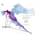
Croatian Adriatic coast is one of the rainiest areas in Europe. Large parts of the coast are not covered by the Croatian Radar network. The Croatian Weather Service (DHMZ) uses data from the NWC-SAF precipitation products to complement Radar data. Results from a validation campain, using Radar and rain gauge data, will be shown in this presentation.
Recording Izidor Pelajic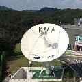
Session 4:
Firstly, the characteristics of synoptic weather which convective cloud occurs over eastern Asian region will be mentioned and the thunderstorm monitoring system with radar data which KMA forecasters use will be also introduced. And then I will present our convective cases and explain them with satellite, radar and other NWP data.
Recording Eunha SonTSN-Trusted Spotter Network Austria (www.zamg.ac.at/tsn_en) was established to build up a reliable network between storm - spotters and chasers, operational forecasters and scientists. TSN in its current state constitutes the collaboration between the Austrian meteorological service ZAMG (www.zamg.ac.at), SKYWARN AUSTRIA with its various partner organizations and the European Severe Storms Laboratory ESSL with its EUROPEAN SEVERE WEATHER DATABASE ESWD. One aim of this collaboration was a standardization of severe weather reports from the partners according to ESWD standards. We want to introduce the Trusted Spotter Network Austria and its MO, also the performance of ESWD reports from Austria relating to heavy rain, severe wind gusts, hail and other parameters will be shown in our presentation.
Recording Thomas Krennert
Session 5:
The environments of non-severe and severe thunderstorms in Central Europe were studied using 16421 proximity soundings acquired in the period from December 2007 to December 2013. In this presentation, we will concentrate on different sounding-derived parameters and how their values change with the increasing severity of thunderstorm-related hazards (large hail, severe wind gusts, tornadoes, excessive precipitation). For example, we show that probability of these hazards as a function of CAPE and 0-6 km bulk shear is different for each hazard. We also present implications for forecasters, such as that area of parameter space with the highest probability of particular hazard may not collocate with the area where it is most frequent.
Recording Tomas PucikThe presentation gives an overview of cold-season derechos that occurred across Central Europe between 1997 and 2014. The environmental conditions leading to persistent, intense thunderstorms and associated long-track high wind events are analysed using reanalysis data and proximity soundings. A focus is the development of deep moist convection in initially stable air masses due to synoptic-scale processes.
Recording Christoph Gatsen
Session 6:
In the presentation the recent upgrades and future developments of the H-SAF products for the monitoring of convective precipitation will be highlighted. The application of a new version of NEFODINA, a tool developed by CNMCA for the detection of convective systems, will be introduced and different improvements such as the application of a calibration formula and the release of new products versions, developed for monitoring the MSG SEVIRI full disk area, will be shown.
Recording Matteo PicchianiWithin the CM SAF we have developed an algorithm for the retrieval of daytime cloud physical properties from MSG-SEVIRI. This algorithm and the retrieval products will be described. Furthermore applications will be discussed with a focus on convection.
Recording Jan Fokke Meirink
Session 7:
Since 2004, EUMETSAT is deriving the Multi-Sensor Precipitation Estimate (MPE) product operationally. The MPE product retrieval is based on a blending technique that uses microwave information from SSMI-S instrument onboard DMSP-F16 polar satellite and infrared information from the Spinning Enhanced Visible and Infra Red Imager (SEVIRI) instrument onboard MSG geostationary satellites. It consists of a rain rate given every 15 minutes at MSG pixel resolution (3x3km2). Although the retrieval is not a state-of-the-art technique, the product has proven to be quite robust and valuable for deep convective precipitation detection. This presentation will present the MPE product and show some example of potential improvements for future SEVIRI precipitation product.
Recording Marie Doutriaux-BoucherDelineating areas where convection is most/least likely to develop can be difficult, especially in the next 3-9 hours. Knowing how forecasts can extend the usefulness of SEVIRI products from observations to forecasts can be equally challenging. This talk discusses a new forecast tool that addresses a number of questions: How can SEVIRI products be used to monitor and predict areas that are becoming more/less supportive for development of convection? Will the details in the SEVIRI observations be retained by short-range forecast tool? How do the derived SEVIRI forecast products relate to standard satellite forecasting conventions? Can IR satellite observations still be useful after convection has begun and clouds have formed? Are the SEVIRI projections useful for monitoring NWP performance?
Recording Ralph Petersen
Session 8:
Next to sufficient instability, strong vertical wind shear is the main driver that promotes thunderstorms to organize into multicells, supercells or lines, which are more probable to attain a longer lifetime and to produce severe weather phenomena like hail or wind gusts. The role of vertical wind shear in storm organization is explained in this presentation, and selected case studies illustrate how favorable conditions for severe storms can evolve either by large-scale processes or, more challenging for forecasters, by local modifications of the wind systems and associated temperature and humidity changes.
Recording Georg PistotnikMountainous regions tend to be the starting point for convective developments due to their elevated heat sources, the topographic amplifying factor or their role as a flow obstacle. In this presentation different synoptic situations and the consequent convection will be analyzed in the Alpine region on the hand of case studies.
Recording Liliane Hofer