EUMeTrain Marine Course 2017
The 3rd Eumetrain Marine Course was delivered on the Moodle platform and was held in the period of 8 weeks. The course was designed to address the following WMO Marine Weather Forecaster Competences requirements (based on MWF Competence Framework document, approved by WMO Congress 17, 2015):
- -Analyze and monitor continually the marine weather situation.
- -Forecast marine weather phenomena, variables and parameters.
- -Warn of hazardous phenomena.
Accordingly the following skills were trained:
- 1. Interpret satellite imagery and products to identify potentially dangerous phenomena.
- 2. Using satellite altimeters and scatterometers.
- 3. Use of NWP in waves and swell forecasting.
- 4. Identify characteristics of waves and swell.
- 5. Monitor sea ice characteristics.
- 6. Identify non-routine weather conditions.
- 7. Use forecasting model outputs in hazardous conditions.
The form of the course was mainly asynchronous, although online practical lectures were provided by experts from ECMWF (https://www.ecmwf.int/), KNMI (http://www.knmi.nl/home) and DMI (http://www.dmi.dk/vejr/).
Lecture 1: Ocean Waves
Starting from the basics, this lecture introduces the students to wave model products (eg. wave height and mean propagation direction), wave spectrum analysis, long swell forecasts, extreme forecast index etc. Since these outputs (alongside data from the bouys) are the basic material marine forecasters have for forecasting and nowcasting waves in seas and especially in oceans, explaining the positive and negative sides of model outputs is very important for understanding and thus correctly using the products marine forecasters use.
Go to Webcast..
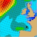
Lecture 2: Sea Surface Vector Winds
The lecture deals with modelled winds and winds derived from instruments onboard satellites like Metop-A and Metop-B in low orbits around the Earth (polar orbits). Today's models are evolving at a rate that is faster than the increase of density of observations and that presents a problem for forecasts. Here stands the question 'Will meteorology continue to develop and improve?'. The lack of observed data is thus filled with the data from satellites, although this data also has its own constraints due to the way it is derived. In the lecture the characteristics of the satellites carrying instruments for measuring winds and waves will be explained and the logic behind the calculations of winds using satellites will be discussed.
Scatterometer data are used for many different purposes in marine meteorology, e.g. warnings, enhancement of situational awareness for winds, monitoring of storm evolution, low pressure systems, etc., therefore marine forecasters using the products about wind and waves from satellites will be instructed how to use them and when to combine the data with model outputs.
Go to Webcast..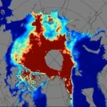
Lecture 3: Arctic Sea Ice Observations
Sea ice has always posed a threat to ships sailing through the northern Atlantic and also the ice was a clear indication of climate changes since the start of satellite observations in the 1970s. Satellites from their beginning have helped very much in tracking the condition and movements of ice sheets over North Pole and Antarctica. Sea ice condition, its melting and freezing over again in winter are important to track to see how they are affecting the weather and climate in these parts. Many satellite products and models were developed to distinguish thin one year ice from the thicker multiyear ice and to determine the actual thickness of these sheets. Further questions like how does ice affect radiation, how does snow affect the ice and what is the quality of the models that are used, will be answered during this lecture.
Go to Webcast..During the course time frame participants were requested to complete several mandatory assignments: 1) Elaboration of a showcase; 2) Going through learning modules and related quizzes; 3) Participation in the course forum with relevant discussions and questions. The showcase was considered the main task for the course participants. Due to high quality of the produced showcases some were selected by experts to be published in the EUMETSAT web page.
Selected Cases:
This showcase is an extended version of:
Medicane Qendresa hits Malta and Sicily by Jochen Kerkmann and Mark Higgins (EUMETSAT), Sancha Lancaster (Pactum), Hans-Peter Roesli (Switzerland), Eleftheria Tsiniari (HNMS) and Dr. Michael Sachew
The next edition of the EUMeTrain Marine Course is foreseen for the spring of 2019.