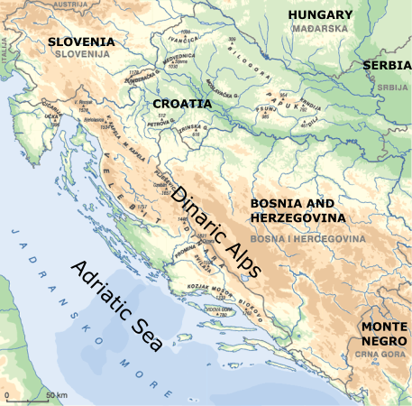
Bora (locally called BURA) is a gusty northeasterly downslope windstorm often occurring along the eastern coast of the Adriatic Sea, at the leeward side of the Dinaric Alps (Velebit, Dinara and Biokovo mountains).
Common Remarks

In strong bora episodes hourly mean wind speeds often surpass 20 m/s with gusts reaching up to 50 or even 65 m/s. In other words, it can reach hurricane-force wind speeds. Severe bora with maximum gusts exceeding 40 m/s may appear along the entire Adriatic coast, but its duration and frequency generally decrease from north to south.
Bora significantly affects the dynamics of currents in the Adriatic Sea. It causes difficulties with aviation as well as land and marine traffic, and in most cases it has an unfavorable impact on agriculture. The spatio-temporal distribution of wind speeds during bora episodes is influenced by the complex orography, with the height and width of the mountain range growing from northwest to southeast.
Winds similar to bora can be found in several other places in the world: along the Black Sea coast at the root of Caucasus Mountains, in the Gulf of Tehuantepec on the Mexican Pacific coast (called Papagayos or Tehuantepecers), as well as in the Kanto Plain in Japan where an exceptionally cold downslope wind prevailing on the leeward side of the Honshu island during winter monsoons is known as Oroshi or Karakaze (meaning dry wind).
I. Cloud Structure In Satellite Images
Learn about how to recognise and detect bora in satellite images.
II. Meteorological Physical Background
Find out more about the meteorlogical and physical background of bora.
III. Key Parameters
Learn which key parameters to use for monitoring bora.
IV. Typical Appearance In Vertical Cross Sections
Find out the typical appearance of bora in vertical cross sections.
V. Weather Events
Explore the weather events associated with bora.
VI. References
Let these comprehensive documents in the references assist you in finding more about bora.