Key Parameters
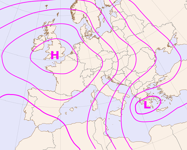
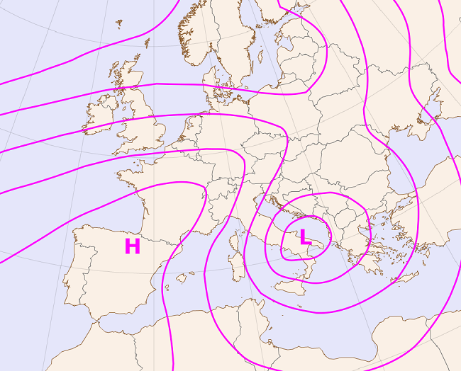
- high pressure gradient between a high over western Europe and a low in the eastern Mediterranean (clear bora cases) or in the southern Adriatic (dark bora)
- the pressure gradient across the mountain range is locally intensified due to mountain wave formation, which additionally intensifies bora
MSLP
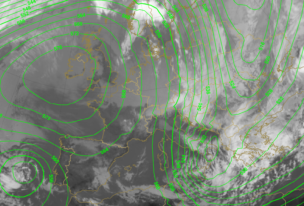
- in clear bora cases AT 500 usually shows a zone of high pressure gradients between the ridge over the Atlantic and western Europe and often, but not necessarily, a deep trough above southeastern Europe.
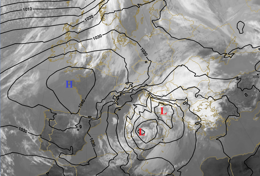
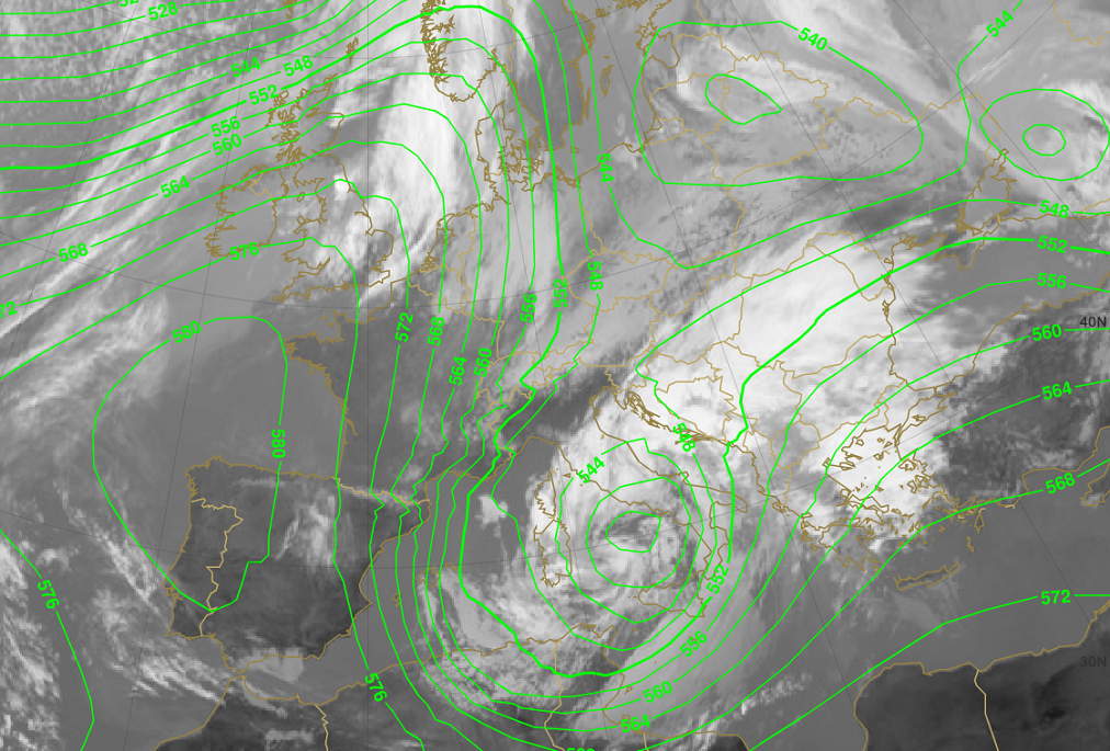
- in dark bora cases there is usually a deep trough over central Europe and central Medirerranean, often with a cut-off low over Italy
AT 500
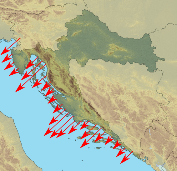
- maxima of NE wind occur along the eastern Adriatic coast and the adjacent Dinaric Alps
10m wind
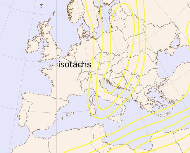
- in deep-layer bora cases NE jet flows above the area
Jet stream (isotachs 300 hPa)
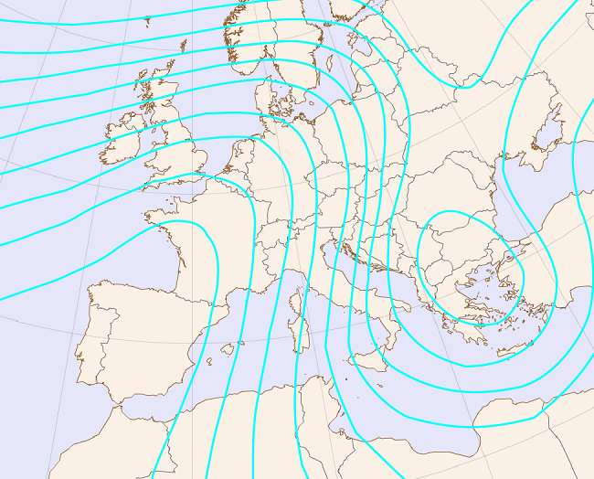
Mean sea level pressure
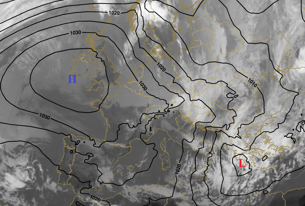
MSLP in anticyclonic (clear) bora cases
|
09 February 2015/12.00 UTC - Meteosat 10 IR 10.8 image; black: mean sea level pressure
|
|
|
|
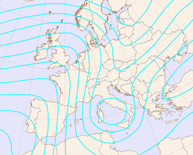
MSLP in cyclonic (dark) bora cases
|
05 March 2015/12.00 UTC - Meteosat 10 IR 10.8 image; black: mean sea level pressure
|
|
|
|
AT 500 hPa
AT 500 in anticyclonic (clear) bora cases
|
09 February 2015/12.00 UTC - Meteosat 10 IR 10.8 image; green: height contours 500 hPa
|
|
|
|
AT 500 in cyclonic (dark) bora cases
|
05 March 2015/12.00 UTC - Meteosat 10 IR 10.8 image; green: height contours 500 hPa
|
|
|
|
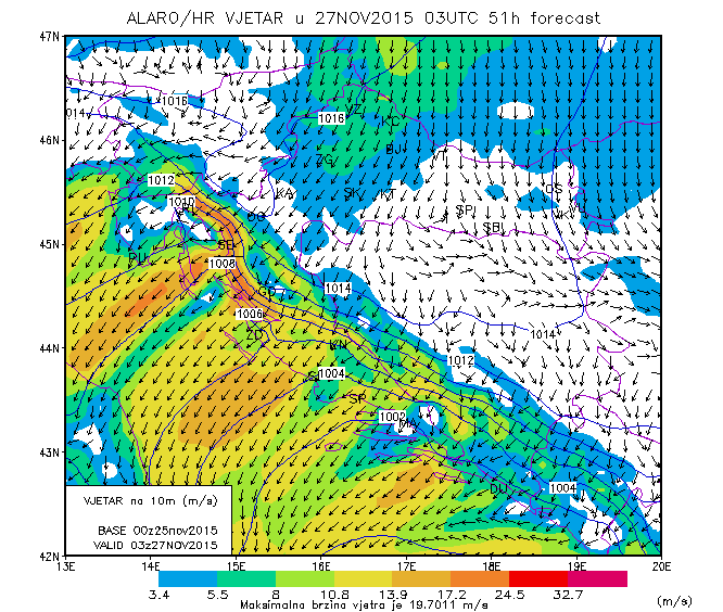
10m wind
|
27 November 2015/03.00 UTC - 10 m wind
|
|
|
|
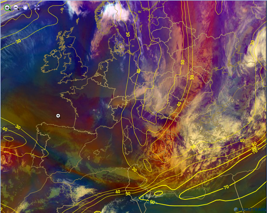
Isotachs 300 hPa
|
09 February 2015/12.00 UTC Meteosat 10 Airmass RGB image; yellow: isotachs 300hPa
|
|
|
|