Cloud Structure In Satellite Images
Depending on the synoptic situation, bora sometimes occurs with clouds gathering on the hilltops and moving towards the sea with rain or snow. This type of bora is usually reffered to as a "dark bora". On the other hand, a "clear bora" is a bora with clear skies, which is the more frequent case.
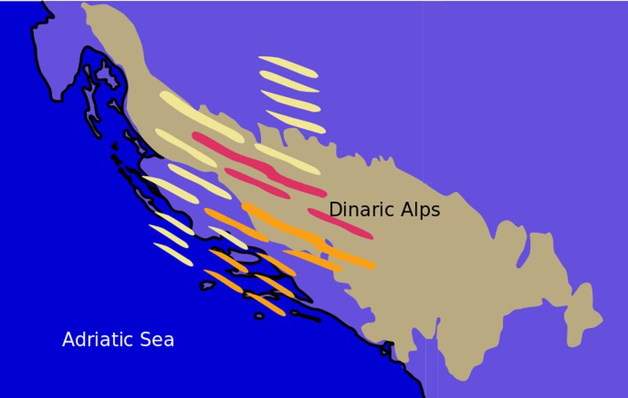
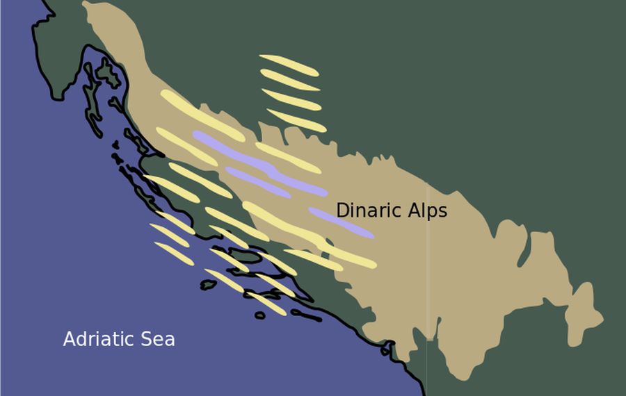
Since bora is a wind phenomenon it is not directly visible in satellite images, but there are different cloud structures typical to bora cases. In strong, deep-layer bora cases, lee clouds can develop all across the Adriatic Sea, reaching the Italian coast. The effects of bora on cloud formation are most clearly seen in HRV images or RGB combinations of IR 10.8 µm and HRV images.
|
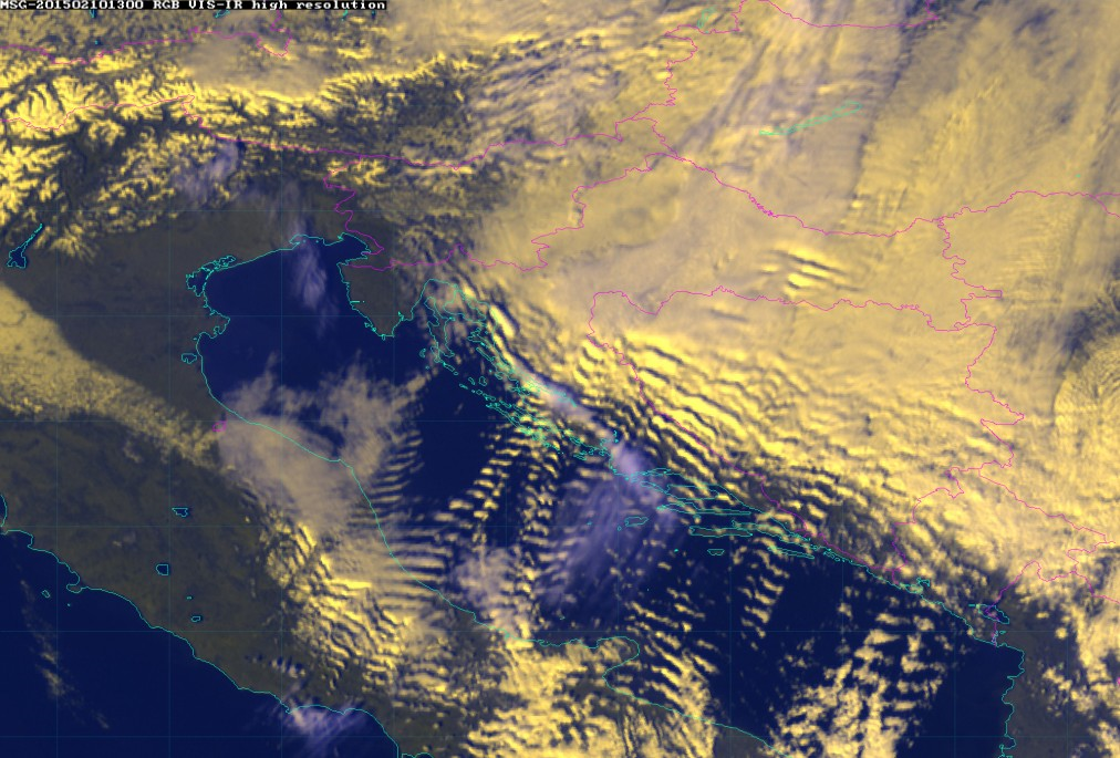
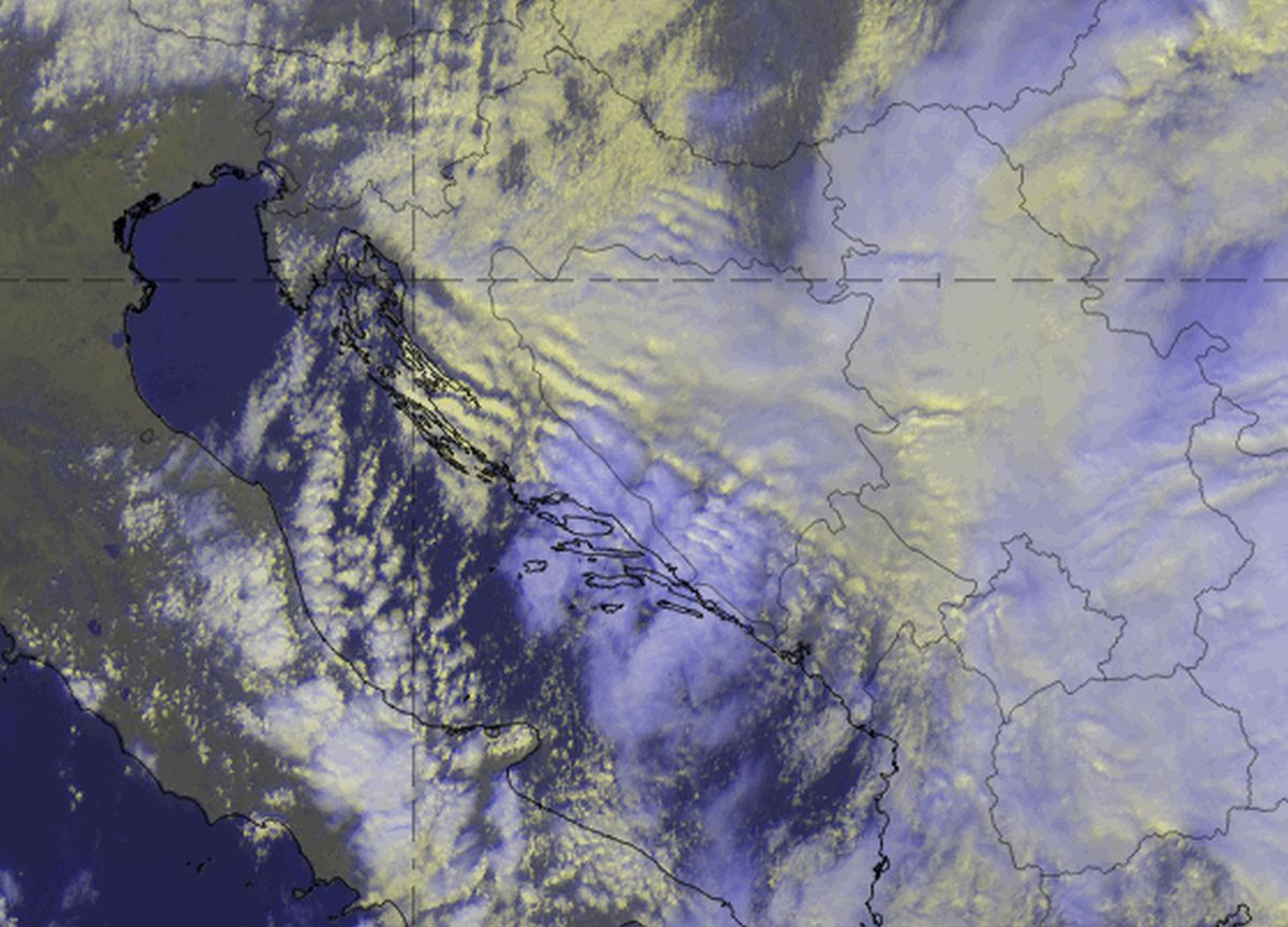
10 February 2015/13.00 UTC - Meteosat 10 RGB image (HRV, 10.8, 10.8)
|
|
|
|
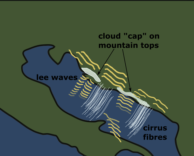
In the loop of HRV-IR images lee waves can be seen forming all across the Adriatic towards the Italian coast. It is easy to notice how the wind there is channeled through the mountain passes, which also influences the lee wave formation.
Fibres of cirrus clouds can also be seen stretching over the Adriatic. A cloud "cap" consisting of mid-level clouds is often seen trapped on the Velebit and Biokovo mountains. In the image loop the effect of clouds dissipating all along the coastline, a very frequent consequence of bora, is seen clearly. A wave-like cloud formation of the trapped waves is also seen here on the upwind side.
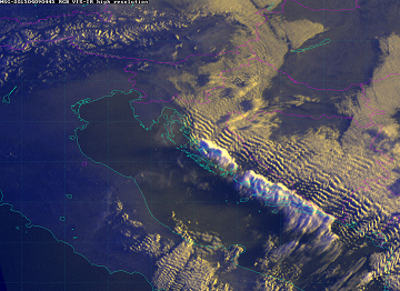
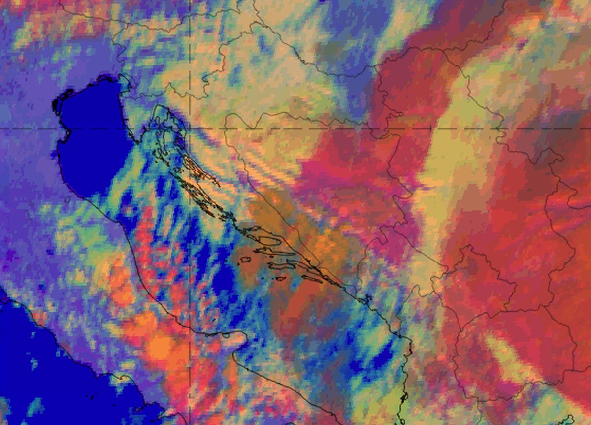
 09 April 2015/04.45 - Meteosat 10 RGB image (HRV, 10.8, 10.8) - 15 min loop
|
|
|
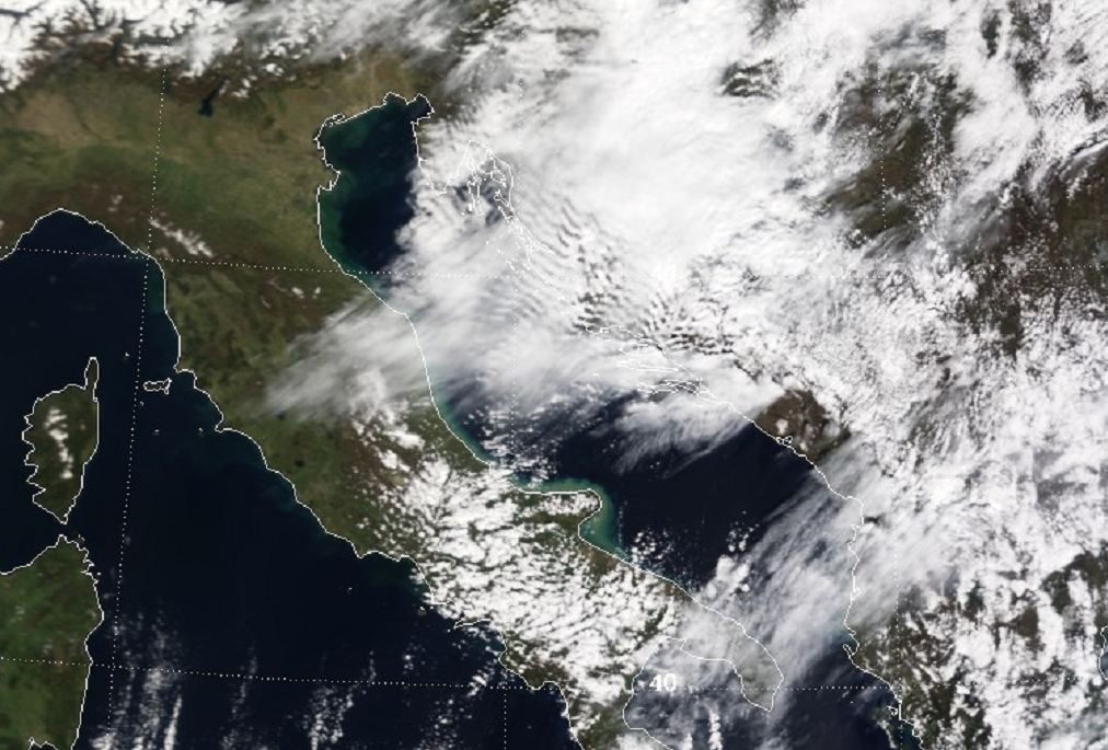
08 April 2015/09.45 UTC Modis TERRA RGB image (0.65 µm, 0.55 µm, 0.46 µm)
|
|
Appearance in the basic channels:
HRV Clouds RGB from 05 February 2020, 12 UTC.
The HRV Clouds RGB provides high resolution, which makes it possible to identify the filigree-like wave structures that can occur, although it has the disadvantage that it cannot be used during the night. Low to mid-level wavy clouds appear very bright or yellowish and can be superimposed by higher clouds (often cirrus), which appear in purple or violet. The waves can be observed downstream and upstream of the mountain ridge but do not necessarily develop during all bora events.
When a more thorough analysis of the clouds is needed, the Day Microphysics RGB can be used to distinguish between ice and water phases. It is also only available during daytime, but it includes two infrared channels and hence provides information on the cloud top particle size, temperature and optical thickness, with a good colour contrast. Thick ice clouds appear reddish: brighter for smaller ice crystals near the top and darker for large ice particles. A yellow colour implies low to mid-level water clouds with larger water droplets. Blue colour stands for cloud-free land, oceans or lakes.
Day Microphysics RGB from 05 February 2020, 12 UTC.
Schematic for HRV Clouds RGB (left); Schematic for Day Microphysics RGB (right)