13 July 2021
Late on 13 July the core of the upper-level low slowly moved over the western Alps. Intense convective precipitation can be found in an arc pattern around the core of the ULL, spanning from the Adriatic Sea over Germany and France (see Figure 2a). Due to a weak surface low over northern Germany, warm and moist air masses are advected from the southeast and ingested into the ULL. Surface convergence fuels convection inside the area of the ULL's influence (see Figure 2b).
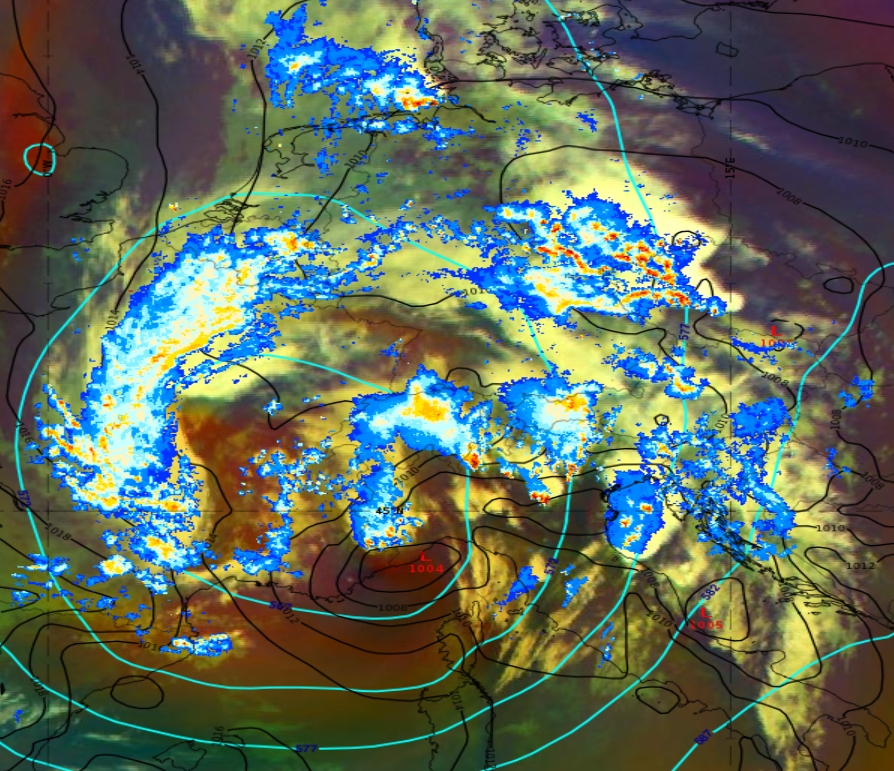
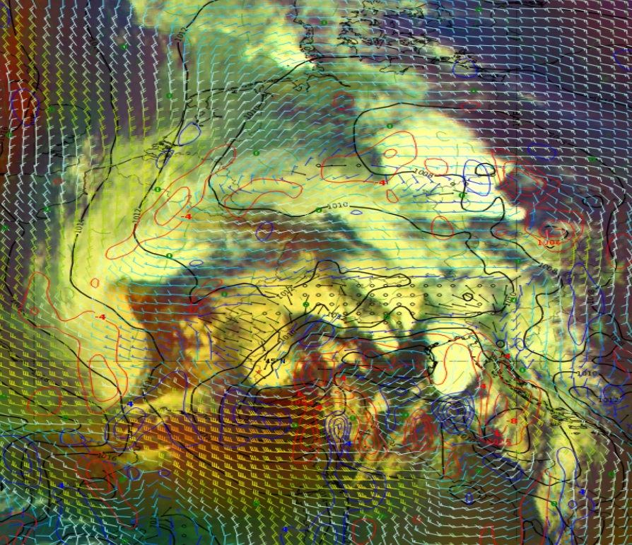
Figure 2: Airmass RGB from 13 July 2021 at 18:00 UTC;
a) Radar reflectivity with geopotential height at 500 hPa (cyan) and mean sea-level surface pressure (black).
b) Mean sea-level surface pressure (black), wind barbs and convergence (red) at 950 hPa.
The slow motion of the ULL, the advection of warm air from the south and the lifting effects over the Alps result in high accumulated precipitation (see Figure 3) over Belgium, Germany and Austria. Side troughs of the ULL increase the lifting effect locally.

Figure 3: 24-hour accumulated precipitation over Germany based on ICON-D2 model run for 13 July 2021 at 12:00 UTC (copyright DWD)