The Dissipation Stage
Once fully developed, upper-level lows are long-lived phenomena. At the end of their life cycle, their temperature difference with the surrounding air masses slowly disappears, as does the cyclonic circulation. This process is caused by friction as well as by latent and sensible heat transport (i.e., convection). In most cases, the ULL merges with a larger trough in the main stream before it has completely dissolved. If the ULL is far from the belt of westerlies, it can dissolve solely by convection. In Europe, this is often the case over the Mediterranean Sea.
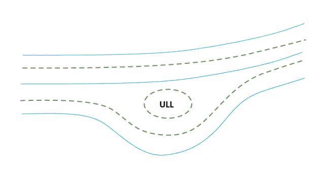
Figure 1: Schematic of the dissipation stage. Cyan lines represent the 500 hPa geopotential height and the dotted green lines the 500 hPa temperature.
In the course of the dissipation, rain showers and convection stop. Temperature near the ground rises steadily.
Upper-level lows are very enduring atmospheric phenomena as can be seen in the Airmass RGB loop below. This is true especially when they move over the oceans - in this case the North Atlantic. In this summertime example of a dissolving ULL the cold air drop is located far north, but the polar front still lies even further north at this time of the year.
Figure 2: Airmass RGB loop of a dissolving ULL from 2 July 2021 at 12:00 UTC to 7 July 2021 at 00:00 UTC. The ULL drifts around a newly formed low-pressure zone and is finally absorbed by the trough. Cyan lines indicate the geopotential height at 500 hPa.
The next example of a dissolving ULL is typical for winter conditions, where the polar front reaches far south. The ULL is moving east, approaching the trough and finally being absorbed.
Figure 3: Airmass RGB loop of an ULL absorbed by a trough at the end of its life cycle (23 February 2021, 12:00 UTC to 25 February 2021, 12:00 UTC). Cyan lines indicate the geopotential height at 500 hPa.