The Upper-Level Trough Stage
The intensity of mid-latitude westerlies (i.e., the corresponding geostrophic wind in higher levels) strongly depends on the meridional pressure difference between approximately 35° and 55° north. A large pressure difference between both latitudes goes hand in hand with a strong westerly component of wind flow and is called a high index circulation. Similarly, in the case of a low index circulation, a weak westerly flow prevails and hence the wind flow's north-south component is relatively stronger.
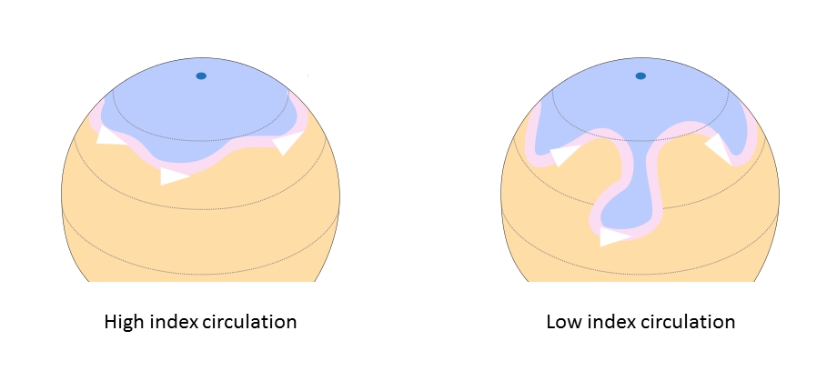
Figure 1: Rossby waves in high (left) and low index circulations (right). Blue represents the polar air mass, and orange the warmer air masses. The pink ribbon marks the position of the jet stream. © Fred the Oyster, CC-BY-SA.
Troughs and their associated upper-level lows emerge with the transition from a high index circulation to a low index one.
Most ULLs remain stuck in the first stage of development. They form within an upper-level trough and persist as long as the trough expands. As soon as the trough withdraws, the ULL vanishes.
Figure 2: Airmass RGB loop and geopotential at 500 hPa from 11 January 2021 at 12:00 UTC to 13 January 2021 at 00:00 UTC.
The above loop shows an upper-level low that forms within a pronounced upper-level trough which moves southeast along the Italian peninsula. This ULL remains within the cold air of an upper-level trough and never tears-off from the polar air mass. This is a very common phenomenon seen in upper-level troughs, especially when they take an elongated form as in this example. In some cases, up to three closed circulations at higher levels can be found inside the trough without a corresponding surface low.