Synoptic overview, satellite imagery, meteorological parameters
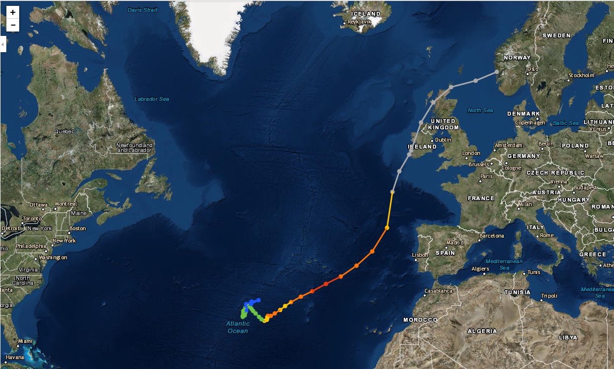
This overview will show the lifecycle (Table 1) of hurricane Ophelia. In Figure 3 Ophelia's path and development can be observed. After the cold front decay on 6th October, the low developed (tropical depression - green colour and subtropical depression - blue colour), the tropical storm then subsequently initiated (yellow colour) followed by the hurricane (orange colour, 11th October) reaching maximum strength of category 3 (red colour, 14th October). The last phase is a transformation to an extratropical storm (16th October - grey colour).
We will observe all the stages with the help of satellite imagery, different channels, different combinations of channels and different meteorological parameters.
* If you want to know more about RGBs used in this chapter look at EUMeTrain's "RGB Colour Interpretation Guide" or "Composite Image Quick Guides" (www.eumetrain.org).
Figure 3: The path of hurricane Ophelia (in different stages of development from 6th to 17th October 2017), source: NOAA
