Formation and development of tropical cyclone
Cyclogenesis over Atlantic
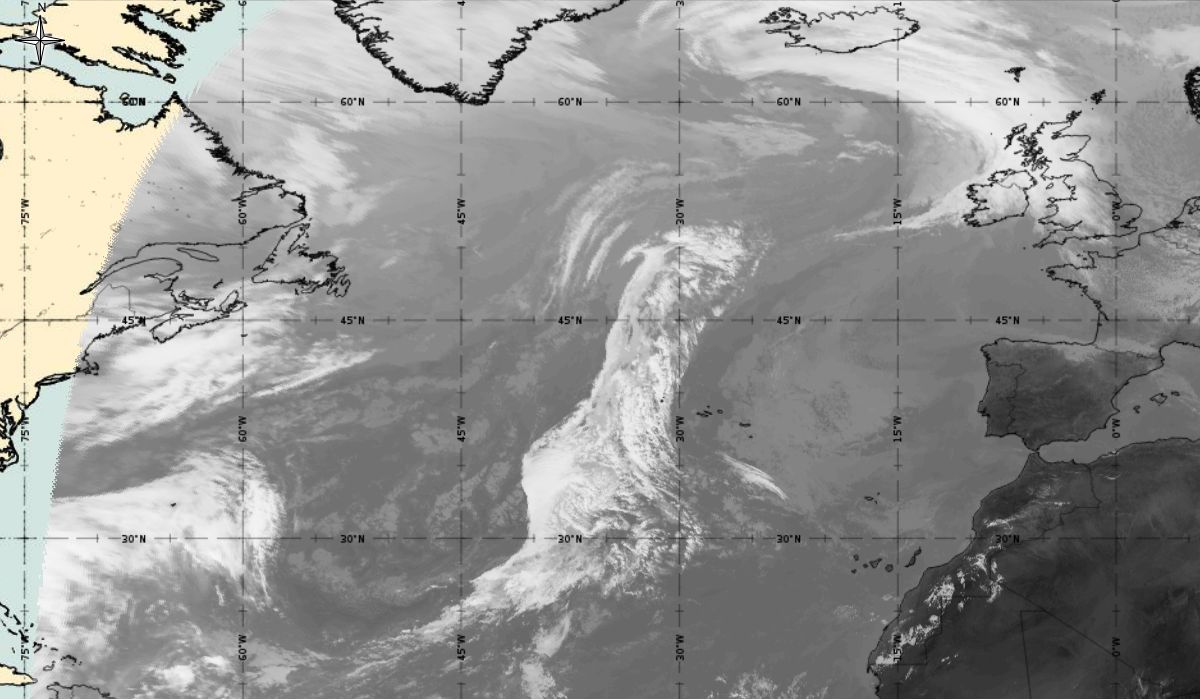
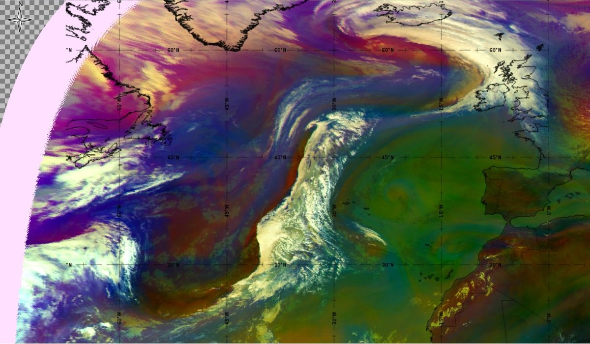
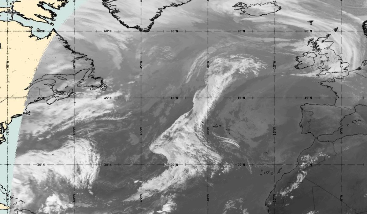
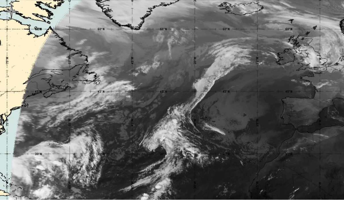
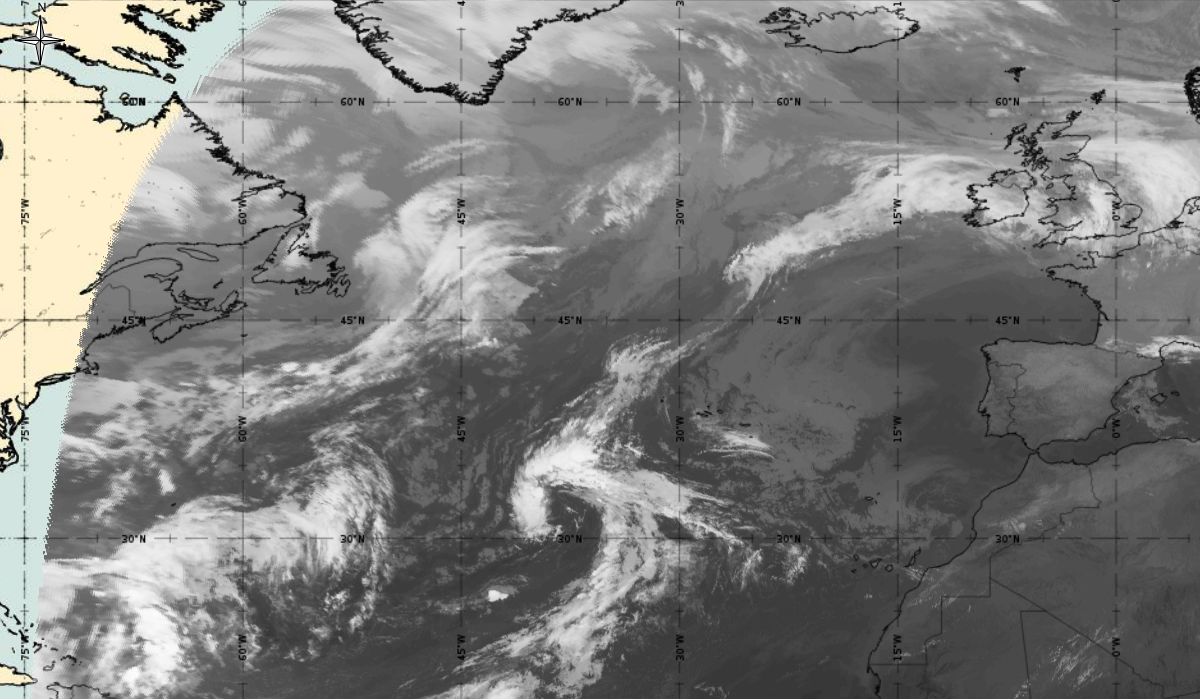
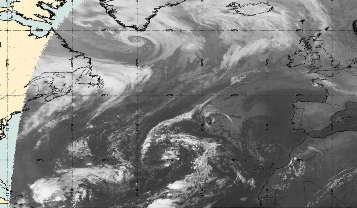
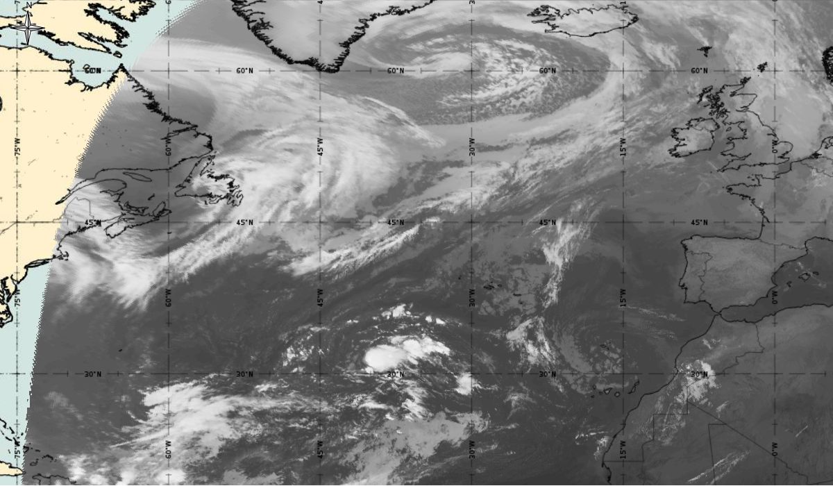
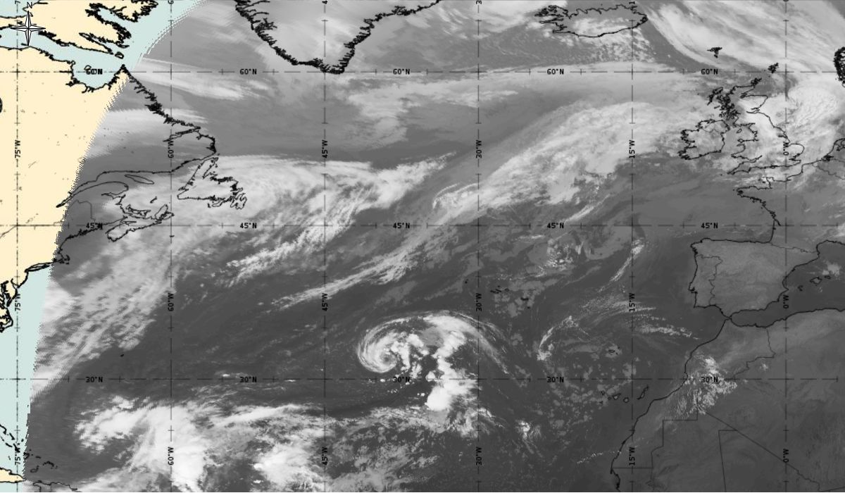
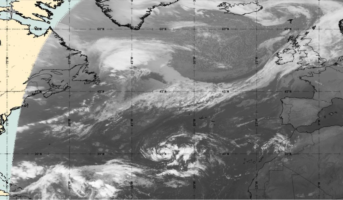
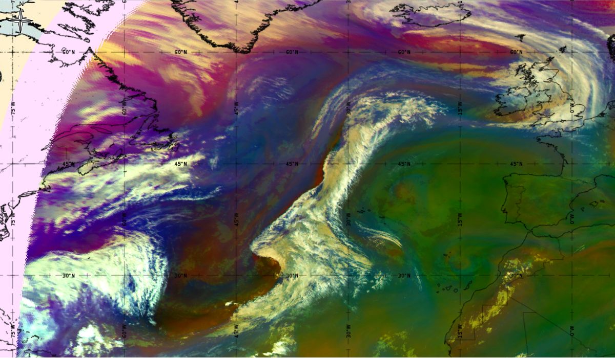
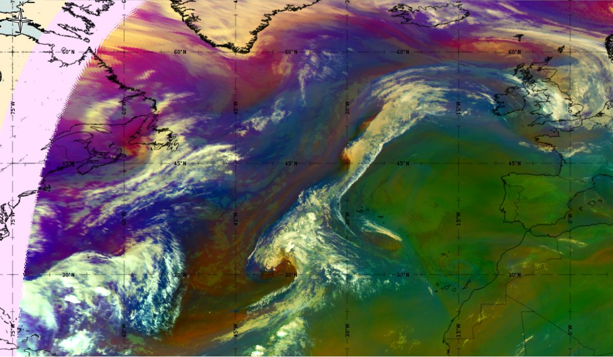
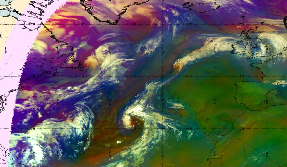
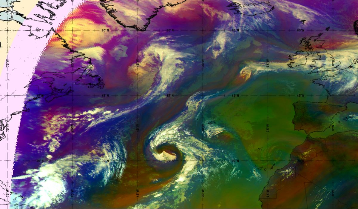
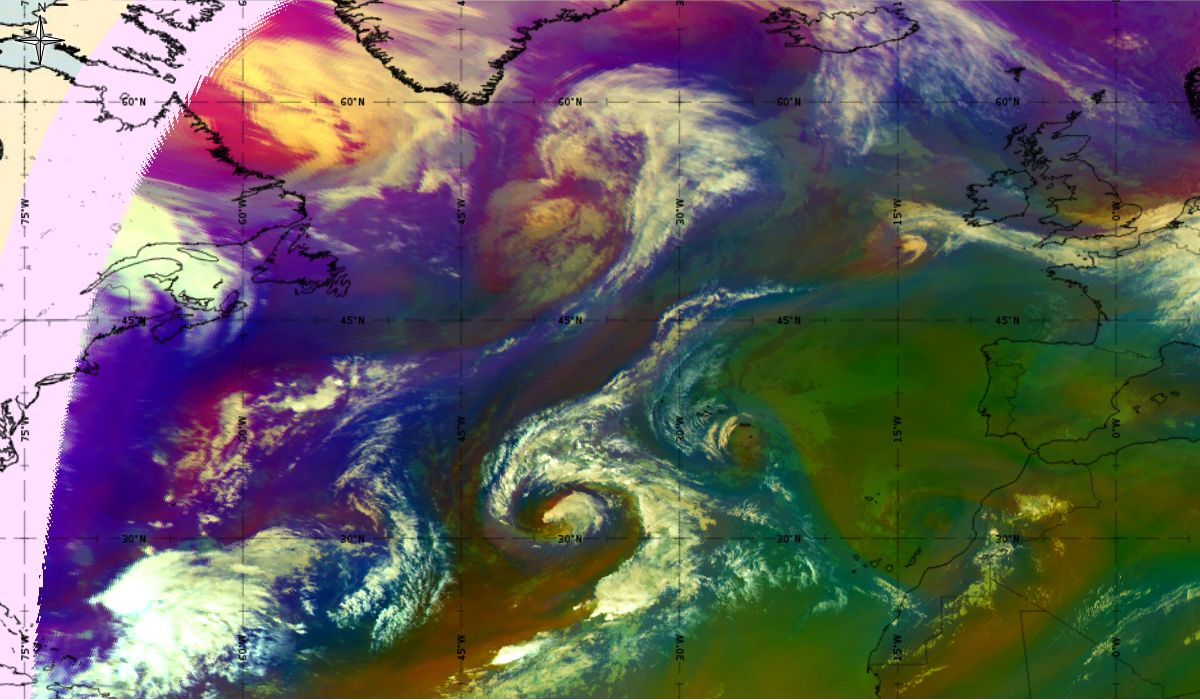
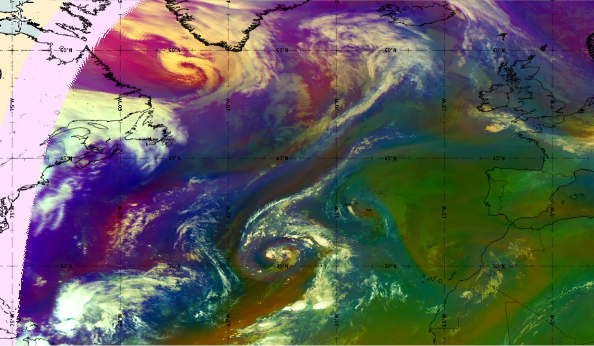
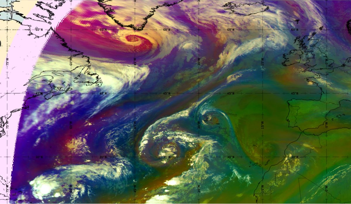
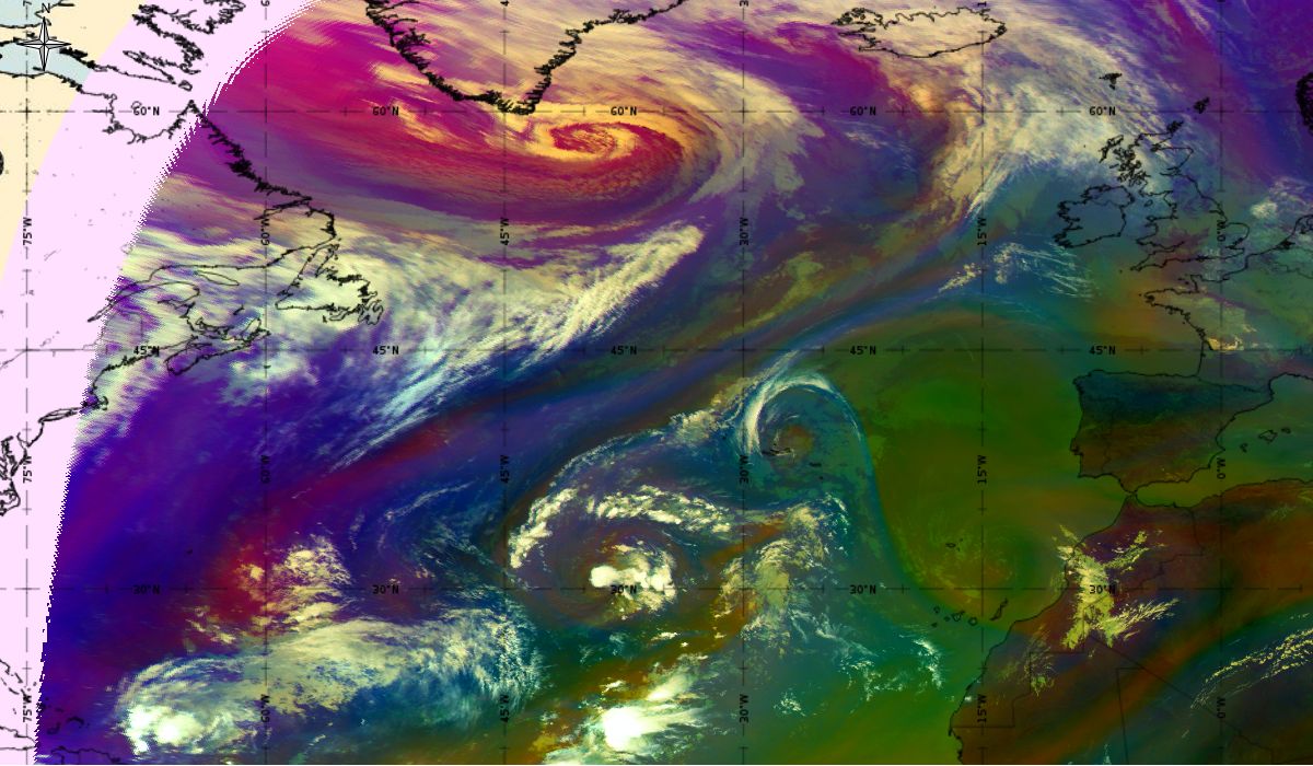
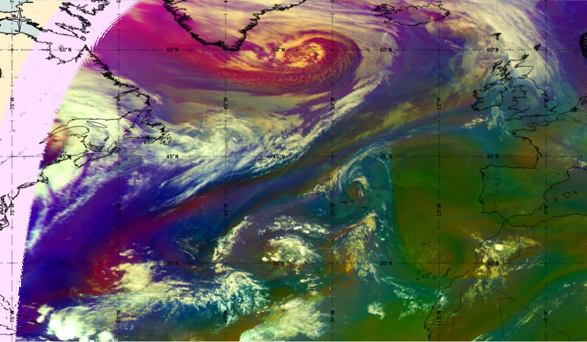
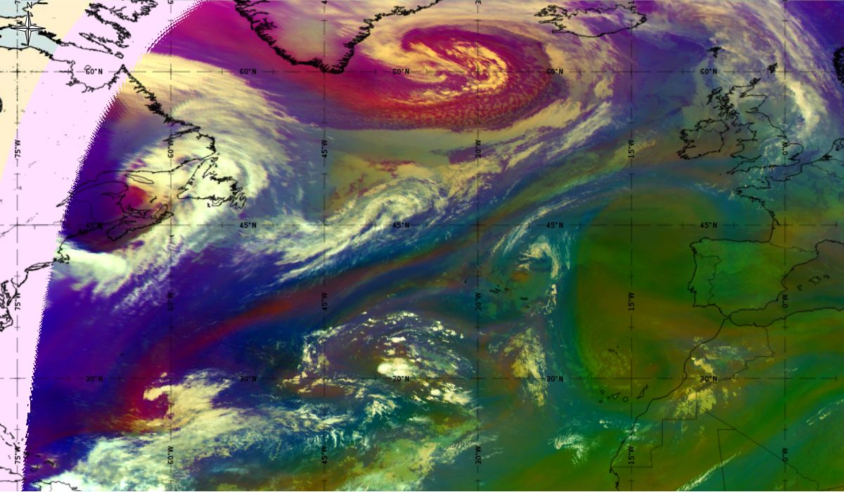
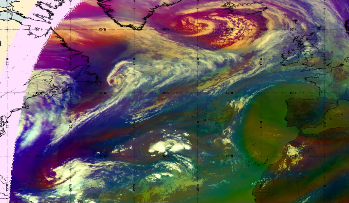
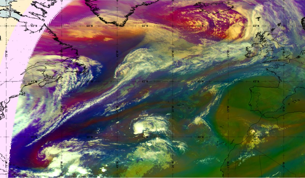
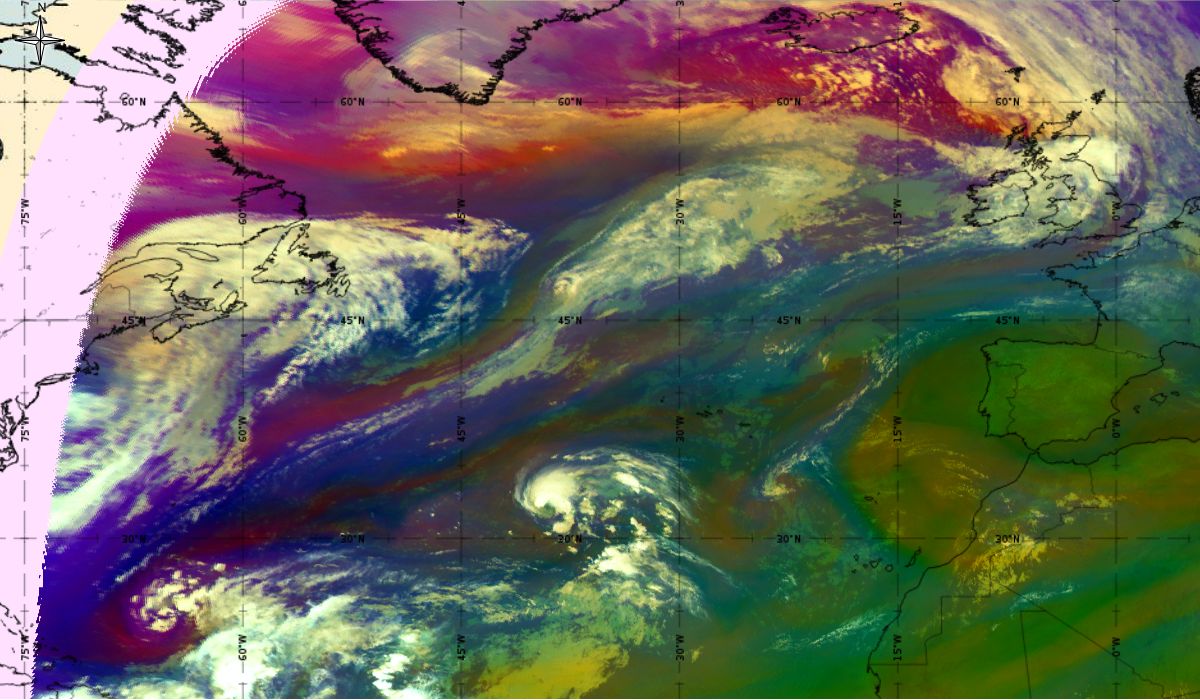
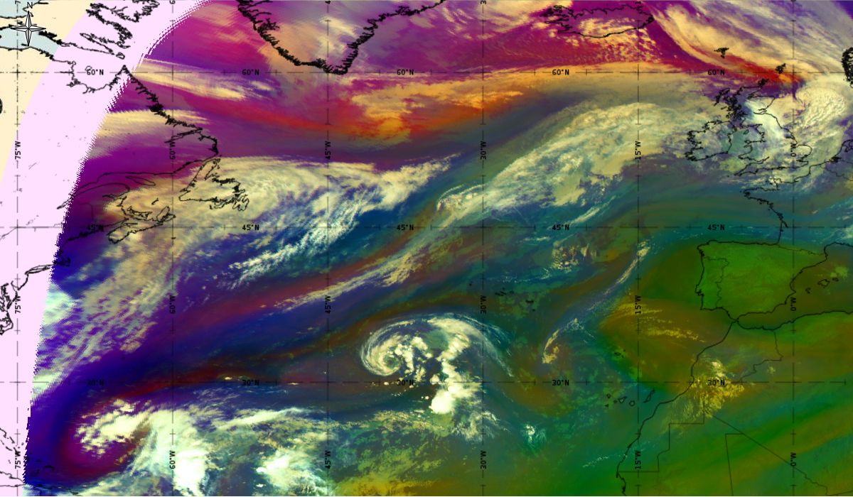
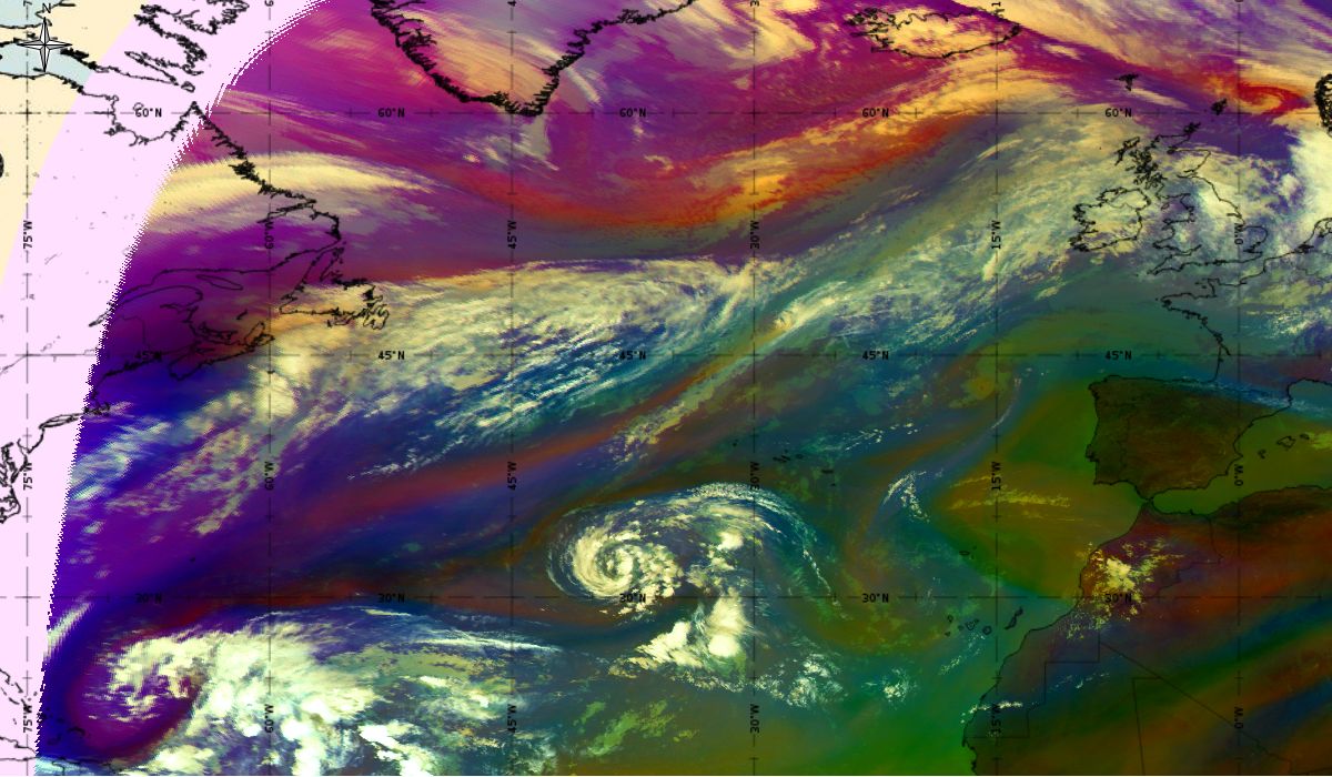
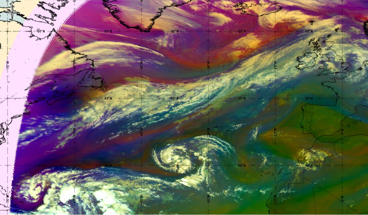
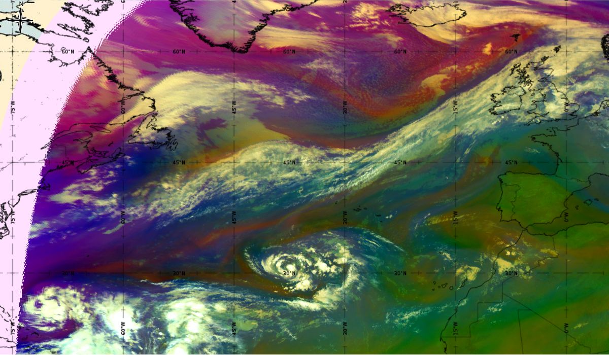
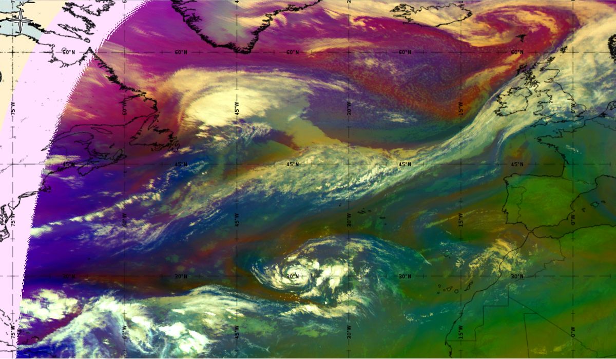
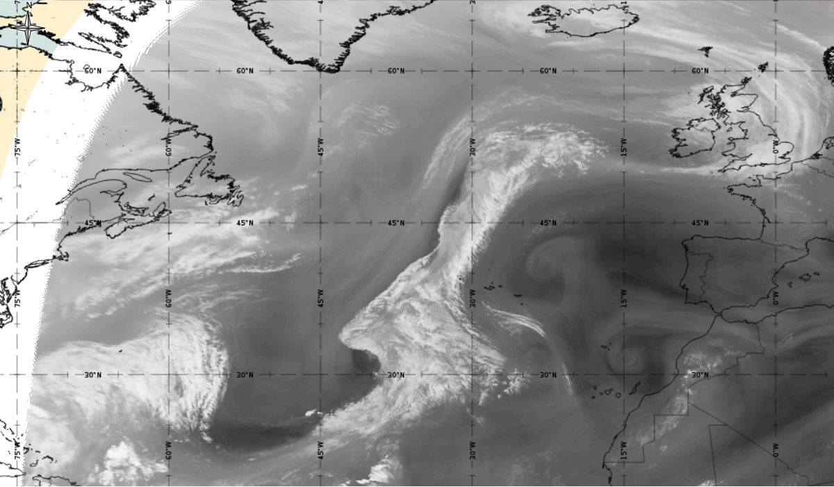
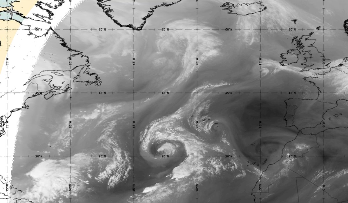
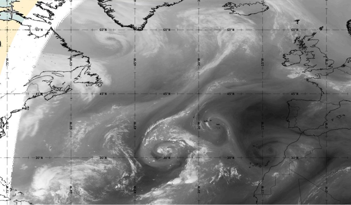
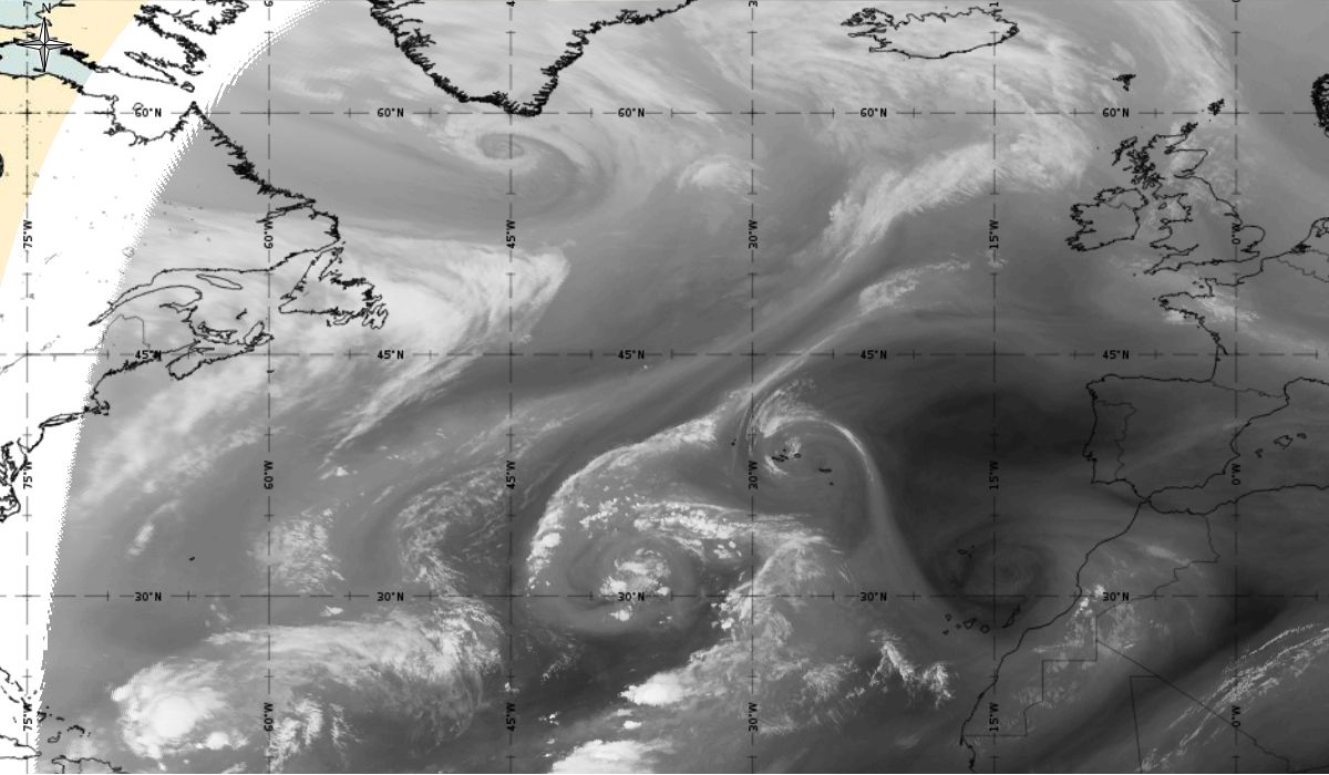
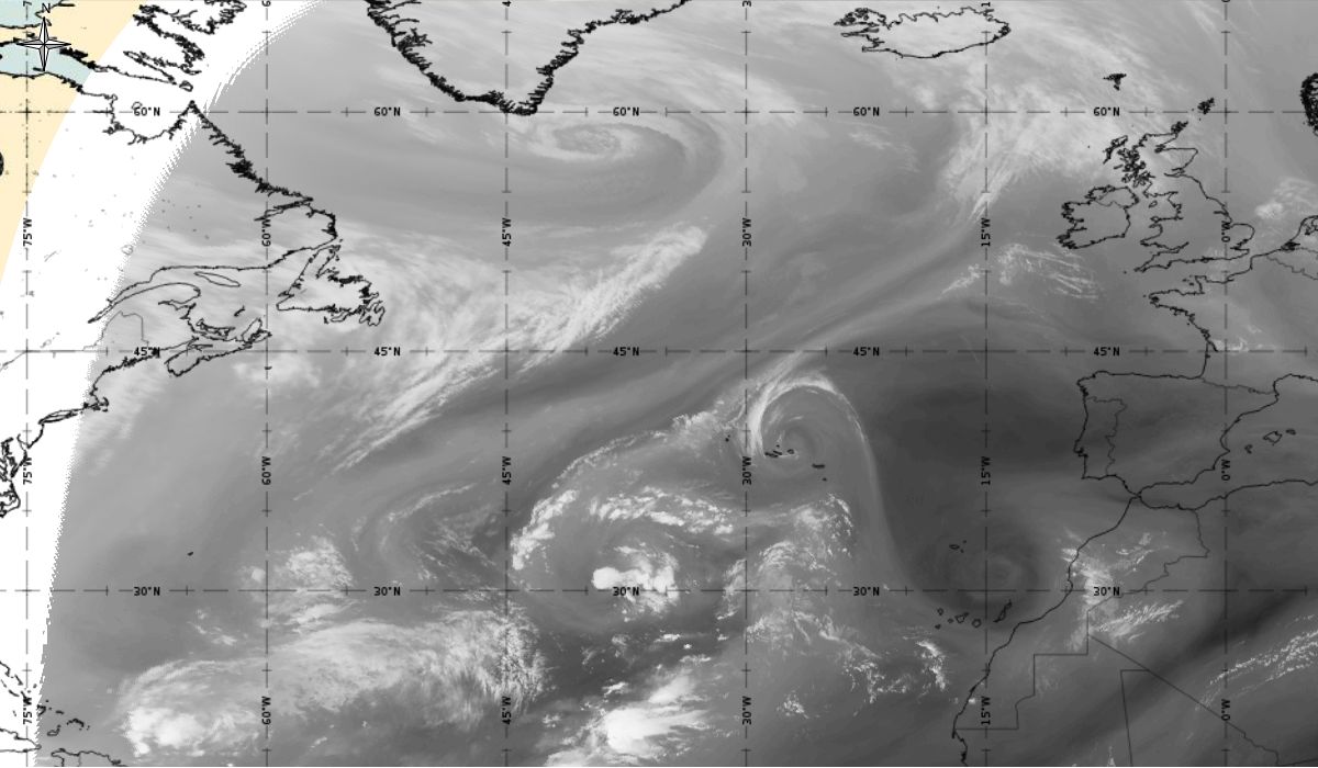
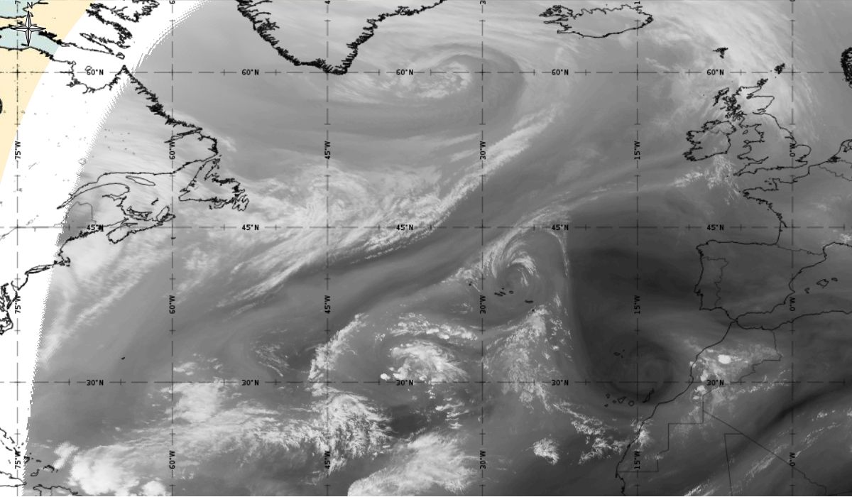
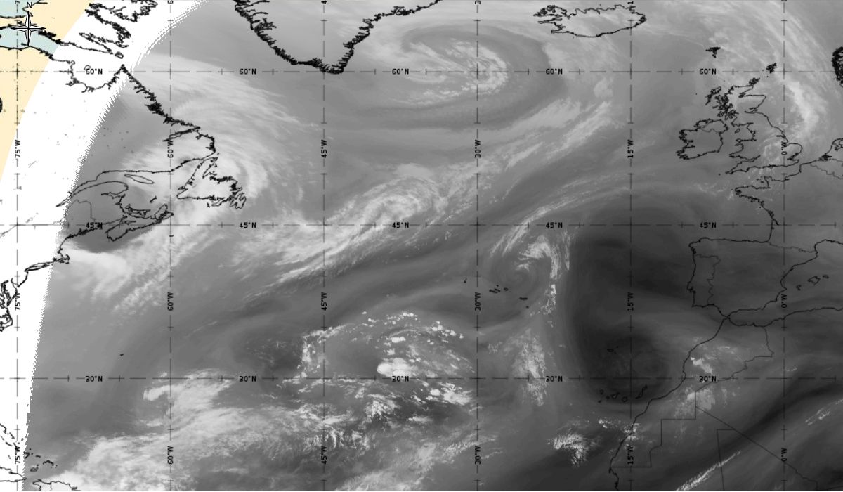
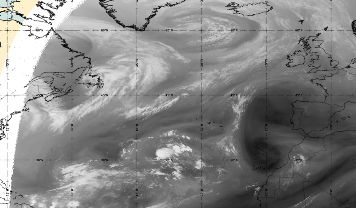
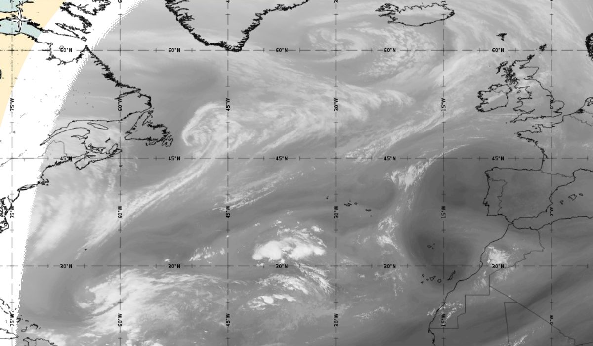
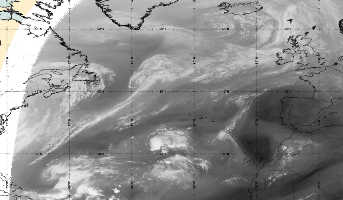
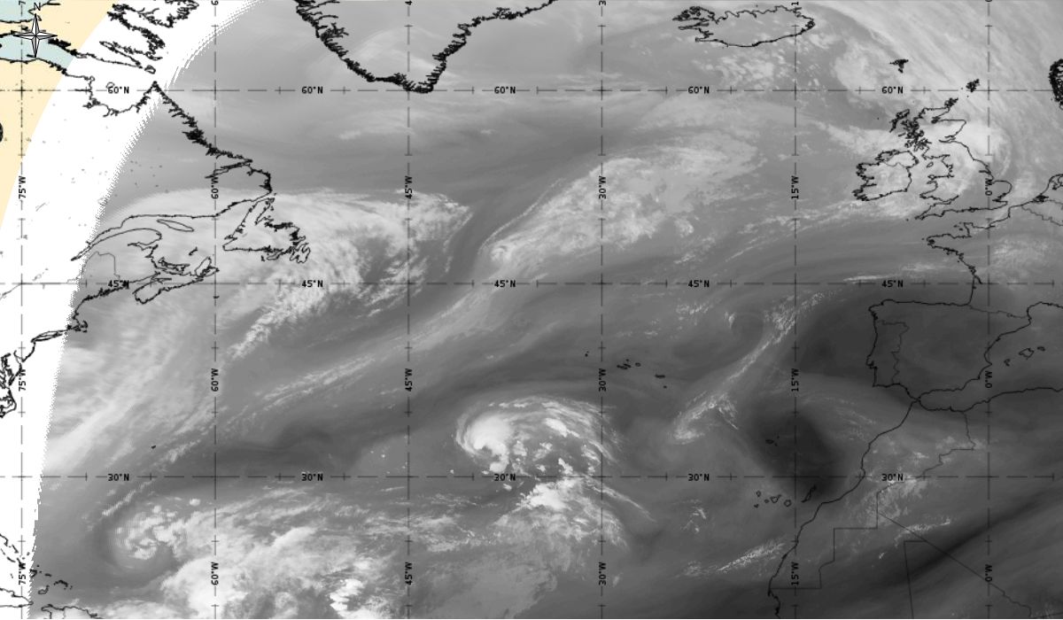
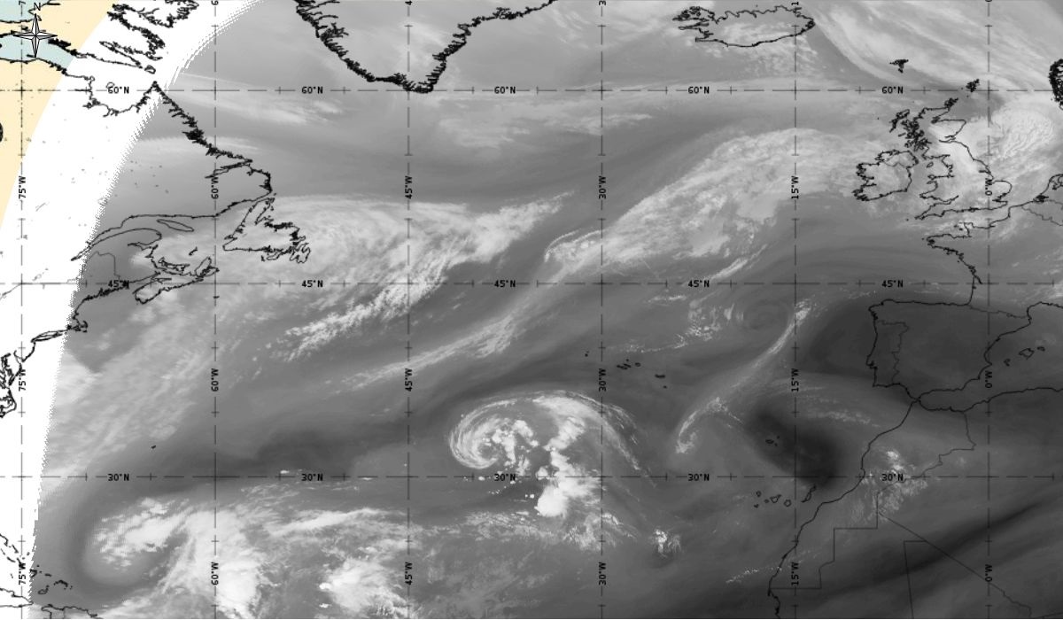
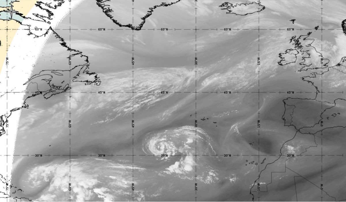
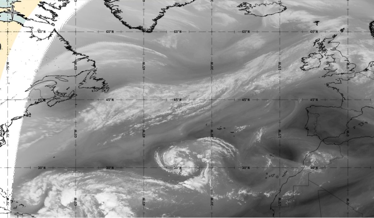
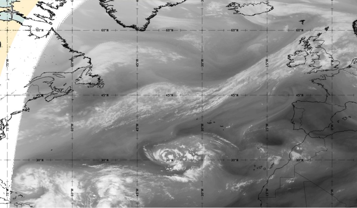
Loop 1 and 2: Meteosat 10 IR 10.8 and Airmass RGB animation from 6th October 2017, 12:00 UTC to 11th October 2017, 06:00 UTC (source: EUMeTrain, ePort)
Note: To go through individual images, click
Loop 1 or
Loop 2!
Cyclonic curvature of the cloud structure over the Atlantic can be followed by the animation of satellite images.
Looking at animations of RGB Airmass satellite images we notice that in the beginning, the frontal cloud band separates into two air masses - warmer over the west Atlantic and colder over the east. The jet axis is along the transition from blue to red colours at the rear side of the cloud band. Dry sinking air appears as red and indicates that cyclogenesis is ongoing. The dry air provides high potential vorticity and is the cause of further development and convection. South of the system, warm tropical air mass is greenish with lower clouds, appear less bright. Thick high-level clouds above the front are bright white.
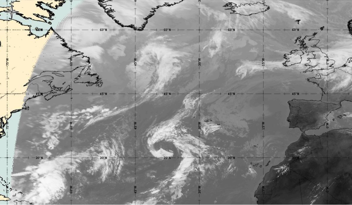
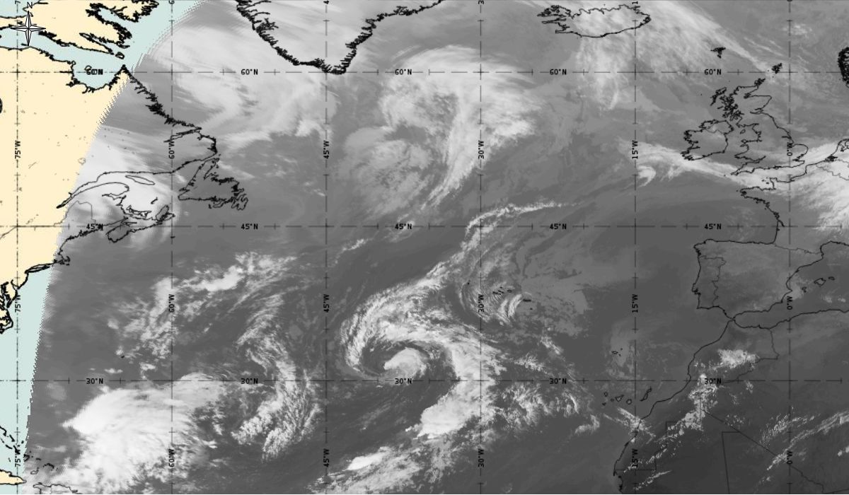
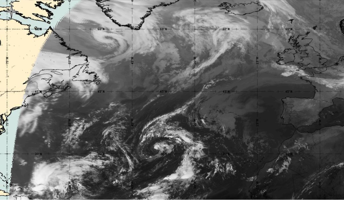
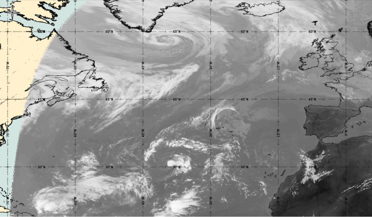
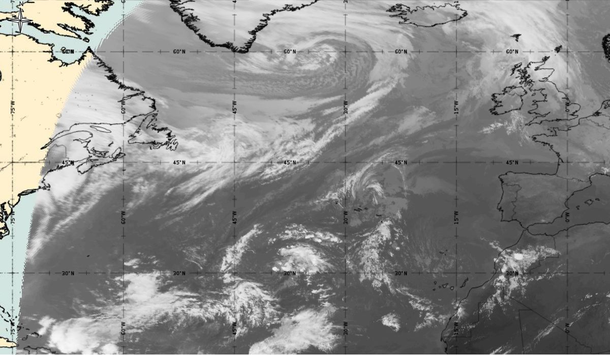
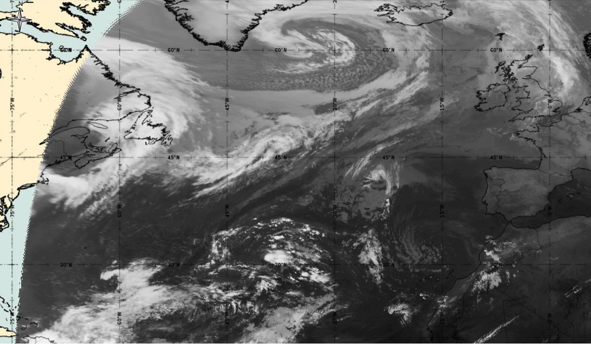
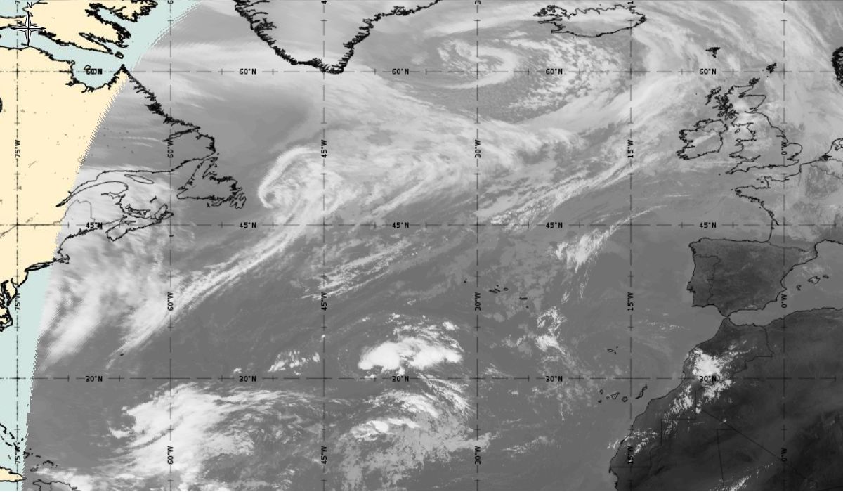
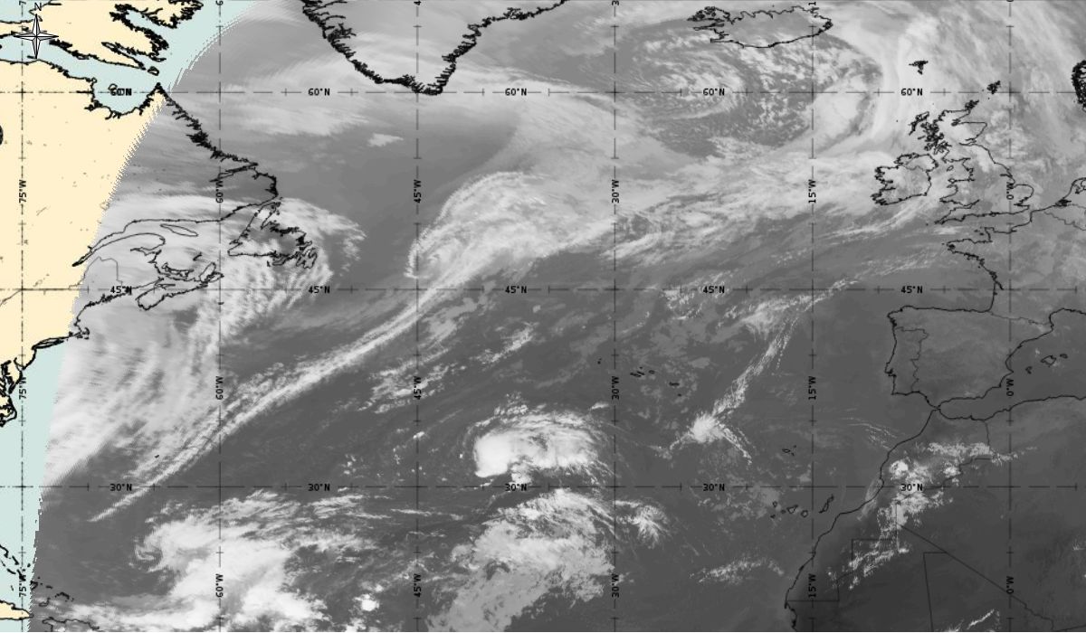
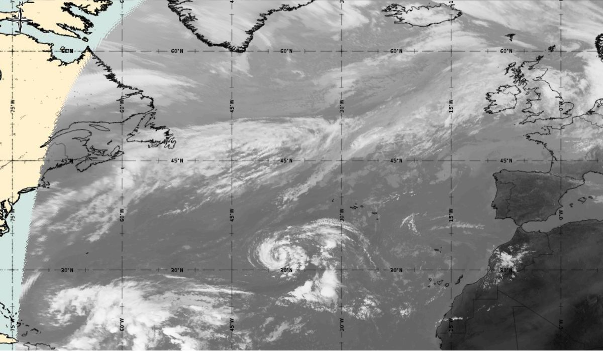
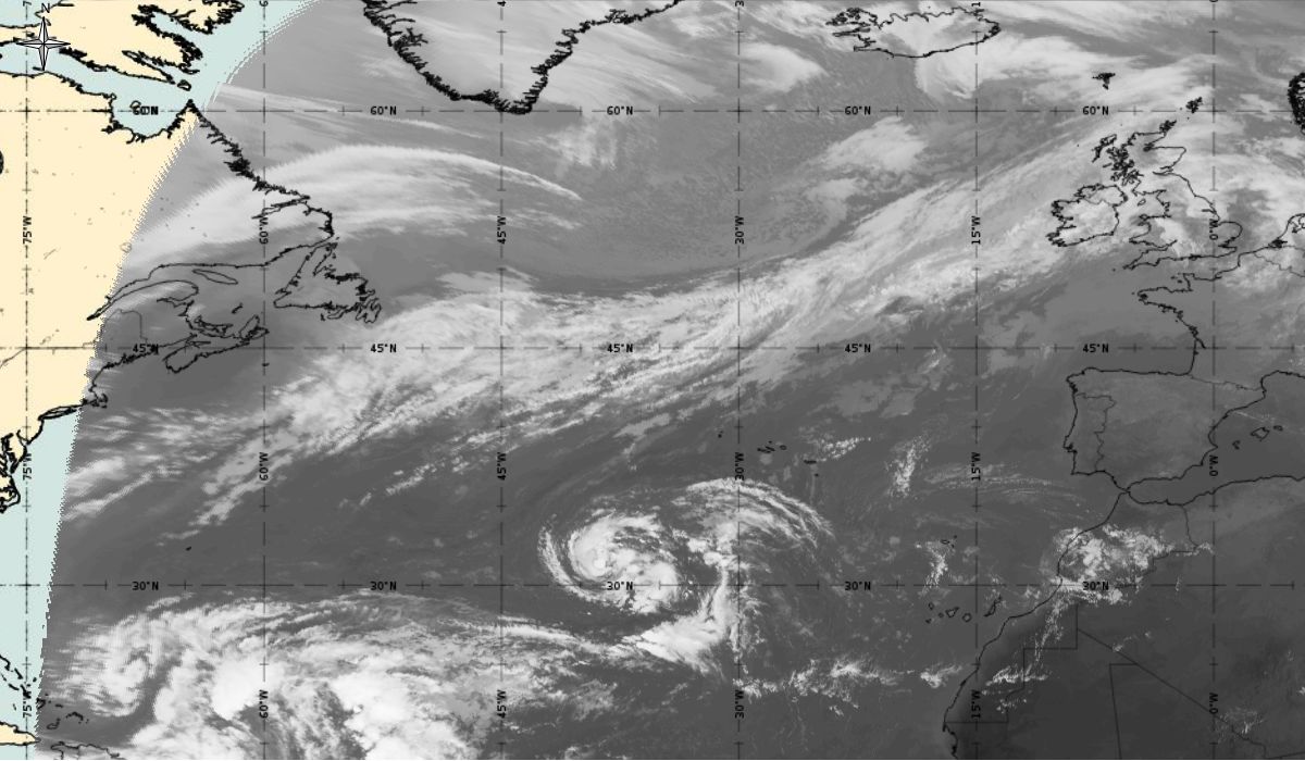
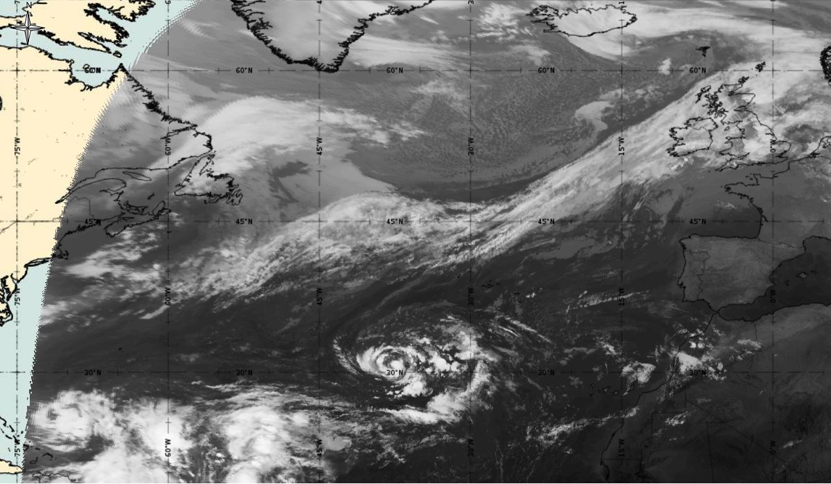
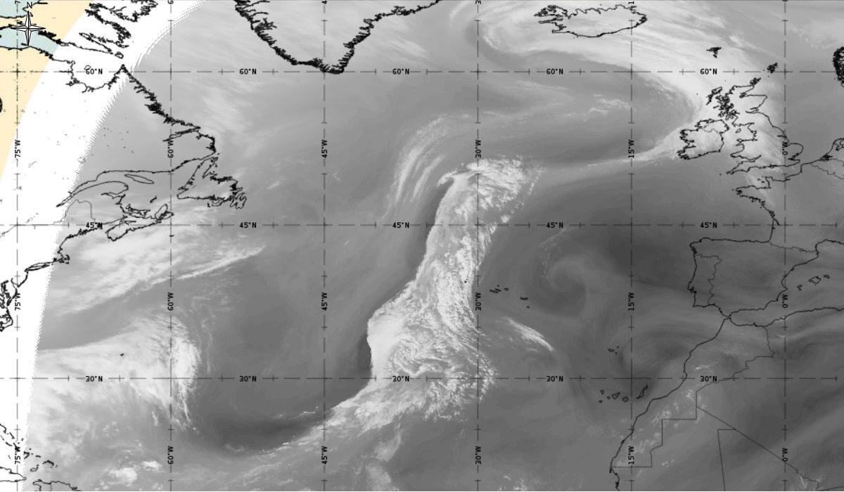
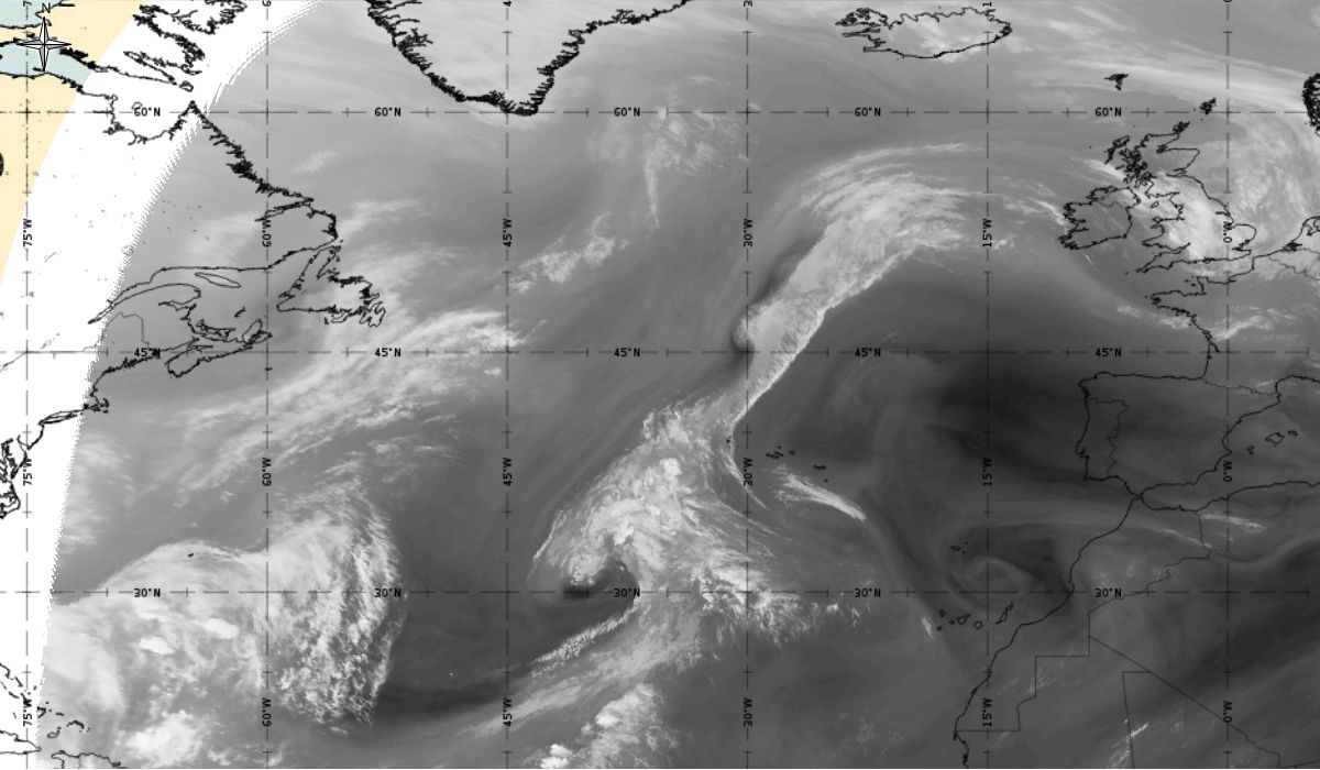
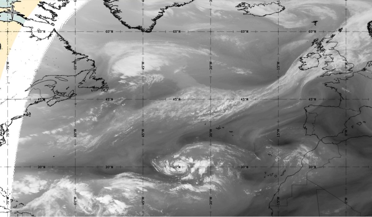
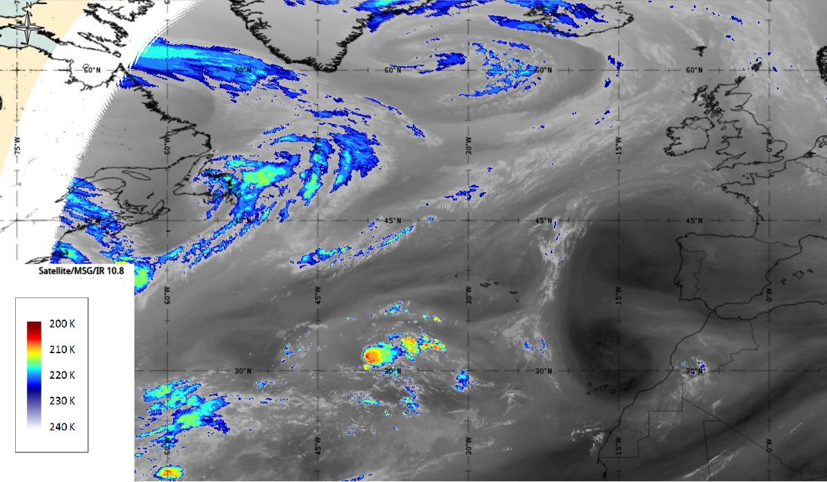
Loop 3: Meteosat 10 WV 7.3 animation from 6th October 2017, 12:00 UTC to 11th October 2017, 06:00 UTC (source: EUMeTrain, ePort)
Note: To go through individual images, click
Loop 3!
One of the key parameters for the development of tropical cyclone is water content in the atmosphere, which can be observed with WV 7.3. Grey shades in the images show the water vapour content in the lower layers of the troposphere (more brightness indicates more water vapour). The dark areas in Loop 3 is dry stratospheric air, which is engaged within the development of cyclone. Bright areas in the second part of the loop show convective development.
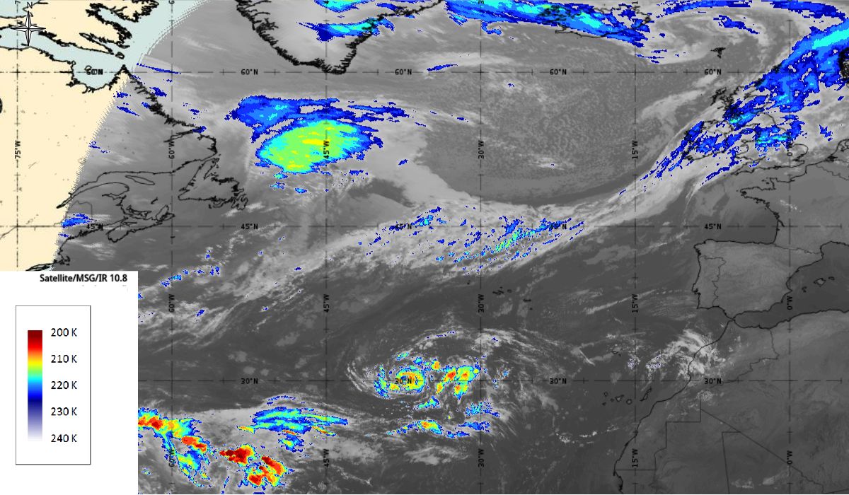
After the passage of the cold front on 6th October, the initial stage of cyclogenesis is seen on Figure 4 as cloud bulges at the rear edge of the aforementioned cold front (31.1 °N, 39.9 °W - in the middle of the Atlantic). While at the same time in the upper level (AT 500 hPa) a deep trough is stretching meridionally (45 °N to 15 °N) between two ridges - one over the West Atlantic and the other over the East Atlantic (west of the Pyrenees Peninsula).
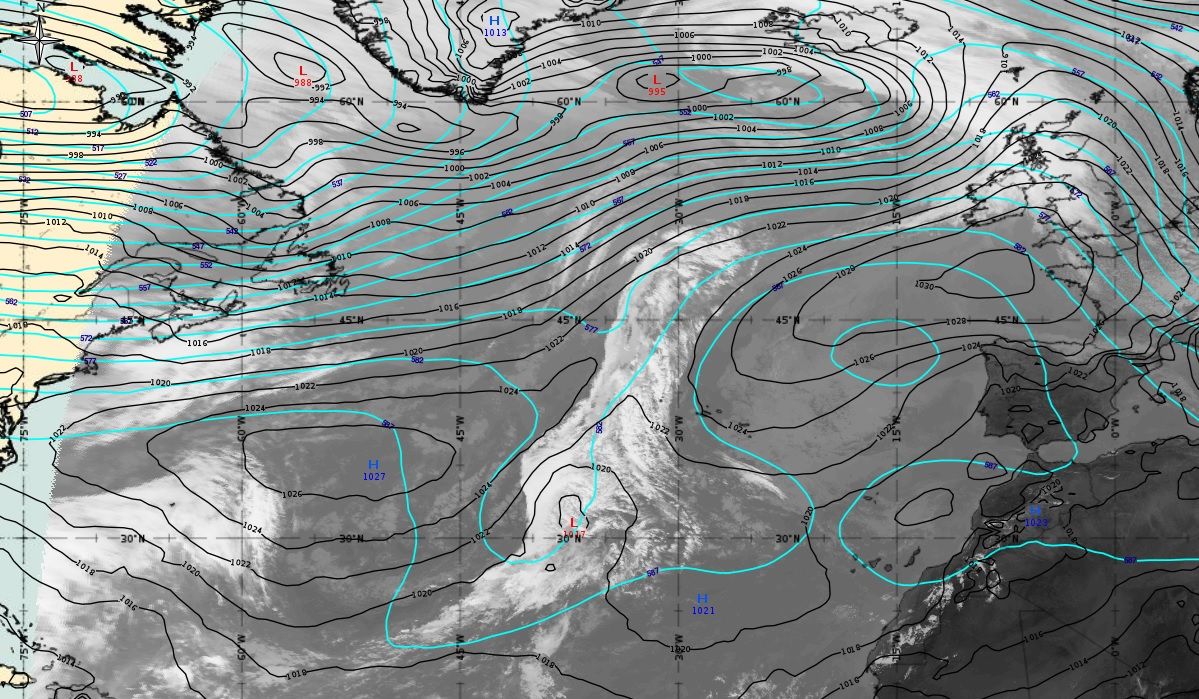
Figure 4: 6th October 2017 12:00 UTC - MSG IR10.8, mean sea level pressure (black line) and geopotential height at 500 hPa (blue line - both ECMWF), source: EUMeTrain, ePort
A low-pressure system above a very warm ocean (sea surface temperature SST was near 27°C - Figure 5) started to deepen. Over the next 2 days the system was almost stationary. An upper-level low formed above the cyclone (Figure 6 - 7th October, 12:00 UTC) and the spiral curvature of clouds is clearly seen.
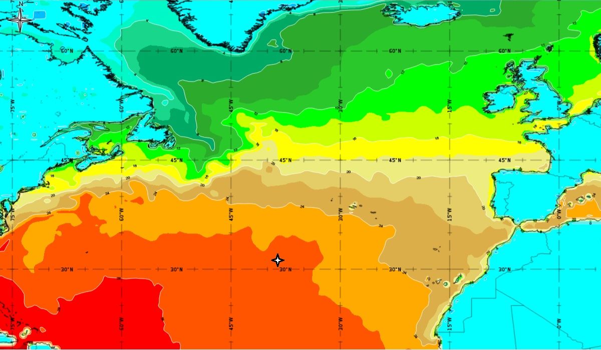
Figure 5: 6th October 2017, 12:00 UTC - SST; star - position of low, orange colour - temperature between 26 and 28 °C (ECMWF), source: EUMeTrain, ePort
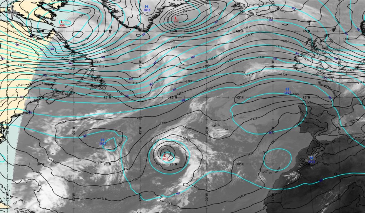
Figure 6: 7th October 2017 12:00 UTC - MSG IR10.8, mean sea level pressure (black line) and geopotential height at 500 hPa (blue line - both ECMWF), source: EUMeTrain, ePort
Over the next day the organized deep convection was unable to persist near the well-defined low-level centre due to intrusion of very dry upper level air. Conversely, a short-lived convective outbreak helped to intensified cyclonic curvature (Figure 7 - 8th October 00:00 UTC - Airmass RGB). The associated clouds are becoming more fragmented and brighter indicating convection which has become more pronounced.
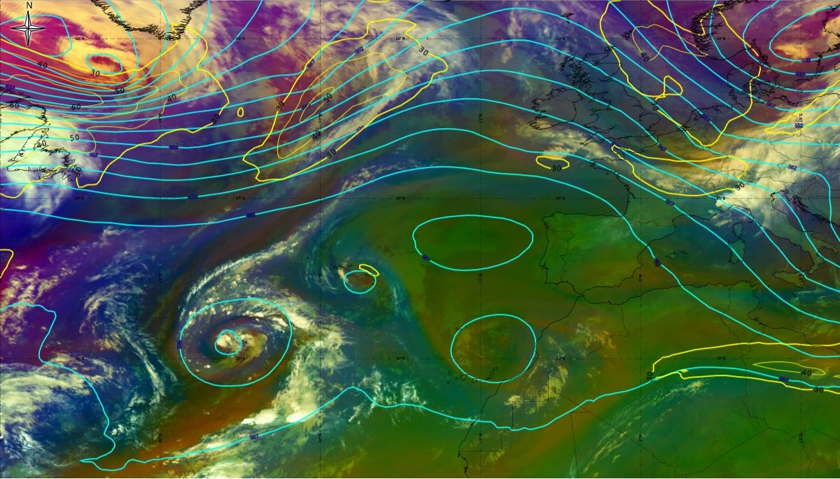
Figure 7: 8th October 2017 00:00 UTC - MSG Airmass RGB, geopotential height at 500 hPa (blue line), jet (yellow line - both ECMWF), source: EUMeTrain, ePort
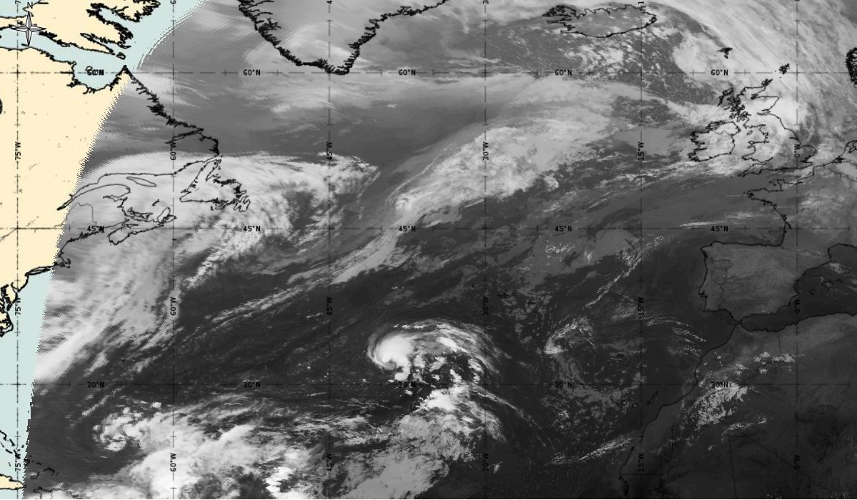
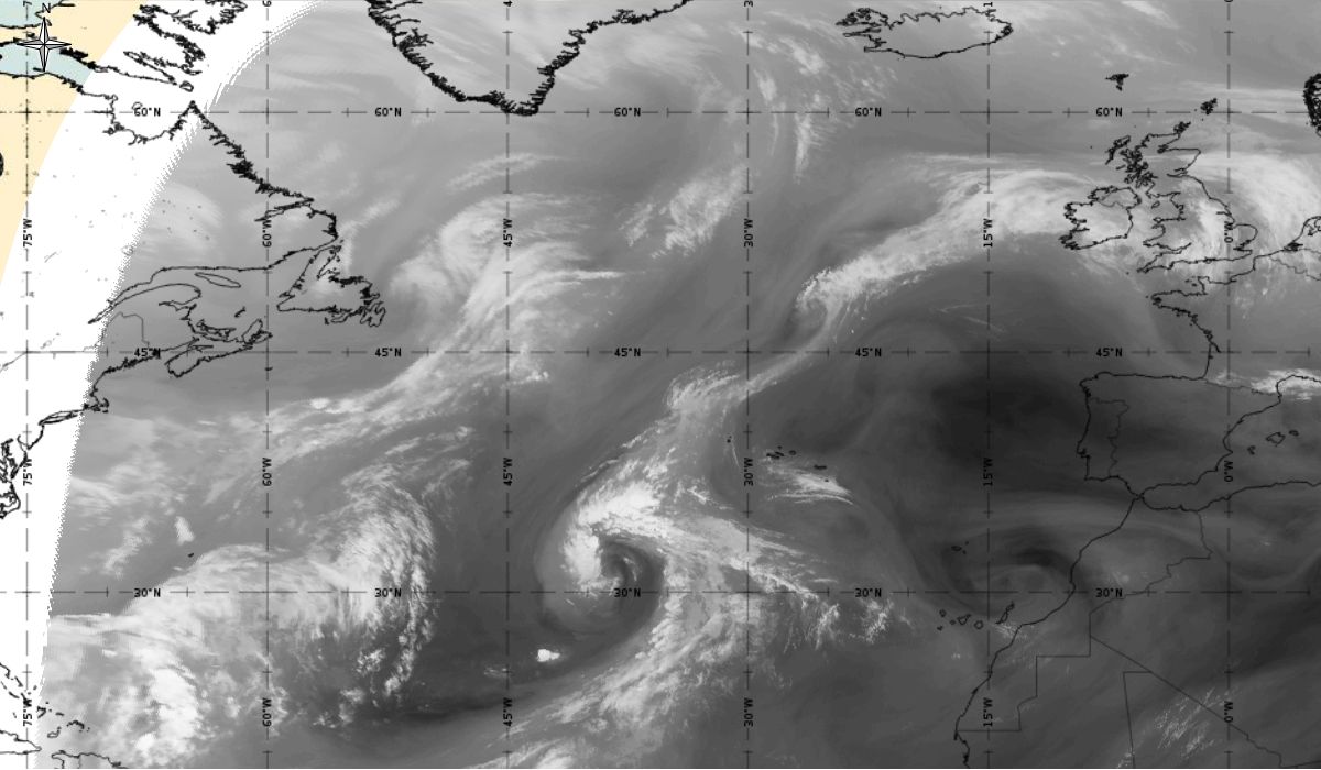
In the next 24 hours, convection steadily increased near the centre of the low and it is estimated by the National Hurricane Center (NHC) that a tropical storm (depression) - Ophelia, formed by 06:00 UTC 9th October when the system was located about 760 nautical miles (about 1400 km) southwest of the Azores (30.9 °N, 40 °W) (Figure 8 - 9th October 06:00 UTC). An area of deep convection was located east of the centre of the low.
|
|
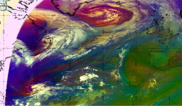
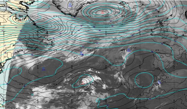
Figure 8: 9th October 2017 06:00 UTC - MSG IR10.8, mean sea level pressure (black line) and geopotential height at 500 hPa (blue line - both ECMWF)/Airmass RGB, source: EUMeTrain, ePort;
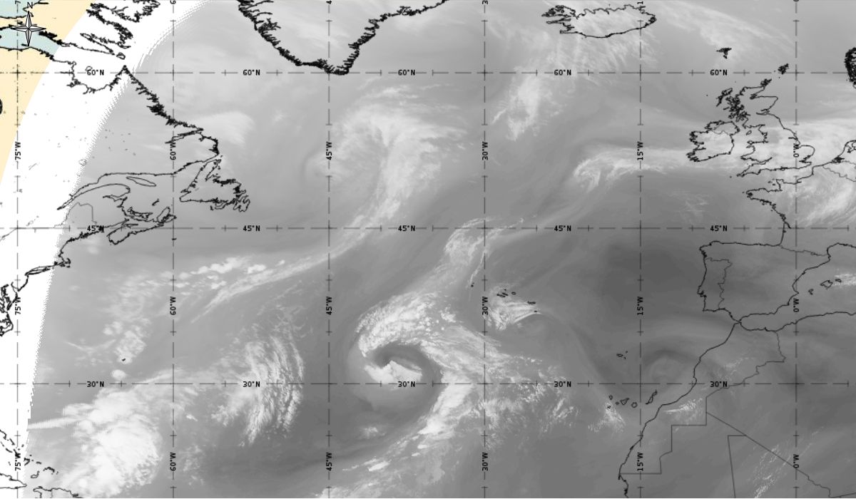
In the next two days, tropical storm Ophelia was almost stationary and steadily strengthening.
Extra information can be gained if we look at the enhanced IR 10.8 by Meteosat 10 (Figure 9). On the north side of the spiral cloud band convective development occurred with the cloud top temperature around -60 °C. The cyclonic curvature is no longer clearly visible.
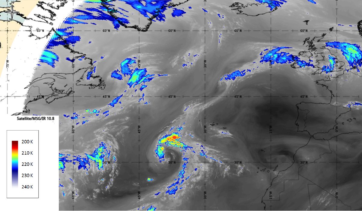
Figure 9: Meteosat 10 Enhanced IR10.8, 7th October 2017, 06:00 UTC/9th October 2017,06:00 UTC/11th October 2017,06:00 UTC (source: EUMeTrain, ePort)
Note: Click on the image to go through the gallery
If we look at Severe Storm RGB and 24-hour Microphysics RGB (Figure 10) we see the processes are intensifying and developing cyclonic properties from 8th to 10th October. Bright yellow spots at severe storm RGB image indicate thick ice cloud with small ice crystals on the top. The same structure could be seen on 24-hour Microphysics, in this case as dark red area.
|
|
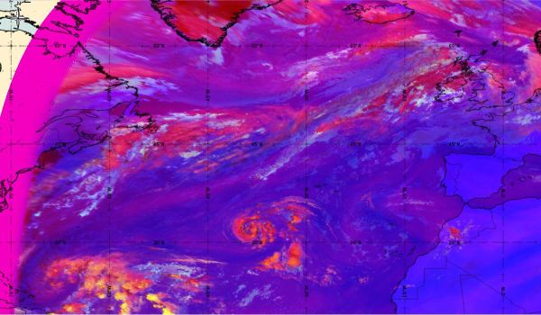
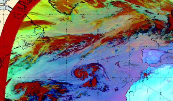
Figure 10: Severe storm RGB 10th October 2017, 12:00 UTC/24-hour Microphysics RGB (source: EUMeTrain, ePort)
Tropical storm at the full stage of development can be seen at MODIS satellite image (Figure 11).
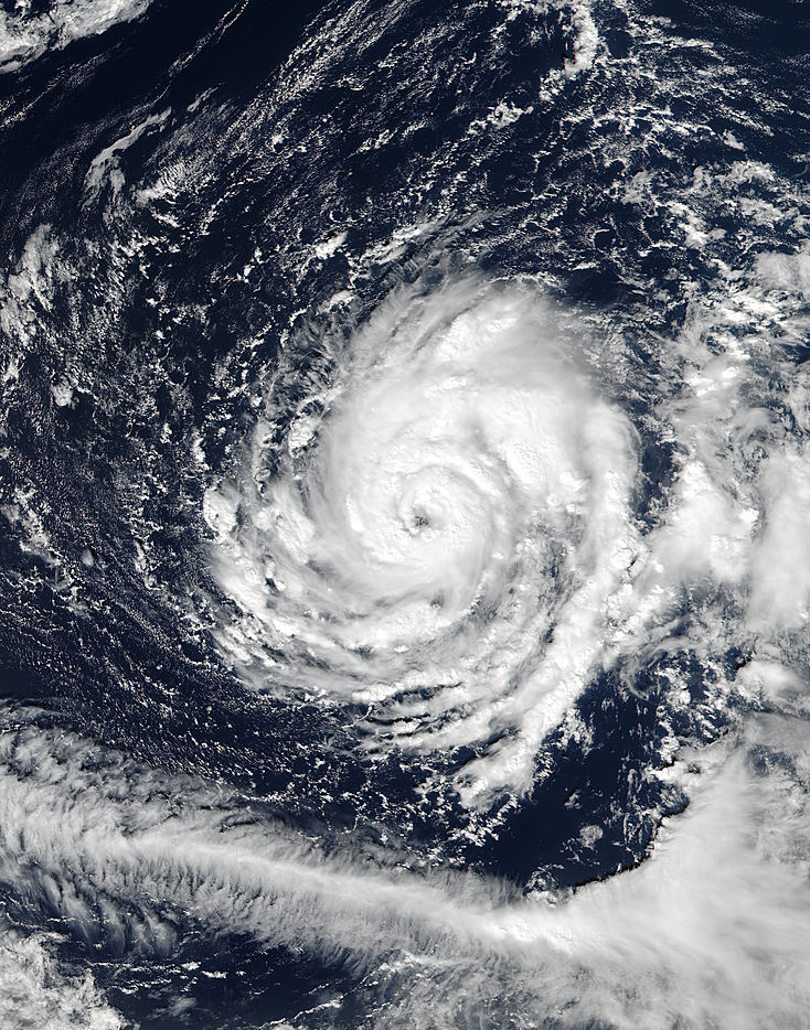
Figure 11: MODIS satellite image (true colour) of tropical storm Ophelia on 11th October 2017, approximately at 16:00 UTC (source: NASA)
Wind speed
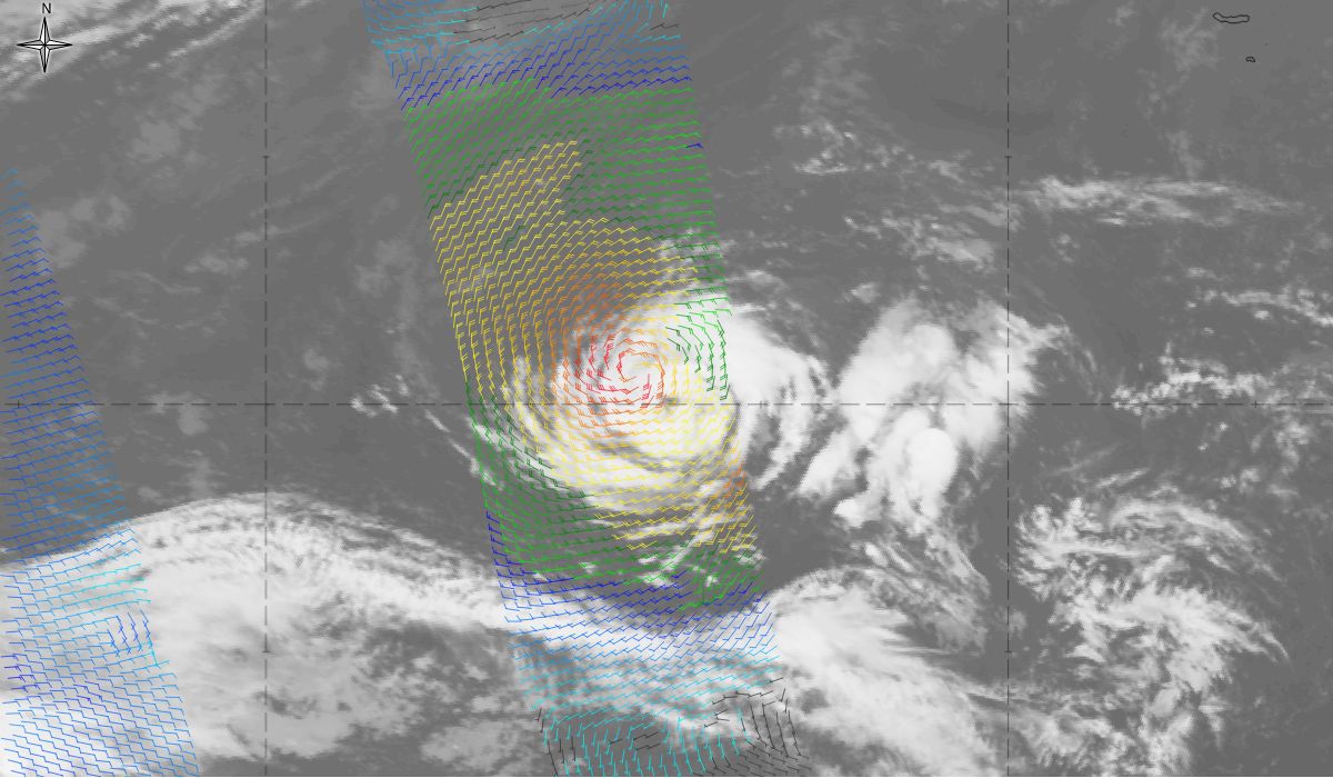
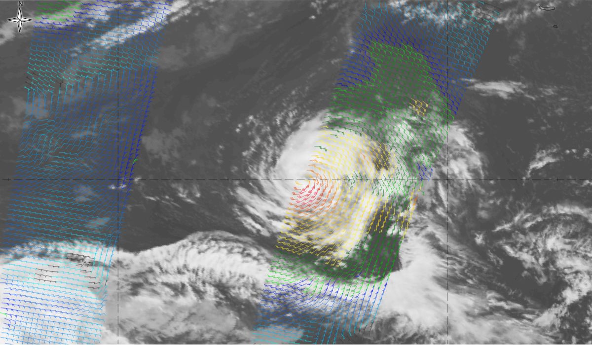
An ASCAT overpass in the region of interest gives the wind speed over the storm Figure 12. This data reveals gale winds (30 kt-orange colour) over a large area, and up to 45 kt (red colour) near the centre of the storm.
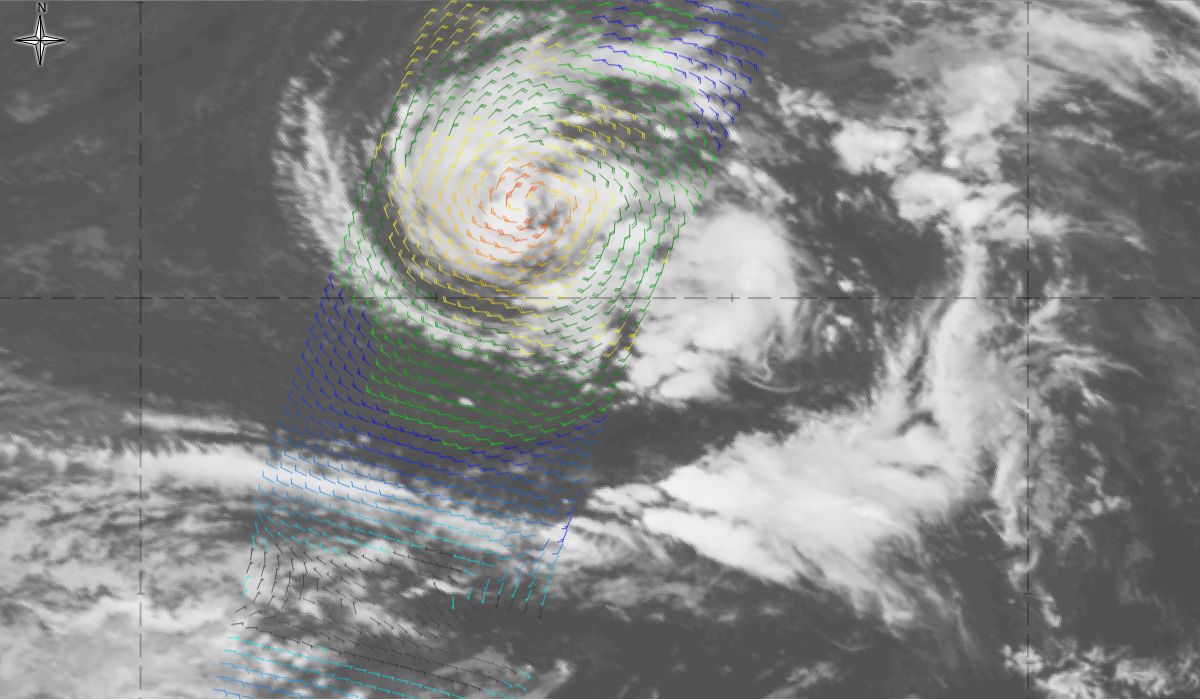
Figure 12: Meteosat 10 IR 10.8 overlaid with ASCAT wind (colour wind barbs) from 10th October 2017, 18:00 UTC to 11th October 2017, 18:00 UTC (source: EUMeTrain, ePort)
Note: Click on the image to go through the gallery
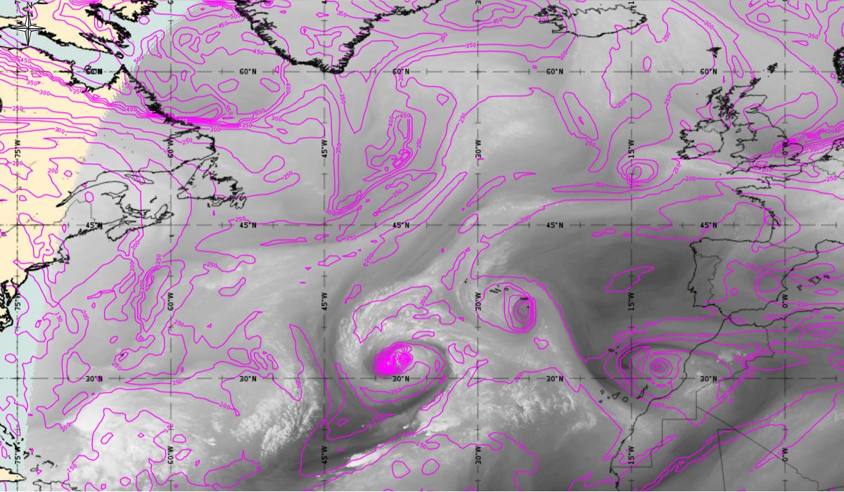
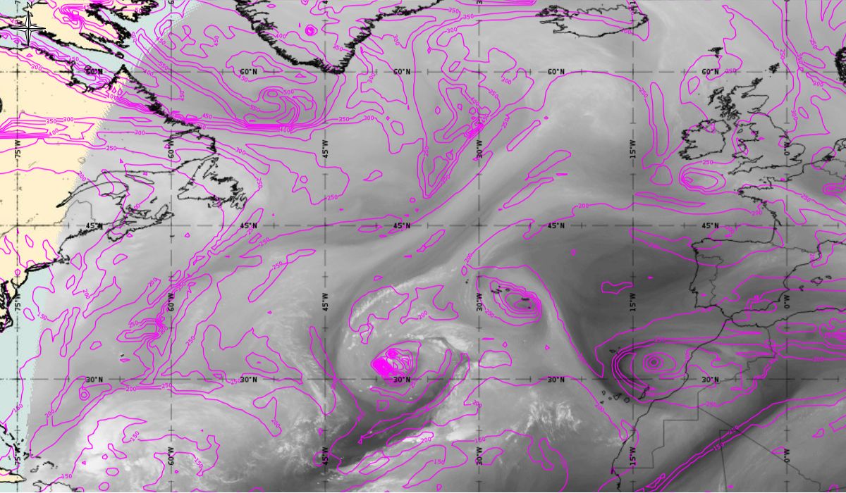
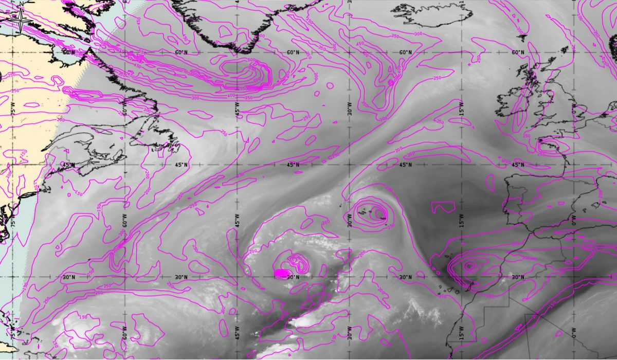
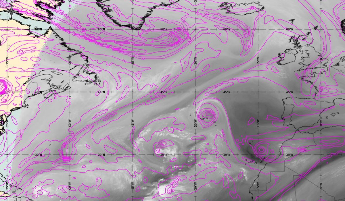
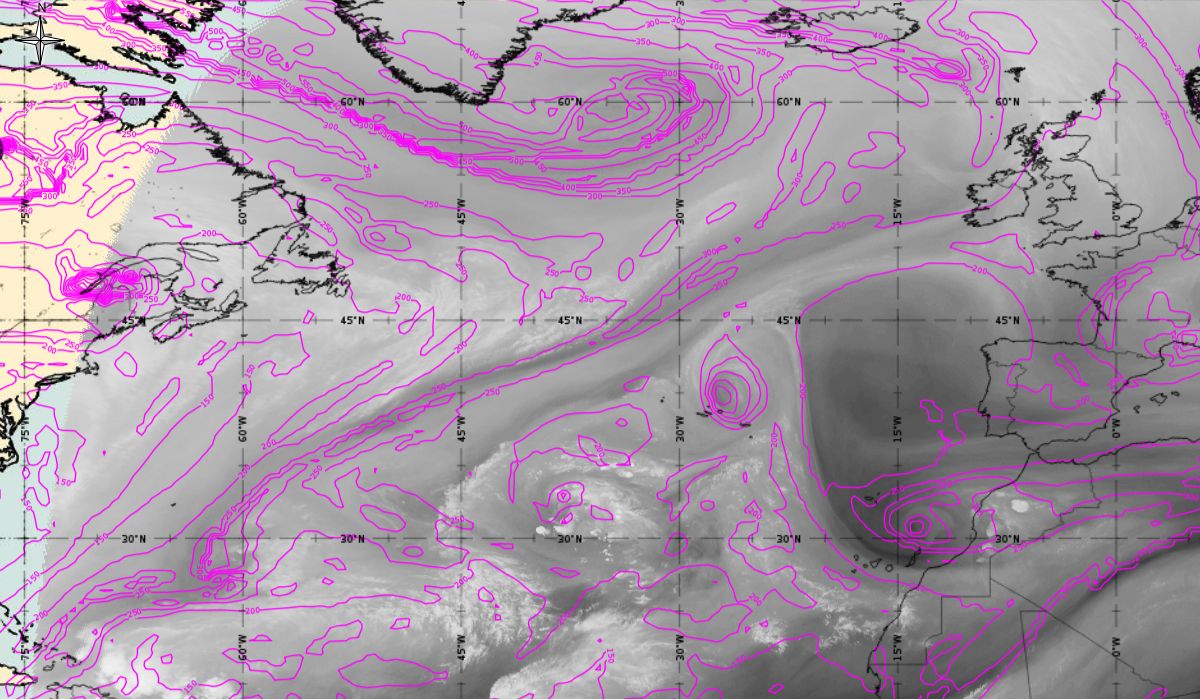
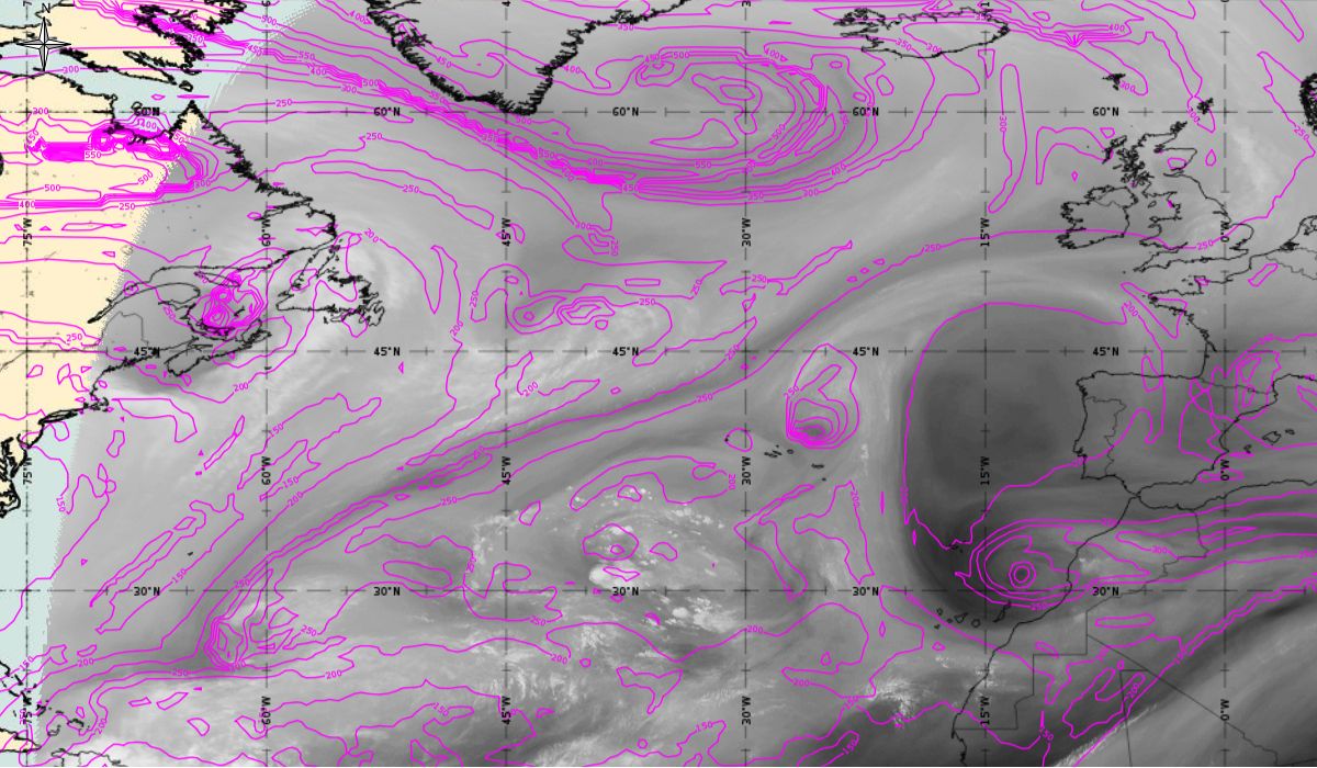
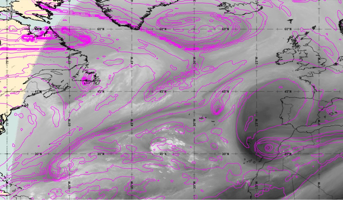
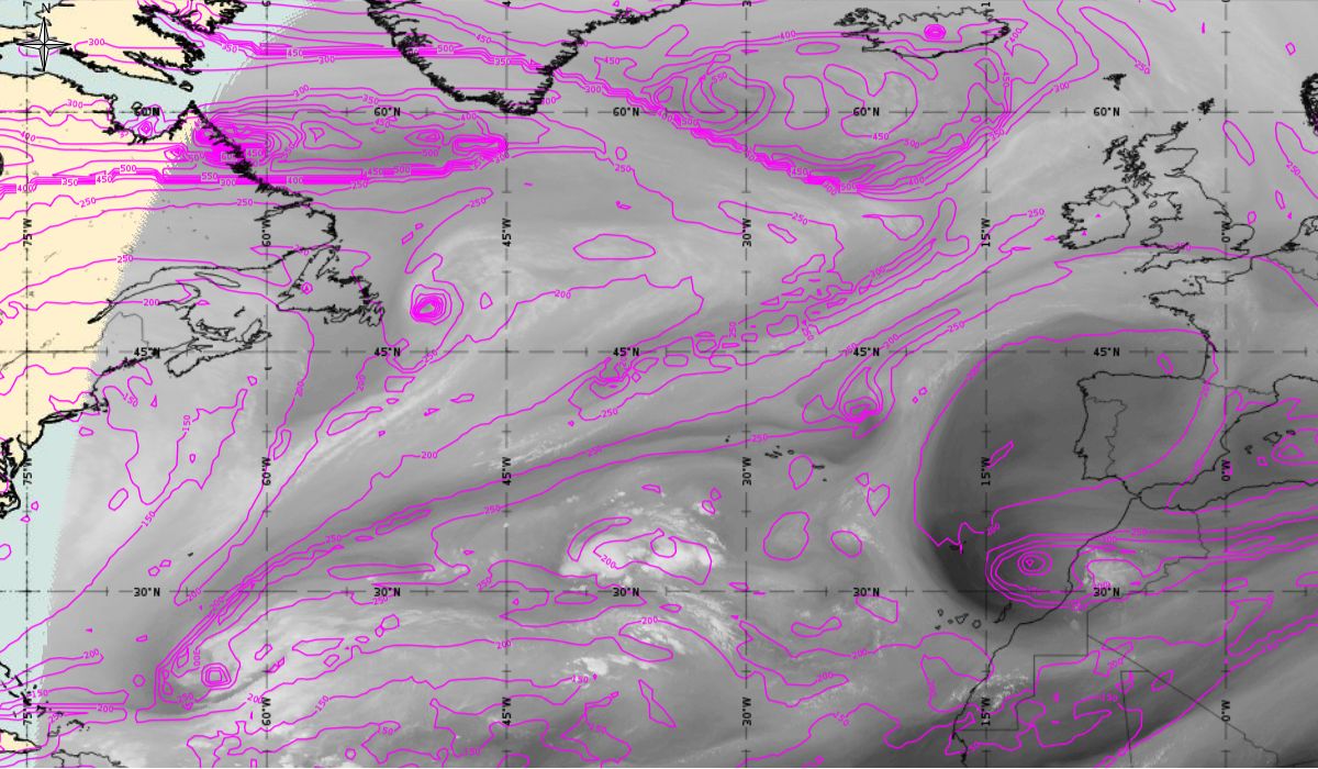
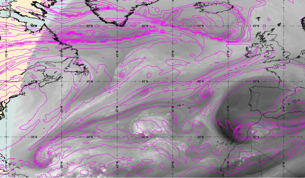
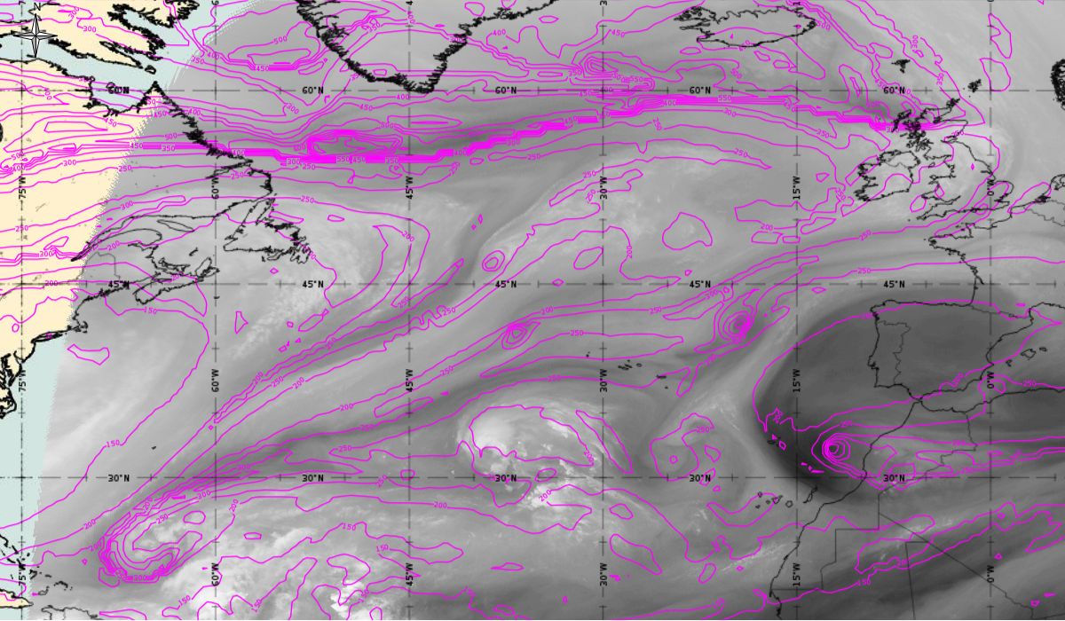
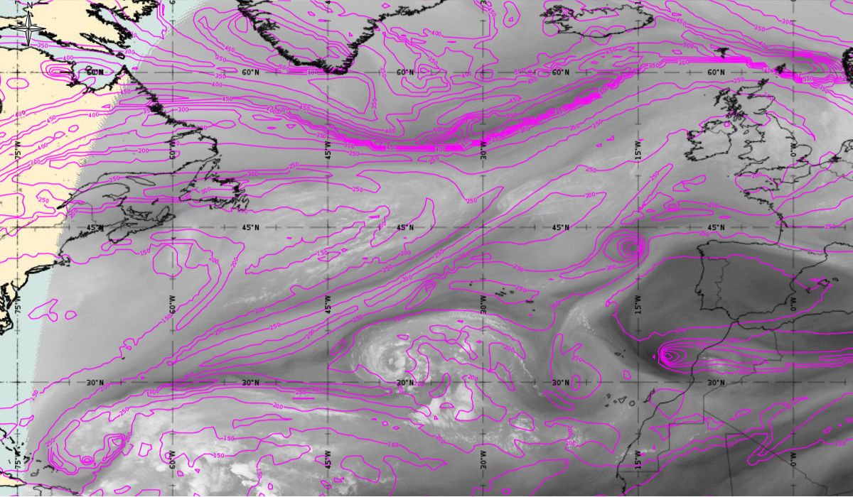
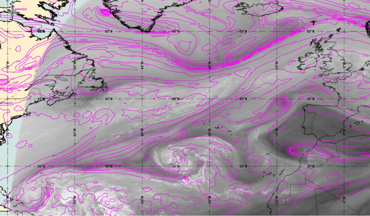
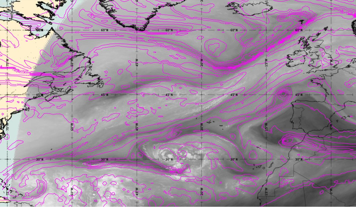
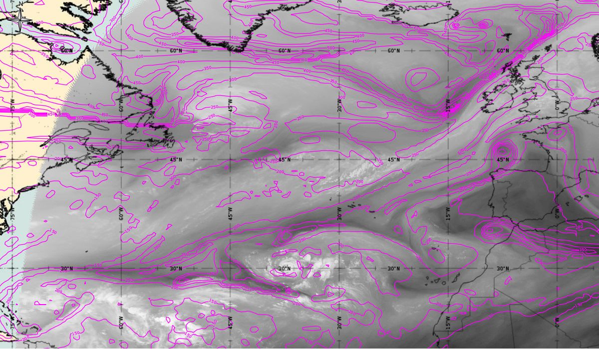
Height of PV=1,5; WV images
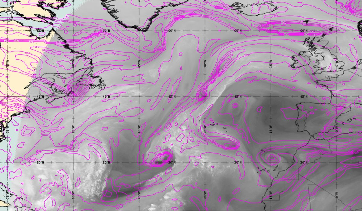
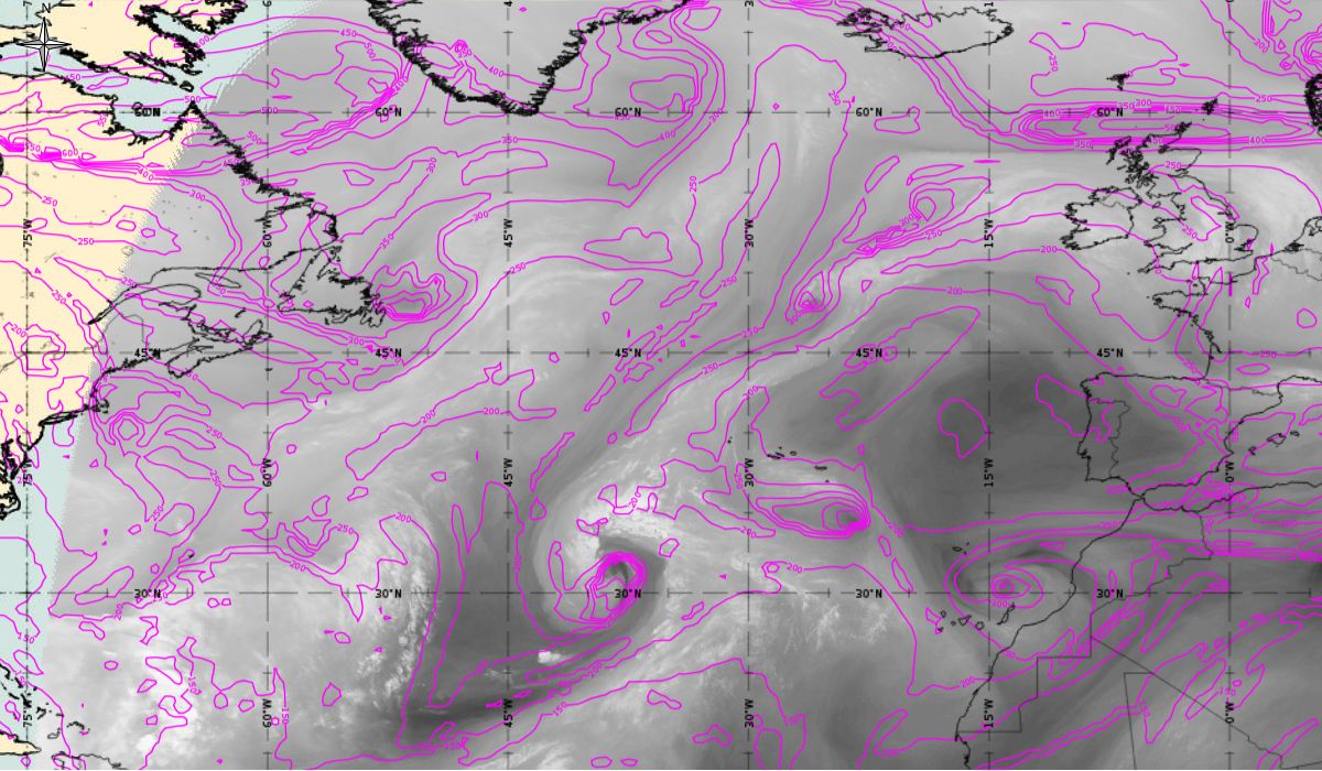
If we look at additional meteorological parameter (Figure 13), (height of PV=1,5), downward protruding stratospheric air could be documented by model fields of PV=1.5 PVU. A PV anomaly coincides very well with the dry intrusion (dark strip) in WV images. At the beginning, when a cyclone is deepening over the Atlantic, this dry intrusion can be clearly seen (during 7th October). PV=1.5 reaches down to 400 (even 450) hPa, which indicates a lowering of the tropopause; this hints at a cyclogenetic process.
Figure 13: Height of PV=1.5 PVU (magenta), Meteosat 10 WV 6.2 from 7th October 2017, 00:00 UTC to 11th October 2017, 06:00 UTC (source: EUMeTrain, ePort)
Note: Click on the image to go through the gallery