Weather Events
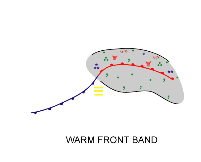
Warm front bands are associated with multi-layered cloud structures, with clearances in the cloud-free regions in the warm sector. Precipitation can exist well ahead of the surface front, until just after the passage of the front.
| Parameter | Description |
| Precipitation |
|
| Temperature |
|
| Wind (incl. gusts) |
|
| Other relevant information |
|
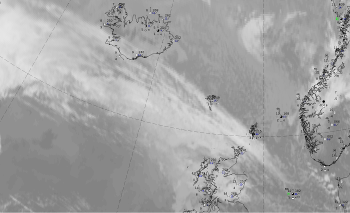
The case from 17 September 2019 at 12 UTC exists mostly over the sea but there are reports from some inhabited Islands which demonstrate the weather situation.
|
|
Legend:
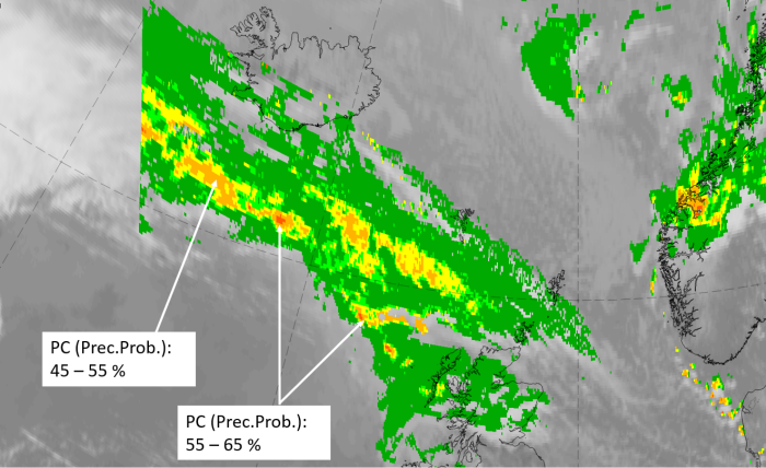
17 September 2019 at 12UTC: IR + synoptic measurements (above) + probability of moderate rain (Precipitting clouds PC - NWCSAF).
Note: for a larger SYNOP image click this link.
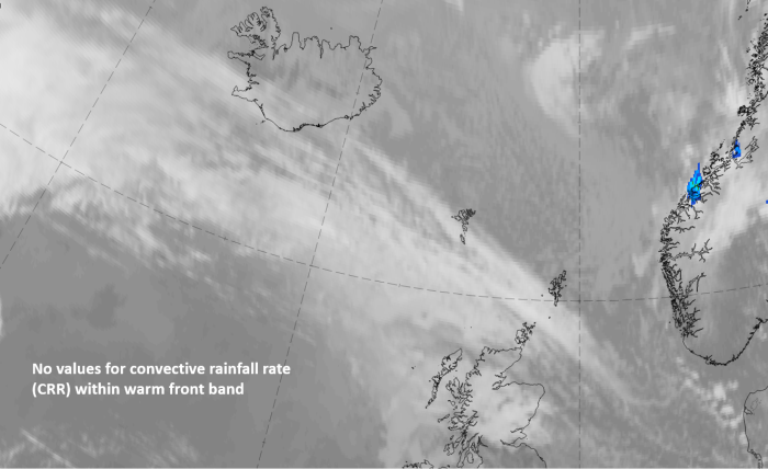
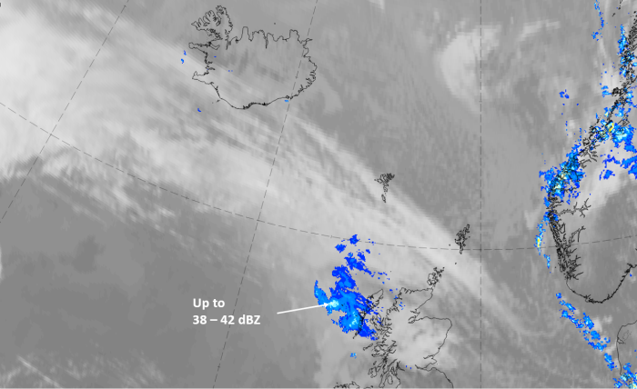
There is no precipitation report from the existing weather stations (which are along the leading edge) but some spots with higher precipitation probabilities are at the rearward edge.
|
|
|
|
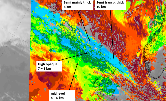
17 September 2019at 12 UTC
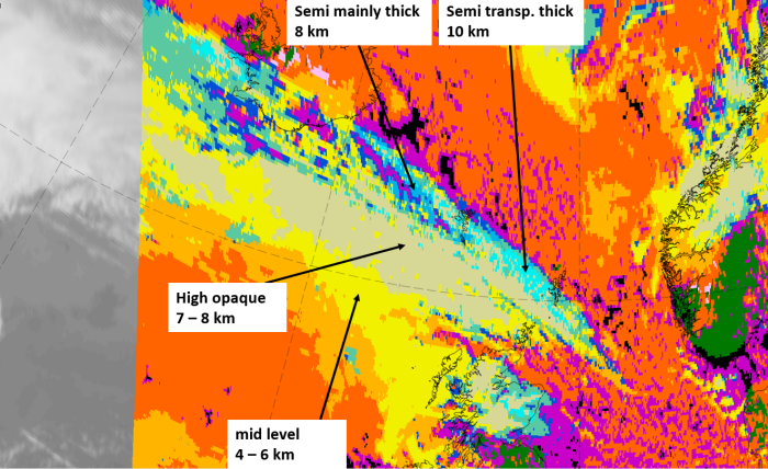
1st row: Cloud Type (CT NWCSAF) (above) + Cloud Top Height (CTTH - NWCSAF) (below); 2nd row: Convective Rainfall Rate (CRR NWCSAF) (above) + Radar intensities from Opera radar system (below).
For identifying values for Cloud type (CT), Cloud type height (CTTH), precipitating clouds (PC), and Opera radar for any pixel in the images look into the legends. (link).