Key Parameters
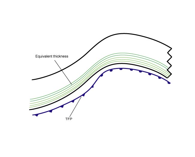
- Equivalent thickness:
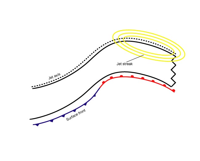
The cloud band of the Warm Front Band is within the higher gradient zone of equivalent thickness. - Thermal front parameter (TFP):
The TFP can be found close to and parallel to the rear edge of the Warm Front cloud band. This is in contrast to the Ana Cold Front where the TFP accompanies the leading edge of the cloud band. - Warm advection (WA):
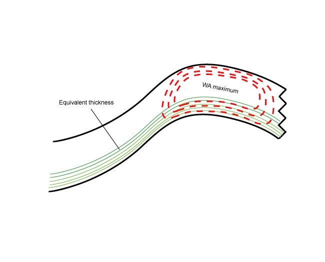
The whole frontal cloudiness lies within a WA maximum, which increases towards the occlusion point. Consequently, the maximum is in front of the frontal line. - Shear vorticity at 300 hPa:
The zero line coincides with the leading edge of the Warm Front cloud band. - Isotachs at 300 hPa:
The leading edge of the Warm Front is superimposed upon a jet streak.
|
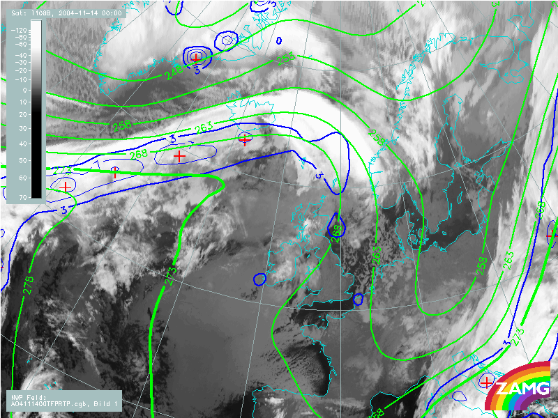
14 November 2004/00.00 UTC - Meteosat 8 IR 10.8 image; thermal front parameter (TFP) 500/850 hPa, green: equivalent thickness 500/850 hPa
|
|
|
|
|
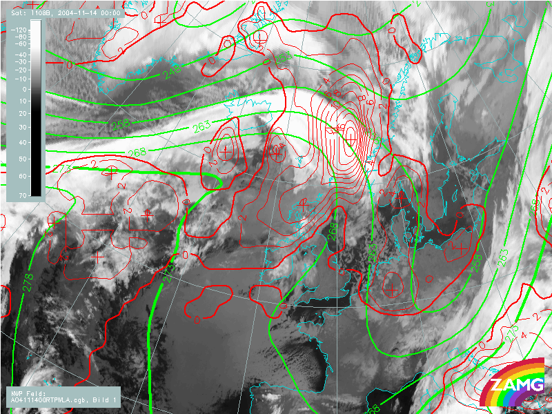
14 November 2004/00.00 UTC - Meteosat 8 IR 10.8 image; red: temperature advection 500/1000 hPa, green: equivalent thickness 500/850 hPa
|
|
|
|
|
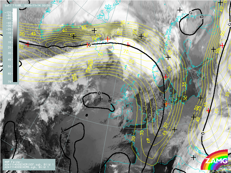
14 November 2004/00.00 UTC - Meteosat 8 IR 10.8 image; yellow: isotachs 300 hPa, black: zero line of shear vorticity 300 hPa
|
|
|
|