Weather Events
An Upper Wave is indicative of various processes occurring at the upper levels of the troposphere. There are no weather events at the surface associated with the Upper Wave bulge. The example below shows an Upper Wave over England.
| Parameter | Description |
| Precipitation |
|
| Temperature |
|
| Wind (incl. gusts) |
|
| Other relevant information |
|
 |
|
|
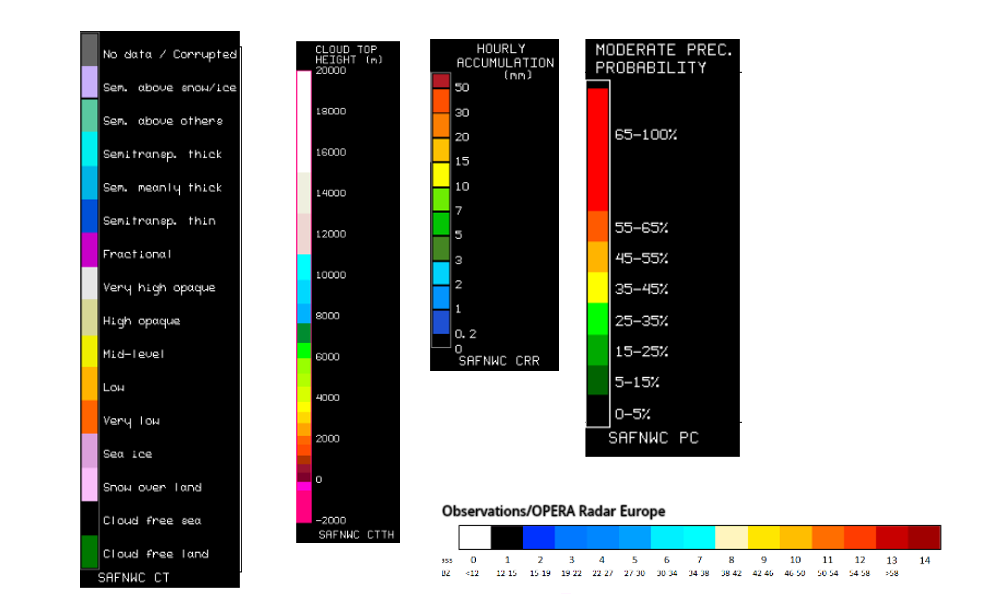
Legend:
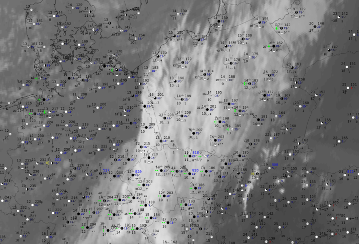
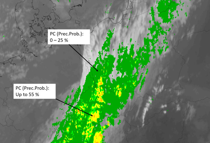
11 July 2020 at 12UTC: IR + synoptic measurements (above) + probability of moderate rain (Precipitting clouds PC - NWCSAF).
Note: for a larger SYNOP image click this link.
Reports of persistent precipitation can be found within the cold front cloud band to the south and of intermittent precipitation to the northeast of the upper wave cloud bulge. In this cloud bulge there are no precipitation reports, only overcast with multi-layered cloud. In the probability of moderate precipitation computed from the NWCSAF there are values from 0-15 %.
|
|
|
|
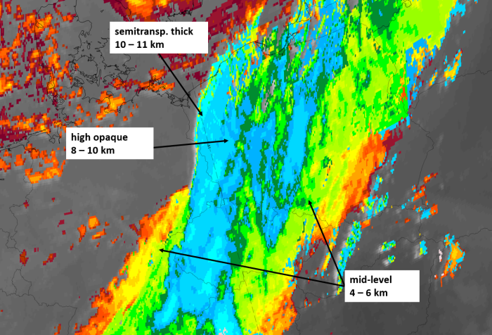
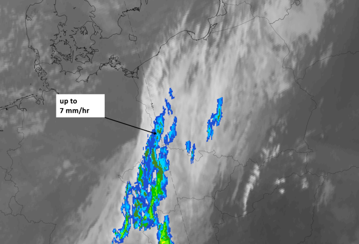
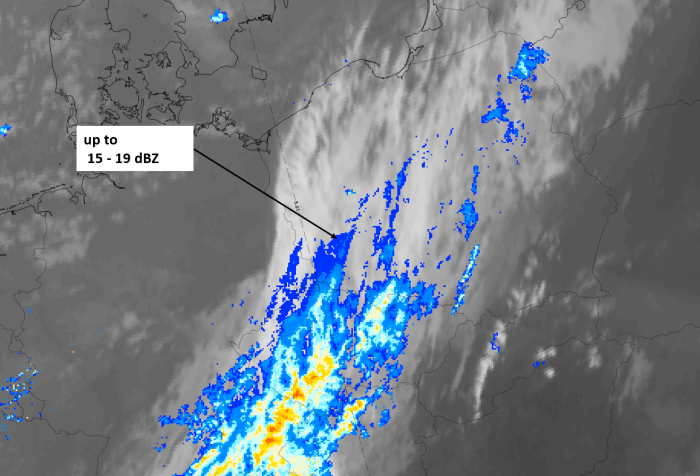
Legend:
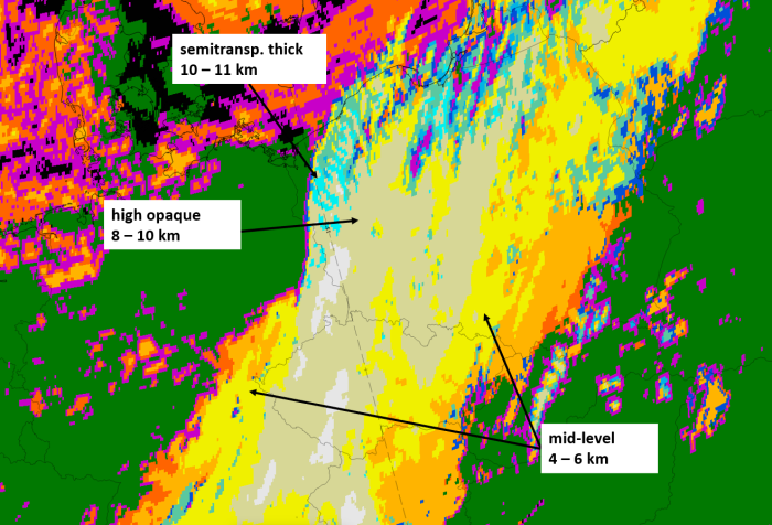
11 July 2020, 06 UTC, IR; superimposed:
1st row: Cloud Type (CT NWCSAF) (above) + Cloud Top Height (CTTH - NWCSAF) (below); 2nd row: Convective Rainfall Rate (CRR NWCSAF) (above) + Radar intensities from Opera radar system (below).
For identifying values for Cloud type (CT), Cloud type height (CTTH), precipitating clouds (PC), and Opera radar for any pixel in the images look into the legends. (link).