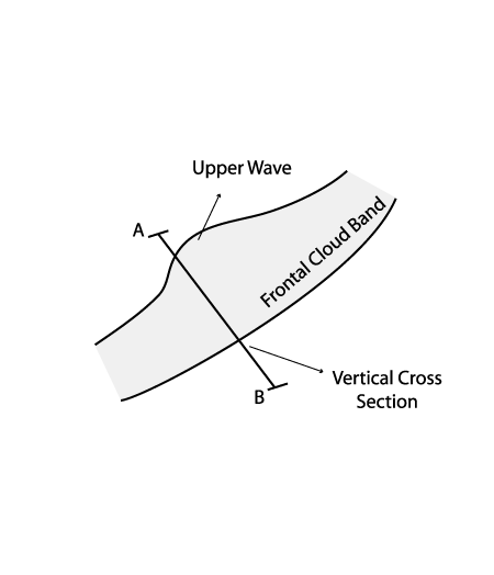
Typical Appearance In Vertical Cross Sections
- Isentropes:
Isentropes show mainly frontal character. No impact from Upper Wave - Temperature Advection:
Maximum at 300 hPa or at higher levels, connected to tropopause folding (related to potential vorticity), cold advection below the Wave bulge at lower levels - Vorticity Advection:
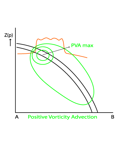
Significant maximum of positive vorticity advection at upper levels connected to the sharpening of the upper level trough at 300 hPa - Vertical motion:
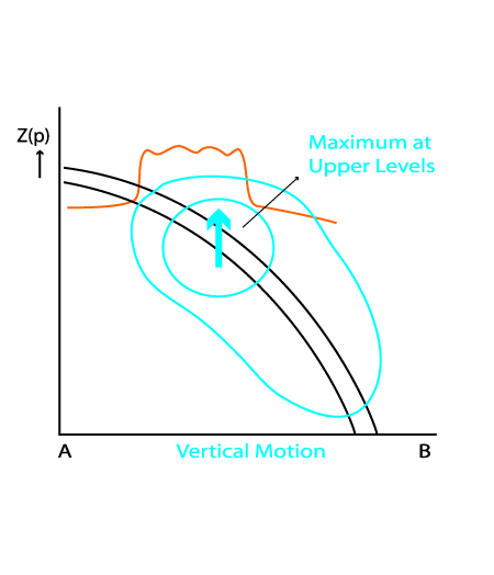
Vertical motion indicates rising air, with the maximum at upper levels, due to a rising upper relative stream
|
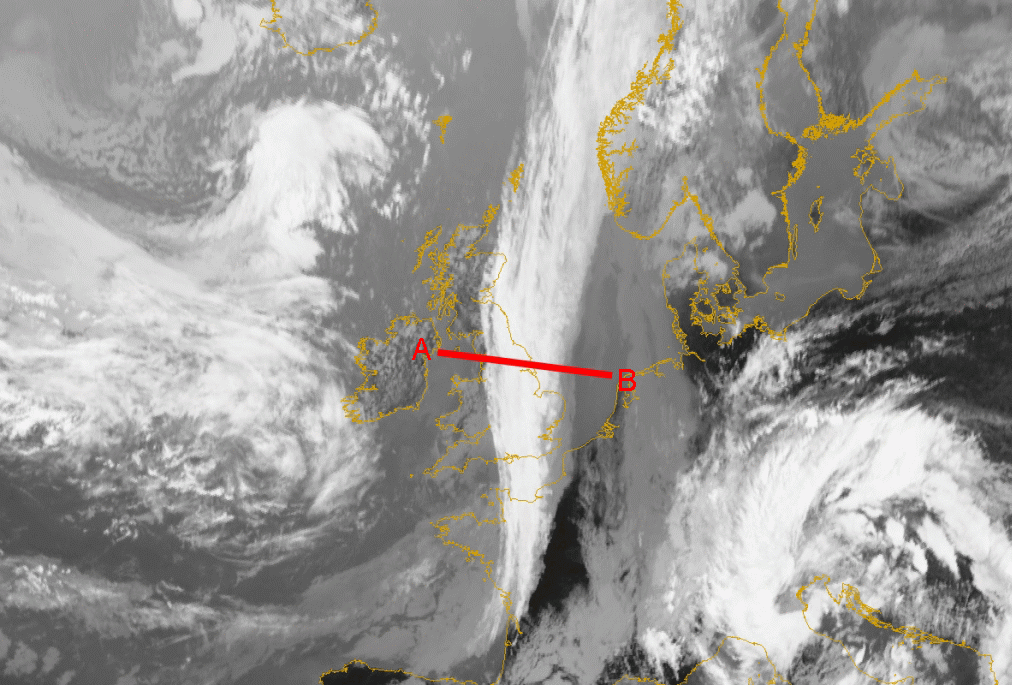
22 August 2005/12.00 UTC - Meteosat 8 IR 10.8 image; position of vertical cross section indicated
|
|
|
|
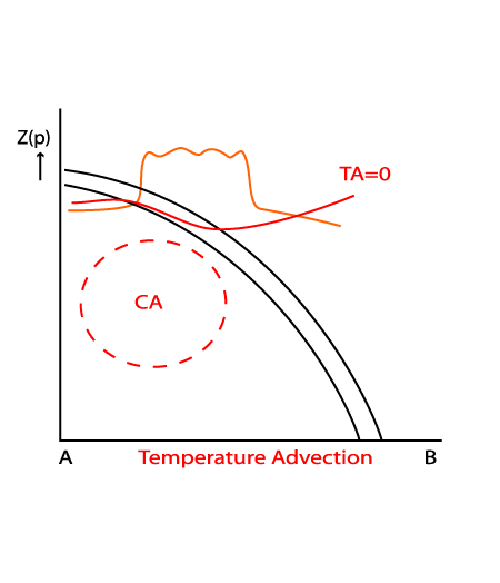
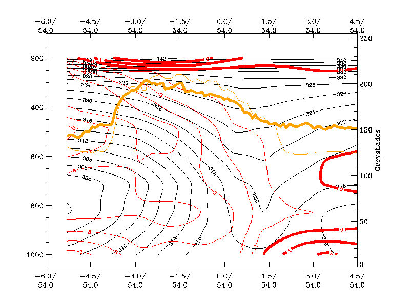
Temperature Advection
|
22 August 2005/12.00 UTC - Vertical cross section; black: isentropes (ThetaE), red thin: temperature advection - CA, red thick: temperature advection - WA, orange thin: IR pixel values, orange thick: WV pixel values
|
|
|
|
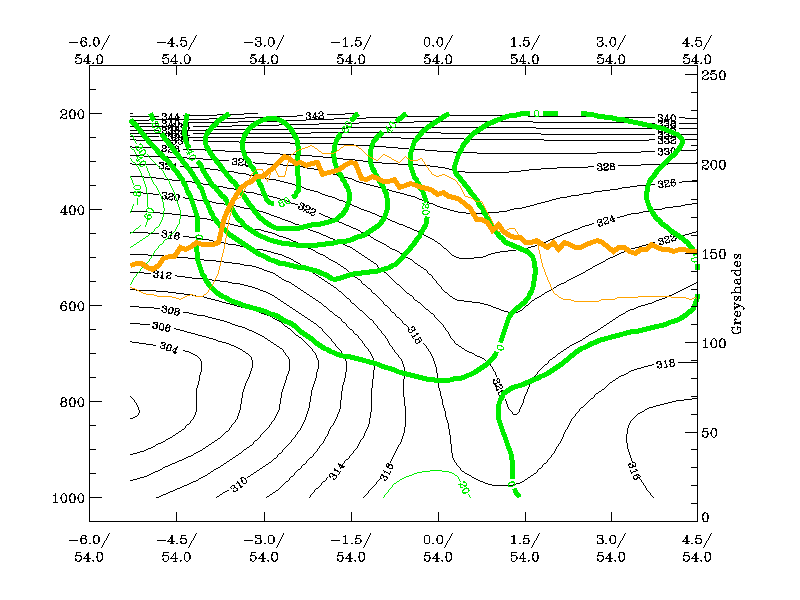
Vorticity Advection
|
22 August 2005/12.00 UTC - Vertical cross section; black: isentropes (ThetaE), green thin: vorticity advection - NVA, green thick: vorticity advection - PVA, orange thin: IR pixel values, orange thick: WV pixel values
|
|
|
|
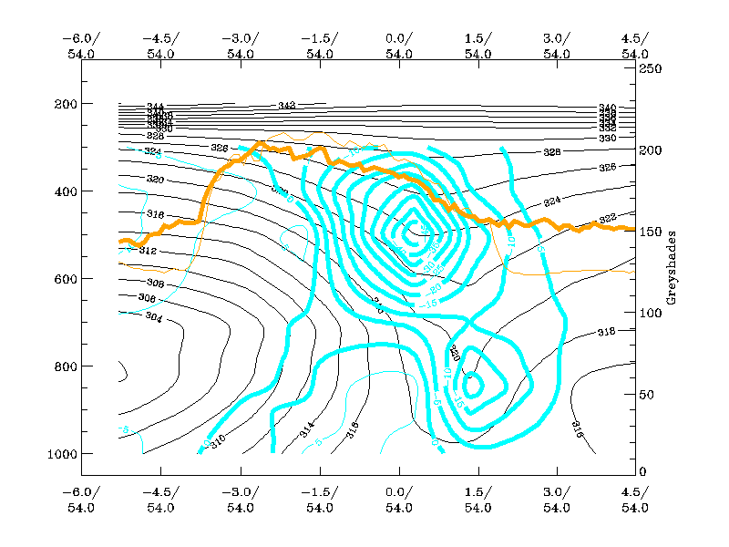
Vertical Motion
|
22 August 2005/12.00 UTC - Vertical cross section; black: isentropes (ThetaE), cyan: vertical motion (omega) - upward motion, orange thin: IR pixel values, orange thick: WV pixel values
|
|
|
|
Potential Vorticity
|
22 August 2005/12.00 UTC - Vertical cross section; black: isentropes (ThetaE), dark green thin: potential vorticity <1 unit, dark green thick: potential vorticity >=1 unit, orange thin: IR pixel values, orange thick: WV pixel values
|
|
|
|
Distinction between Wave and Upper Wave according to vertical cross sections
| Upper Wave | Wave |
|
|
|
|
|
|
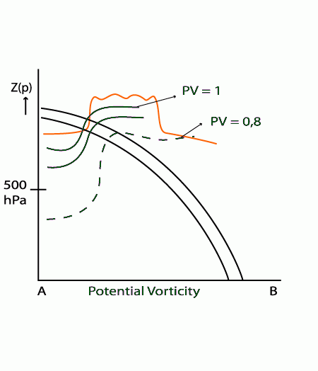
Below left is the case of an Upper Wave, below right is the case of a Wave (2nd row below left shows vertical cross section over Wave bulge). While the Upper Wave has no separate maximum of PV>=1 unit at low levels, the Wave case from the 4 July 2005/12.00 UTC shows a distinct maximum at low levels, which is usually more intense and can exceed PV>=2 units.
|
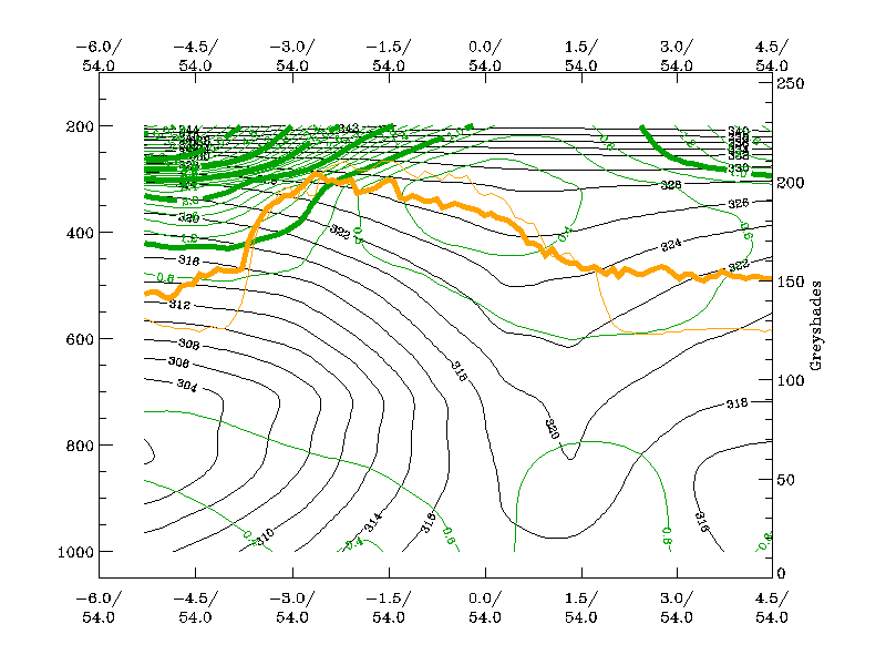
22 August 2005/12.00 UTC - Vertical cross section; black: isentropes (ThetaE), dark green thin: potential vorticity <1 unit, dark green thick: potential vorticity >=1 unit, orange thin: IR pixel values, orange thick: WV pixel values
|
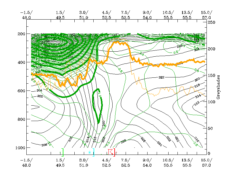
04 July 2005/12.00 UTC - Vertical cross section; black: isentropes (ThetaE), dark green thin: potential vorticity <1 unit, dark green thick: potential vorticity >=1 unit, orange thin: IR pixel values, orange thick: WV pixel values
|

|
|
|
|
|
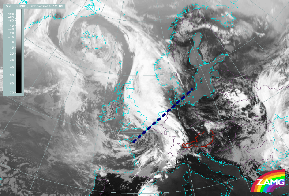
04 July 2005/12.00 UTC - Meteosat 8 IR 10.8 image; position of vertical cross section indicated
|