Weather events
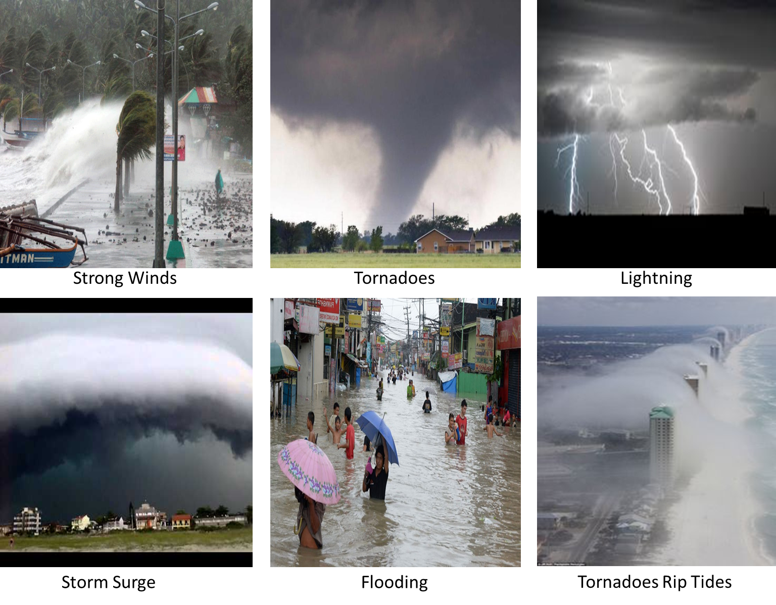
With TCs being as powerful as they are, it is hardly surprising that they cause such destruction to man and nature. Although they always pose a potential hazard, most of the severe damage occurs when they make landfall. The main types of damage are described in the table below:
| Parameter | Description |
|---|---|
| Strong Winds | Strong winds are the most common means of destruction associated with TCs. Their sometimes continuous barrage can uproot trees, knock over buildings and homes, fling potentially deadly debris around, sink or ground boats, and flip over cars. The most severe wind damage occurs when the eyewall of a TC passes over land. In areas of high wind shear, feeder band convergence can result in periods of prolonged and persistent rains, with echo training events producing excessive rainfall amounts. They are often enhanced by topographical effects, with 24 hrs rainfall amounts peaking at 250-500mm and circulation in the cyclone being disrupted. The Saffir-Simpson Scale: Cat 5 TCs are referred to as Catastrophic TCs, with maximum sustained wind speed exceeding 252 km/h. |
| Lightning | When lightning does occur in TCs, it is mostly found in the convective outer rainbands. |
| Storm Surge | A storm surge is a the rising of the sea level due to the low pressure, high winds, and high waves associated with a TC when it makes landfall. Storm surge can cause significant flooding and even loss of life if people are caught unexpected. The eyewall is where the greatest wind speeds are found, air rises most rapidly, clouds reach their highest altitude, and precipitation is the heaviest. The height of a storm surge varies according to the intensity of a TC, typically ranging from 1 meter to more than 5 meters. Coastal towns adjacent to large bays or areas of shallow water are especially susceptible to damage caused by storm surges. This damage can be further intensified if the storm surge coincides with a high astronomical tide. |
| Flooding | Apart from the storm surge, heavy rainfall can cause both flash and long term flooding. Feeder band convergence can result in periods of prolonged and persistent rains, with echo training events producing excessive rainfall amounts. They are often enhanced by topographical effects, with 24- hourly rainfall amounts peaking at 250-500mm and circulation in the cyclone being disrupted. |
| Tornadoes | Tornadoes are also found close to or within the eyewall. |
| Rip Tides | Rip tides form when strong winds from a storm or TC push waves up against the shoreline. The water from these waves collects together and seeks an exit point from which it can flow away again from the shore, thereby forming a strong, narrow current. Rip currents can be caused by a TC which is still hundreds of miles off-shore and warnings of these currents are often the first indication that a TC is approaching. Storm surge and high waves can contribute to water rising as high as 9m. |
|