Key Parameters
The key parameters in using NWP to examine the propagation of northerly cold surges (NCS) from mid-latitudes to the maritime continent are:
-
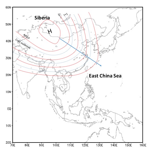
Mean sea level pressure:
The first sign of NCS initiation is rise of the mean sea level pressure to over 1045 hPa in northern China. After that, the pressure continues to rise southeast of it. When a 10 hPa pressure gradient between Hong Kong and 30°N, 115°E is detected, it indicates the arrival of a NCS in Hong Kong.
-
Temperature:
A surface temperature drop around 5°C within 24 hours is considered the other sign of an NCS occurrence in Hong Kong. 4-6 days after this occurs, a severe weather warning can be released and heavy precipitation expected around eastern Sumatra and western Java.
-
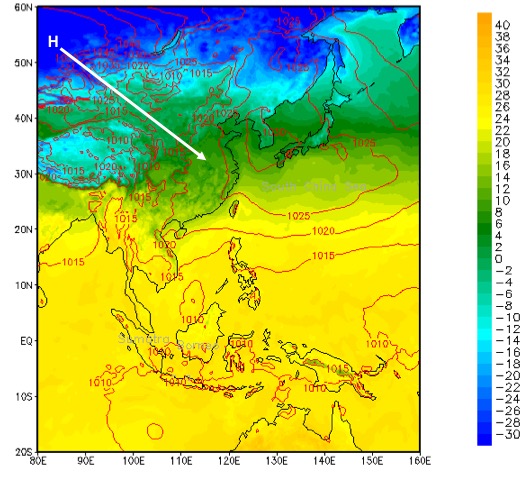
Meridional wind at 925 hPa:
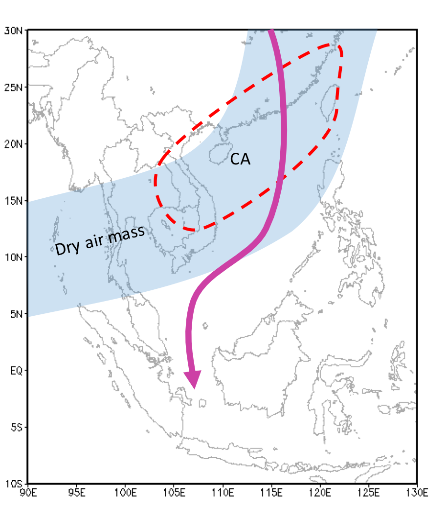
The cold surge's progress over the South China Sea and the equator is marked by a strengthening of the meridional wind towards southeast.
-
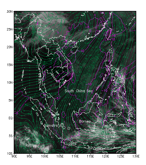
Relative humidity:
At the mid-levels, around 700 hPa, humidity contours will show the boundary of dry air protruding south almost to the equator.
-
Temperature advection:
Cold advection associated with NCS occurs along the coastline of southern China.
-
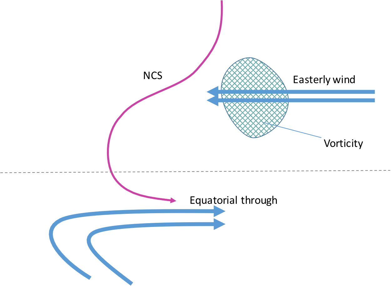
Zonal wind:
Strong zonal winds from opposite sides of equator may help in building a vortex. The Borneo vortex exists in 60 % of NCS cases.
-
Vorticity:
Combined with the NCS, the vorticity advection of the easterly winds provides favorable conditions for the formation of the Borneo vortex.
-
Geopotential height:
If there is a sufficient amount of vorticity and a low geopotential height contour in northeast Borneo, the Borneo Vortex is likely to form.
Mean Sea Level Pressure and Surface Temperature in Northern China
|
18 January 2010, 13UTC. contour: MSLP (mb)
|
|
|
|
Streamline and Isotach at 925 hPa (classical NCS or meridional case)
|
01 February 2007 06UTC. MTSAT IR1 channel.
Green: Streamline (m/s); magenta: Isotach >=5 m/s at 925 hPa |
|
|
|
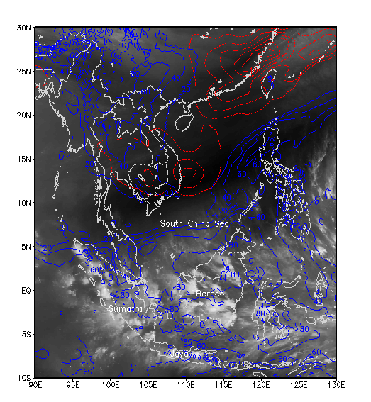
Humidity at 700 hPa and Temperature Advection at 925 hPa
|
28 January 2007 06UTC. MTSAT WV channel.
Blue: Humidity at 700 hPa (%); red : cold advection (°C) |
|
|
|
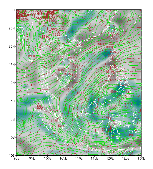
Geopotential height, Streamline and Vorticity at 850 hPa (vortex cases)
|
17 January 2010. MTSAT IR channel.
Brown: Geopotential height (m); teal: Vorticity ; green: Streamlines at 850 hPa |
|
|
|