Appearance in Satellite Data
|
Typical northerly cold surge cloudiness
|
|
Convection in the Maritime Continent is typically the result of one of three synoptic disturbances, namely Northerly Cold Surge (NCS), Borneo Vortex, and Madden-Julian Oscillation (MJO).
- NCS events often occur during the peak of boreal winter monsoons (December-January-February). When the strong flow associated with NCS propagates southward and crosses the equator, it may affect the intensity of convection in the South China Sea and the Maritime Continent. The time scale for the whole system is a few days to a week.
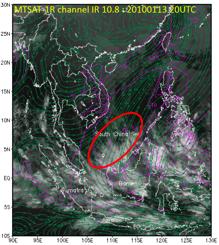
- A Borneo vortex typically appears off the northwestern coast of northern Borneo. When a NCS event coincides with a vortex, the convection strengthens over northwest Borneo and weakens north of Java. The lifetime of the vortex is a few days.
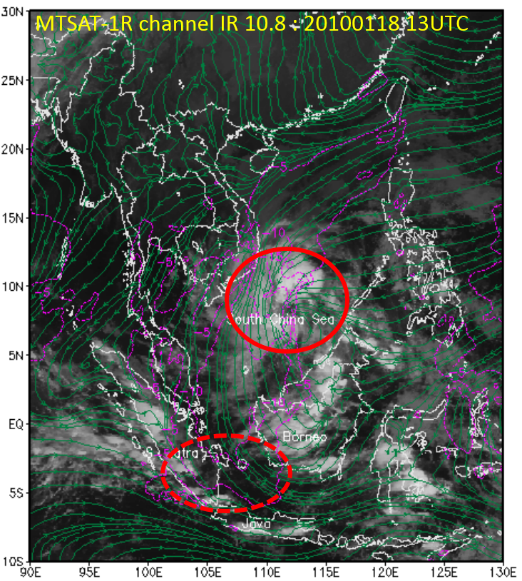
- The MJO is a dominant intra-seasonal oscillation in tropical latitudes which makes the degree of convective activity depend on variations in zonal wind convergence. The MJO originates from the Indian Ocean and propagates eastward across the Maritime Continent into the Pacific Ocean with time period of 30 to 60 days. When the active phase of MJO reaches the Maritime Continent, enhanced convection appears in the eastern Indian Ocean (west of Sumatra), Java Island and south of Java.
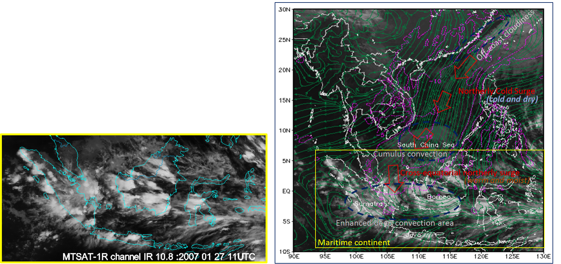
The interaction of these disturbances of various scales leads to a favorable environment for deep convection in the Maritime Continent. Southern equatorial latitudes are impacted when cross equatorial flow develops.
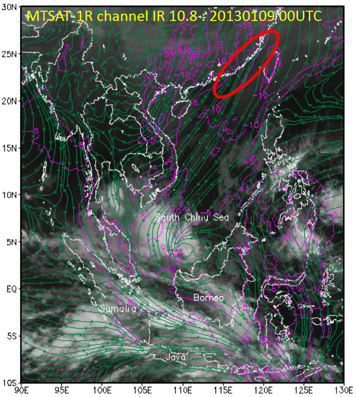
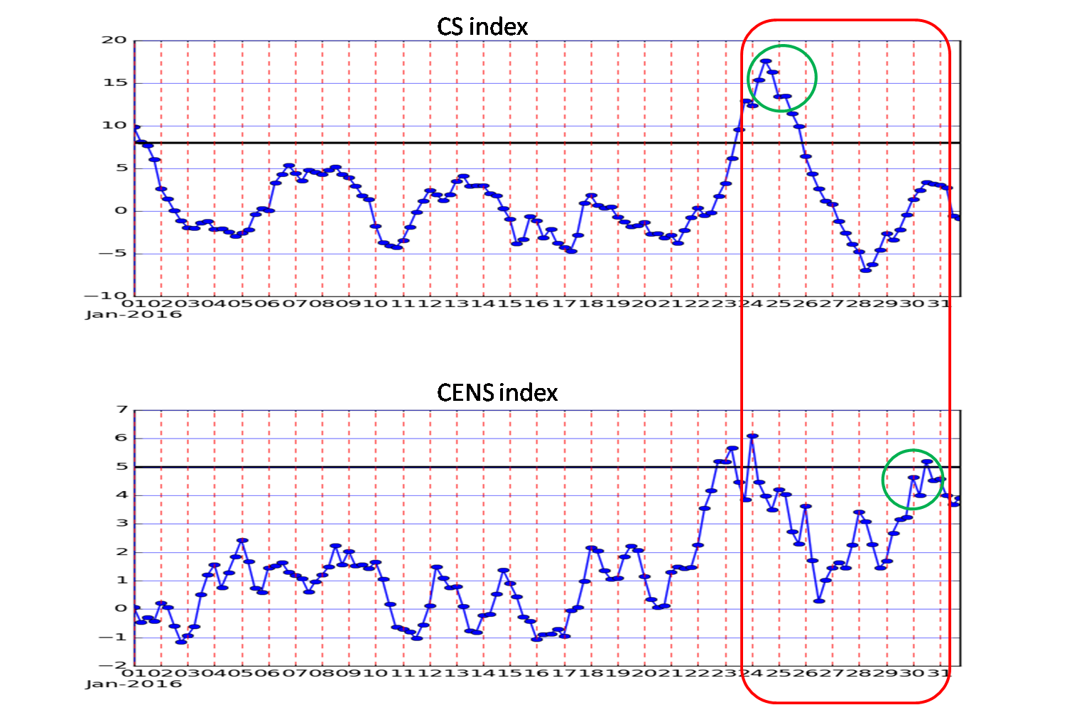
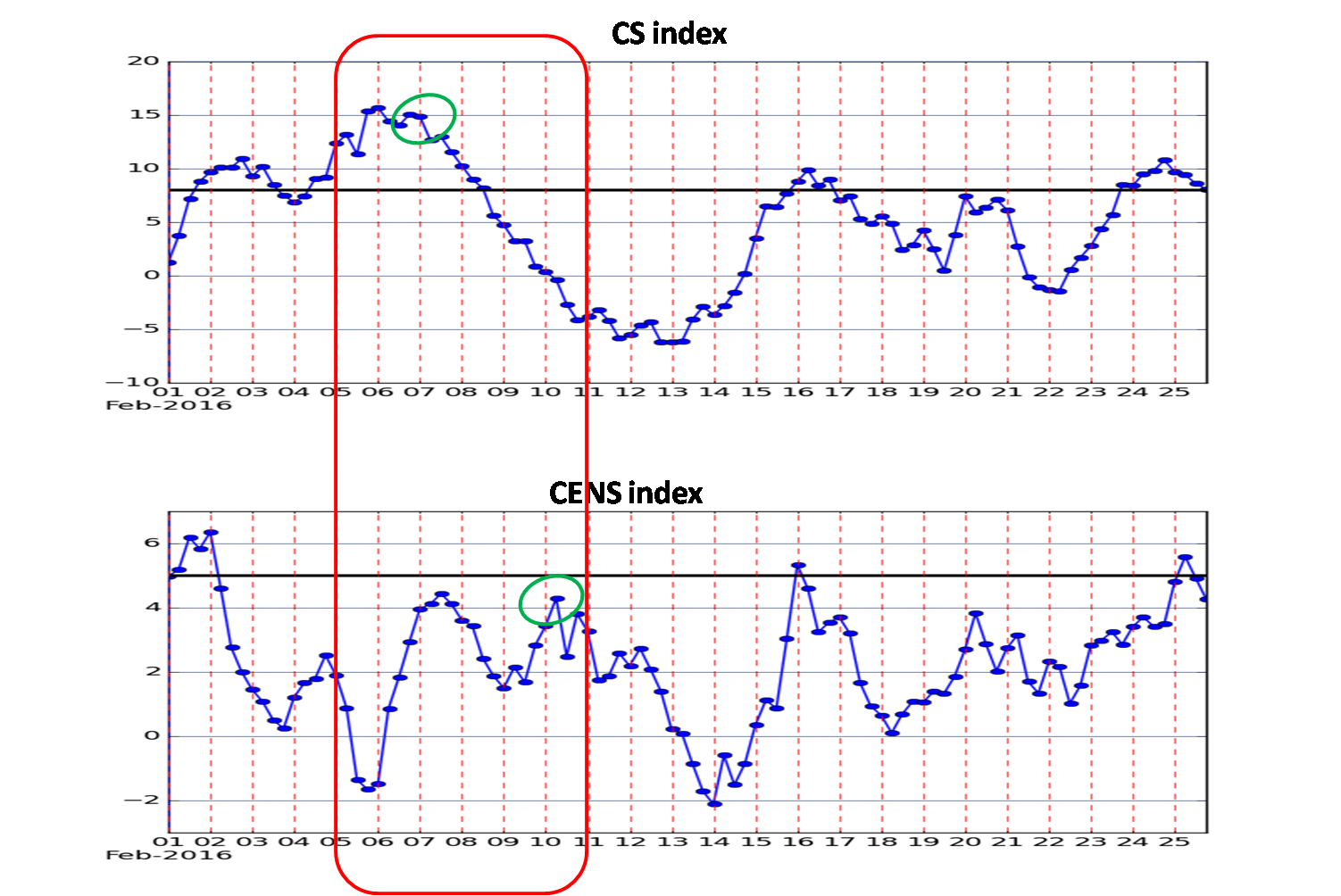
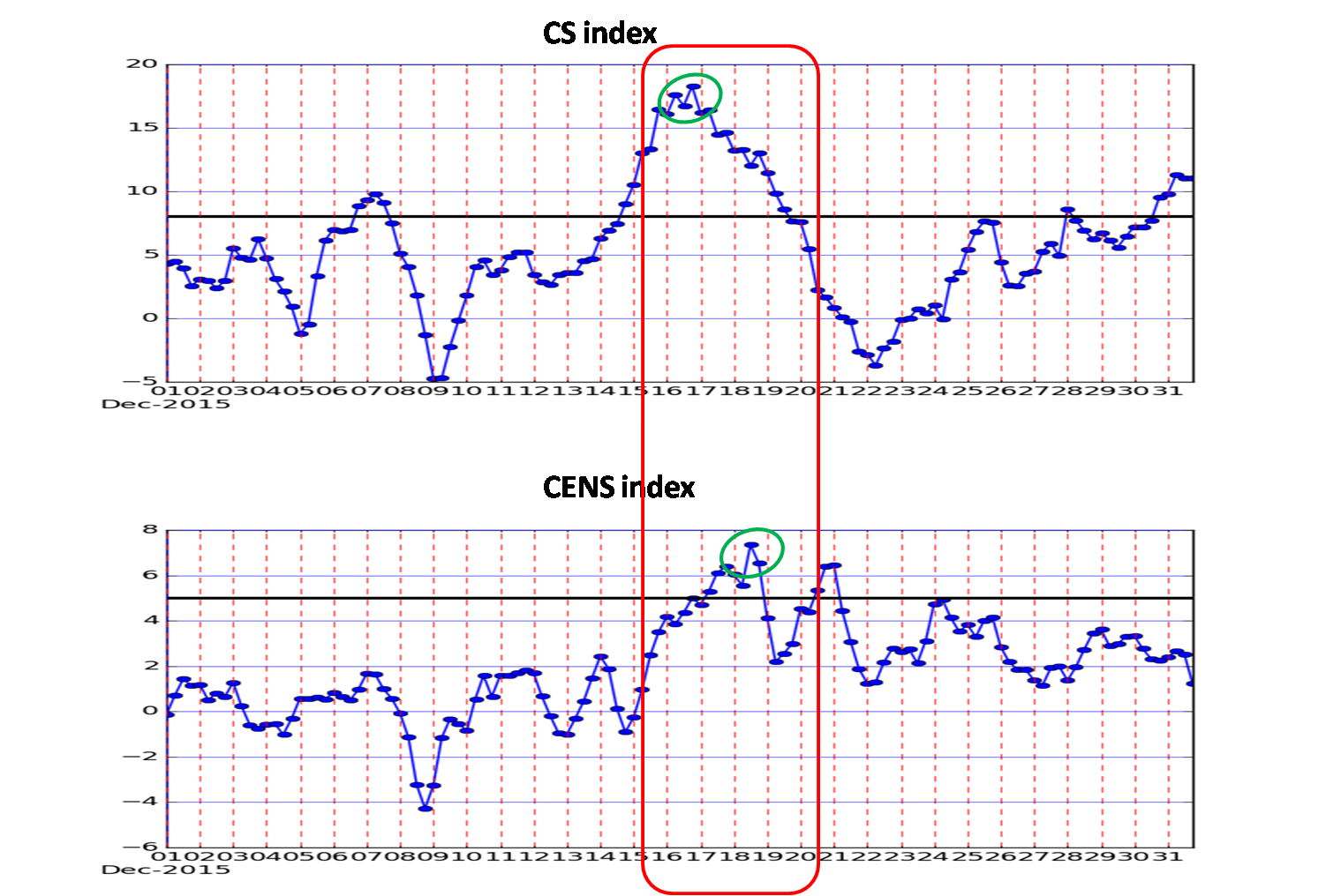
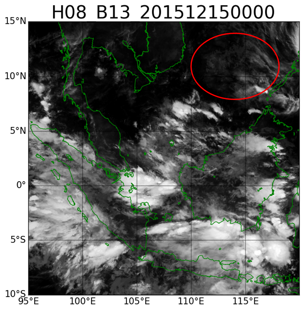
- Phase-1: when the NCS is estimated to arrive in Hongkong (22N, 114E), indicated by a change towards cold and dry conditions.
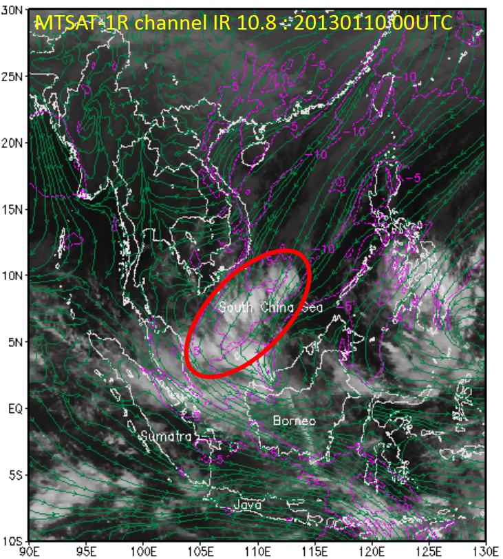
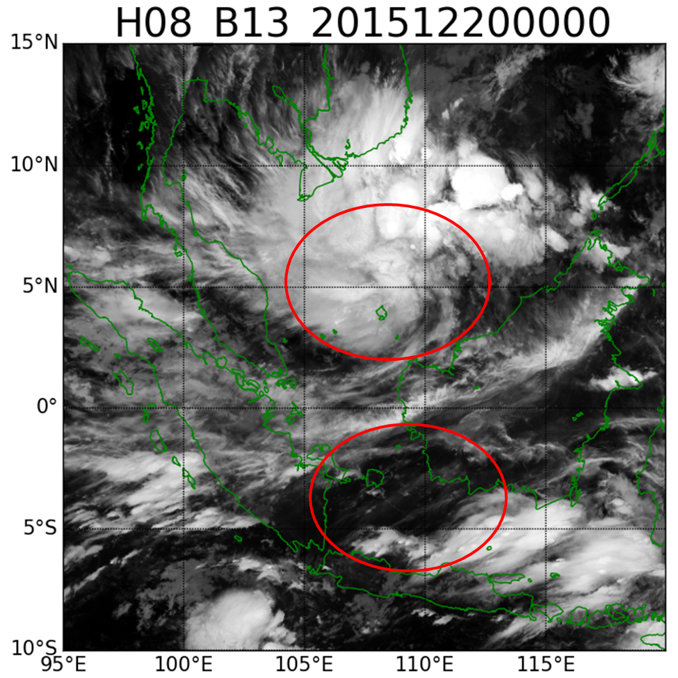
- Phase-2: when the NCS is estimated to reach 15N in the South China Sea, indicated by mean strong meridional wind above 8m/s along 15N.
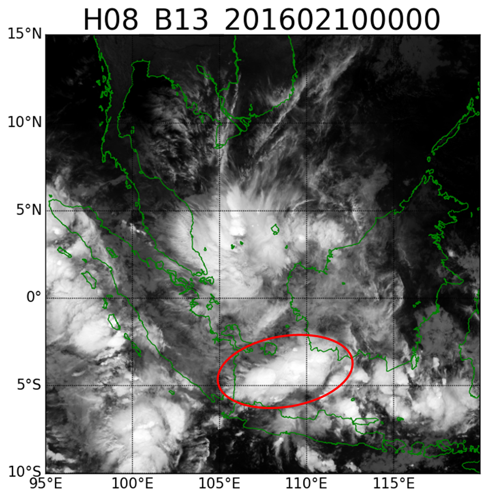
- Phase-3: when there is a Cross-Equatorial Northerly Surge (CENS) due to the NCS, indicated by area averaged (0S-5S, 105E-115E) strong meridional wind above 5m/s.
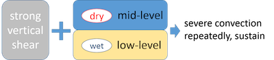
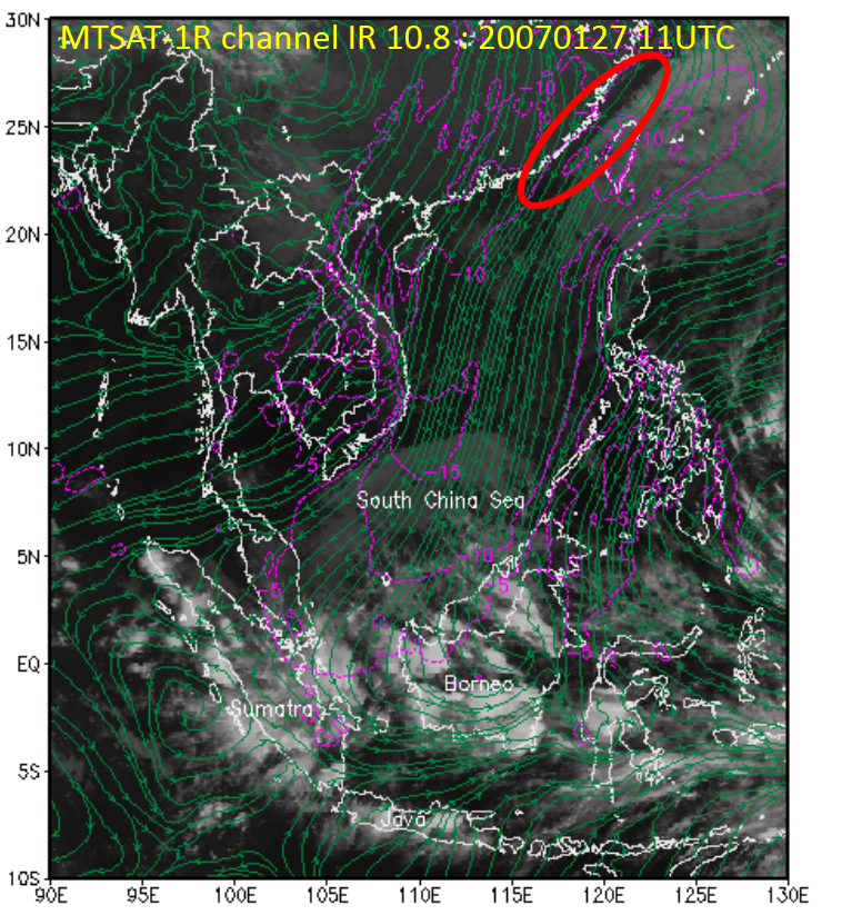
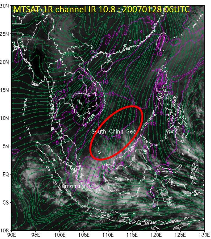
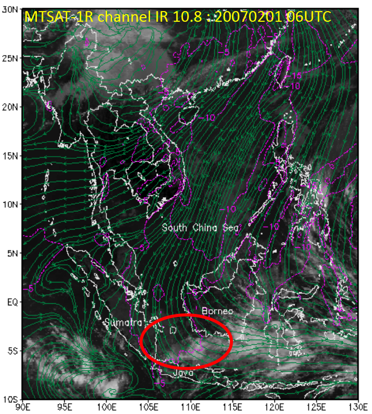
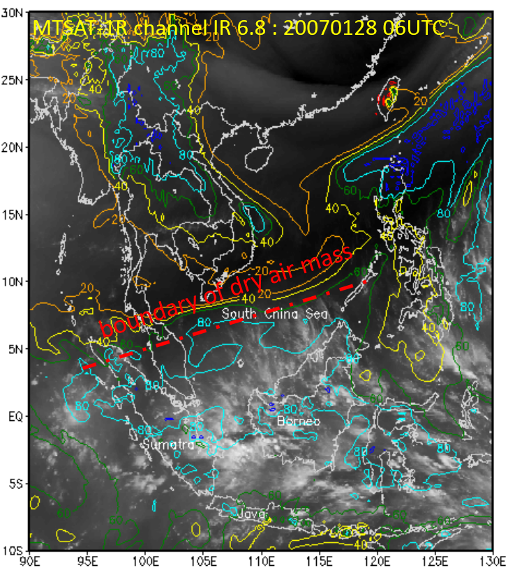
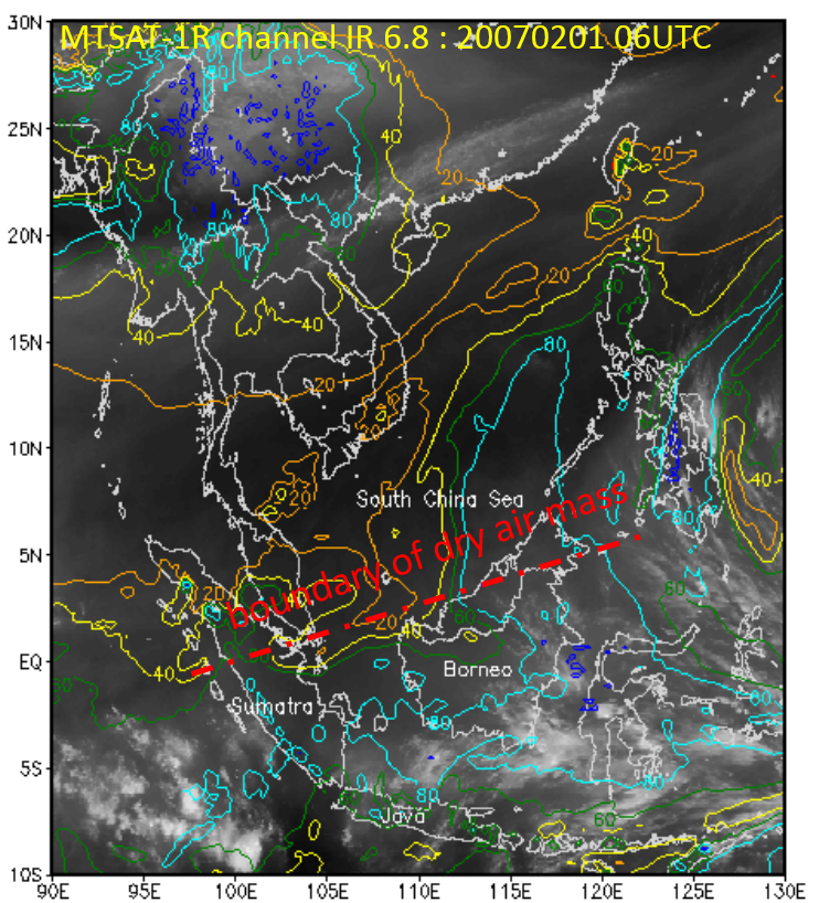
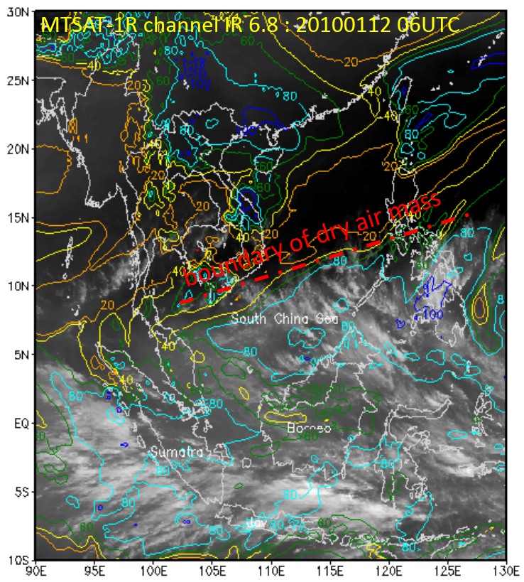
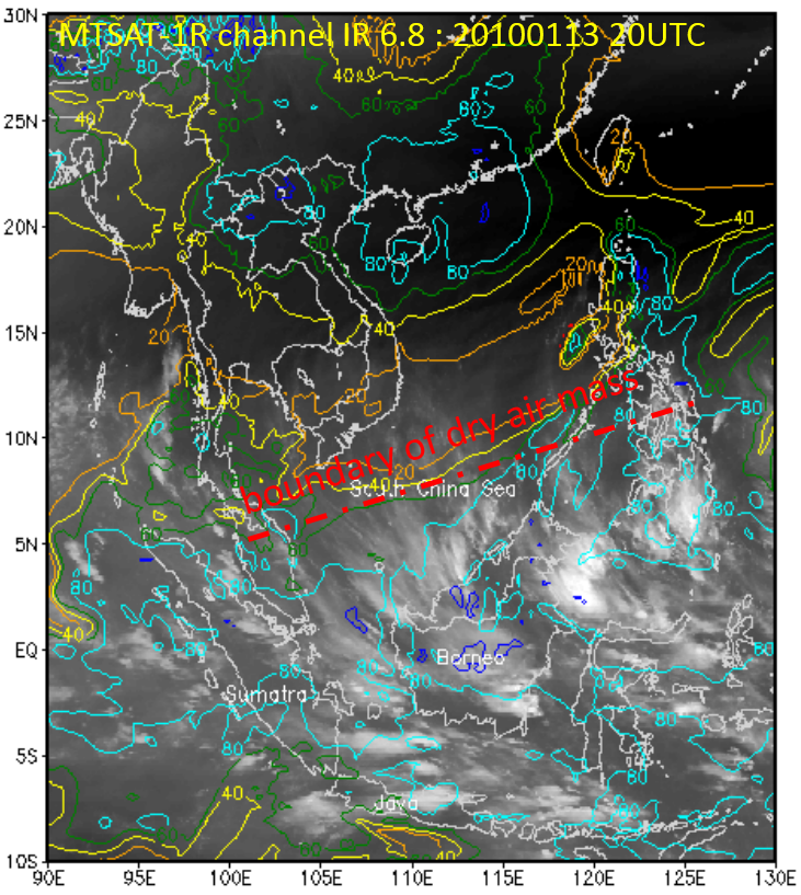
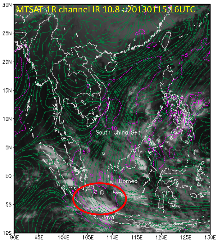
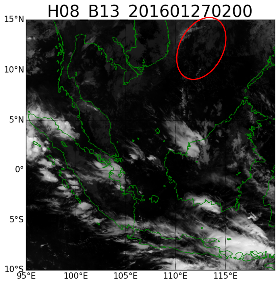
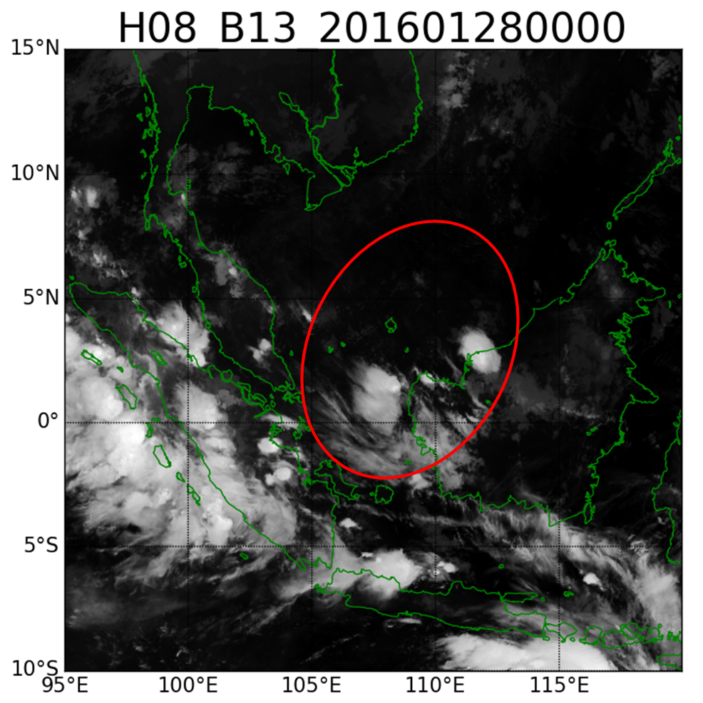
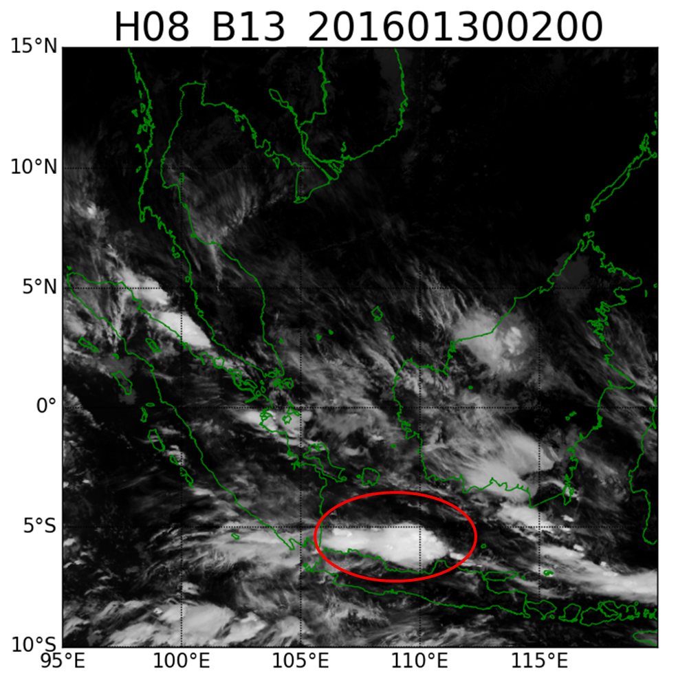
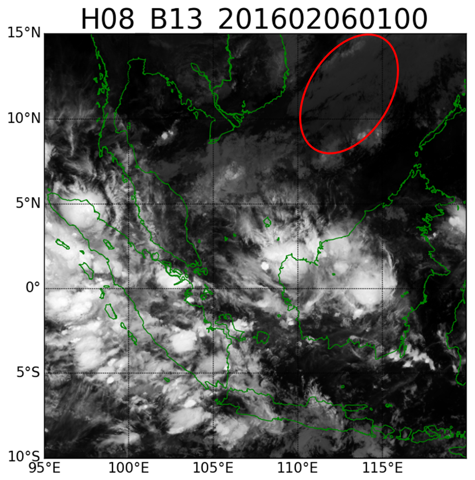
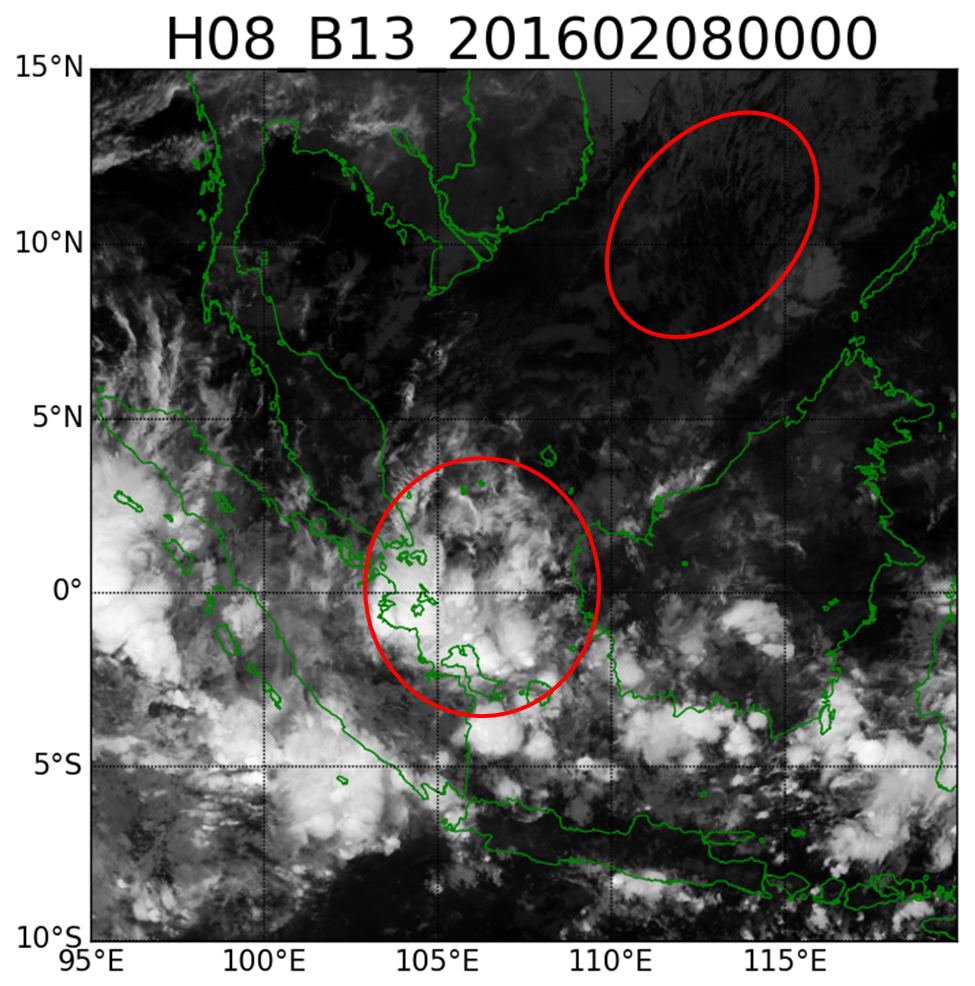
The significant temperature difference between land and sea surface produces a shallow convectively unstable layer. Initially this produces cloudiness just off the coast of China mainland, which indicates the Phase 1 of the NCS event. During Phases 1 and 2, cloudiness in the form of cloud streets appears in the South China Sea, as indicated by cumulus convection caused by the growing convectively unstable layer. During Phase 3 enhanced convection develops over the Karimata Strait and the Java Sea in the form of organized cloud systems of various scales, including Mesoscale Convective Systems (MCS). This is due to the presence of a favorable environment with enhanced low-level convergence, instability and strong vertical wind shear.
|
Typical northerly cold surge cloudiness
|
|
- Low level wind shear is a favorable and necessary condition for convection. This applies especially for convection that is triggered and maintained by downdrafts from previously existing organized cloud clusters.
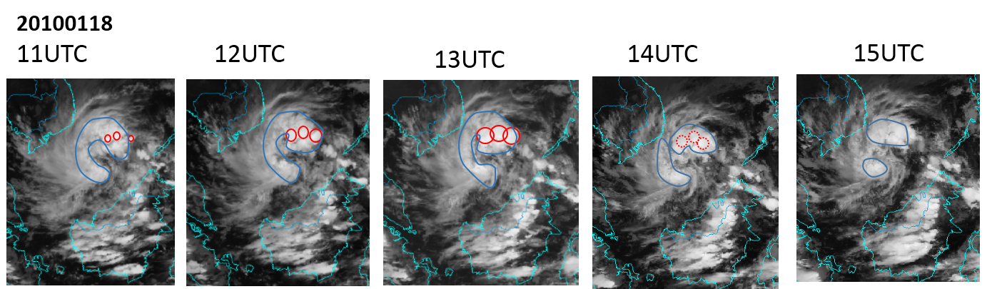
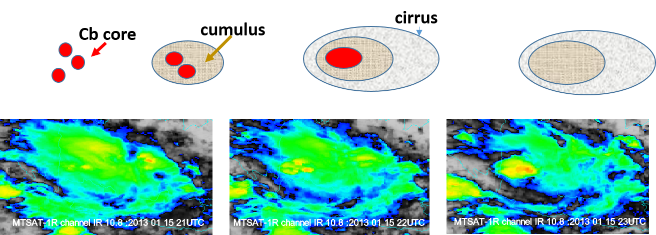
- Oval shape Cirrus shields with a distinctive appearance occur in several Cumulonimbus (Cb) cores that initiate the organized system.
- CENS may induce intensive low level wind convergence.
- Northwesterly flows at lower levels and southeasterly ones at upper levels could produce strong low level vertical wind shear over certain areas for days.
- Wind shear over Java is usually weak due to the limited number of periods with intense cross-equatorial flow.
 |
|
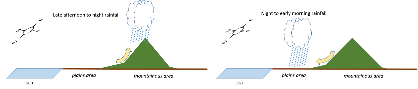
This schematic illustrates the convective activity and rain event due to diurnal orographic circulation
|
 |
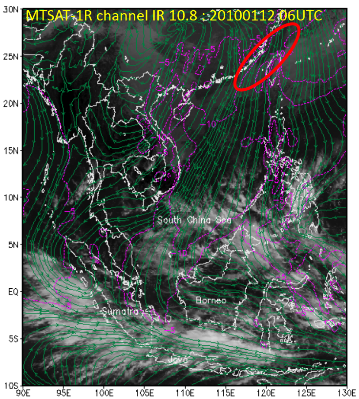
NCS Pattern
|
Streamline : meridional wind at 925 hPa ; Color contour: relative humidity at 700 hPa
|
||
|
Stage 1
|
Stage 2
|
Stage 3
|
|
|
|
|
|
|
Notes:
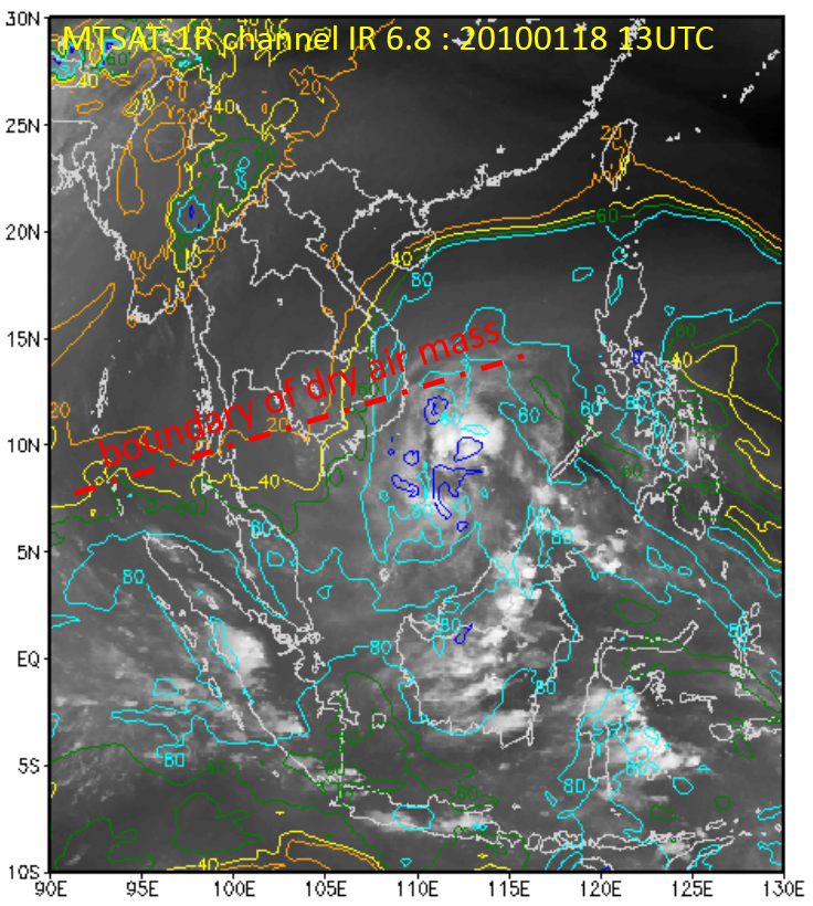
- Cloudiness associated with NCS varies in MCS size clusters.
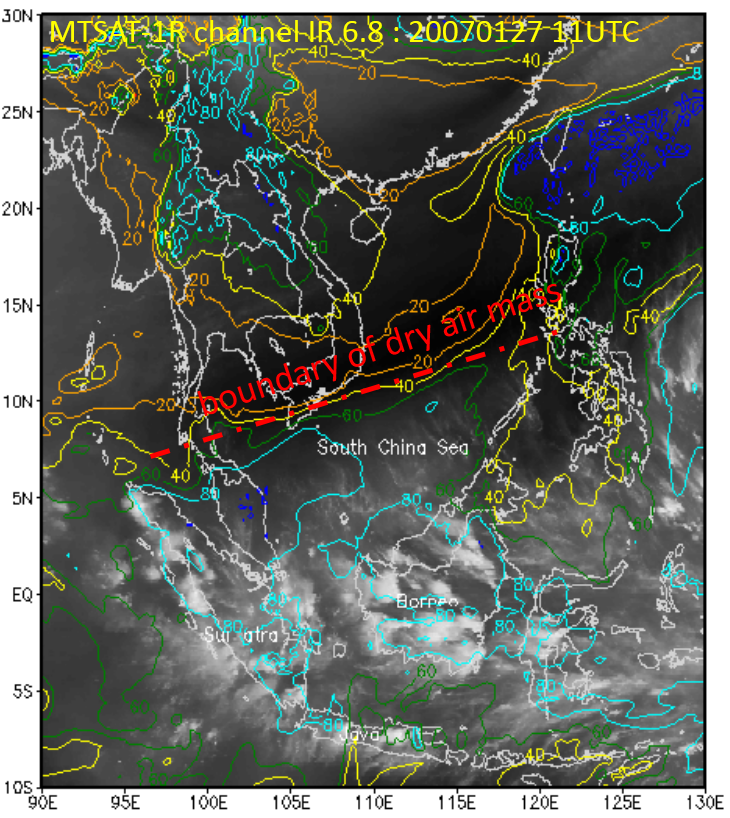
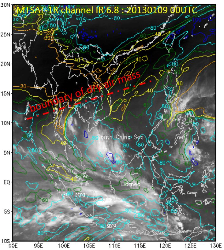
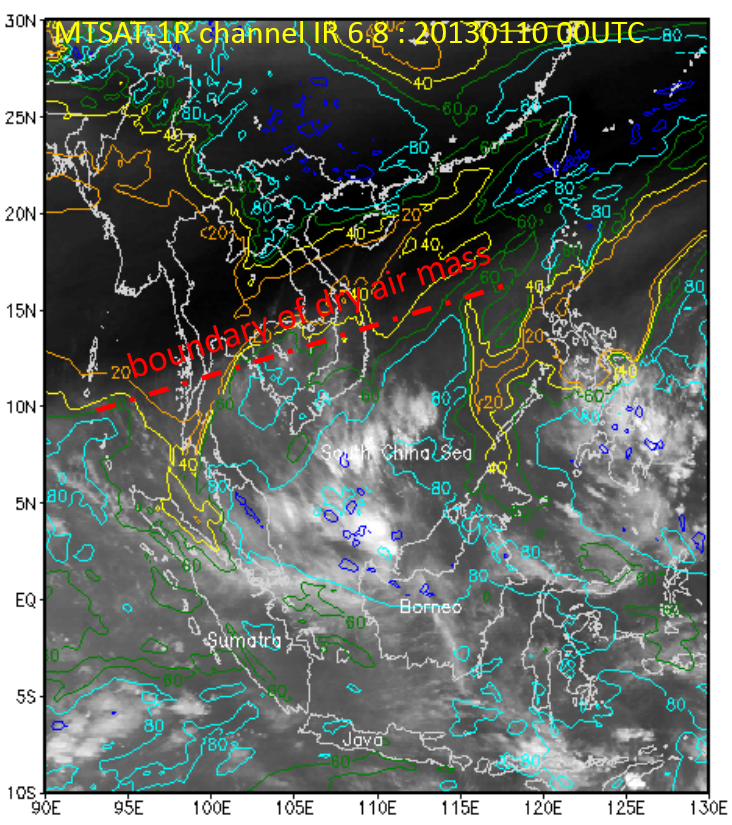
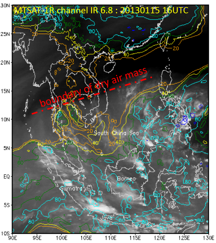
- WV channel is useful to indicate the persistence of NCS. Transportation of relatively drier air mass to the equator can be confirmed.
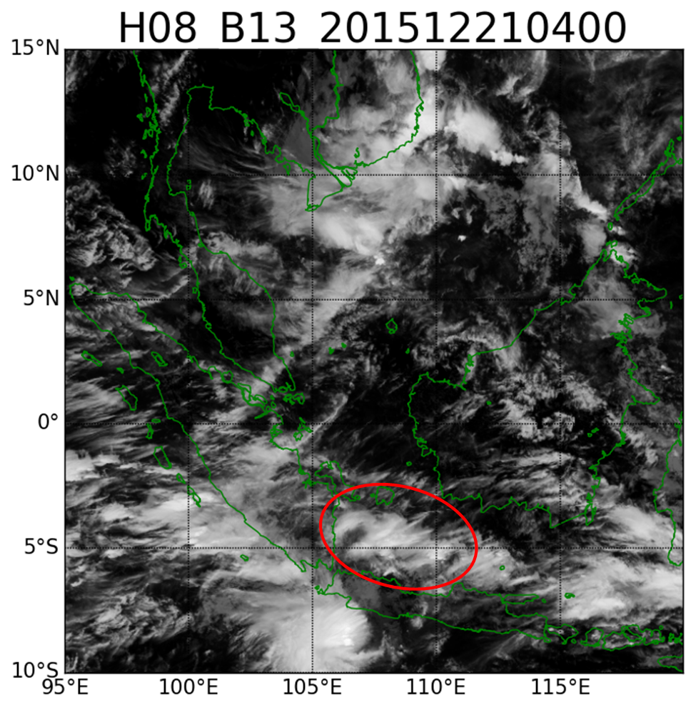
- Convergence caused by a strong cross-equatorial flow during NCS leads to an area of enhanced convection south of the equator, especially the Java Sea.
|
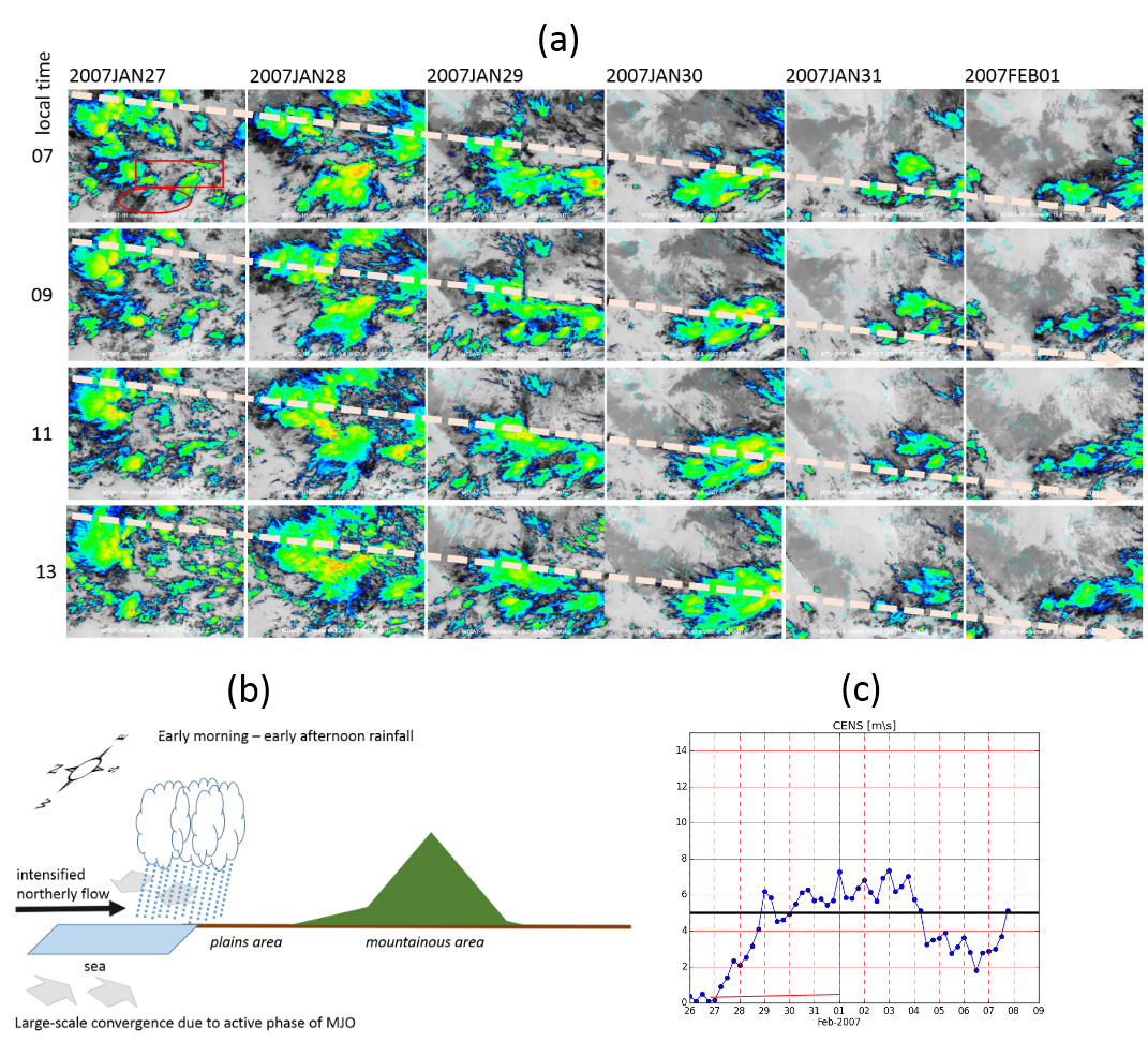
Fig (a) above shows the shift of enhanced convection from west to east. The red circle and rectangle indicate western Java and Java Sea, respectively. The schematic in fig (b) illustrates the heavy rainfall event from early morning to early afternoon. The marine convection north of Java forms at night due to convergence caused by NCS-generated cross-equatorial northerly flow which is further enhanced by nocturnal land breezes. This phenomena is more intense when it coincides with the active phase of MJO.
|
 |
NCS - Vortex Pattern
|
Streamline : meridional wind at 925 hPa ; Color contour: relative humidity at 700 hPa
|
||
|
Stage 1
|
Stage 2
|
Stage 3
|
|
|
|
|
|
|
Notes:
- Clouds in the northeastern parts of the vortex have a comma-shaped structure.
- The vortex limits the southward progression of the cold surge and the accompanying cross-equatorial flow. Hence, it limits convection over the Java Sea while aiding convective enhancement over the South China Sea.
|
Comma-shaped clouds north of Borneo (red : Cb cloud formation)
|
 |
NCS - Vortex - MJO Pattern
|
Streamline : meridional wind at 925 hPa ; Color contour: relative humidity at 700 hPa
|
||
|
Stage 1
|
Stage 2
|
Stage 3
|
|
|
|
|
|
|
Notes:
- When combined with a dominant easterly zonal flow, the MJO produces a carrot-shaped cloud structure. Cloudiness associated with the MJO produces a carrot-shaped structure which is also indicated the structure due to dominant eastward zonal flow.
- The MJO inhibits the penetration of the relatively drier air mass to equatorial latitudes.
- As it crosses the equator, the vortex retains the characteristics of a NCS-vortex pattern as more enhanced convection develops on its other side.
|
MCS cloud structure : Carrot-shaped
|
 |
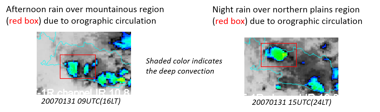
Normally, the diurnal cycle causes deep convection to develop from late afternoon into the evening in mountainous areas, and from evening into early morning in the adjacent plains, as it does in Jakarta. Nevertheless, when additional synoptic forcing from an NCS is present, deep convection develops from morning to early afternoon.
This loop shows the propagation of cumuliform clouds from the South China Sea to the equator starting from 27 January 2007. It is followed by deep convection above the Karimata Strait and reaches the Java Sea on 1 February 2007. The deep convection occurs between morning and early afternoon, leading to torrential rains in the northern parts of Java, including the coastal city of Jakarta and its surrounding areas.

|
Press "Play Button" to see the loop; Satellite images from 27 January 2007 at 00UTC to 1 February 2007 at 23UTC. |
Special Investigation - NCS seen in Himawari-8 imagery
NCS pattern
 |
||
|
Phase 1
|
Phase 2
|
Phase 3
|
|
|
|
NCS+MJO pattern
 |
||
|
Phase 1
|
Phase 2
|
Phase 3
|
|
|
|
NCS+Vortex+MJO pattern
 |
||
|
Phase 1
|
Phase 2
|
Phase 3
|
|
|
|