Cloud Structure In Satellite Images
Introduction
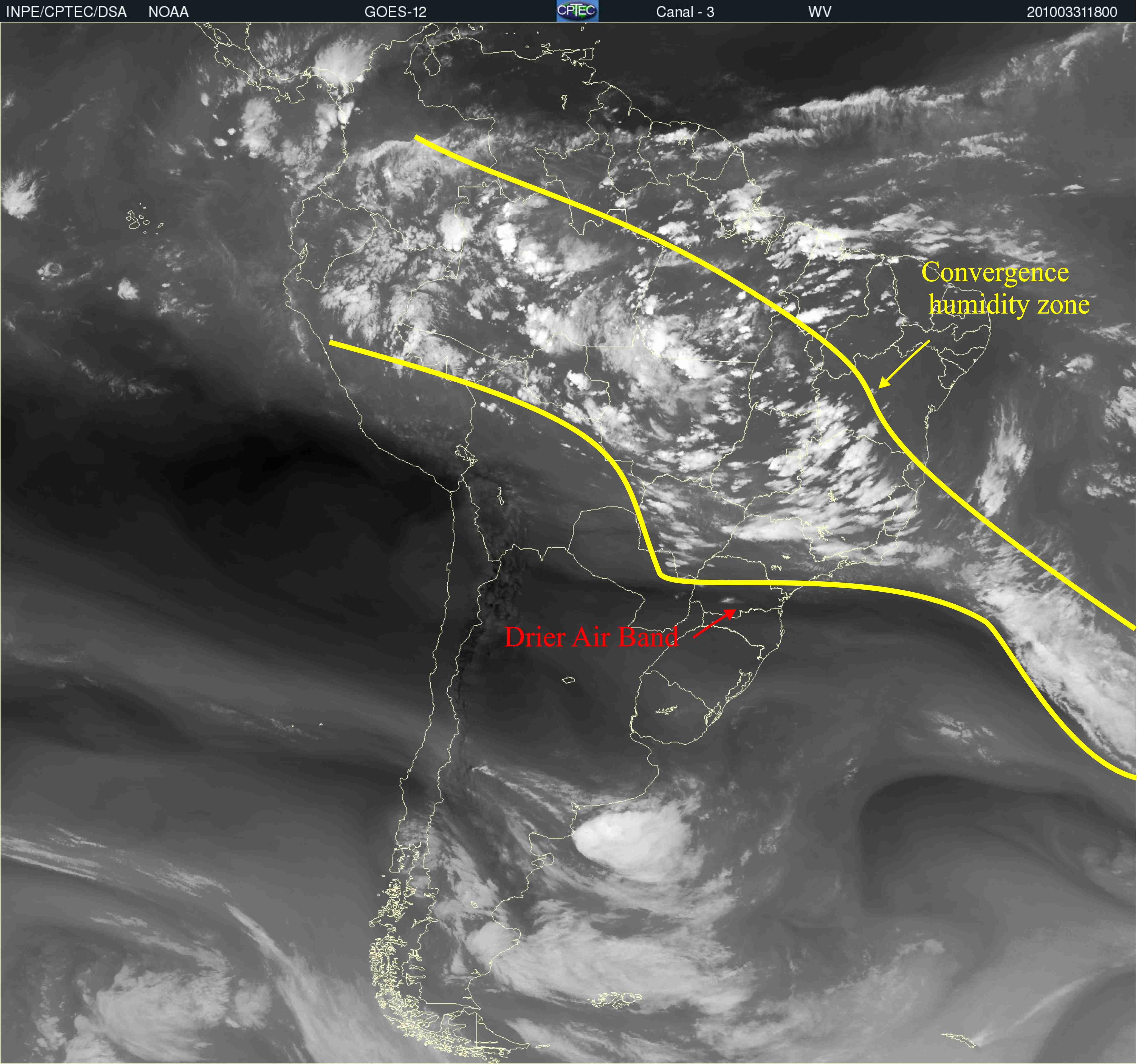
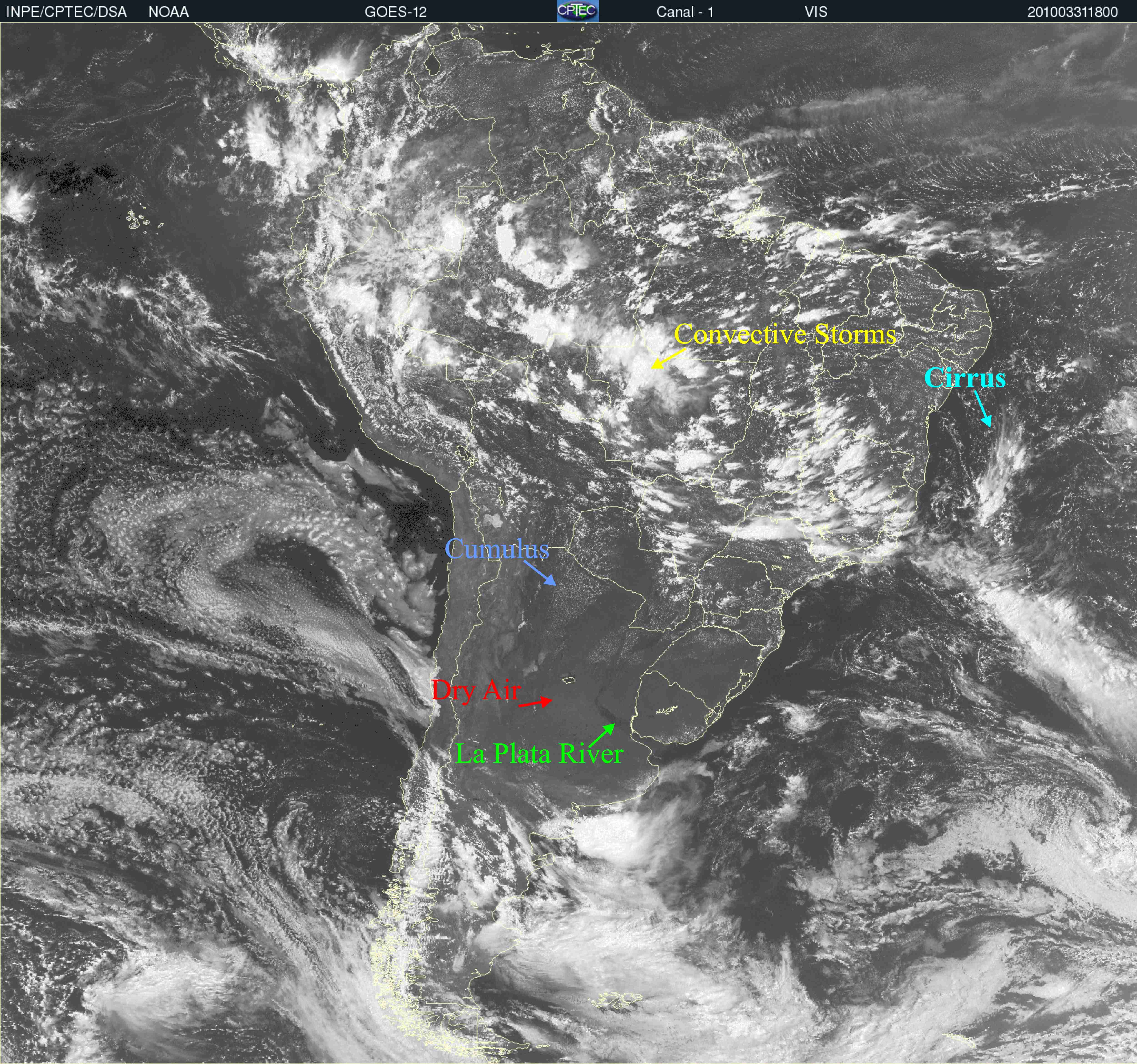
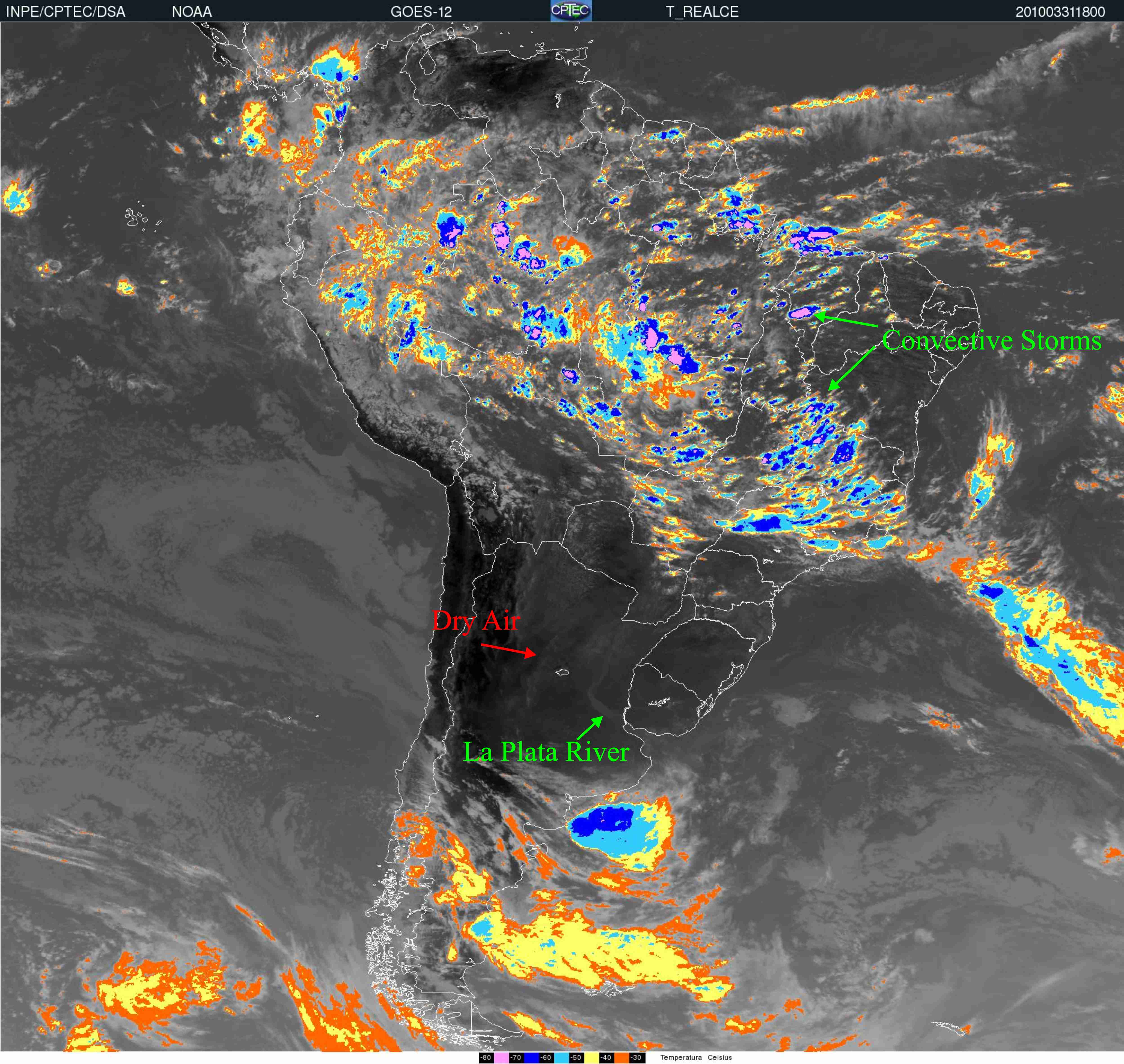
The South Atlantic Convergence Zone (SACZ) is a large cloud system that forms in subtropical South America and in the western South Atlantic Ocean in the summer. It can be seen on climatological maps showing the average outgoing longwave radiation (OLR) and precipitation. Cold cloud tops have the lowest OLR in satellite images (white in VIS, IR and WV channels).
Description
The main features observed in satellite imagery are the following:
- An elongated zone of clouds, precipitation, and convergent winds with a northwest-southeast orientation across southeastern Brazil to the southwestern Atlantic Ocean. It can be seen on the VIS, IR and WV-channels.
- The WV channel shows deep clouds over Brazil from the western Amazonian region to the state of Rio de Janeiro, while there is drier air in Argentina and southern Brazil.
- Northeastern Brazil and Argentina and southern Brazil have clear skies or small cumulus clouds, as seen in the VIS image.
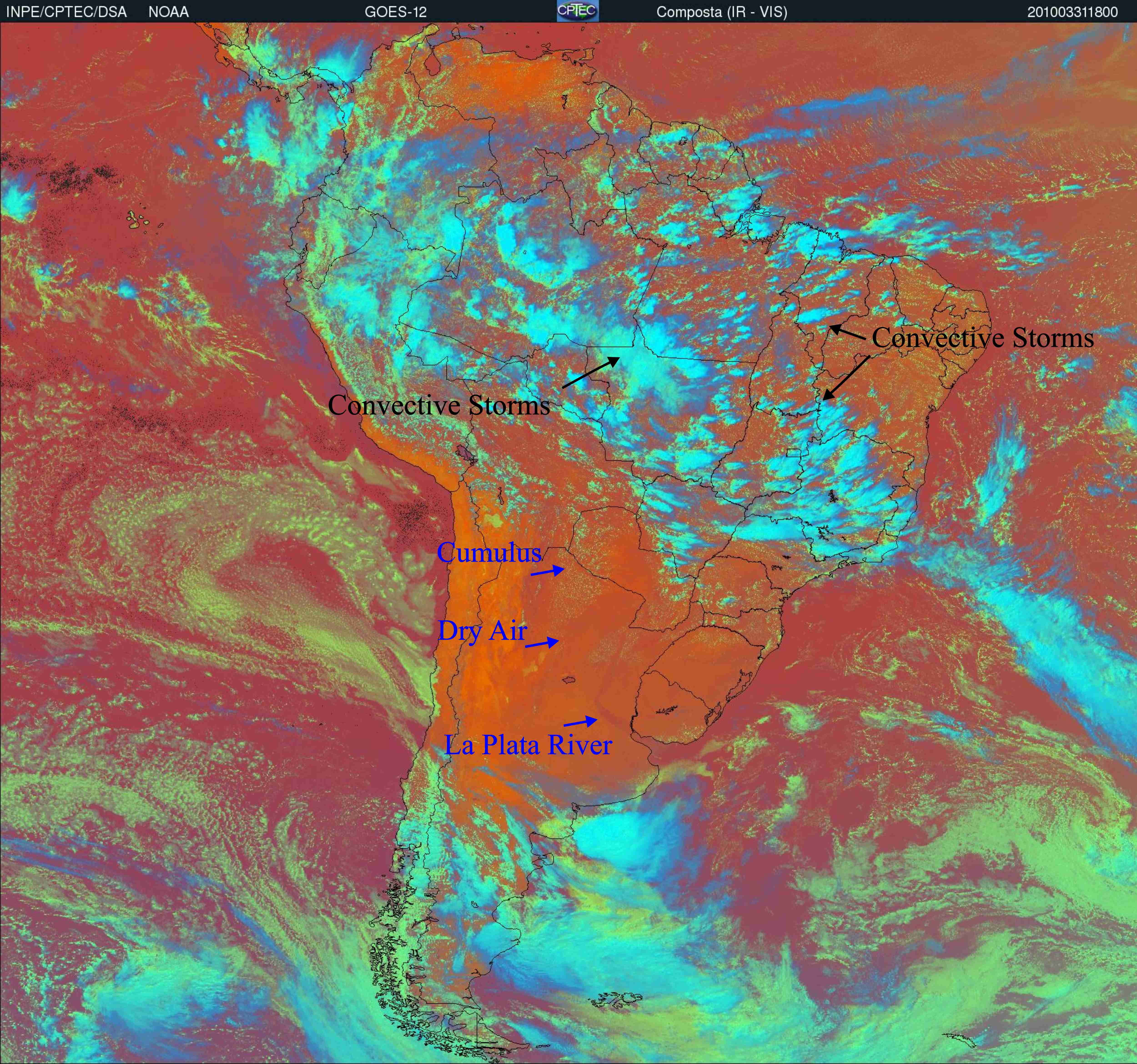
- The combination of IR and VIS channels emphasizes the deep convection within the SACZ (bluish colors) while the orange and red hues represent clear skies around it.
|
|
|
Figure 1: 31 March, 2010 - 1800UTC GOES-12 - Channel 3- WV
|
Figure 2: 31 March, 2010 - 1800UTC GOES-12 - Channel 1- Visible
|
|
|
|
Figure 3: 31 March, 2010 - 1800UTC GOES-12 - Channel 4- IR Enhanced
|
Figure 4: 31 March, 2010 - 1800UTC GOES-12 - VIS Channel + IR Enhance - Blurish colors indicate deep convection and orange and reddish colors represent clear sky condition.
|
The channels from GOES Imager are presented in the table below:
| Channel number | Wavelength range (µm) | Range of measurement | Meteorological objective |
|---|---|---|---|
| 1 | 0.52 to 0.71 | 0 to 100% albedo | Cloud cover |
| 2 | 3.73 to 4.07 | 4 to 335K | Nighttime clouds |
| 3 | 13.00 to 13.70 | 4 to 320K | Cloud cover and height |
| 4 | 10.20 to 11.20 | 4 to 320K | Sea surface temperature and water vapor |
| 5 | 5.80 to 7.30 | 4 to 320K | Water Vapor |
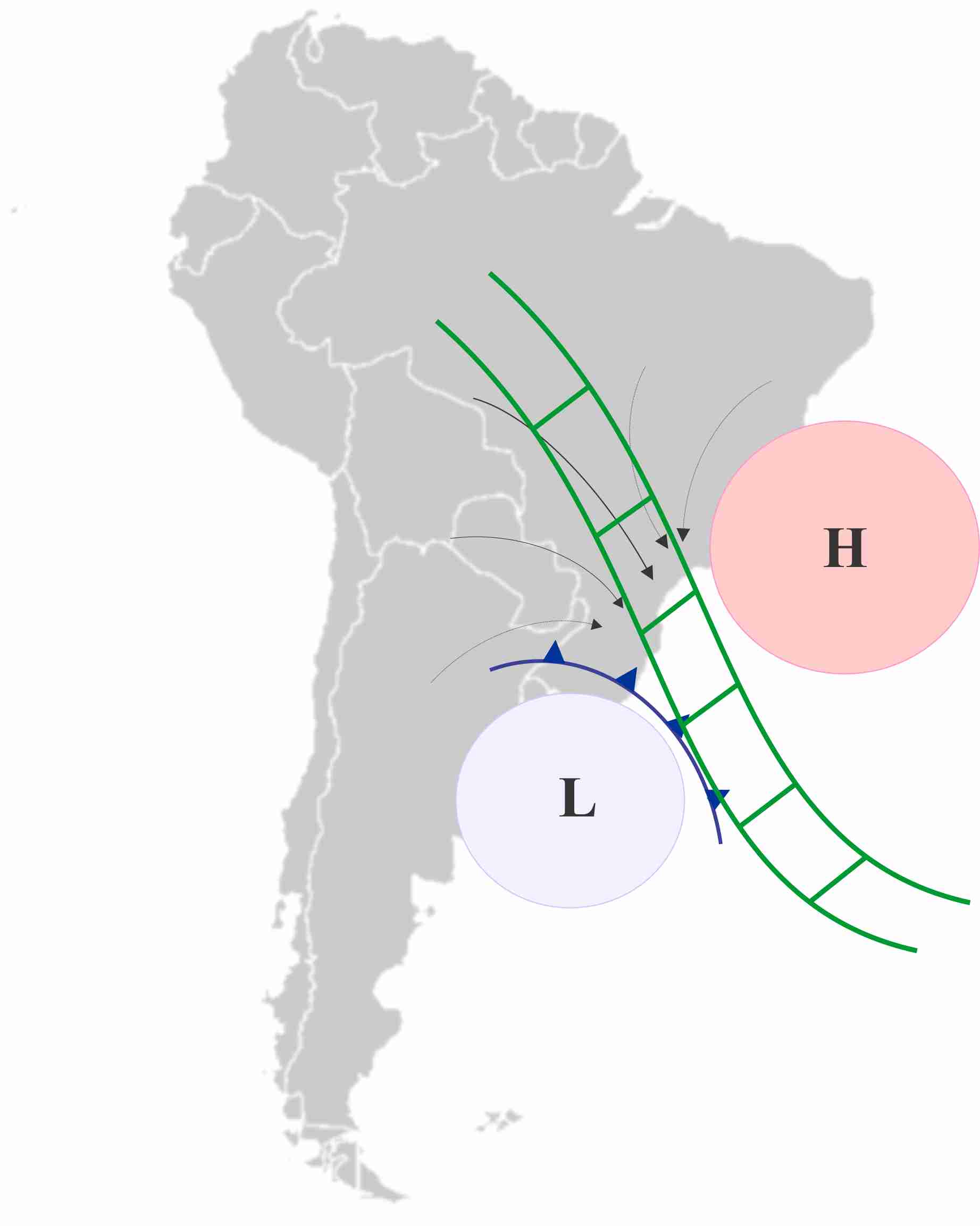
Typical austral summer circulations within the SACZ:
Low levels: Northerly-northwesterly flow transports moisture from the Amazon region to the central and southeastern parts of Brazil.
High levels: Anticyclonic circulation (Bolivian high) and a quasi-stationary trough over northeastern Brazil.
|
|
|
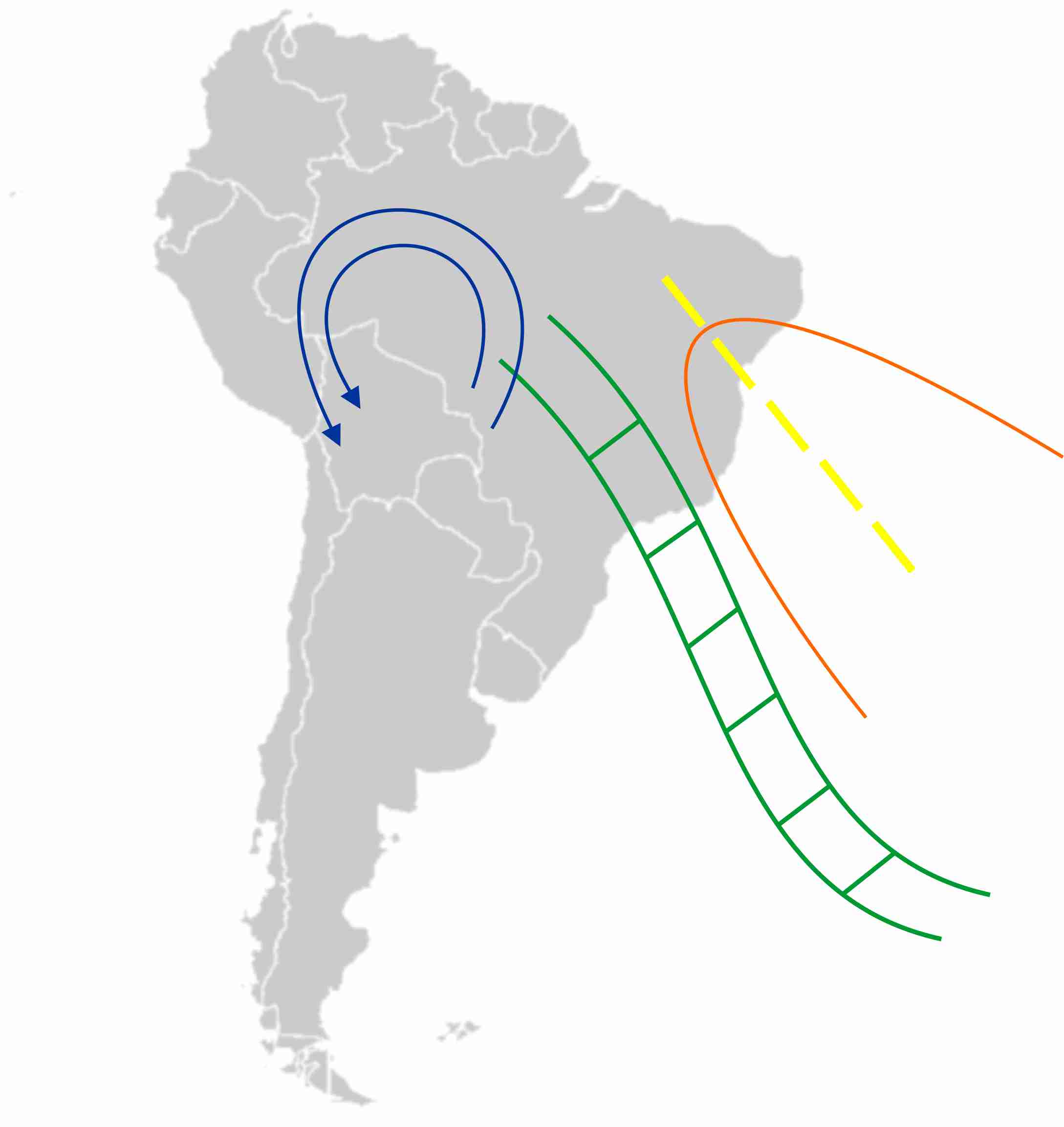
Typical positions of the SACZ (green) and the quasi-stationary surface frontal system (the low and the cold front), and convergence of low-level winds.
|
Typical configuration at high levels: an anticyclonic circulation (Bolivian high - blue lines) over northwestern South America and a trough over northeastern Brazil (orange and yellow lines).
|
The loop below represents the evolution of SACZ IR Images (Channel 4) from 24-30 March 2009. The most important feature is the persistence of convection over subtropical South America and the western South Atlantic Ocean. The timescale of SACZ varies, but it seldom persists for more than ten days at a time.
Loop: MSG Air Mass RGB of 24/03/2009 - 30/03/2009 18UTC - SACZ |