Common Remarks
Climatologically the South Atlantic Convergence Zone (SACZ) is characterized as a persistent clouds band with northwest-southeast orientation that connects the southern Amazon region with the western portion of the Subtropical South Atlantic having a duration of at least four days with quasi-stationary behavior during the austral summer. Satellite images, maps of outgoing longwave radiation(OLR) and precipitation aid in the identification and synoptic climatological of this system.
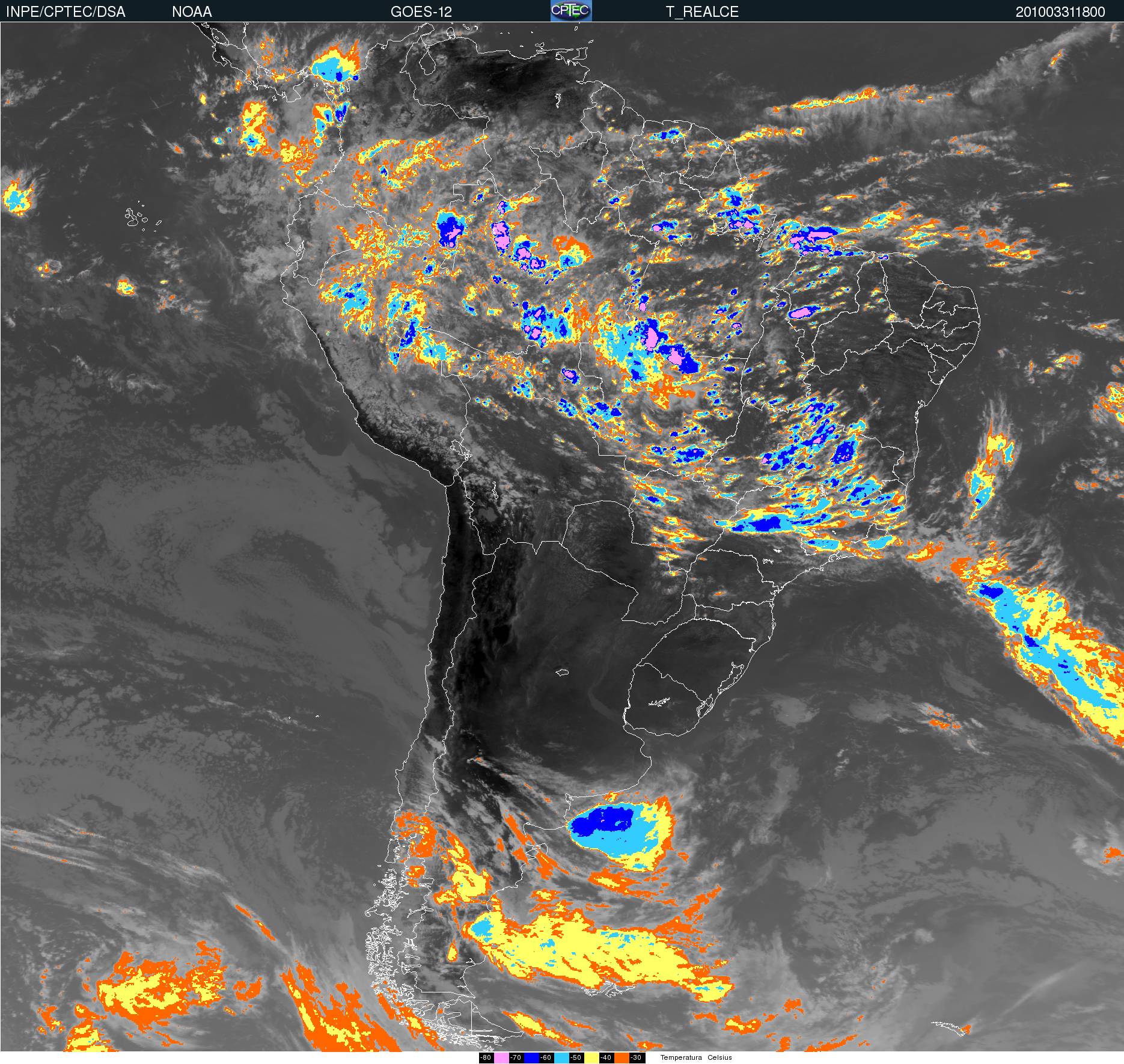
I. Cloud Structure In Satellite Images
Learn about how to recognise and detect Atlantic Convergence Zone in satellite images.
II. Meteorological Physical Background
Find out more about the meteorlogical and physical background of Atlantic Convergence Zone
III. Key Parameters
Learn which key parameters to use for montoring Atlantic Convergence Zone
IV. Typical Appearance In Vertical Cross Sections
Find out the typical appearance of Arctic Atlantic Convergence Zone in vertical cross section
V. Weather Events
Explore the weather events associated with Atlantic Convergence Zone
VI. References
Let these comprehensive documents in the references assist you in finding more about Atlantic Convergence Zone