Weather Events
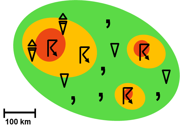
Significant weather events are related to the occurrence of mesoscale convective systems. In Southeastern South America (SESA), where these systems are related to the presence of SALLJs, the principal weather events are heavy precipitation, gusts, hail, lightning, and tornadoes.
| Parameter | Description |
|---|---|
| Precipitation |
|
| Temperature |
|
| Wind (incl. gusts) |
|
| Lightning |
|
| Other relevant information |
|
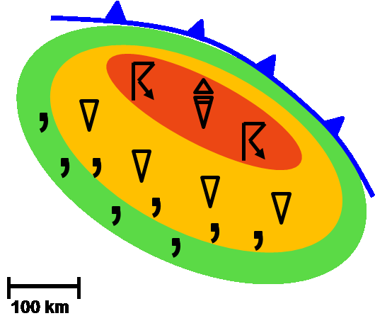
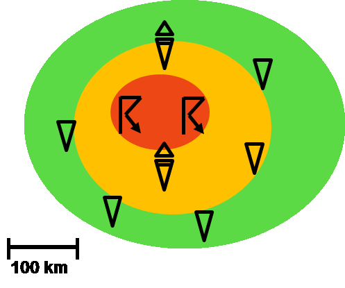
The following schemes show the main three types of MCS in SESA and the location of the significant weather events:
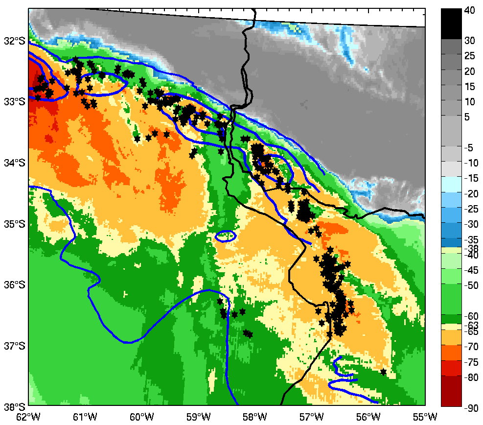
Squall line
|
|
10 January 2001/05.25 UTC - TRMM/VIRS IR 10.8 image, LIS lightning location (black dots) and TMI rain rate (blue contours).
|
|
|
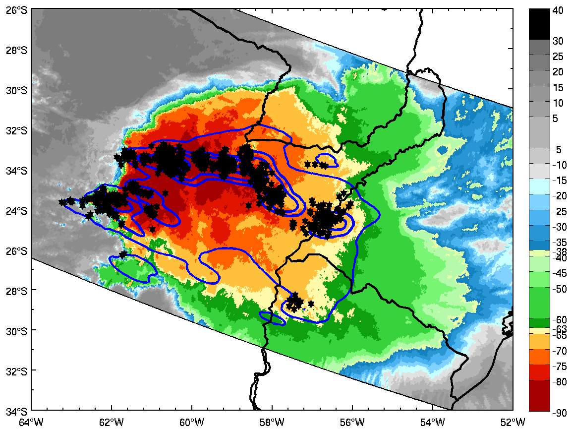
Symmetric System
|
|
21 December 2003/08.22 UTC - TRMM/VIRS IR 10.8 image, LIS lightning location (black dots) and TMI rain rate (blue contours).
|
|
|
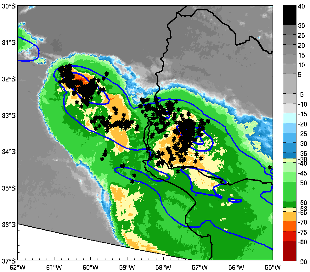
MCS with embedded supercells
|
|
15 November 2006/23.36 UTC - TRMM/VIRS IR 10.8 image, LIS lightning location (black dots) and TMI rain rate (blue contours).
|
|
|