Key Parameters
- Bonner criterion 1 is used to identify the SALLJ events and requires the following:
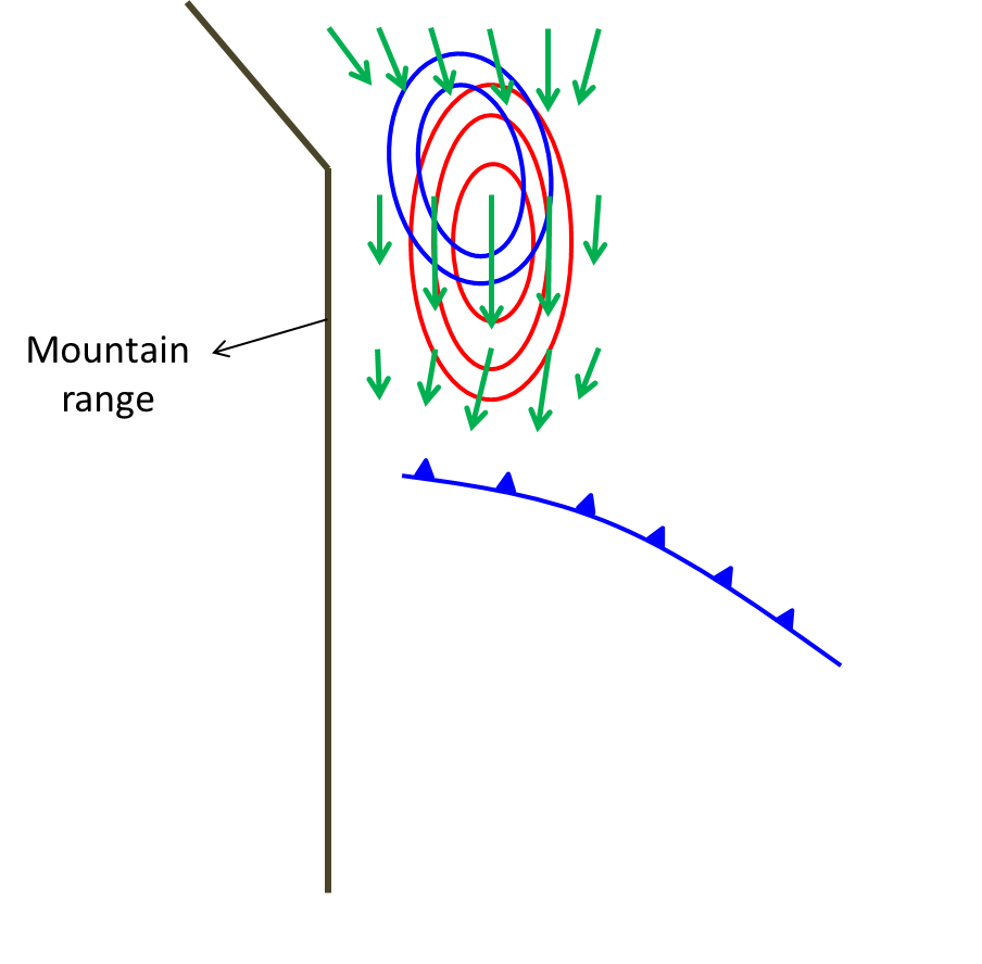
- Isotachs at 850 hPa: maximum wind intensity equal to or greater than 12 m/s.
- Wind shear 850-700 hPa: the wind speed difference between 850 and 700 hPa equal to or greater than 6 m/s in some part enclosed by the 12 m/s isotach.
- Wind vectors at 850 hPa: the meridional component must be northerly and greater than the zonal component in the entire region enclosed by the 12 m/s isotach.
- Equivalent thickness 850-500 hPa: maximum gradient in the frontal zone.
- Thermal front parameter (TFP): maximum values of TFP in the frontal zone.
- Moisture convergence at 850 hPa: maximum moisture convergence ahead of the front.
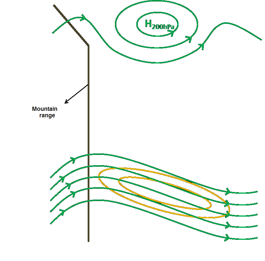
- Streamlines at 200 hPa: well-developed Bolivian High.
- Isotachs at 250 hPa: upper level jet at the leading side of the mid-latitude trough.
NOTE: These key parameters are shown in the following example only for a Chaco Jet event, where the synoptic pattern is the most favourable for the atmosphere destabilization over Argentina.
Bonner Criterion 1: Wind shear 850-700 hPa, isotachs and wind vectors at 850 hPa.
|
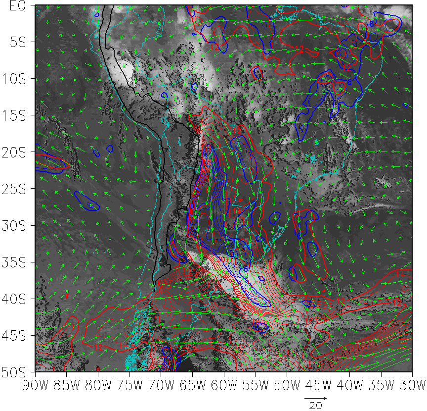
|
28 February 2002/06.00 UTC - GOES 13 IR 10.8 image; blue: wind shear 850-700 hPa, red: isotach at 850 hPa, green vector: wind at 850 hPa.
|
|
|
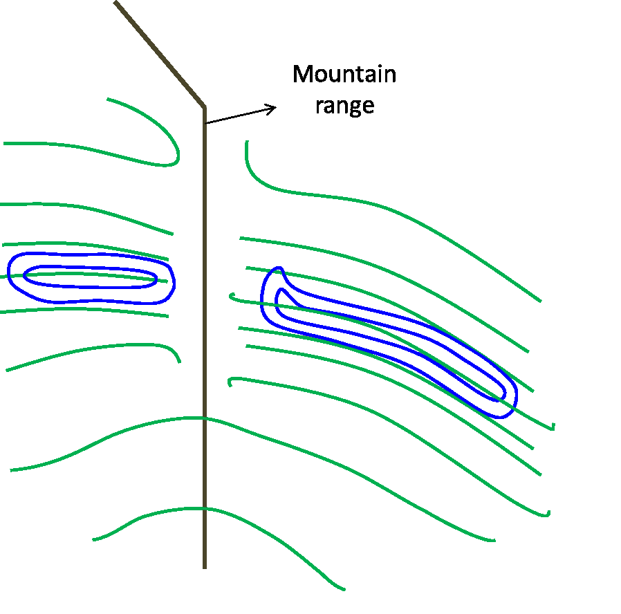
Equivalent Thickness 850-500 hPa and TFP
|
|
28 February 2002/06.00 UTC - GOES 13 IR 10.8 image; green: equivalent thickness, blue: TFP.
|
|
.gif)
|
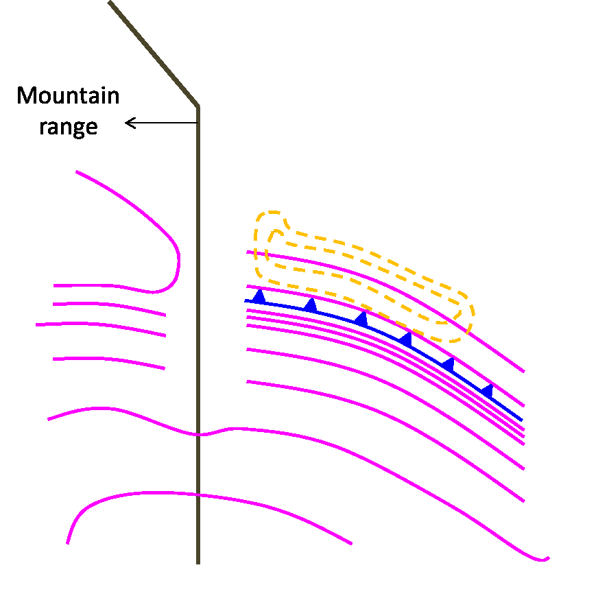
Moisture convergence and Thetae at 850 hPa
|
|
28 February 2002/06.00 UTC - GOES 13 IR 10.8 image; magenta: equivalent potential temperature 850 hPa, yellow: humidity convergence, green vector: wind at 850 hPa.
|
|
|
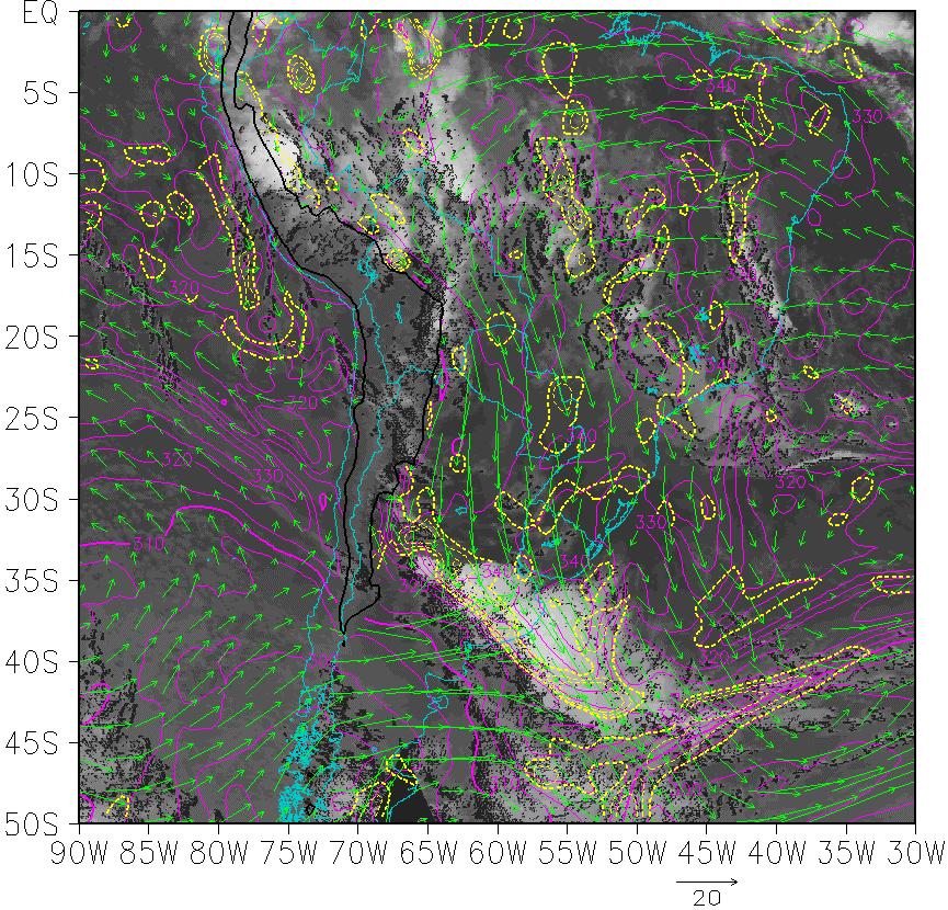
Streamlines at 200 hPa and isotach at 250 hPa
|
|
28 February 2002/06.00 UTC - GOES 13 IR 10.8 image; yellow: isotachs at 250 hPa, green: streamlines at 200 hPa.
|
|
|