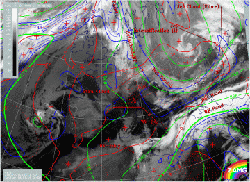
06.00 UTC - Key parameters on isobaric surfaces
|
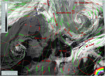
15 March 1998/06.00 UTC - Meteosat IR image; red: height contours 1000 hPa, green: height contours 500 hPa, SatRep overlay: names of
conceptual models
|
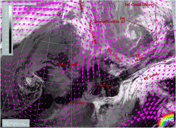
15 March 1998/06.00 UTC - Meteosat IR image; magenta: wind vectors 500 hPa, SatRep overlay: names of conceptual models
|
|
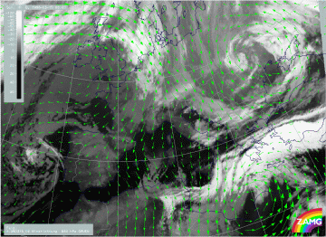
15 March 1998/06.00 UTC - Meteosat WV image; green: wind vectors 850 hPa
|
|
The first image (left image top) represents surface and upper level height, the second image (right image top) and the third image (left image bottom) the wind vectors at 500 and 850 hPa. The main feature in the Mediterranean is a distinct surface low over north Africa with a well-developed upper level trough to the west of it. There are extended areas in the warm Front cloud band where the wind directions in low levels and those in high levels are opposite (south-eastward - south-westward components). Especially over the Aegean Sea there is a confluence zone at both levels but with completely different wind directions. This is exactly the area of the fibrous deformation cloud band which is elongated, especially in eastern directions.
The second area with an intensive cyclone is Romania and the Ukraine with a low centre developed throughout the whole troposphere and with a nearly vertical axis.
|
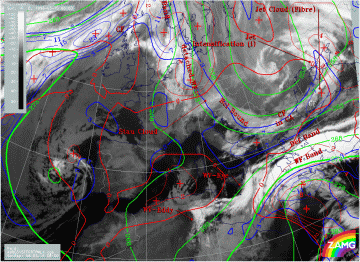
15 March 1998/06.00 UTC - Meteosat IR image; blue: thermal front parameter (TFP) 500/850 hPa, green: equivalent thickness 500/850 hPa,
red: temperature advection - WA 1000 hPa, SatRep overlay: names of conceptual models
|
15 March 1998/06.00 UTC - Meteosat IR image; blue: thermal front parameter (TFP) 500/850 hPa, green: equivalent thickness 500/850 hPa,
red: temperature advection - CA 1000 hPa, SatRep overlay: names of conceptual models
|
The frontal conditions are represented by three typical key parameters: thermal front parameter, equivalent thickness and temperature advection. There are two zones of high thickness gradients accompanying the frontal cloud bands: one in the Warm Front Band and a second within and north of the Cold Front across the Balkan Peninsula. The thermal front parameter TFP is in each of the two locations on the warm side of this thickness zones and at the leading edges of the cloud bands. Both frontal systems are well-developed, but the Cold Front in the north is under strong cold air advection (CA) (right image) with its minimum at the rear over Romania and Bulgaria, while the warm front in the south is in the boundary area of warm advection (WA) (left image).
The latter fact concerning the WA is rather untypical for Warm Fronts and confirms that this Mediterranean system is rather difficult to diagnose. This is especially true for a Cold Front diagnosis over the Mediterranean and north Africa. From the numerical parameters (compare also height levels) a Cold Front can be diagnosed over Africa crossing for instance 30N/22E with intensive WA at the leading side. But there is no reflection of such a frontal situation in the satellite imagery; on the contrary, this is a cloud-free area with very dry air in upper levels as can be seen in the WV image (image below). The cloud fields extending from the east of Crete south-eastward are situated on the warm boundary of the thickness ridge and do not represent a Cold Front there.
|
15 March 1998/06.00 UTC - Meteosat WV image; SatRep overlay: names of conceptual models
|
|
