15.00 - 18.00 UTC - Overview of satellite imagery
|
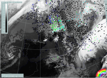
15 March 1998/15.00 UTC - Meteosat IR image; weather events (green: rain and showers, blue: drizzle, cyan: snow, red: thunderstorm with
precipitation, purple: freezing rain, orange: hail, black: no actual precipitation or thunderstorm with precipitation)
|
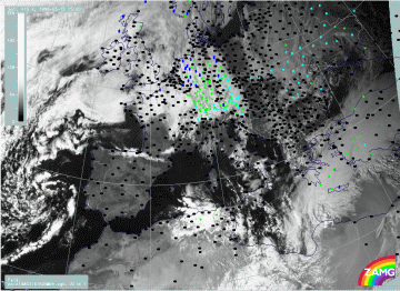
15 March 1998/15.00 UTC - Meteosat VIS image; weather events (green: rain and showers, blue: drizzle, cyan: snow, red: thunderstorm
with precipitation, purple: freezing rain, orange: hail, black: no actual precipitation or thunderstorm with precipitation)
|
|
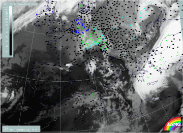
15 March 1998/18.00 UTC - Meteosat IR image; weather events (green: rain and showers, blue: drizzle, cyan: snow, red: thunderstorm with
precipitation, purple: freezing rain, orange: hail, black: no actual precipitation or thunderstorm with precipitation)
|
|
The images show the IR (left images top and bottom) and VIS (right image top) images and weather events from 15.00 and 18.00 UTC. In general, there are the same cloud features as before but the northern low top cloud band vanishes more and more under the bright cloud shield of the southern frontal band. The latter is connected with widespread rain over the Aegean Sea, Crete and south-east Turkey propagating eastward together with the cloud band. A new feature which can be observed during this period is a change in the low cloudiness at the rear side of the bright cloud band over Greece and the northern Aegean Sea; this low cloud patch clearly becomes more dense between 15.00 and 18.00 UTC. As this cloudiness is in connection with the southward moving Cold Front cloud band two explanations might be drawn:
- It is possible that the low frontal cloudiness intensifies, an idea which is supported by the development of a low level circulation cell, as was already seen and described in the vertical cross sections for 12.00 UTC;
- It is also possible that the bright dense Warm Front cloud band moves across the rather stationary low cloudiness of the northern band, which consequently becomes more and more visible.
|
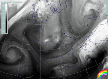
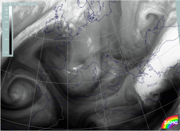
15 March 1998/15.00 UTC - Meteosat WV image
|
15 March 1998/18.00 UTC - Meteosat WV image
|
The most important additional information from the WV images is that the humid band accompanying the northern frontal zone in the upper levels is now entirely over north Greece with a dry, Black Stripe at its northern boundary. The only conclusion which can be drawn from this observation is that there is enough humidity supply in middle and high levels above the low level cloudiness.
