15/21.00 - 16/00.00 UTC - Overview of satellite imagery
|
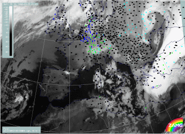
15 March 1998/21.00 UTC - Meteosat IR image; weather events (green: rain and showers, blue: drizzle, cyan: snow, red: thunderstorm with
precipitation, purple: freezing rain, orange: hail, black: no actual precipitation or thunderstorm with precipitation)
|
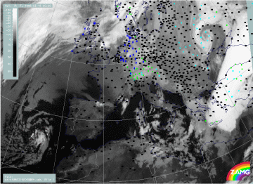
16 March 1998/00.00 UTC - Meteosat IR image; weather events (green: rain and showers, blue: drizzle, cyan: snow, red: thunderstorm with
precipitation, purple: freezing rain, orange: hail, black: no actual precipitation or thunderstorm with precipitation)
|
Although the main cloud features can still be observed, the IR images reveal some changes now. The most important change with the southern frontal zone is its considerable movement; the white cloud band extends now from Crete across Turkey to the Black Sea and is accompanied by intensive precipitation in the central and southern parts of the cloudiness. The most important change with the northern system of the lower clouds is that is has become a dominating feature in an area extending from Greece southward to Africa; also some intensification of the grey shades has taken place compared to six hours before. But there is no band - like, frontal organization of the low cloud fields any longer.
|
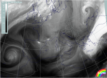
15 March 1998/21.00 UTC - Meteosat WV image
|
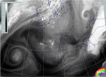
16 March 1998/00.00 UTC - Meteosat WV image
|
The WV images add some information about the WV content higher up. The area of the low clouds described in the IR images does not show up as the same or similar configuration in the WV features. Rather, the latter still indicate the former northern Cold Front zone with a long WV band stretching from the Mediterranean west of Greece across Greece to the Black Sea.


