15.00 - 18.00 UTC - Key parameters on isobaric surfaces
|
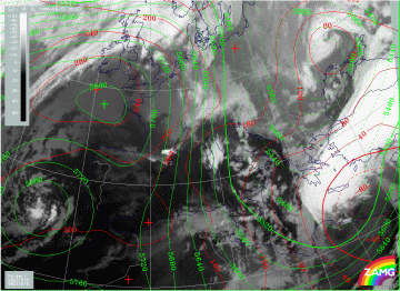
15 March 1998/18.00 UTC - Meteosat IR image; red: height contours 1000 hPa, green: height contours 500 hPa
|
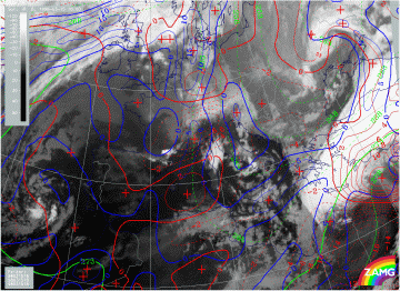
15 March 1998/18.00 UTC - Meteosat IR image; blue: thermal front parameter (TFP) 500/850 hPa, green: equivalent thickness 500/850 hPa,
red: temperature advection 1000 hPa
|
The images above contain the same basic parameters for 18.00 UTC as before. Both surface low and upper level trough have moved eastward, which means that the upper level trough line has now reached the eastern coast of Greece. The WA area influences now only the eastern part of the Aegean Sea and Turkey while CA dominates over the Balkan Peninsula spreading southward across Greece to Africa.
|
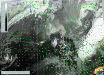
15 March 1998/18.00 UTC - Meteosat IR image; green: wind vectors 850 hPa
|
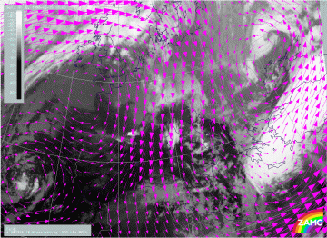
15 March 1998/18.00 UTC - Meteosat IR image; magenta: wind vectors 500 hPa
|
This eastward movement is of course also reflected in the wind vector fields at 850 hPa (left image) and at 500 hPa (right image). The distinct confluence zone at the low level with eastern wind directions extends now from south-east Turkey to Crete while the still strong northern flow across Greece has developed a south-eastward component compared to six hours before. Upper level winds still have western components.


