Chapter VI: Summary
Table of Contents
- Chapter VI: Summary
- Summary
Summary
A blocking situation with an upper level trough over Western Europe and a ridge over Central Europe caused a strong southerly flow that brought up very warm and humid air mainly to France, Belgium, the Netherlands and the western parts of Germany. Those were the ingredients providing for CAPE values of up to 1900 J kg-1 K-1 and the constant generation of new thunderstorms producing large hail.
Satellite-based nowcasting facilities were used in order to forecast these thunderstorms. Two methods were applied for capturing the general instability: the GII (global instability indices) and the NWCSAF Statistical Physical Retrieval algorithm. Both algorithms compute the K-Index, Lifted Index and Total Precipitable Water (TPW). The Physical Retrieval also provides the Showalter-Index and the TPW in three layers (boundary layer, medium layer, high layer). In this special case the GII performed a little bit better than the Physical Retrieval, which does not make the GII better in general. The GII detected the humid and warm air mass with the TPW particularly well. A slight disadvantage of both algorithms is that they require cloud-free areas, so they are best used in the morning hours.
After capturing the most unstable regions the task was to forecast where convection would start. For this purpose a convective initiation (CI) algorithm adapted for MSG SEVIRI channels in the SATCAST algorithm was used. This method proved to be still lacking as it produced a hit, a false alarm and a miss. Therefore, its results should not be taken at face value until further improvements have been made.
Several cold ring shapes occurred in the mature stage of the thunderstorms, producing not only heavy rainfall and large hail, but also a tornado. The best method to detect those shapes is the IR window BT channel.
This case study has proven that satellite data can help forecast the whole life-cycle of thunderstorms from the formation to the mature stage. Especially SAFs (Satellite Application Facilities) like the GII have proven to be helpful.
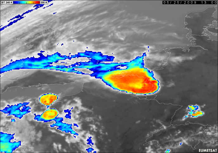
In the final picture (Fig. 6.1) one can see how severe and huge some of the thunderstorm cells were on this day. In this special case, the Belgian and Dutch meteorologists were not to be envied.
Figure 6.1: Meteosat 8 IR10.8: 25 May 2009 1300UTC
