Chapter V: Mature Phase
Table of Contents
- Chapter V: Mature Phase
- Mature Phase
Mature Phase
Overshooting tops are distinct features of mature thunderstorms. They are formed when the updraft is strong enough to penetrate the equilibrium level, which often coincides with the tropopause. The overshooting tops can be long- or short-lived, depending on the severity of the thunderstorm. Overshooting and long-lasting overshooting tops in particular indicate heavy rainfall and dangerous regions for aviation. Therefore it is important to detect those regions.
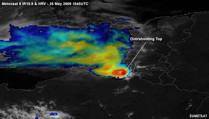
Figure 5.1: Meteosat 8 IR10.8 and HRV Sandwich: 25 May 2009 1045UTC
A distinct overshooting top can be seen in the so called sandwich product of IR window BT and visible bands at the French-Belgian border (Fig. 5.1). The sandwich product is a multilayer image, in which the bottom layer or background is a HRVIS image and the upper layer a IR10.8 BT image.
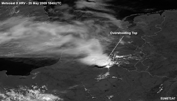
Due to the high solar angle at this time the HRVIS alone is rather inconspicuous (Fig. 5.2).
Figure 5.2: Meteosat 8 HRVIS: 25 May 2009 1045UTC
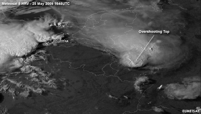
A better VIS-picture of overshooting tops can be found later that day with lower sun-angle resulting in higher contrast, over the western part of Germany, where also an above-anvil plume appears (fig.5.3).
Figure 5.3: Meteosat 8 HRVIS: 25 May 2009 1645UTC
With even lower sun-angle, In figure 5.4, over France not only some distinct overshooting tops over France, but also gravity waves due to the pertubation caused by the Overshooting Tops over Normandy are visible. These gravity waves are a strong signal for turbulence.
Figure 5.4: Meteosat 8 HRVIS: 25 May 2009 1845UTC
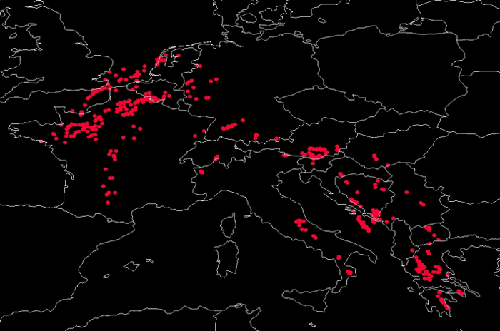
Bedka et al. developed a method to detect overshooting tops numerically. This method uses IR window temperature gradients and NWP tropospheric information. On May 25th 2009 this method revealed good results as shown in Figure 5.5.
Figure 5.5: Overshooting Tops Detection using Bedka etal. IR10.8 algorithm: 25 May 2009
Comparing the red dots, indicating overshooting tops, with the severe weather reports from ESWD (Fig. 5.6; courtesy of ESSL) one can find a similar structure.
Figure 5.6: Severe weather reports on May 25th 2009 (red: tornado, yellow: severe wind gusts, green: large hail, blue: heavy rain, white: funnel cloud)
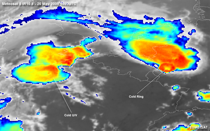
Beside overshooting tops also the enhanced IR10.8 shows some remarkable features. Nearly all the thunderstorms developed cold ring shapes. A somewhat different structure is in literature often denoted as Cold U/V shapes. An example of this is seen in Figure 5.7.
Figure 5.7: Meteosat 8 IR10.8: 25 May 2009 1550UTC
The appearance of this shape is however rare because the wind speed at 200 hPa., respectively at tropopause level, is just up to 30 or 40 knots with a correpsonding low upper-level wind shear.
In the following animations one can get an overview about the spatial and temporal scale of this convective outbreak. The thunderstorm cells show a cross-section dimension from 300 to 500 km and exist for up to 12 hours. With a south-westerly flow enough moisture from the Gulf of Biscay is transported to France to produce new cells along the day over.
Meteosat 8 RSS - HRV (black and white)
Especially with the smaller scale cells the high resolution channel allows us a very good monitoring of the convective development. In a sequence of 5 minutes the satellite images are presented and described. Try to focus on subtle signals such as overshooting tops (which casts a shadow) and V-shaped storms.
Meteosat 8 RSS - IR10.8 (color enhanced)
Meteosat 8 infrared 10.8 μm is shown, but the images have been artificially color enhanced using the color scheme from blue to turqois to yellow and red applied over a fixed interval from the temperatures of 200 to 240 K. This will improve the discrimination of where most ice particles form during the several convective stages. In a sequence of 5 minutes the rapid scan satellite images are presented.
Meteosat 8 RSS - Sandwich Product
Combination of both the HRVIS and the enhanced IR10.8 to correlate the fine structures that the HRVIS offers in combination with the tempareture information.
