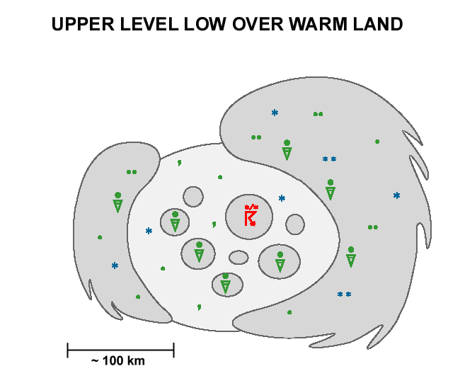
Weather Events
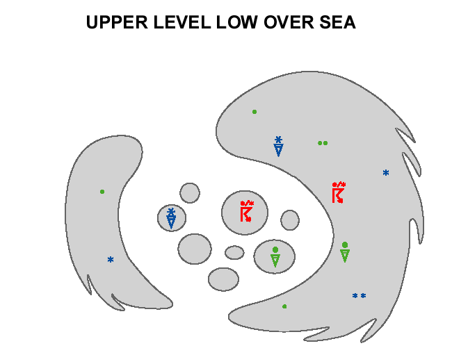
- The frontal cloud band on the leading edge of an Upper Level Low is usually thick enough to produce precipitation. In some cases there is also frontal cloudiness on the rearward edge. Within the cloud bands there are embedded Cbs, and therefore the precipitation is showery.
- When the Upper Level Low is over land, there is a low cloud layer in the centre.
- Over cold surface there is no convection, and therefore no showers occur.
Over Sea
| Parameter | Description |
| Precipitation |
|
| Temperature |
|
| Wind (incl. gusts) |
|
| Other relevant information |
|
The case west of and over Spain from 13 May 2020 at 18 UTC can be used as an example for a cut-off low (at least partly) over sea. The IR image below shows the two cyclonically curved cloud bands around the cut-off low centre which is located to the west of Spain, over the ocean.
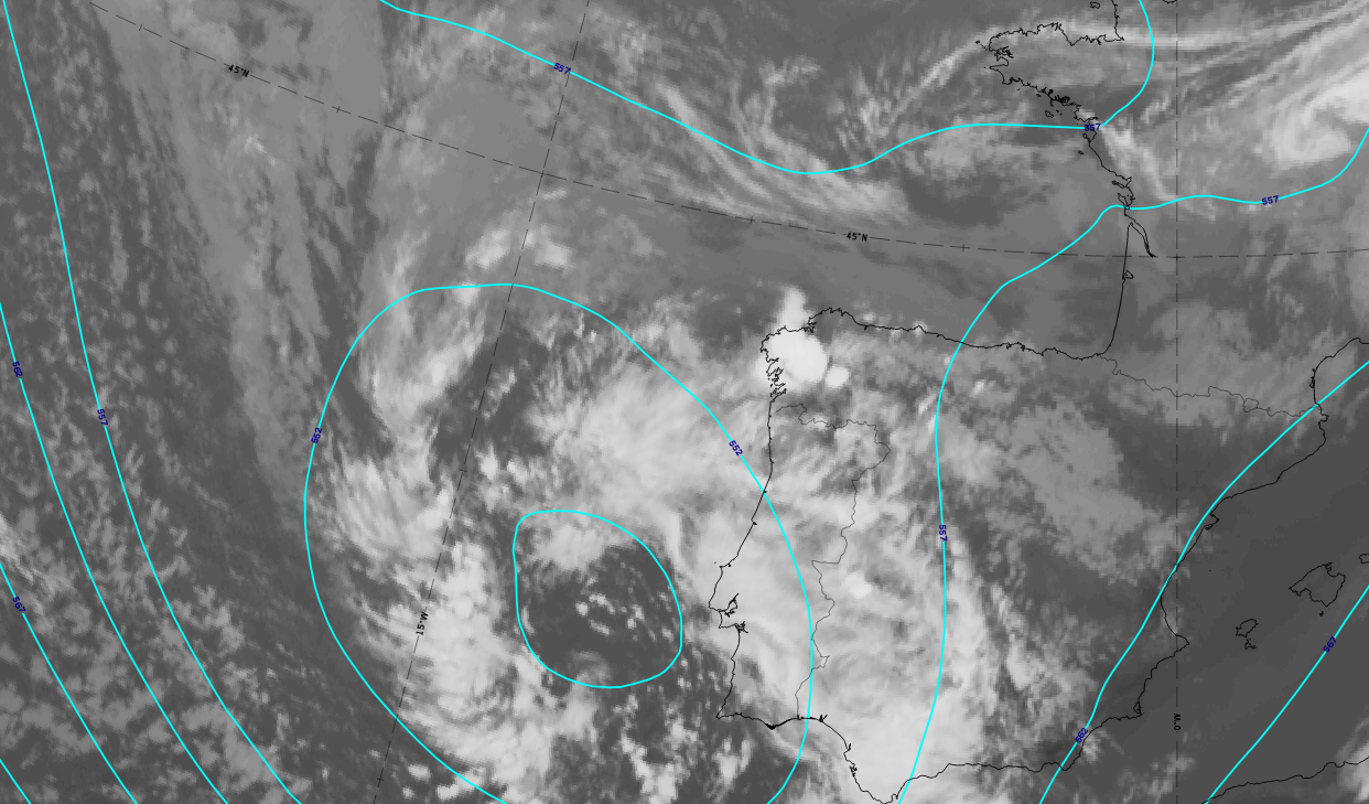
13 May 2020 at 18 UTC: IR; cyan lines: height contours 500 hPa.
|
Hover over the image and move your pointer left and right to fade between images.Tap if using a touch interface. |
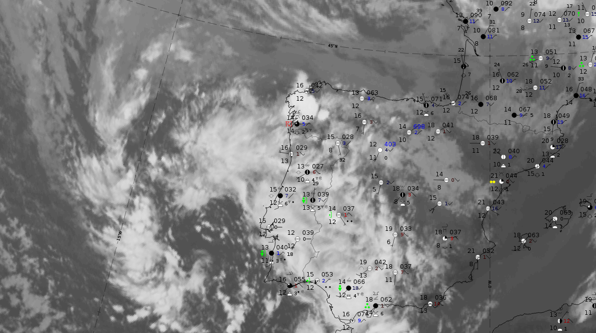
Legend: 13 May 2019 at 18UTC: IR + synoptic measurements (above) + probability of moderate rain (Precipitting clouds PC - NWCSAF).
Note: for a larger SYNOP image click this link.
The cut-off low centre is mostly cloud free with some smaller cloud cells. The cloud bands at the cut-off low boundary are accompanied by precipitation, mostly in shower form. This corresponds with the fact that the probability of moderate precipitation from the NWCSAF is low.
|
Hover over the image and move your pointer left and right to fade between images.Tap if using a touch interface. |
|
Hover over the image and move your pointer left and right to fade between images.Tap if using a touch interface. |
Legend:
13 May 2020 at 18 UTC, IR ; superimposed:
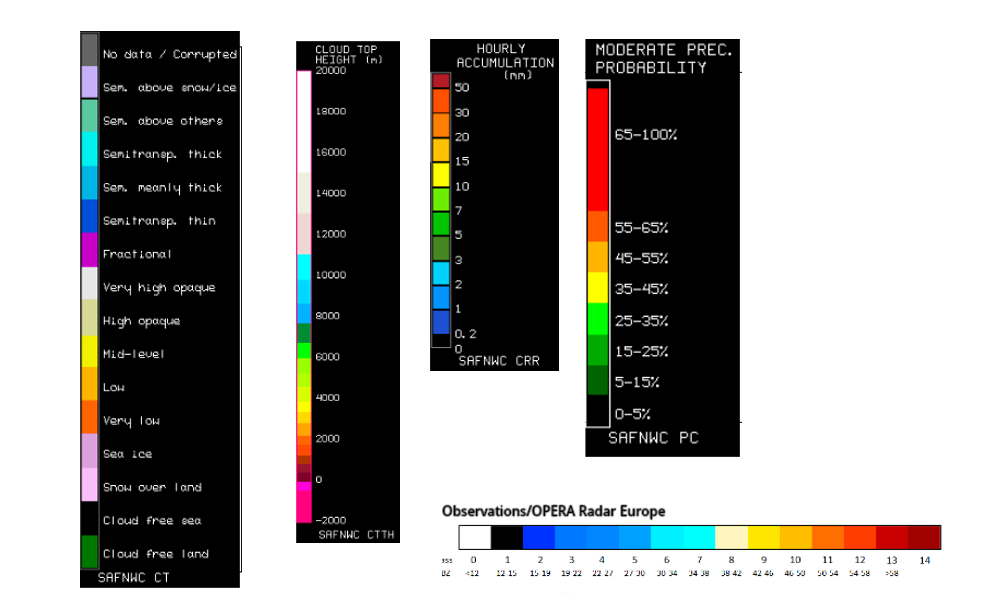
1st row: Cloud Type (CT NWCSAF) (above) + Cloud Top Height (CTTH - NWCSAF) (below); 2nd row: Convective Rainfall Rate (CRR NWCSAF) (above) + Radar intensities from Opera radar system (below).
For identifying values for Cloud type (CT), Cloud type height (CTTH), precipitating clouds (PC), and Opera radar for any pixel in the images look into the legends. (link).
Over Land
| Parameter | Description |
| Precipitation |
In the summer season:
|
| Temperature |
|
| Wind (incl. gusts) |
|
| Other relevant information |
|
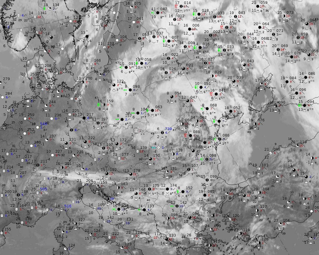
The case from 6 May 2020 at 12 UTC, described in detail in the chapter "Appearance in satellite images" over Central Europe, can be used as an example for a cut-off low over land. The IR image below shows the two cyclonically curved cloud bands around the cut-off low centre which is at least partly filled with dense low-level cloud over Eastern Poland and Western Ukraine. More eastwards, cellular cold air cloud does exist in the mostly cloud free area.
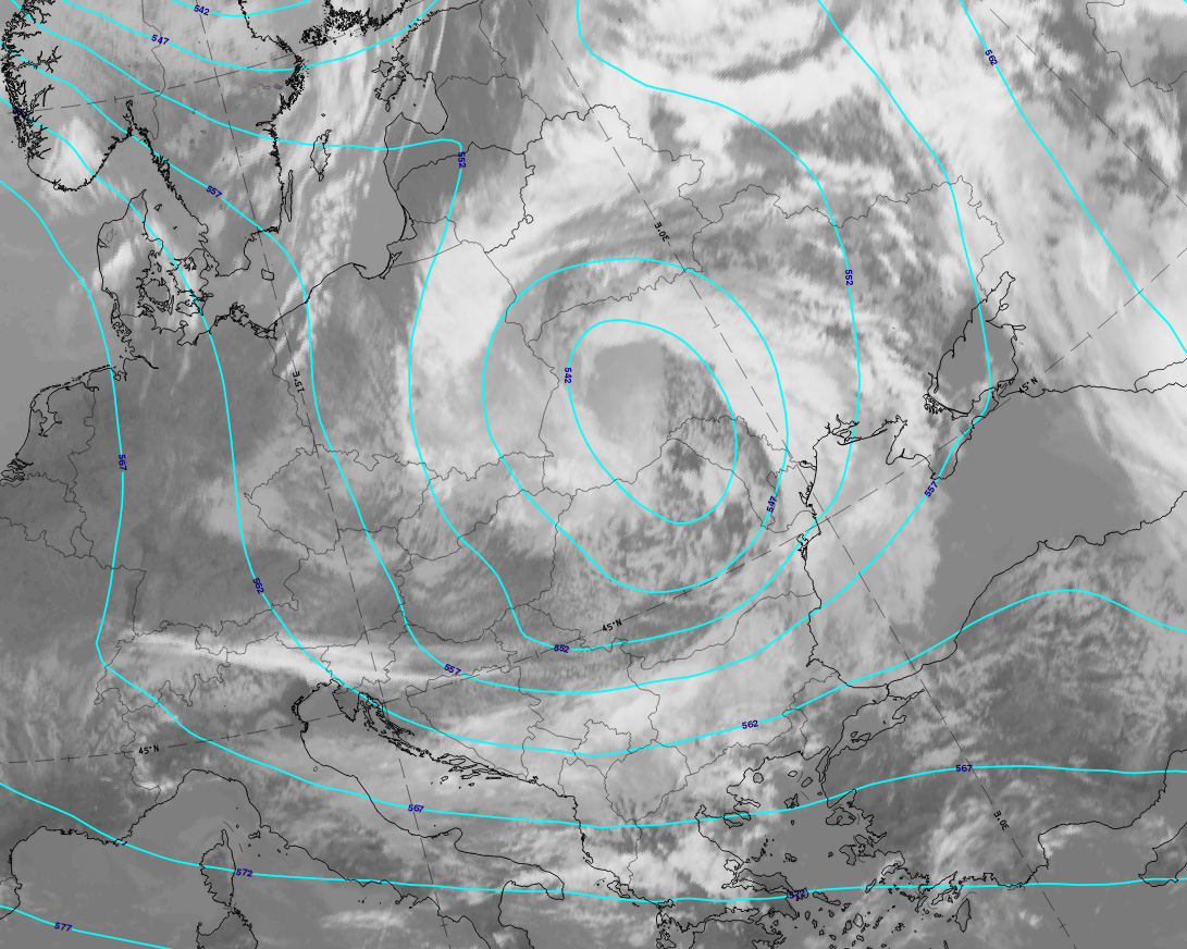
6 May 2020 at12 UTC: IR; cyan lines: height contours 500 hPa.
|
Hover over the image and move your pointer left and right to fade between images.Tap if using a touch interface. |
Note: for a larger SYNOP image click this link.
The overcast part of the cut-off low over Eastern Poland and Western Ukraine show rain as well as showers and Cbs which are superimposed. East of this, there are isolated Cbs and thunderstorms. The probability of moderate precipitation computed by NWCSAF diagnoses very high values for the overcast part in the cut-off low centre.
|
Hover over the image and move your pointer left and right to fade between images.Tap if using a touch interface. |
|
Hover over the image and move your pointer left and right to fade between images.Tap if using a touch interface. |
Legend:
6 May 2020 at 12 UTC, IR ; superimposed:
u.l.: Cloud Type (CT NWCSAF); u.r.: Cloud Top Height (CTTH - NWCSAF); l.l.: Convective Rainfall Rate (CRR - NWCSAF); l.r.: Radar intensities from Opera radar system.
For identifying values for Cloud type (CT), Cloud type height (CTTH), precipitating clouds (PC), and Opera radar for any pixel in the images look into the legends. (link).