Cloud Structure In Satellite Images
Dust-Infused Baroclinic Storms (DIBS), sometimes also called Dust-Infused Baroclinic Systems, often show a characteristic cloud top pattern that is best seen at low solar angles in high-resolution visible imagery. When mineral dust reaches the cloud top region due to the strong ascending motions in these baroclinic storms, the opaque cirrus clouds exhibit a cellular structure over large parts of the cloud deck.
The cellular or pockmarked cloud structure is mainly observed at the warm front part of a frontal system, especially if the frontal system is in the form of a cloud shield (see Warm Front Shield). Warm fronts usually have a smooth cloud top layer, so that the difference between a dust-infused cirrus cloud deck and a 'clean air' warm front is clearly visible.
More rarely, this characteristic cloud top structure is observed at Warm Conveyor Belt (WCB) type Occlusions, when the upgliding WCB air splits into two branches (see Occlusion: WCB type).
Appearance in the basic channels
- The cellular pattern of dust-infused cirrus clouds is best seen at low solar angles in high-resolution visible imagery. The uneven structure of the cirrus cloud deck is enhanced by the shadows cast on the cloud top layer.
- At high solar zenith angles, the characteristic cloud pattern is not clearly visible.
- The shallow cloud pattern is not well seen in thermal infrared imagery as the cloud top height variations are rather small and hence the cloud top temperature differences are minimal.
- Water vapor absorption bands do not depict the cellular cloud top structure at any resolution.
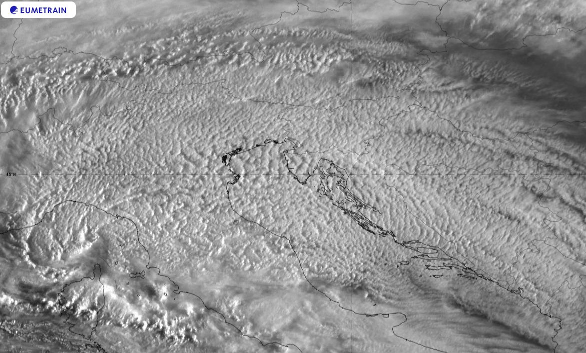
Figure 1: SEVIRI High Resolution Visible image from 30 March 2022 at 06:00 UTC.
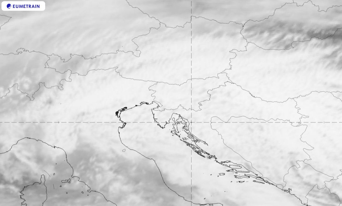
Figure 2: SEVIRI IR 10.8 µm image from 30 March 2022 at 09:00 UTC.
Appearance in standard RGBs:
HRV Cloud RGB
Dusty cirrus clouds appear whitish blue in the HRV Cloud RGB. The high reflectivity of the opaque cloud layer in visible channels combined with very cold cloud tops results in a bluish hue. Shaded areas around the cloud cells are dark blue due to missing the contribution of reflected short wave radiation.
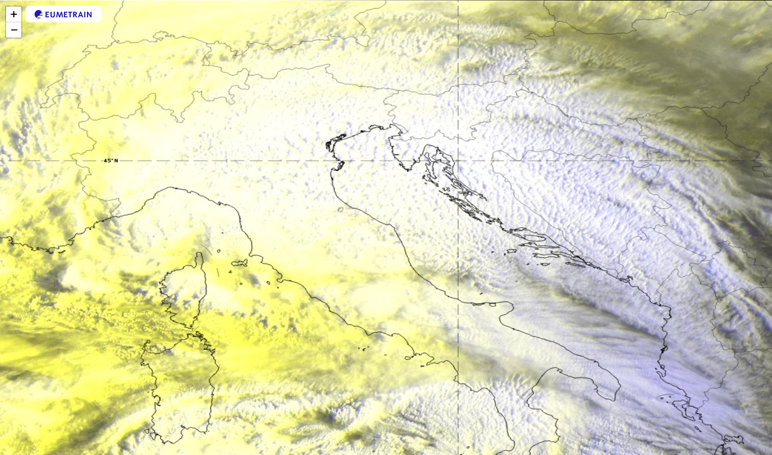
Figure 3: SEVIRI HRV Cloud RGB from 30 March 2022 at 06:00 UTC.
Day Natural Color RGB
The pockmarked cloud structure appears cyan in the Day Natural Color RGB. The cyan color is typical for high reaching opaque clouds made of ice crystals.
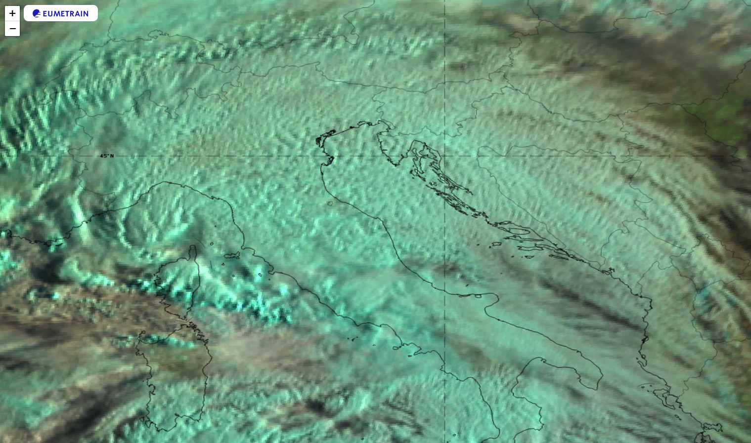
Figure 4: SEVIRI Natural Color RGB from 30 March 2022 at 06:00 UTC.
Severe Storms RGB
Dusty cirrus clouds are characterized by pinkish red to washed-out yellow colours in the Severe Storms RGB. This is an indication of small ice crystals, which typically appear at the top layers of clouds formed by dust.
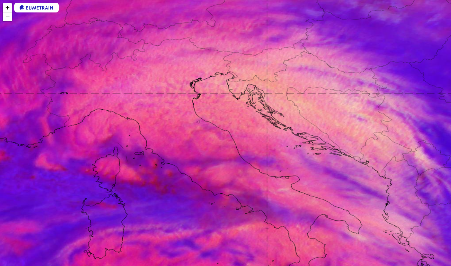
Figure 5: SEVIRI Severe Storms RGB from 30 March 2022 at 06:00 UTC.