Weather Events
The strongest influence of DIBS, and especially of dusty cirrus, on surface weather is mainly the reduced solar radiation reaching the ground as dust particles act as condensation nuclei and form clouds where otherwise no clouds would have been present. As current numerical weather prediction models do not accurately account for microphysical cloud formation processes caused by the additional dust at higher atmospheric levels, predicted maximum temperatures often have a considerable bias towards higher values.
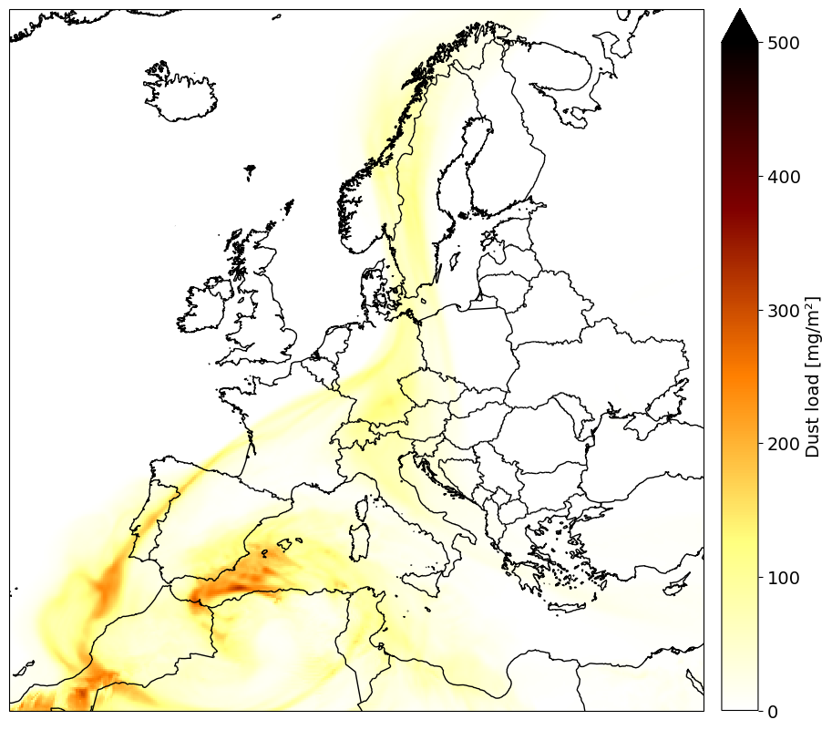
Figure 1: Total dust column for 17 March 2020 at 06:00 UTC (in mg/m2).
|
|
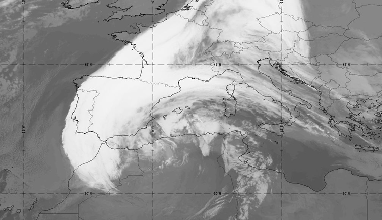
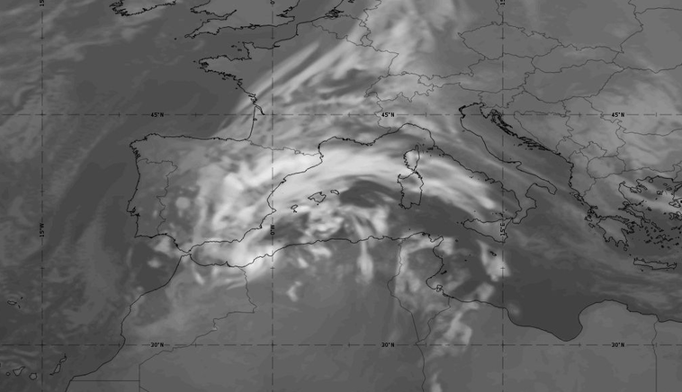
Figure 2: Comparison of a simulated IR 10.8 µm image (ECMWF 6-hour forecast) with a SEVIRI 10.8 µm IR image, for 17 March 2022 at 06:00 UTC (move the slider to compare the two images).
Table 1: Description of the effect of dusty cirrus on surface weather.
| Parameter | Description |
|---|---|
| Solar radiation | Surface solar radiation is considerably reduced when dusty cirrus clouds are present. |
| Temperature | Daytime surface temperature maxima are lower than predicted when dusty cirrus is present. This is mainly due to the reduced intensity of incoming short-wave solar radiation at the ground. Depending on the season, the temperature bias can be up to 5°C.
Vice versa, night-time temperature minima are higher than predicted when cirrus cloud is present because outgoing longwave radiation is backscattered. Overall, the temperature range is smaller than predicted. |
| Precipitation | There is little or no precipitation under a dusty cirrus cloud deck. |
| Visibility and optical phenomena | Reduced visibility due to mineral dust suspended in the air. Diffuse light conditions at the ground below dusty cirrus clouds.
High dust concentration in the atmosphere produces reddish and yellowish skies during sunset hours. |
| Other relevant information | When dusty cirrus is present, the forecasted development of convective precipitation can be inhibited or at least delayed in the convective season.
Dust deposition may occur, which becomes visible on shiny surfaces or snow. When mineral dust is washed out from the atmosphere, rain drops can take on a reddish or brownish colour. |
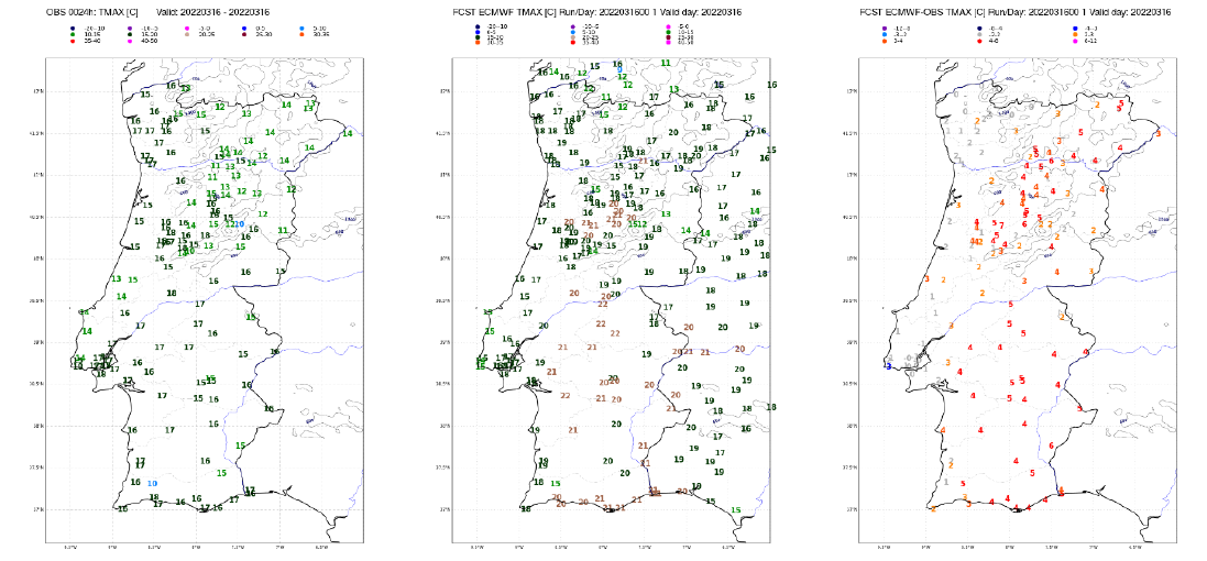
Figure 3: 2-m maximum temperature on 16 March 2022: observations (left), ECMWF forecast from run at 00 UTC (middle) and difference between forecast and observation (right).
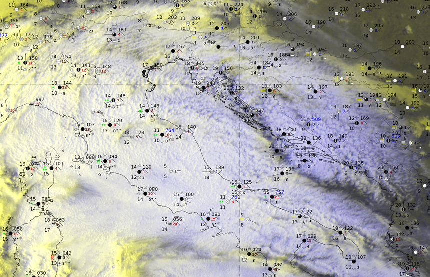
The HRV Clouds RGB shows widespread dusty cirrus over the Adriatic Sea, Slovenia, Croatia and Bosnia-Herzegovina, while the model forecasts almost no cloud cover. However, synoptic reports confirm a cloud-covered sky in this area, with no precipitation reported.
|
|
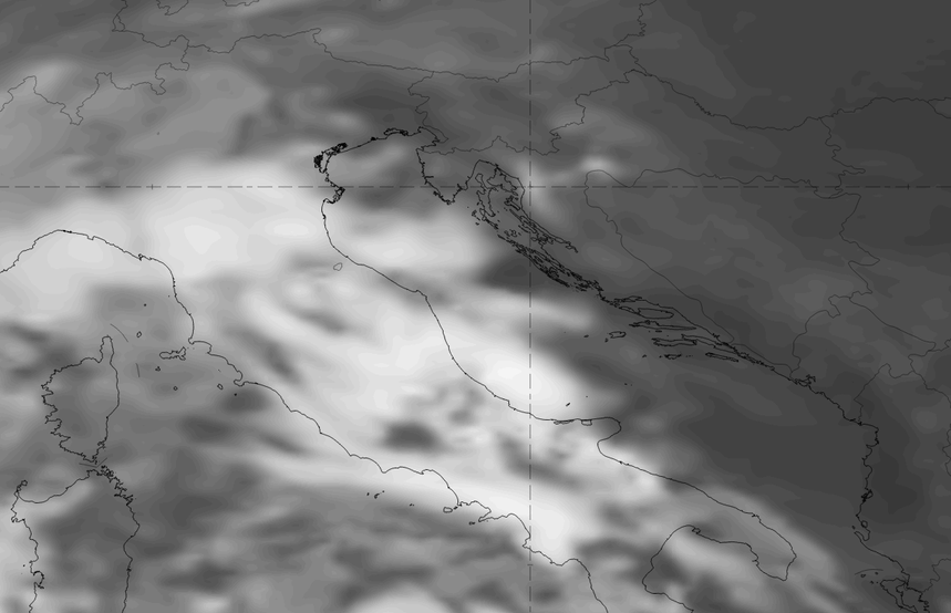
Figure 4: Comparison of a simulated IR 10.8 µm image (ECMWF 6-hour forecast) with a SEVIRI HRV Clouds RGB and SYNOP data for 20 May 2023 at 06:00 UTC (move the slider to compare the two images).
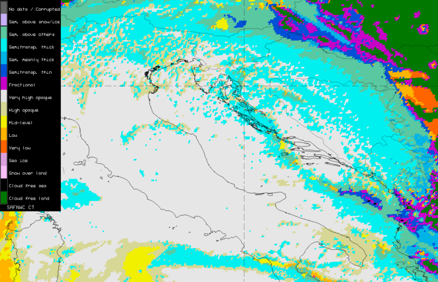
The NWC SAF Cloud Type product shows that the dusty cirrus cloud deck consists mainly of semi-transparent cirrus clouds. Over the Adriatic Sea and Italy, this layer is superimposed on thick opaque clouds from a front.
|
|
Figure 5: Comparison of the HRV Clouds RGB with the NWC SAF Cloud Type product for 20 May 2023 at 06:00 UTC (move the slider to compare the two images).
The dusty cirrus clouds are located above the frontal cloud shield at heights between 10 and 12 km.
|
|

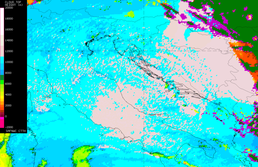
Figure 6: Comparison of the HRV Clouds RGB with the NWC SAF Cloud Top Height product for 20 May 2023 at 06:00 UTC (move the slider to compare the two images).
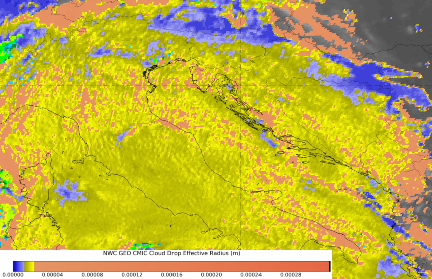
Ice crystals in the dusty cirrus layer have sizes of 10-20 µm according to the Cloud Effective Radius product of NWC SAF.
|
|
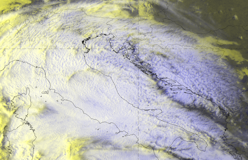
Figure 7: Comparison of the HRV Clouds RGB with the NWC SAF Cloud Effective Radius product for 20 May 2023 at 06:00 UTC (move the slider to compare the two images).

Note: to enter a gallery with the Figures 4 − 7 click here.