Key Parameters
For Europe, the major source of mineral dust in the atmosphere is the Sahara desert in northern Africa. Under favorable meteorological conditions, dust particles are transported northwards until they reach the European continent.
The phases leading to dusty cirrus can be described as follows:
- Dust lifting process
- A baroclinic system over the desert with winds strong enough to raise mineral dust particles from the surface up into the air.
- Dust transport
- A meridional dust transport towards Europe, typically in connection with the east side of a deeper trough.
- A lifting mechanism (e.g. a warm conveyor belt) so that dust particles can reach higher atmospheric levels.
- Dust cloud formation
- According to the Mixing Instability Theory, a layered air mass with a dusty dry air mass and a clean moist layer on top is necessary to form the dusty cirrus cloud.
Key parameters related to the dust lifting process:
Surface winds
Strong surface winds are needed to lift the dust particles up into the air. These strong winds are most commonly associated with low-pressure systems over Africa.
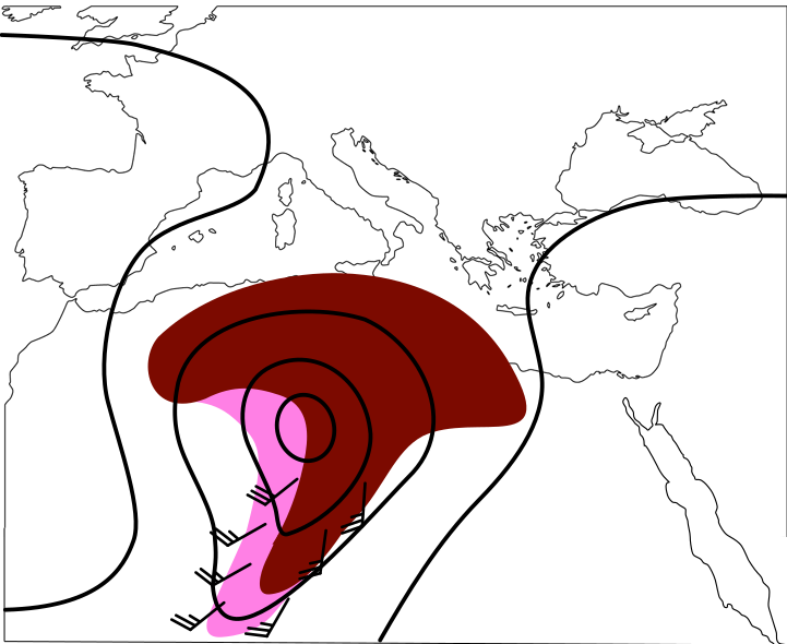
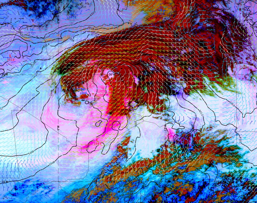
Figure 1: 20 March 2023 at 15:00 UTC. Left: Schematic of strong surface winds. Right: Meteosat 9 (IODC) Dust RGB image showing dust-loaded air (magenta). Mean sea-level pressure (black) and wind barbs at 10 m height.
Key parameters related to the dust transport:
Geopotential height at 500 hPa and mean sea-level pressure
Meridional dust transport over the Mediterranean Sea takes place when an upper-level trough reaches far south. Geostrophic winds at the east side of the trough bring the dust particles to Europe.
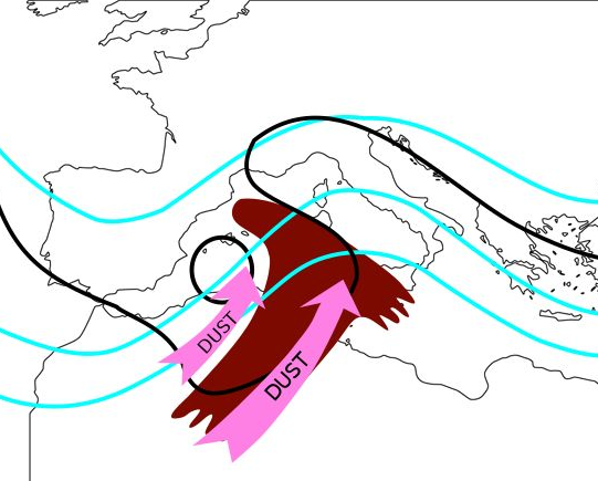
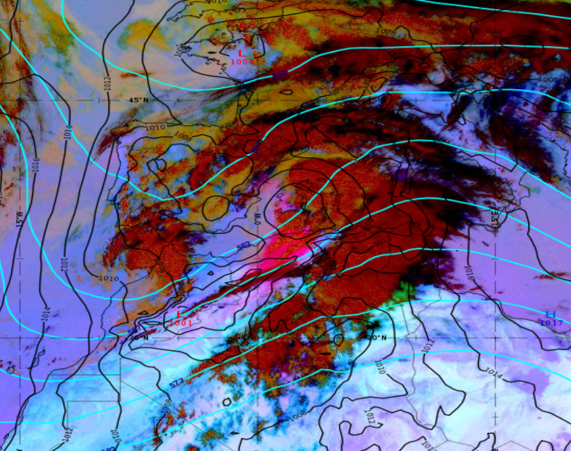
Figure 2: 29 March 2022 at 15:00 UTC. Left: Schematic of meridional dust transport. Right: Meteosat 11 Dust RGB image showing dust-loaded air (magenta). Geopotential height at 500 hPa (cyan) and mean sea-level pressure (black).
Geopotential height at 500 hPa and wind barbs at 850 hPa
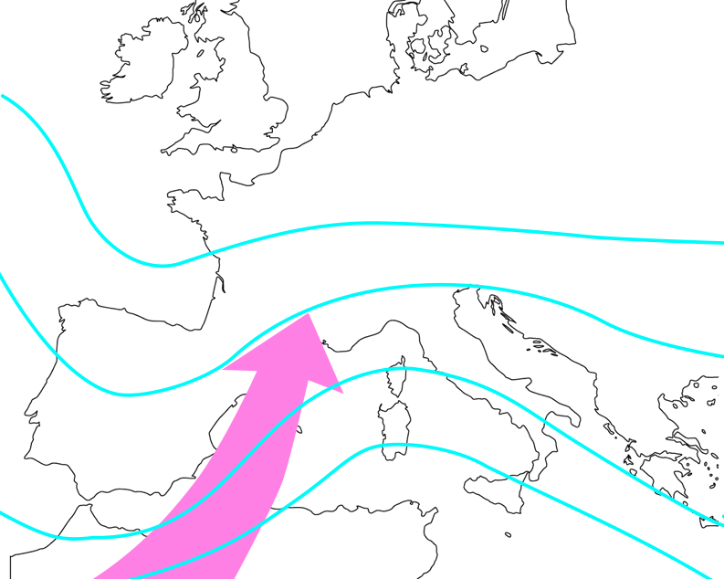
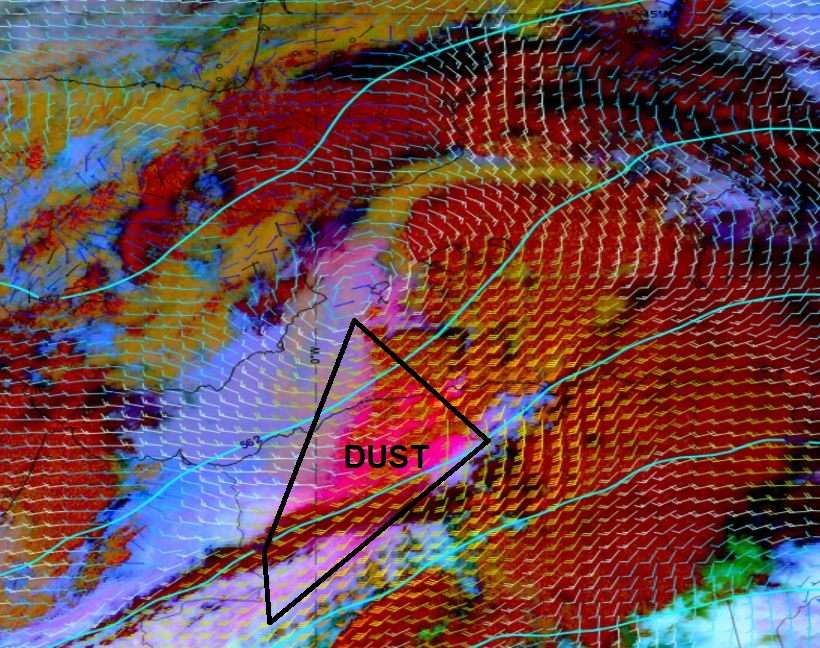
Figure 3: 29 March 2022 at 15:00 UTC. Left: Schematic of meridional dust transport. Right: Meteosat 11 Dust RGB image showing dust-loaded air (magenta). Geopotential height at 500 hPa (cyan) and wind barbs at 850 hPa.
Key parameters related to the dust cloud formation process:
Relative humidity
High-level humidity is required for the formation of the cirrus cloud layer. The vertical distribution of relative humidity shows higher values at cloud level and lower values below. See also the chapter Typical Appearance In Vertical Cross Sections.
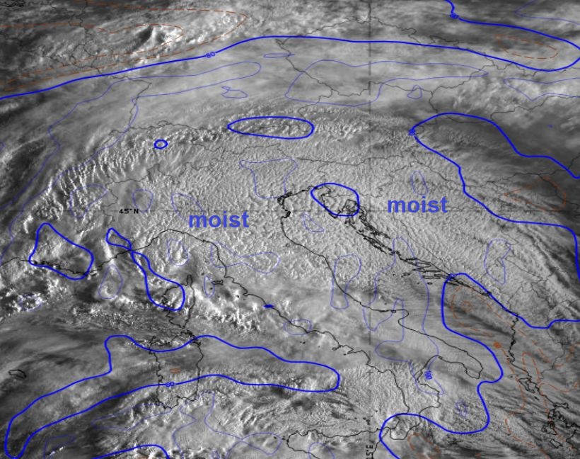
Figure 4: 30 March 2022 at 06:00 UTC. Meteosat 11 HRV image. Relative humidity at 300 hPa (blue).
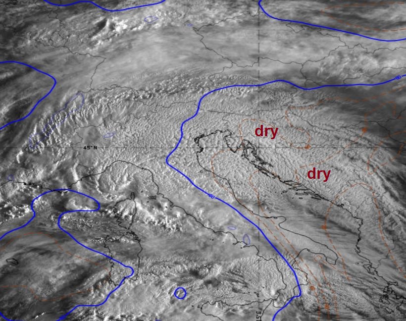
Figure 5: 30 March 2022 at 06:00 UTC. Meteosat 11 HRV image. Relative humidity at 700 hPa (blue).