Weather Events
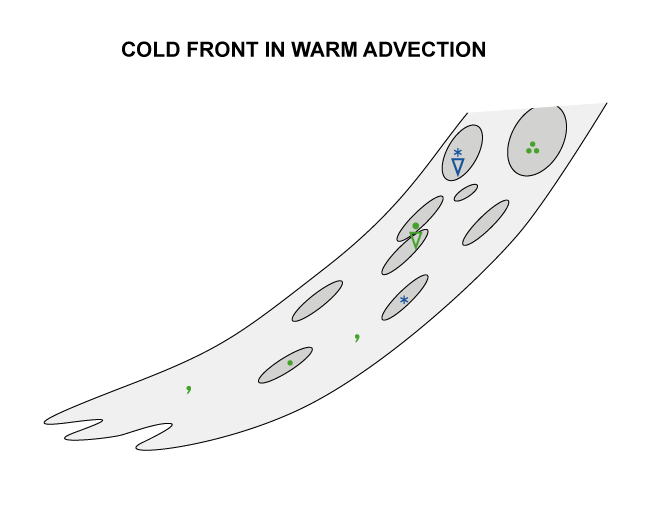
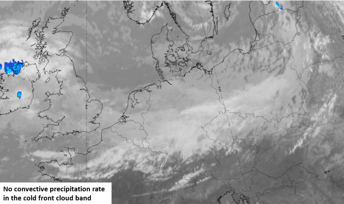
As Cold Fronts in WA are usually weaker than other Cold Fronts, they produce less precipitation. In about a third of the cases there is no precipitation at all. Severe weather such as thunderstorms is very unlikely.
| Parameter | Description |
| Precipitation |
|
| Temperature |
|
| Wind (incl. gusts) |
|
| Other relevant information |
|
|
|
|
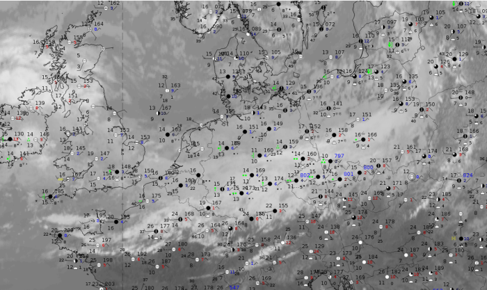
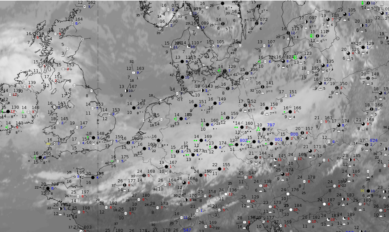
Note: for a larger SYNOP image click this link.
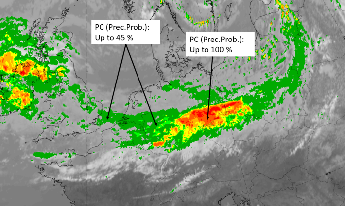
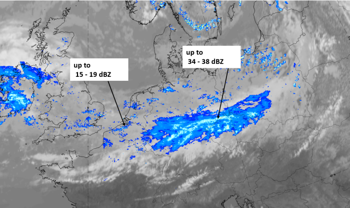
The whole cloud band extends from southern England across southern Germany to Poland and has in its western parts, which are close to the subsequent warm front cloud shield, only low precipitation activity. This is also reflected in the low probability of precipitation computed from NWCSAF. To the east, in the centre of the cloud band, more precipitation observations occur, with higher values; here, the precipitation could be enhanced by orographic effects.
|
|
|
|
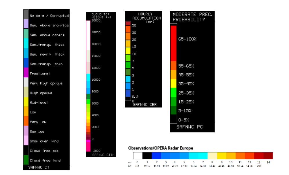
Legend:
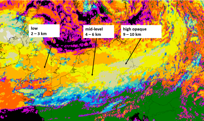
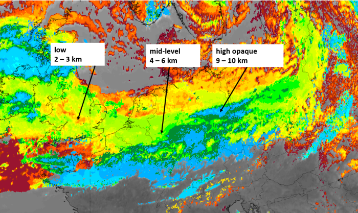
8 July 2020, 12 UTC, IR; with the following fields superimposed: 1st row: Cloud Type (CT NWCSAF) (above) + Cloud Top Height (CTTH - NWCSAF) (below); 2nd row: Convective Rainfall Rate (CRR NWCSAF) (above) + Radar intensities from Opera radar system (below).
For identifying values for Cloud type (CT), Cloud type height (CTTH), precipitating clouds (PC), and Opera radar for any pixel in the images look into the legends. (link)