Meteorological Physical Background
Cold Fronts in Warm Advection, abbreviated CF in WA, are principally like normal Cold Fronts, but they are wholly within warm advection. The warm advection is generally weak, and it is weaker behind the frontal zone than ahead of it.
In summer the Cold Fronts in Warm Advection are nearly as common as Cold Fronts in Cold Advection, but in winter they are rare.
CF in WA forms, when a Cold Front encounters an area of warm advection connected to another, approaching system. Usually this system is a Warm Front, either a wave forming within the Cold Front, or another cyclone catching up the Cold Front. It can also be Detached Warm Front, Warm Conveyor Belt, Baroclinic Boundary, or an Occlusion with warm advection ahead of it.
CF in WA is often a relatively old, weakening front. This stage does not last long (typically less than 12 hours), and it soon turns into some other type of Cold Front or a Wave, or just disappears.
According to studies at ZAMG, about half of CF in WA cases are weakening, and only about 10 % are intensifying.
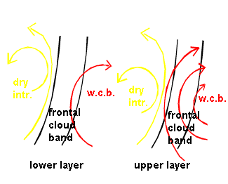
The main feature of a CF in WA is a Warm Conveyor Belt. It tends to either intensify with height or to exist only at higher levels. In about half of the cases the Warm Conveyor Belt overruns the cloud band to the north. An upper level stream occurs only in the minority of cases. In several cases a closed cyclonic circulation can be found behind the Warm Conveyor Belt, but with little vertical displacement.
As there is only one conveyor belt involved, the temperature and humidity contrasts are rather weak in the area of the frontal cloud band.
|
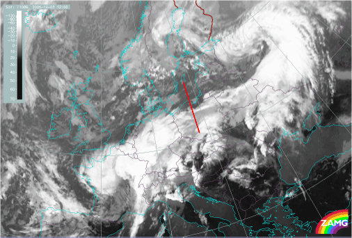
03 October 2006/12.00 UTC - Meteosat 8 IR10.8 image; position of vertical cross section indicated
|
|
|
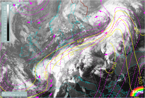
03 October 2006/12.00 UTC - Meteosat 8 IR10.8 image; magenta: relative streams 318K, yellow: isobars 318K
|
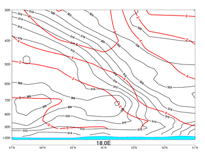
03 October 2006/12.00 UTC - Vertical cross section; black: thetaE, red: warm advection
|


