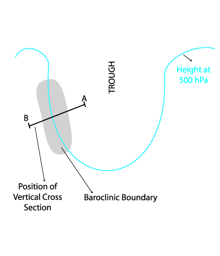
Typical Appearance In Vertical Cross Sections
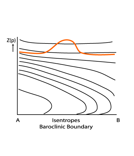
A crowding of isentropes indicates an air mass boundary and a baroclinic zone. Though similar to fronts, the cloud band of the Baroclinic Boundary shows no front like appearance in a vertical cross section. The appearance is similar throughout all types of Baroclinic Boundary.
- Isentropes (equivalent potential temperature):
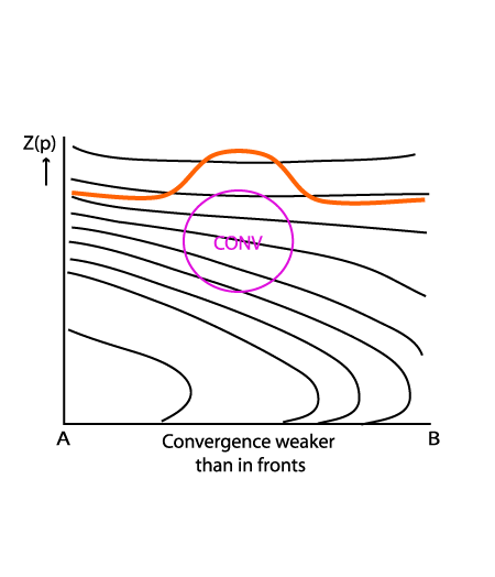
- Zone of high gradient of equivalent potential temperature, gradient mostly weaker than in fronts
- Flat decline of crowded isentropes - a distinct difference from a front
- Superadiabatic stratification only at low levels (associated with diabatic heating or cold air advection)
- Divergence:
- Zone of convergence within the highest gradient of isentropes, usually weaker than within a frontal zone
- Vertical motion (Omega):
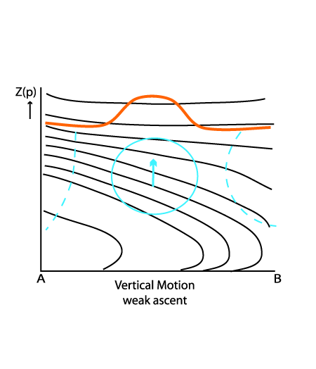
- Upward motion within the gradient zone indicating ascent, but usually weaker than in a frontal zone
- All cases show weak ascent at middle levels
|
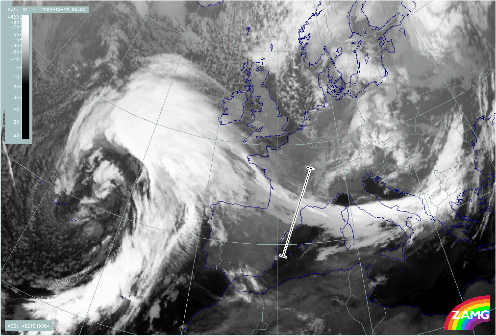
19 October 2002/06.00 UTC - Meteosat IR image; position of vertical cross section indicated
|
|
|
|
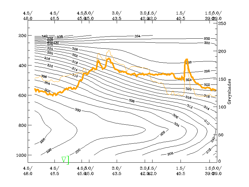
Isentropes (equivalent potential temperature)
|
19 October 2002/06.00 UTC - Vertical cross section; black: isentropes (ThetaE), orange thin: IR pixel values, orange thick: WV pixel values
|
|
|
|
Divergence
|
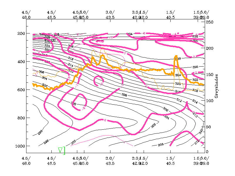
19 October 2002/06.00 UTC - Vertical cross section; black: isentropes (ThetaE), magenta thin: divergence, magenta thick: convergence, orange thin: IR pixel values, orange thick: WV pixel values
|
|
|
|
Vertical motion (Omega)
|
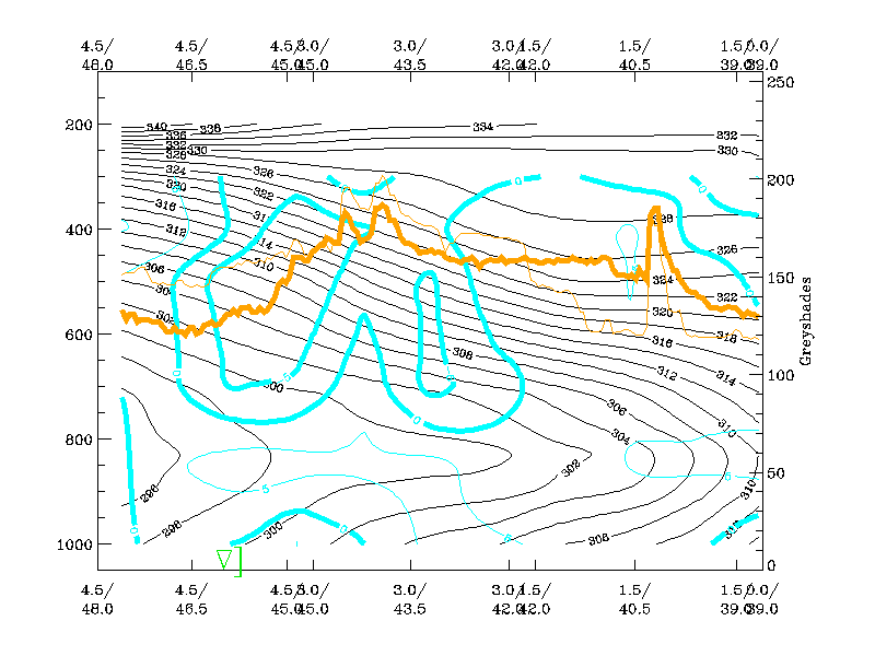
19 October 2002/06.00 UTC - Vertical cross section; black: isentropes (ThetaE), cyan thick: vertical motion (omega) - upward motion, cyan thin: vertical motion (omega) - downward motion, orange thin: IR pixel values, orange thick: WV pixel values
|
|
|
|