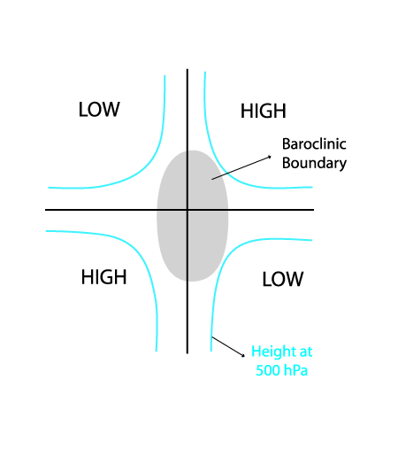
Key Parameters
- Height contours at 500 hPa:
- Distribution of height at 500 hPa indicates boundary between closed synoptic systems:
- To the rear of a trough
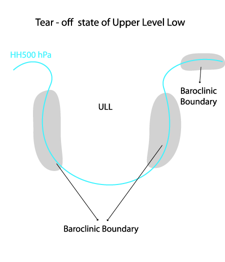
- To the rear and in front of an ULL, in the tear - off stage of development
- At the deformation zone between two troughs and two ridges
- Equivalent thickness:
- A distinct gradient of equivalent thickness accompanies the cloud band
- Mostly weaker than "classical" fronts
- The appearance of this parameter is similar within all 3 types of Baroclinic Boundary
- Thermal front parameter (TFP):
- Maximum of TFP associated with the cloud band
- Normally, weaker than "classical" fronts
- No significant propagation
- The appearance of this parameter is similar within all 3 types of Baroclinic Boundary
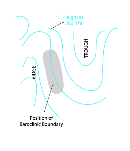
Height contours at 500 hPa
- At the rear of synoptic scale trough
- Baroclinic boundary associated with ULL
- Baroclinic Boundary associated with deformation zone at a saddle point of upper height Fields
|
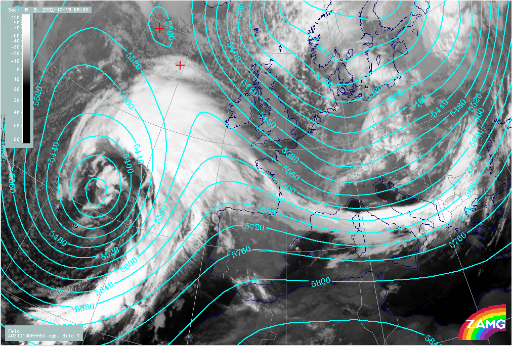
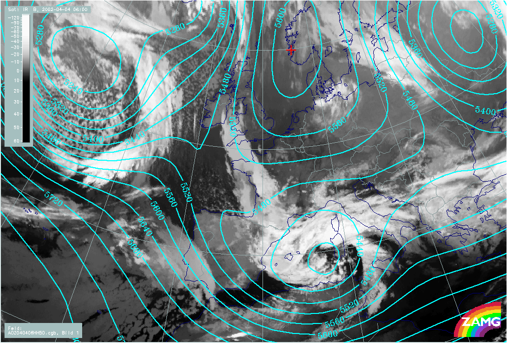
19 October 2002/06.00 UTC - Meteosat IR image; cyan: height contours 500 hPa
|
|
|
|
|
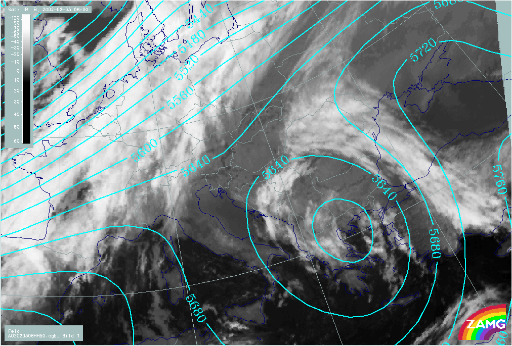
05 February 2002/06.00 UTC - Meteosat IR image; cyan: height contours 500 hPa
|
|
|
|
|
04 April 2002/06.00 UTC - Meteosat IR image; cyan: height contours 500 hPa
|
|
|
|
Thermal front parameter (TFP) and equivalent thickness
|
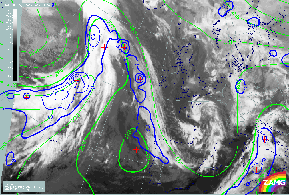
29 November 2002/12.00 UTC - Meteosat IR image; blue: thermal front parameter (TFP) 500/850 hPa, green: equivalent thickness 500/850 hPa
|
|
|
|