Weather Events
In general observed precipitation is significantly weaker than in fronts; or there may be no precipitation at all.
| Parameter | Description |
| Precipitation |
|
| Temperature | No connection (stationary) |
| Wind (incl. gusts) | No connection (stationary) |
| Other relevant information |
The following example represents the location "at the rear of a synoptic scale trough".
|
|

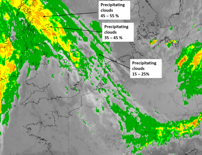
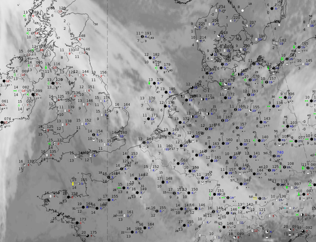
5 October 2019, 12UTC: IR + synoptic measurements (above) + probability of moderate rain (Precipitting clouds PC - NWCSAF).
Note: for a larger SYNOP image click this link.
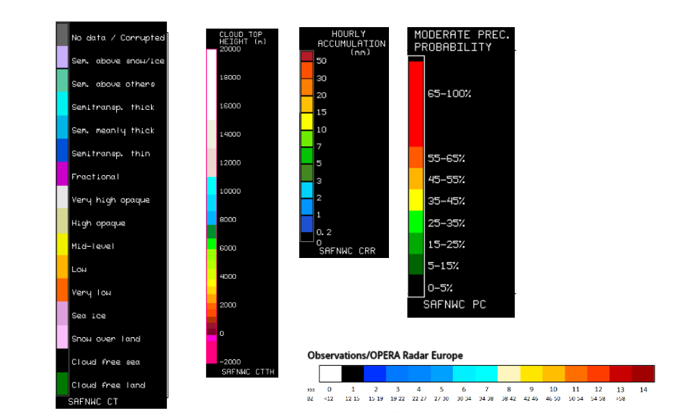
The images show only very few shower and rain reports and the precipitation probability is generally very low, being higher only in the transition area between the warm front and the baroclinic boundary over Scotland. (link to legends)
|
|
|
|
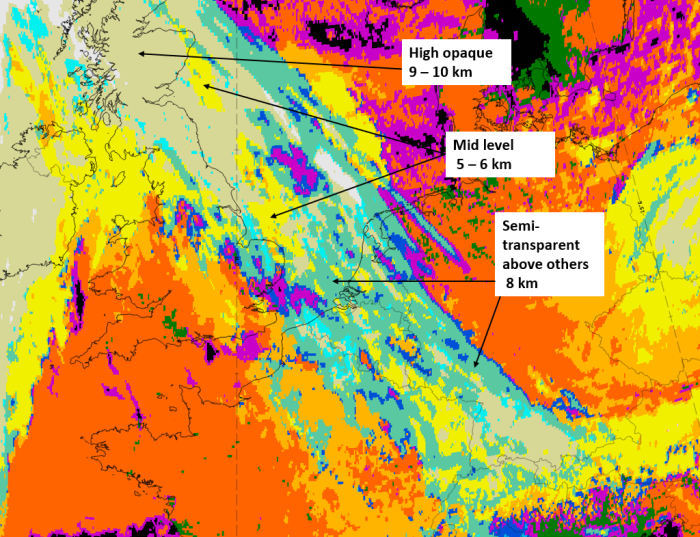
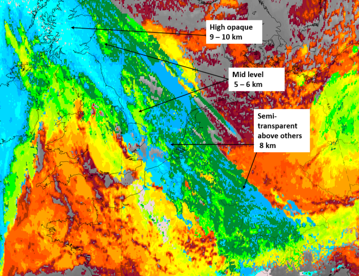
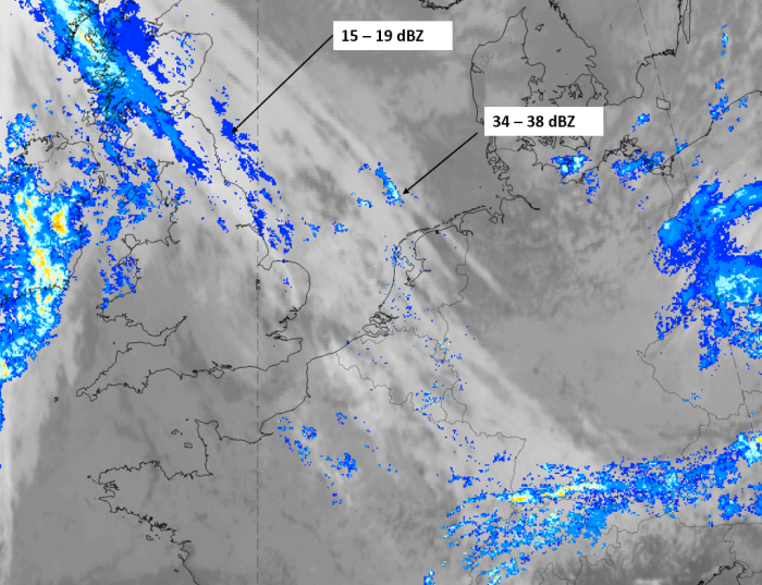
5 October 2019, 12 UTC, IR ; superimposed:
1st row: Cloud Type (CT NWCSAF) (above) + Cloud Top Height (CTTH - NWCSAF) (below); 2nd row: Convective Rainfall Rate (CRR NWCSAF) (above) + Radar intensities from Opera radar system (below).
For identifying values for Cloud type (CT), Cloud type height (CTTH), precipitating clouds (PC), and Opera radar for any pixel in the images look into the legends. (link)