Meteorological Physical Background
General Description
Atmospheric rivers (ARs) are low-level moisture bands emerging from a moist tropical air mass. They usually form over the seas and propagate polewards, later turning towards the east/west in the northern/southern hemisphere. ARs are frequent phenomena that are found in the region between the moist tropical air mass and the polar front. When they reach the polar front, they are often seen merging with the latter.
ARs are characterized by:
- A low-level moisture band (< 700 hPa).
- An initial water vapor content sourced from a moist tropical air mass or from a mid-latitude moisture source.
- A pronounced low-level jet along their way, which carries out the majority of the poleward moisture transport.
- Their location over the seas and rapid deterioration caused by friction and/or lifting upon making landfall.
- High amounts of precipitation during rapid lifting, such as when meeting mountains.
ARs should not be confused with the moisture bands found in the convergence zones of cold and warm fronts, nor with the Warm Conveyor Belt, which is a rising flow of warm and moist air ahead of a cold front.
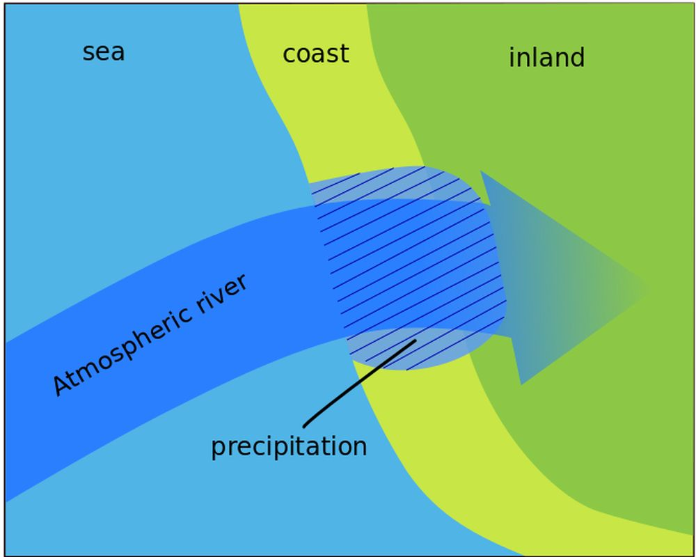
Figure 7: Schematic of an atmospheric river making landfall and being lifted by coastal orography.
Structure
- Atmospheric Rivers (ARs) are long and narrow bands of moisture in the lower troposphere that transport large amounts of water in liquid and gaseous form.
- ARs are defined as being at least 2000 km long and around 300 km wide on average with a total column water vapor (IWV) above 20 mm.
- Most of the humidity in ARs is found at levels below 700 hPa.
Location and origin of Atmospheric Rivers
ARs are located in the maritime tropical (mT) air mass, which consists of moist warm air. Influenced by pressure systems on their way north, they are typically found on the warm side of extratropical cyclones.
The initial water vapor supply in ARs stems from tropical moisture sources, from which it is transported outside the tropics over thousands of kilometers. Additional moisture is supplied on the way by evaporation from the sea surface, ensuring that the base of the AR always contains enough moisture. In addition, pre-frontal convergence helps maintain high total column water vapor.
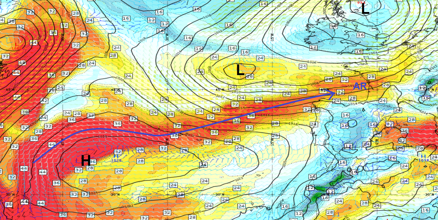
Figure 8: AR (blue arrow) shown in the Total Column Water parameter (ECMWF) on 16 June 2024 at 09:00 UTC. Mean Sea Level Pressure (black) and Wind barbs at 850 hPa.
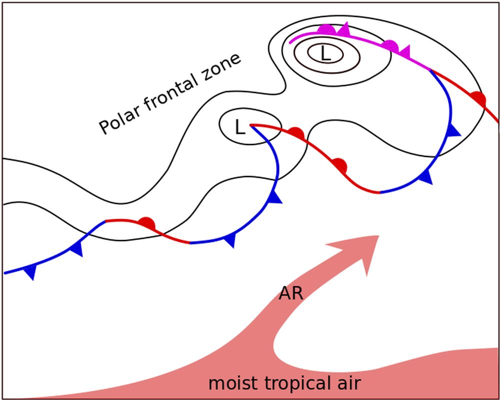
Figure 9: Schematic of the location of an AR compared
to the polar front.
Upon landfall, the river's typical elongated shape rapidly deteriorates and the amount of precipitable water decreases. ARs can cause precipitation and flooding, especially if the moist air is forced to ascend near the coast or in a mountainous region.
Evolution of Atmospheric Rivers: Merging and deformation
ARs are often observed converging with the polar front as they move north. When this happens, the moisture band of the AR becomes mixed with the moisture band of the polar front. Under these conditions, the AR is integrated into the pre-frontal moisture band and cannot be differentiated (see chapter IV on appearance in vertical cross sections).
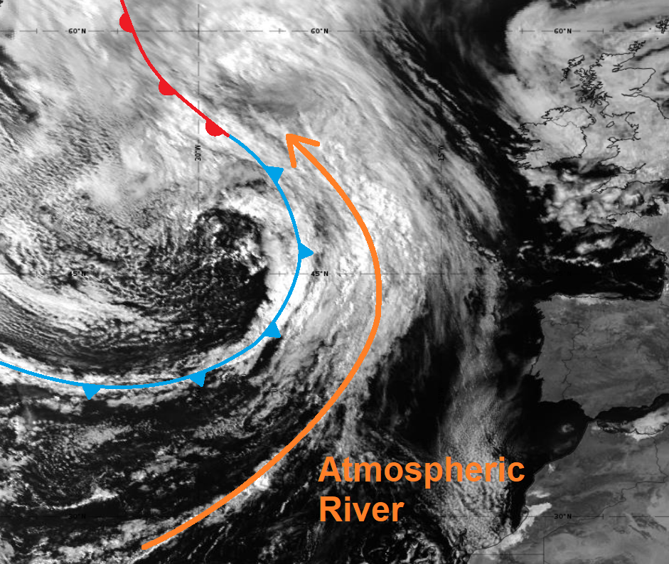
Figure 10: SEVIRI VIS 0.8 µm image from 24 May 2024 at 09:00 UTC.
AR merging with a cold front.
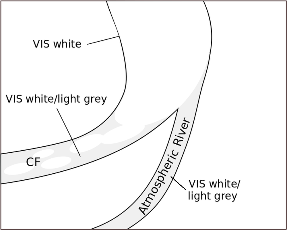
Figure 11: Schematic of an AR merging with a cold front.
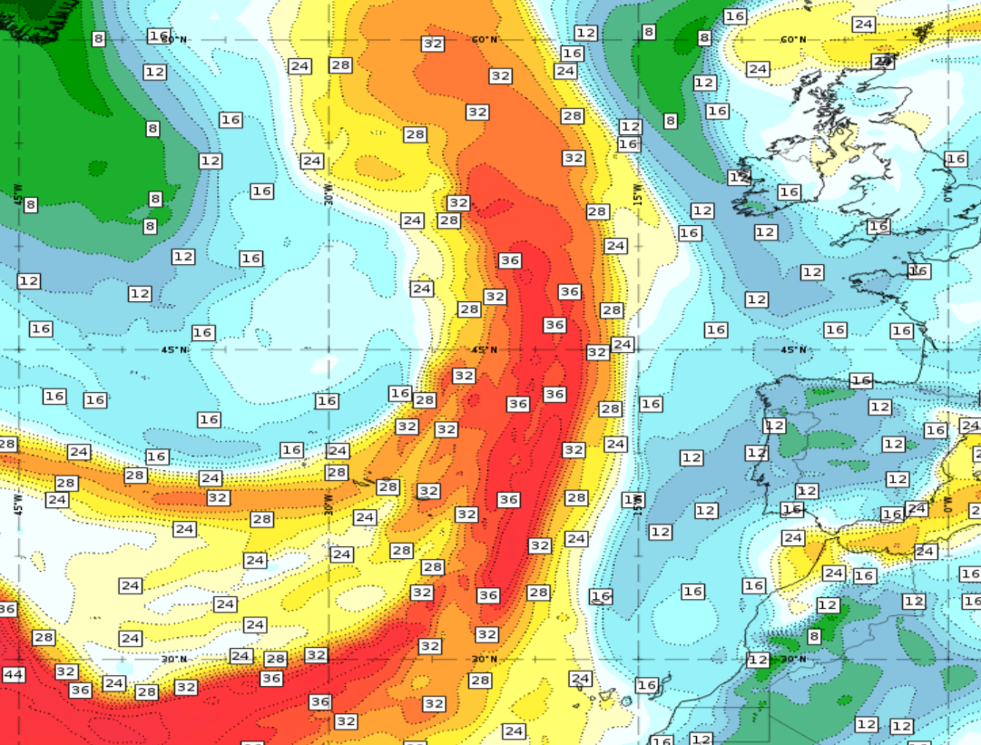
Figure 12: Total Column Water (TCW) from 24 May 2024 at 09:00 UTC.
Merging of the high moisture bands of the cold front and the AR.
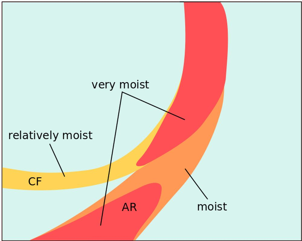
Figure 13: Schematic of the TCW amount in a merging process of an
AR with a clod front.
These narrow ribbons of low-level moisture often undergo transformations over time. When influenced by high and low pressure systems, these bands can be stretched, compressed or bent in various ways. Under these circumstances, ARs do not show a unidirectional wind field from source region to the very end of the AR. Wind direction can even become reversed when the AR is stretched or deformed by changing pressure gradients.
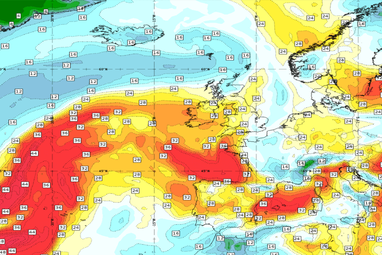
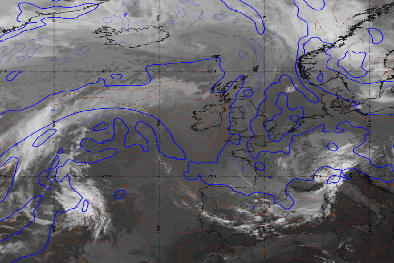
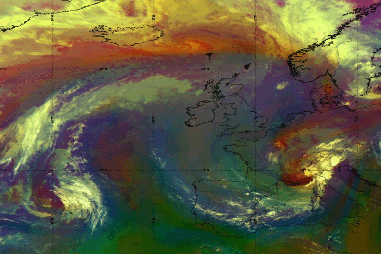
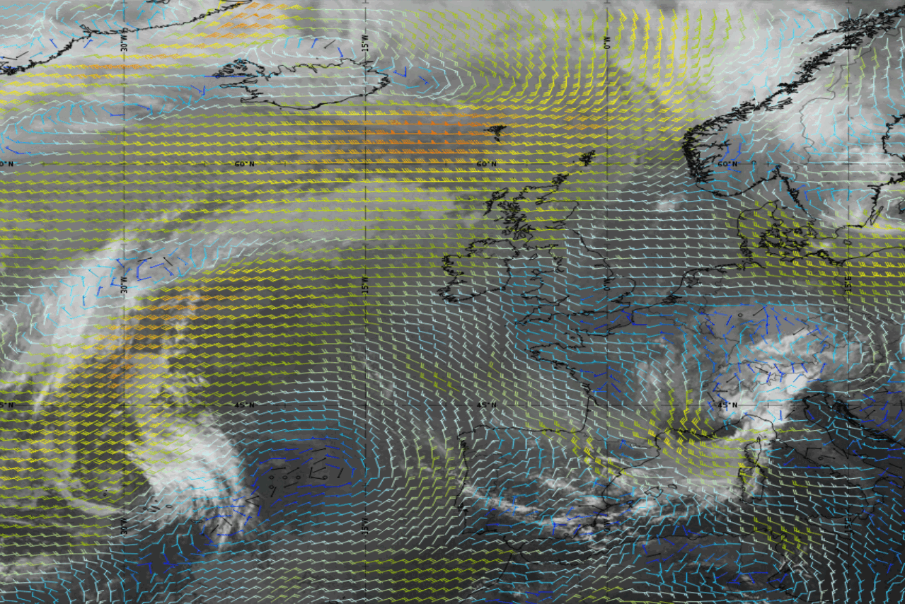
Figure 14: AR loop from 23 to 24 May 2024. Total Column Water (ECMWF) (top left), Airmass RGB (top right), relative humidity at 850 hPa (bottom left) and wind barbs at 850 hPa (bottom right) superimposed on the SEVIRI IR10.8 µm image.
Distinction from the Warm Conveyor belt
- ARs are not identical to the Warm Conveyor Belt (WCB), although they can be found in the same place. While a WCB rises continuously ahead of a cold front to eventually reach the upper troposphere, an AR remains at altitudes below 700 hPa. A WCB and an AR can be superimposed on each other.
- ARs are always accompanied by a low-level jet (LLJ). These strong near-surface winds induce an intense moisture transport from the tropics to mid-latitude regions.
- WCBs are relative streams that are defined with respect to a particular extratropical cyclone. In contrast, ARs are usually not connected to a single extratropical cyclone; instead, they remain in the warm sector of a succession of extratropical cyclones.