Common Remarks
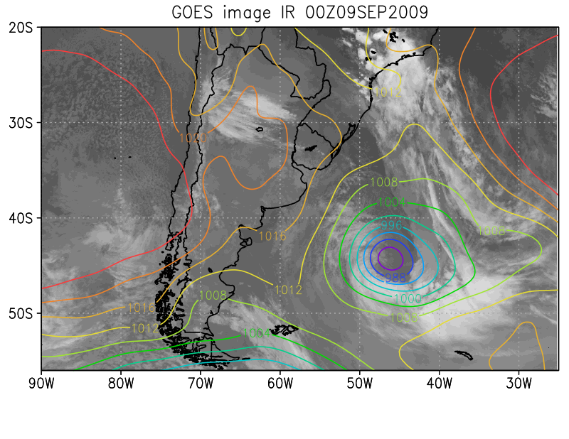
Closed atmospheric circulations developing in the southeastern regions of South America typically form near the eastern coasts of Uruguay and Southern Brazil and then propagate southeastwards, reaching their maximum intensity over the South Atlantic. The diagram below shows an example of a cyclone which displaced from the coast of Uruguay to the Atlantic Ocean.
|
09 September 2009 / 0000UTC. Example of cyclogenesis near eastern South America (IR 10.8 image - channel 4 from GOES13 and MSLP).
|
|
|
|
I. Appearance in Satellite Data
Learn about how to recognise and detect Cyclogenesis and Extra-tropical Cyclones Over Southeastern South America in satellite images.
II. Meteorological Physical Background
Find out more about the meteorlogical and physical background of Cyclogenesis and Extra-tropical Cyclones Over Southeastern South America
III. Key Parameters
Learn which key parameters to use for montoring Cyclogenesis and Extra-tropical Cyclones Over Southeastern South America
IV. Typical Appearance In Vertical Cross Sections
Find out the typical appearance of Arctic Cyclogenesis and Extra-tropical Cyclones Over Southeastern South America in vertical cross section
V. Weather Events
Explore the weather events associated with Cyclogenesis and Extra-tropical Cyclones Over Southeastern South America
VI. References
Let these comprehensive documents in the references assist you in finding more about Cyclogenesis and Extra-tropical Cyclones Over Southeastern South America