Chapter IV: Discussion
Table of Contents
- Chapter IV: Discussion
- Discussion
Discussion
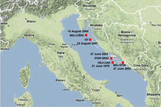
Besides the case of Mali Lošinj there are three more cases known in the Adriatic in the past. They have all been analyzed in details and the analyzes have been published. The image below shows the locations of all known meteotsunami cases in the Adriatic.
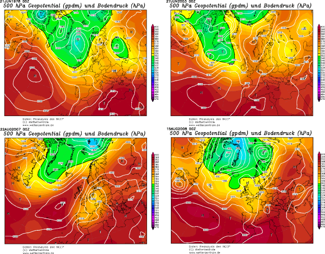
Synoptic situations were similar in three of four cases, whereas in the case of 27 June 2003 large scale streaming was a bit different, as seen in the image below:
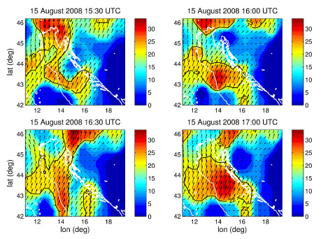
But in all these cases a convective system was present in the area! For example, one can easily detect it during the 2007 Ist meteotsunami:
Therefore, a new idea that came up from the analysis of all known cases is that convective system traveling above the sea causes the pressure or wind disturbance which, if other circumstances are favorable, can cause meteotsunami formation. The reason for that idea was the fact that in all Adriatic cases a convective cloud or system was present and moving towards the affected area.
The question is: What is the atmospheric origin of meteotsunami development in other areas of the world? and another: If we assume that there is connection with convective system aloft, are there cases in other parts of the world ocean that developed in similar situations?
To answer these questions an international conference on meteorological tsunamis has been organized in Vela Luka on the island of Korčula, Croatia, on the 30th anniversary of the strongest Adriatic meteotsunami that hit Vela Luka on 21 June 1978. As the result of this conference, a special issue of the journal Physics and Chemistry of the Earth was published, with 12 papers documenting and explaining the meteotsunami occurence in different seas all over the world.