Chapter II: Synoptic Situation
Table of Contents
- Chapter II: Synoptic Situation
- Synoptic Situation
Synoptic Situation
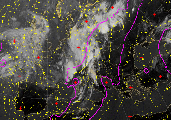
On 15 August 2008 the upper level flow over the Adriatic was south-westerly, on the leading side of a deep upper-level trough. Frontal parameter shows that convective development occurred within the frontal zone, during the passage of the front. A maximum of warm air advection is found in the region of the Northern Adriatic and Showalter index value is negative and less than -3 in the whole region!
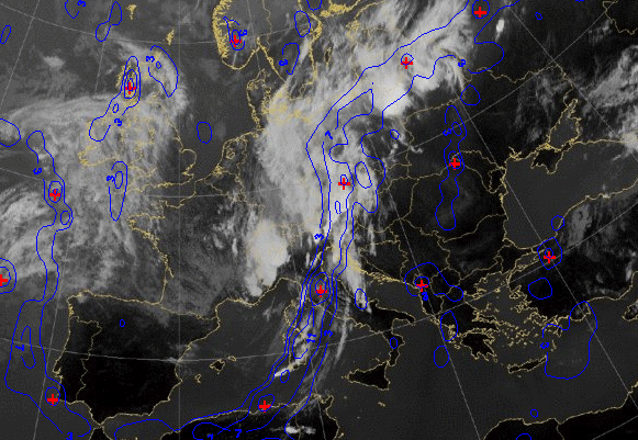
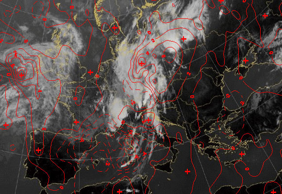
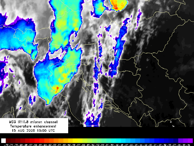
Satellite images reveal the presence of a large MCS over the Northern Adriatic and Alpine region. In the southern part of the system overshooting tops (seen as red dots) can be noticed traveling towards the island Lošinj an reaching it at about 16:45 UTC. Cloud-top temperature in this spots is about -70°C. Overshooting tops develop due to very strong updrafts in the convective cloud.
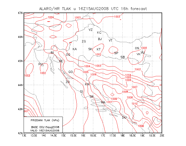
The mean-sea level pressure chart from the ALADIN model (ALARO/HR) show that the model forecast the development of a small low near the island Lošinj at 16 UTC.
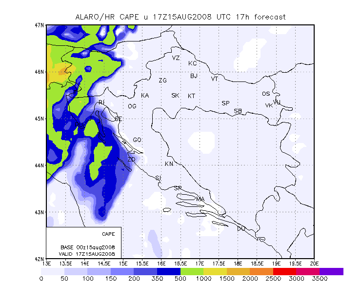
At nearly the same time convective development is expected by the model, as seen in CAPE image for 17 UTC.
Looking at the wind field, a line of convergence forming 16 UTC in the northern Adriatic and traveling towards the island Lošinj appears as the probable cause for convective development.